
Wikimedia Commons / CC-BY-SA-3.0 / GFDL
Capital: Phoenix
Population: 7.6 million+
Language: English
Arizona skips daylight saving time, but the Navajo Nation observes it, and the Hopi Reservation inside the Navajo Nation doesn’t.

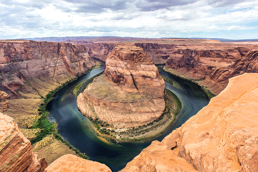
1 – Horseshoe Bend (also above)
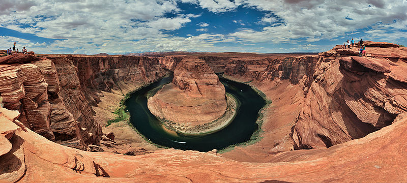
Horseshoe Bend is a tight loop of the Colorado River near Page, in northern Arizona, where the water turns almost full circle around a sandstone spur about 1,000 feet (300 m) below the overlook, a few miles downstream from Glen Canyon Dam, which has held back Lake Powell since the 1960s.
The walk to Horseshoe Bend is under a mile each way from a car park run by the City of Page, which has charged since 2019 (about $10 a car, and national park passes don’t count), and a railed viewing platform opened in 2018 — though most of the rim is still unfenced and people have died falling from it.
Horseshoe Bend was a quiet local viewpoint until it went viral on Instagram, where by 2018 its geotag was reported to be ten times as popular as anything else nearby, and visitor estimates now run from around 830,000 a year by the Park Service’s count to 2 million by the city’s.
2 – Grand Canyon
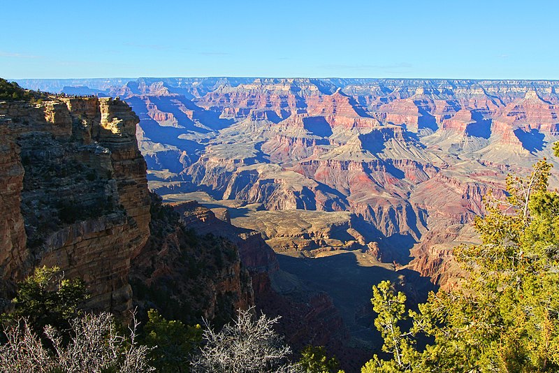
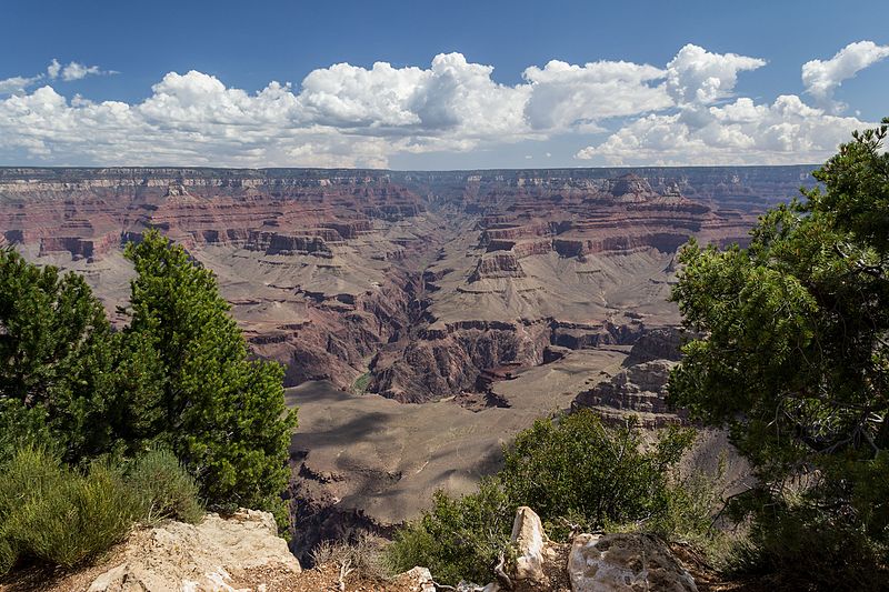
The first Europeans at the Grand Canyon were a Spanish party under García López de Cárdenas, led by Hopi guides in 1540, whose three best climbers tried to reach the river and failed, and the first known trip down its length was John Wesley Powell’s in 1869, led by a man who had lost most of his right arm at Shiloh.
On the South Rim you’ll find El Tovar, the grand hotel of 1905, and next to it the Buckey O’Neill Cabin, the rim’s oldest surviving building, built in the 1890s by the son of an Irish immigrant who served in the Irish Brigade — O’Neill was later killed charging up Kettle Hill with the Rough Riders in 1898.
Two days before Powell finished, three of his men climbed out at Separation Canyon and were never seen again, and whether they were killed by Shivwits Paiute or by local Mormon militia is still argued over — while down in the canyon at Supai, the Havasupai village still gets its post by the last mule-mail route in the United States.
3 – Monument Valley
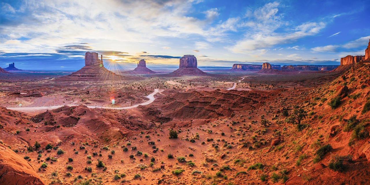
Monument Valley straddles the Arizona–Utah border on the Navajo Nation, and its buttes are layer cakes of rock: red De Chelly sandstone cliffs on a base of Organ Rock shale, capped with harder Shinarump conglomerate that has kept them from wearing away, rising about 1,000 feet (300 m) above the valley floor.
Visiting Monument Valley costs $10 a person plus $15 a vehicle, paid to the Navajo Nation and with no national park passes accepted, and beyond the self-drive loop the backcountry is guided-only, because this is a lived-in landscape — Navajo families still make their homes in the valley, some hauling water from miles away.
John Ford, who made the valley the shorthand for the American West, was born John Martin Feeney to parents from Spiddal, Co. Galway, and Kilronan on Inis Mór, and Stanley Kubrick used aerial footage of Monument Valley, tinted, as an alien planet in the stargate sequence of 2001: A Space Odyssey (1968).
4 – Meteor Crater
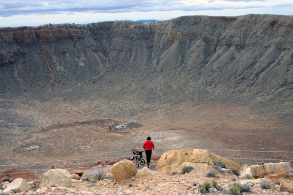
Meteor Crater, also called Barringer Crater, is a hole about 1.2 km (three-quarters of a mile) wide and 170 m (560 ft) deep in the desert east of Flagstaff near Winslow, made around 50,000 years ago by an iron-nickel asteroid perhaps 50 m across.
Meteor Crater is privately owned by the Barringer family’s company rather than the Park Service, so it’s a National Natural Landmark, not a national park, and admission (about $29 for adults) gets you the rim-top viewpoints, a museum on impacts and space, and the spot where Apollo astronauts trained from 1967.
Mining engineer Daniel Barringer spent 27 years and most of a fortune drilling for the huge iron mass he was sure lay buried under the crater floor, when the impactor had in fact largely vaporised on impact, and it took Eugene Shoemaker’s discovery of shock-formed minerals in 1960 to prove beyond argument that the crater was made by an impact at all.
5 – Papago Park
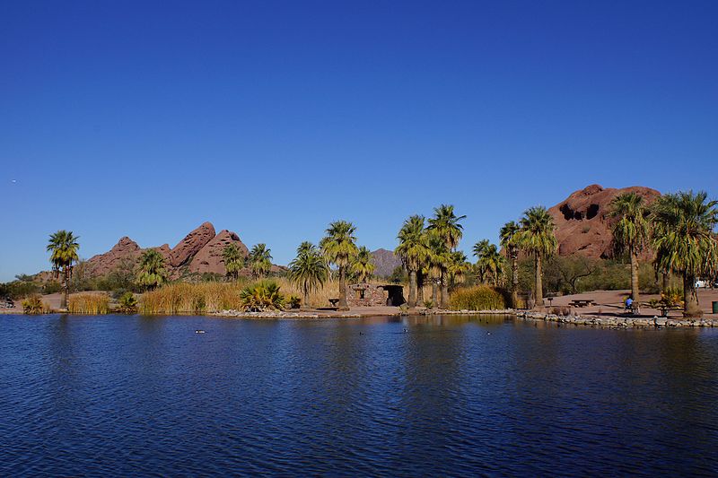
Papago Park is a desert park of red sandstone buttes on the Phoenix–Tempe line, known for Hole-in-the-Rock, a hollow butte that some believe the Hohokam used to mark the solstice, and its name is the old term for the Tohono O’odham people, now widely considered derogatory.
Papago Park holds the Phoenix Zoo, the Desert Botanical Garden, short trails up Hole-in-the-Rock and the buttes, and the small white pyramid built in 1931 by Arizona’s first governor, George W. P. Hunt, as the tomb for his wife and later himself.
During World War II Papago Park held a prisoner-of-war camp, and on 23 December 1944, 25 German prisoners, many of them U-boat men, escaped through a 178-foot tunnel, planning to float down the Salt River to Mexico in a homemade boat — only to find the river nearly dry — and their leader, Jürgen Wattenberg, held out until 28 January 1945, when he gave himself away asking a Phoenix street cleaner for directions.
6 – Phoenix
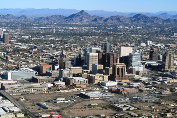
Phoenix sits on the Salt River in the Sonoran Desert, where the Hohokam dug hundreds of miles of irrigation canals, often called the largest prehistoric irrigation network in North America, and abandoned them by about 1450, and tradition credits settler Darrell Duppa with the city’s name, for a town that would rise from the ruins of an older civilisation.
Phoenix, the capital since 1889 and now the fifth-largest US city with about 1.67 million people, has the S’edav Va’aki Museum on a Hohokam platform mound, the Heard Museum’s Native art, Frank Lloyd Wright’s Taliesin West in neighbouring Scottsdale, a World Heritage Site since 2019, and the Irish Cultural Center’s castle-style McClelland Library and Famine memorial.
The modern canals still largely follow the Hohokam lines, which is how a city this size survives in heat this extreme: in July 2023 Phoenix hit 110°F (43°C) or more for 31 days in a row, and in 2024 it reached at least 100°F for 113 consecutive days.
7 – Montezuma Castle

Montezuma Castle is a five-storey, roughly 20-room cliff dwelling built by the Sinagua people in the 1100s, about 90 feet up a limestone cliff above Beaver Creek near Camp Verde, and on 8 December 1906 Theodore Roosevelt made it one of the first four national monuments.
You can’t go inside Montezuma Castle — visitors climbed ladders into it until 1951, when damage closed it — but the trail below gives a clear view, and the same ticket covers nearby Tuzigoot, while 11 miles away Montezuma Well is a spring-fed sinkhole taking in 1.5 million gallons of water a day, with no fish but leeches and shrimp-like creatures found nowhere else on Earth.
The name is wrong twice over: early American settlers assumed it was Aztec, but the Sinagua had moved on by about 1400, more than 40 years before Moctezuma was born, and it was never a castle — Hopi, Zuni and Yavapai oral histories all connect their ancestors with the valley.
8 – San Xavier del Bac

San Xavier del Bac is a Spanish mission church about nine miles south of downtown Tucson on the Tohono O’odham Nation, founded by the Jesuit Eusebio Kino in 1692, with the present white church built by Franciscans between 1783 and 1797, largely by O’odham labour, making it the oldest intact European building in Arizona.
Inside San Xavier del Bac, still a working parish, the walls and altarpiece are covered in painted and gilded statues and murals, often called one of the finest Spanish colonial interiors in the US, and outside, look up at the façade for the carved cat and mouse — when the cat catches the mouse, so the story goes, the world ends.
The east tower was never finished, and the tale of a builder falling to his death from it has no record behind it — nobody knows why — while the interior was restored from 1992 by conservators from Rome, who trained four members of the Tohono O’odham Nation, one of whom still works on the church today.
9 – Oak Creek Canyon

Oak Creek Canyon runs about 12 miles from the edge of the Colorado Plateau at Flagstaff down to Sedona, cut along the Oak Creek Fault up to 2,000 feet deep, and its first non-Native settler was Irish-born J. J. Thompson, who arrived in 1876 and farmed at Indian Gardens until he died in 1917.
The road through Oak Creek Canyon, State Route 89A, follows the creek past the West Fork Trail and Slide Rock State Park, where a natural rock chute on an old apple-orchard homestead makes a water slide, and down at the canyon mouth stands Sedona’s Chapel of the Holy Cross, built into the red rock in 1956.
Sedona’s famous energy “vortexes” are a recent invention — the psychic Page Bryant first used the term this way in 1980, the 1987 Harmonic Convergence made it popular, and no one has measured any unusual energy there — and the canyon was the setting for Zane Grey’s The Call of the Canyon, filmed here in 1923.
10 – Petrified Forest National Park
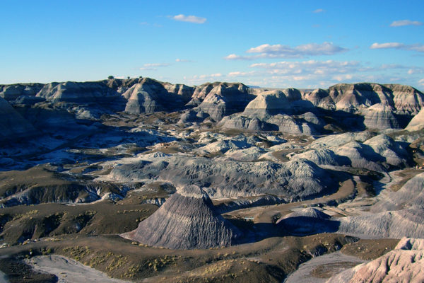
Petrified Forest National Park, in northeast Arizona, preserves fallen trees around 225 to 207 million years old, from the Late Triassic, whose wood was turned to colourful quartz by silica-rich groundwater, and it became a national monument in 1906 and a national park in 1962.
Highlights of Petrified Forest include the log-strewn Crystal Forest and Blue Mesa, the Painted Desert Inn with murals by the Hopi artist Fred Kabotie, the 200-room Puerco Pueblo and the petroglyphs of Newspaper Rock, and it’s the only park in the National Park System with a stretch of old Route 66 running through it.
For decades the park claimed visitors stole about 12 tons of petrified wood a year, but around 2011 staff compared more than 200 old and new photographs and found damage in just one pair — though that hasn’t stopped people mailing back more than a thousand stolen pieces with “conscience letters” blaming them for their bad luck.
11 – Old Tucson Studios

Old Tucson Studios is a Western film set in the Tucson Mountains west of Tucson, a city whose Spanish presidio was founded on 20 August 1775 by the Dublin-born officer Hugo O’Conor, and the set itself was built by Columbia Pictures in 1939 for the film Arizona.
At Old Tucson you walk a dusty main street of saloons, a mission and a railway depot used in some 400 films, TV shows and adverts, including Gunfight at the O.K. Corral, Rio Bravo and El Dorado, with stunt shows and seasonal events like the Nightfall Halloween nights.
A fire on 24 April 1995 destroyed more than 25 buildings, the soundstage and a wardrobe going back to 1939, and the set was rebuilt at about half its size, but the films live on: John Wayne made several here, including McLintock! (1963), co-starring Dublin’s own Maureen O’Hara.
12 – Canyon de Chelly
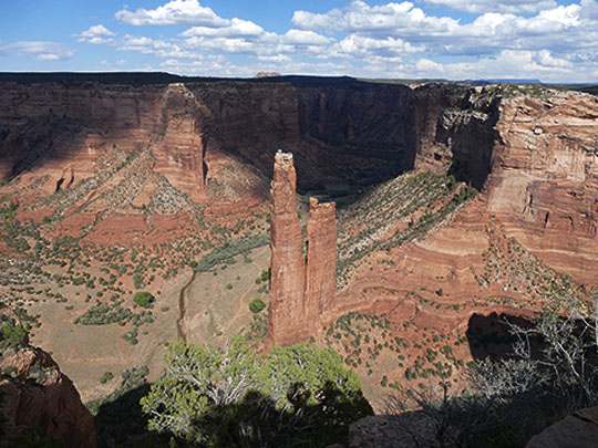

Canyon de Chelly, in the far northeast of Arizona, is a national monument that belongs entirely to the Navajo Nation, where about 40 Navajo families still live and farm on the canyon floor, and its name is a Spanish rendering of the Navajo Tséyi’, “inside the rock”, pronounced “d’SHAY”.
The North and South Rim Drives at Canyon de Chelly look down on the 750-foot spire of Spider Rock, where Navajo tradition says Spider Woman lives, and on the ruins of White House, an Ancestral Puebloan village of about 1060–1275 reached by the only trail you’re usually allowed to walk without a Navajo guide.
Canyon de Chelly was the Navajo stronghold: in 1805 a Spanish force killed about 115 people at what’s now called Massacre Cave, and in 1864 US troops under Kit Carson’s campaign cut down thousands of peach trees, forcing the Navajo onto the Long Walk to Bosque Redondo, where thousands died before the Treaty of 1868 let them come home — considered the only time a tribe used a treaty to reverse its removal.
13 – Tombstone
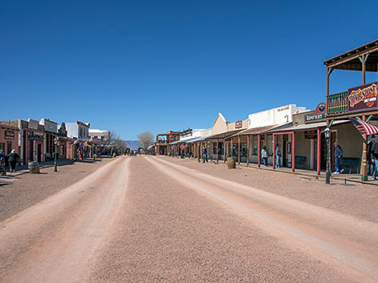
Tombstone, in southeast Arizona, takes its name from prospector Ed Schieffelin, who was warned that the only rock he’d find out there was his own tombstone and named his 1877 silver claim accordingly, and by 1881 it had perhaps 6,000–7,000 people before the mines flooded and the boom faded.
On Tombstone’s Allen Street you can see the 1881 Bird Cage Theatre, the Courthouse museum, the Boothill Graveyard and daily re-enactments of the gunfight of 26 October 1881, when the Earps and Doc Holliday killed Billy Clanton and Frank and Tom McLaury in about 30 seconds — in a vacant lot six doors from the O.K. Corral, which the gunfight was only named after decades later.
Tombstone’s most loved resident was Nellie Cashman from Co. Cork, who ran the Russ House restaurant, raised money for the town’s Catholic church and nursed miners, earning the name “the Angel of Tombstone” — and Boothill’s famous “Here lies Lester Moore, four slugs from a .44” is on a replacement marker for a man who may never have existed.
14 – Hoover Dam
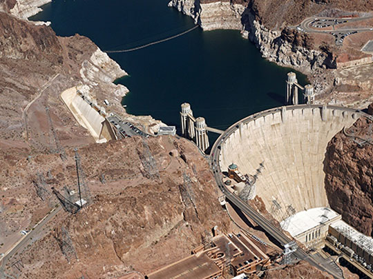
Hoover Dam blocks the Colorado River in Black Canyon on the Arizona–Nevada border, a concrete arch 726 feet (221 m) high built between 1931 and 1936, more than two years ahead of schedule, at the cost of 96 official deaths — and holding back Lake Mead, the largest reservoir in the US by capacity, which hit record lows in 2026.
At Hoover Dam you can walk across the crest past Oskar Hansen’s 30-foot bronze Winged Figures of the Republic and a star map fixing the sky at the moment Franklin Roosevelt dedicated it in 1935, take a power plant tour from the Nevada-side visitor centre, and look down on the dam from the 2010 bypass bridge.
The two intake towers carry two clocks, one for each state, which show the same time all summer and differ by an hour in winter because Nevada uses daylight saving and Arizona doesn’t, and the story that workers are buried in the concrete is a myth — it was poured in blocks five feet deep, which would have made that practically impossible.
15 – The Hopi Mesas and Old Oraibi
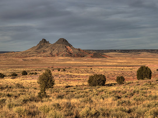
The Hopi Mesas are three fingers of high ground in northeast Arizona, First, Second and Third Mesa, on a Hopi reservation entirely surrounded by the Navajo Nation, and on Third Mesa, Old Oraibi, lived in since before 1100, is among the oldest continuously inhabited towns in the United States.
On First Mesa you can visit Walpi, a stone village on a narrow ridge with no electricity or running water, only on a tour led by Hopi guides, while the Hopi Cultural Center on Second Mesa has a museum and restaurant — and in every village, photography, video, sound recording and even sketching are banned.
In September 1906 Old Oraibi split between traditionalists and those willing to work with the US government, and the quarrel was settled by a pushing contest across a line that sent the losers off to found Hotevilla — and the Hopi still keep their own time, staying on standard time all year while the Navajo Nation around them changes its clocks.