
Wikimedia Commons / CC-BY-SA-3.0 / GFDL
Capital: Tallinn
Population: 1.3 million+
Language: Estonian
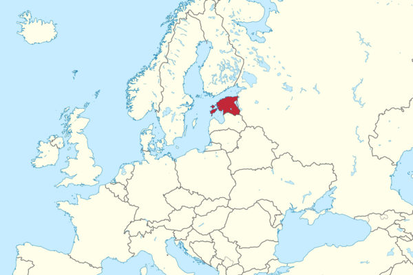
1 – Tallinn (also above)
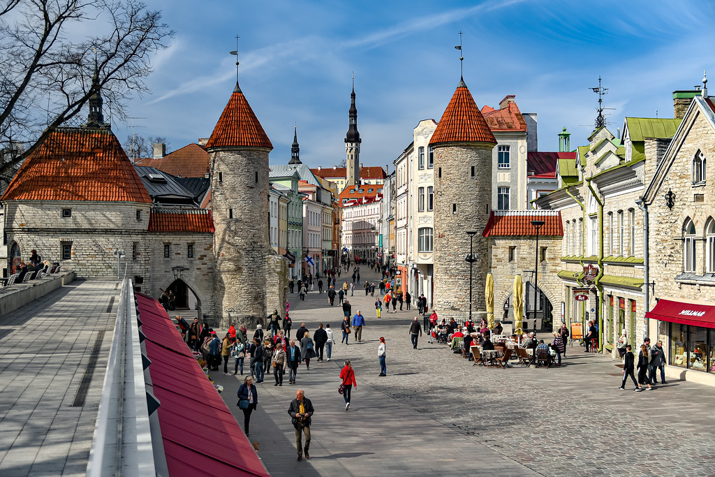
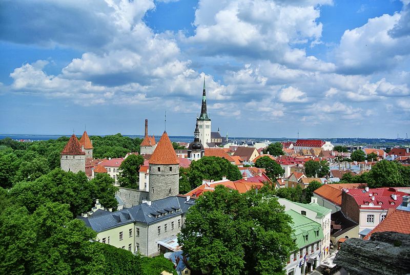
Tallinn, on the Gulf of Finland, was taken in 1219 by the Danes under King Valdemar II, who built a fortress on Toompea hill, and as Reval it joined the Hanseatic League in 1285 as its northernmost member; UNESCO listed the Old Town in 1997.
Walk Tallinn’s Old Town to the Gothic Town Hall, finished in 1404, the Town Hall Pharmacy, one of the oldest continuously running pharmacies in Europe, and St Olaf’s Church, then climb Toompea to the Alexander Nevsky Cathedral and head out to Peter the Great’s Kadriorg Palace.
Legend says Denmark’s flag fell from the sky during the Danish conquest of Tallinn, St Olaf’s spire may have made it the tallest building in the world in the 16th century, and Skype was launched here in 2003, written by three Estonian programmers.
2 – Narva

Narva, Estonia’s third-largest city, sits on the Narva River border with Russia, its Danish-built Hermann Castle facing Ivangorod, the fortress Muscovy built across the water in 1492.
Visit Narva’s Hermann Castle and its museum, walk the riverside promenade between the two fortresses, and see the vast Kreenholm textile mill, founded in 1857 and once one of the largest in Europe.
At the Battle of Narva in 1700, Charles XII of Sweden beat a far larger Russian army in a snowstorm, and among the defeated was Peter Lacy from Killeedy, Co. Limerick, a Wild Geese exile who rose to become a Russian field marshal and governor of Livonia.
3 – Tartu
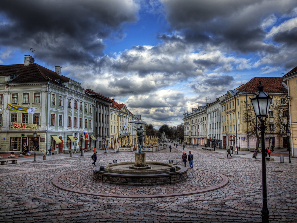
Tartu, Estonia’s second city, on the Emajõgi river, is home to the university founded by King Gustav II Adolf of Sweden in 1632, and in 1920 the Treaty of Tartu saw Soviet Russia renounce its claims to Estonia “voluntarily and forever”.
See Tartu’s Town Hall Square with its Kissing Students sculpture, the Estonian National Museum, whose roof runs out along the runway of a former Soviet airfield, and the Tartu Observatory, a station on the Struve Geodetic Arc.
Tartu’s Struve Geodetic Arc, a chain of survey points measured in 1816–55 across 10 countries from the Arctic Ocean to the Black Sea, helped pin down the size and shape of the Earth, and UNESCO listed it in 2005.
4 – Lahemaa National Park
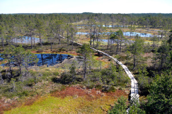
Lahemaa National Park, on Estonia’s north coast east of Tallinn, was founded in 1971 as the first national park in the Soviet Union, a landscape of bays, forest, bog and old manor estates.
Walk the boardwalk across Lahemaa’s Viru bog to its lookout tower, tour the manor houses of Palmse, Sagadi and Vihula, and visit Käsmu, the “Captains’ Village” by the sea.
Lahemaa’s coast is strewn with boulders carried from Finland by ice-age glaciers, and Käsmu’s marine school, open from 1884 to 1931, turned out 94 ocean-going captains, 66 of them from the village itself.
5 – Rakvere

Rakvere, in north-east Estonia, first appears in 1226 as Tarvanpea, “head of the aurochs”, and its hilltop castle, taken by the Danes in 1219 and later held by the Teutonic Order, was badly damaged in the fighting of 1605 and left in ruins.
Explore Rakvere’s castle ruins, where the castle museum stages medieval exhibitions and re-enactments, then walk over to Tarvas, the bronze aurochs, and the old town below.
Rakvere’s Tarvas, made by Tauno Kangro for the town’s 700th anniversary in 2002, is seven metres long and weighs about seven tonnes, a nod to the town’s ancient name.
6 – Hiiumaa

Hiiumaa is Estonia’s second-largest island, long home to Swedish-speaking farmers, about 1,000 of whom were resettled on Catherine the Great’s orders in 1781 to a new village in southern Ukraine.
Climb Hiiumaa’s Kõpu lighthouse, first lit in 1531, see the French-made cast-iron Tahkuna lighthouse, the tallest in Estonia, and the Stenbock family’s baroque manor at Suuremõisa.
Before leaving Hiiumaa, the departing Swedes held a farewell service at Ristimägi, the Hill of Crosses, where visitors have added crosses ever since, while Kõpu, paid for by Tallinn at the Hanseatic League’s request, ranks among the oldest working lighthouses in the world.
7 – Matsalu National Park
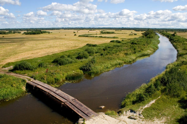
Matsalu National Park covers a shallow bay and the Kasari river delta on Estonia’s west coast, protected as a nature reserve since 1957 and listed as a wetland of international importance in 1976.
Watch birds from Matsalu’s towers at Haeska, Penijõe and Puise, looking out over reed beds, coastal meadows and the open bay.
More than 2 million waterfowl pass through Matsalu each spring, making the bay one of the great stopovers on the migration routes of northern Europe.
8 – Pärnu

Pärnu, on Estonia’s south-west coast, was a Hanseatic port and became a seaside spa in 1838, when its first bathhouse opened, and on 23 February 1918 Estonia’s independence was first proclaimed in public from the balcony of its Endla Theatre.
Stroll Pärnu’s long sandy beach, pass through the Tallinn Gate, the only 17th-century town gate with its rampart left in the Baltics, and see the Red Tower, the neoclassical Mud Baths of 1926–27 and the Art Nouveau Villa Ammende.
Pärnu’s Koidula Museum remembers the poet Lydia Koidula, whose “Mu isamaa on minu arm” became Estonia’s unofficial anthem under Soviet rule, while it was her father, J.V. Jannsen, who wrote the words of the official one.
9 – Saaremaa
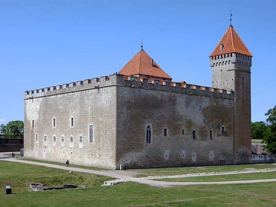
Saaremaa is Estonia’s largest island, conquered by crusaders in 1227, then sold to Denmark in 1559, passed to Sweden in 1645 and to Russia in 1721.
Explore Saaremaa’s Kuressaare Castle, the bishops’ stronghold and one of the best-preserved medieval fortresses in Estonia, then the Kaali meteorite crater, the Angla windmills and the limestone Panga cliff.
Saaremaa’s Kaali crater, about 110 m across, was blasted out by a meteorite several thousand years ago, and the writer and president Lennart Meri even suggested the island was Thule, the far northern land described by the Greek explorer Pytheas.
10 – Haapsalu
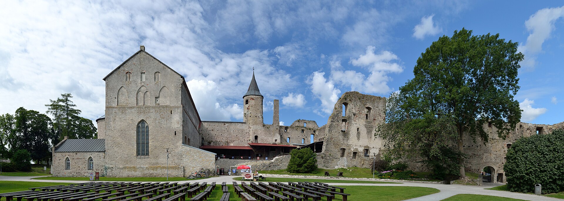
Haapsalu, on Estonia’s west coast, was chartered in 1279 and was for about 300 years the seat of the bishops of Ösel–Wiek, and in 1825 Dr Carl Abraham Hunnius opened its first mud spa.
See Haapsalu’s castle and cathedral, one of the largest single-nave churches in the Nordic and Baltic countries, the railway station of 1904–05, with its imperial pavilion and 216 m platform, and Ilon’s Wonderland, named after Astrid Lindgren’s illustrator, Ilon Wikland, who grew up here.
Haapsalu’s White Lady, a girl said to have been walled up in the castle chapel for sneaking in disguised as a choirboy, legend says she appears in the baptistery window on August full moons, while Tchaikovsky spent the summer of 1867 here and wrote Souvenir de Hapsal.
11 – Viljandi
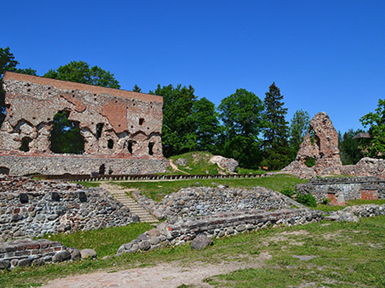
Viljandi, in south Estonia on the shore of Lake Viljandi, was taken by the Sword Brethren in 1223, and the castle they began the next year became one of the strongest of the Order’s castles in Livonia.
Walk Viljandi’s castle hills and cross the suspension bridge, built in 1879 and moved here in 1931, then climb the Old Water Tower and visit the Estonian Traditional Music Centre.
Viljandi is the home of Estonia’s largest annual music festival, the Viljandi Folk Music Festival, which began in 1993 as a single day of traditional music.