Argentina in 12 Pics

0

Wikimedia CommonsCC-BY-SA-3.0 / GFDL

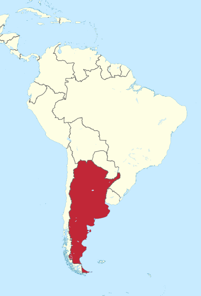
Capital: Buenos Aires

Population: 46 million+

Language: Spanish/ (Guaraní co-official in Corrientes)

Wikimedia CommonsCC-BY-SA-3.0 / GFDL

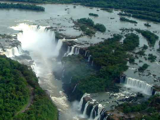
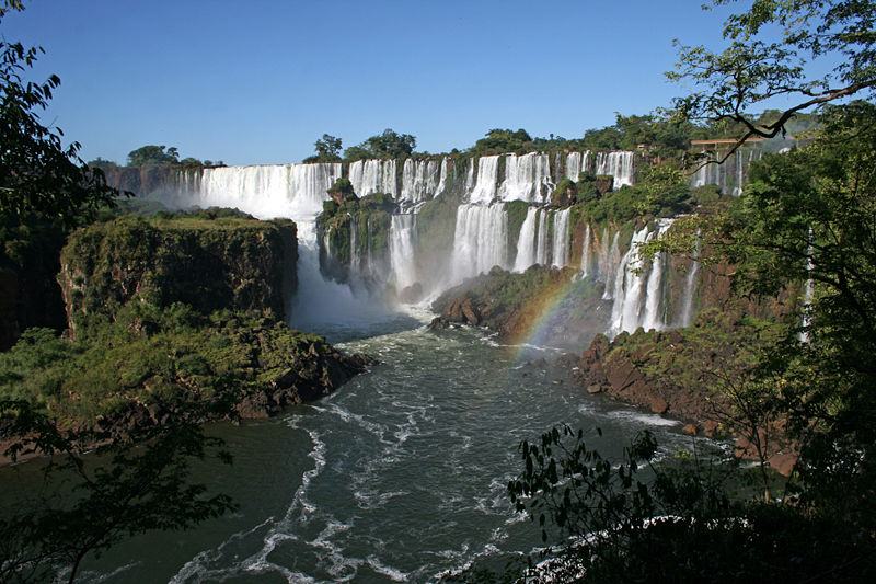
1 – Iguazú Falls & National Park (also above)

Wikimedia CommonsCC-BY-SA-3.0 / GFDL

Straddling the border of Argentina and Brazil, deep in the subtropical Atlantic rainforest, Iguazú is the largest waterfall system on Earth — a thundering, mile-and-a-half-wide wall of some 275 separate cascades, so overwhelming it’s counted among the Seven Natural Wonders of the World.

Walkways lead you right out over and among the falls, past clouds of spray and drifting rainbows, to the very brink of the Devil’s Throat — a horseshoe-shaped abyss where half the entire river plunges 80m into the roar below; all around, the jungle teems with toucans, jaguars and cheeky, food-stealing coatis.

When the American First Lady Eleanor Roosevelt first laid eyes on Iguazú, she is said to have taken one look at its sheer scale — wider than Niagara and Victoria — and exclaimed simply: “Poor Niagara!”

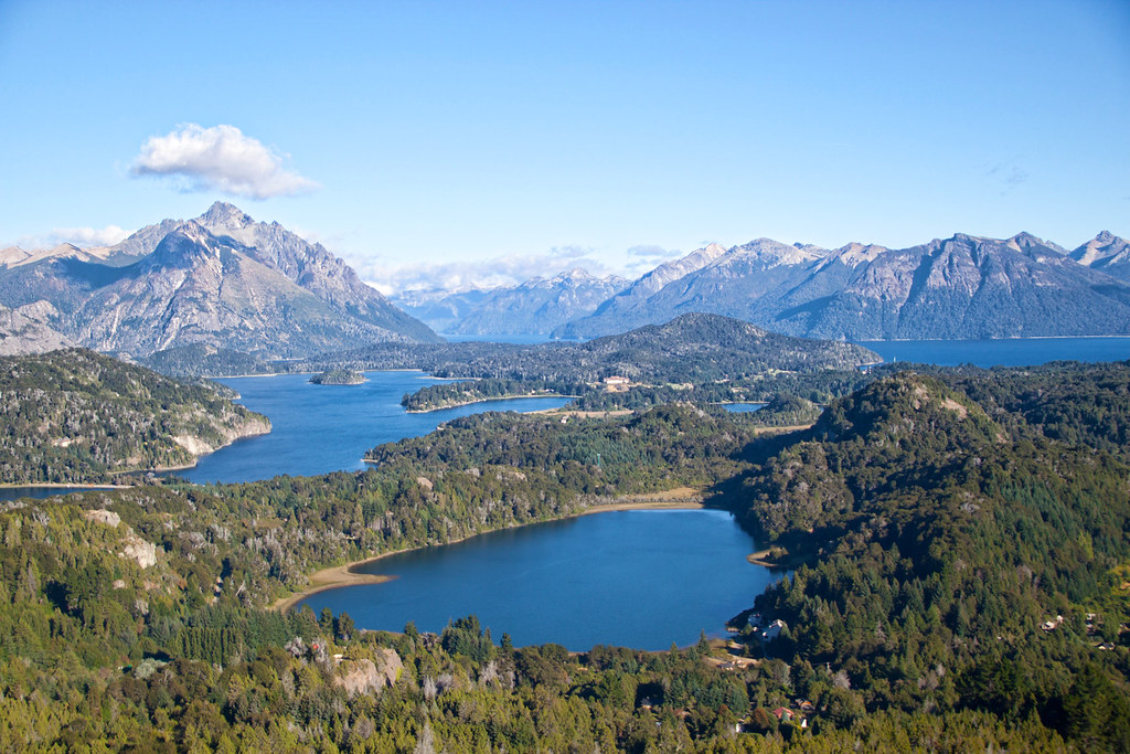
2 – Bariloche

She Paused 4 Thought / Wikimedia CommonsCC-BY-SA-3.0 / GFDL

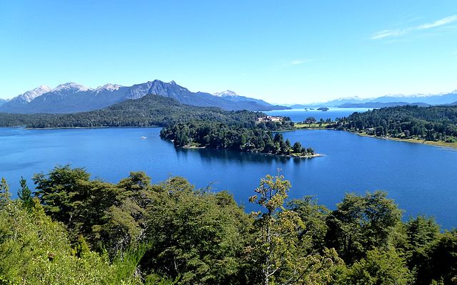
On the shore of a vast, island-dotted glacial lake, ringed by the snow-capped peaks of the Andes, Bariloche is the gateway to Argentina’s Lake District — a town so alpine in look and feel, with its wood-and-stone chalets and steep roofs, that it’s fondly known as “Little Switzerland.”

That Swiss and German heritage, brought by 19th-century immigrants, flavours everything: cosy fondue restaurants, a famous string of chocolate shops along the main street, and world-class skiing on Cerro Catedral in winter, giving way in summer to hiking, kayaking and the storied lakeside drive of the Circuito Chico.

The town’s Germanic character has a darker side to its story: after the Second World War, its alpine, German-speaking setting made Bariloche a hiding place for fugitive Nazis — most notoriously the SS captain Erich Priebke, who lived here openly for decades, even running the local school, until a television crew finally unmasked him in 1994.

3 – Monte Fitz Roy

Wikimedia CommonsCC-BY-SA-3.0 / GFDL

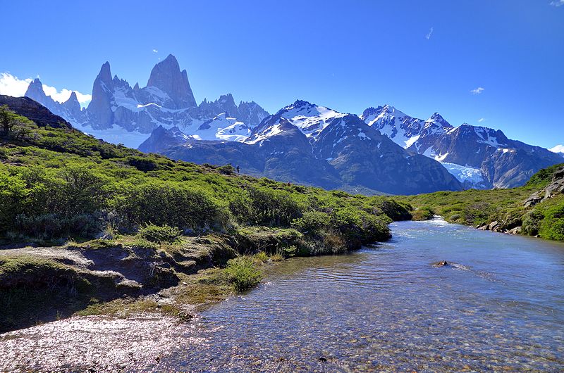
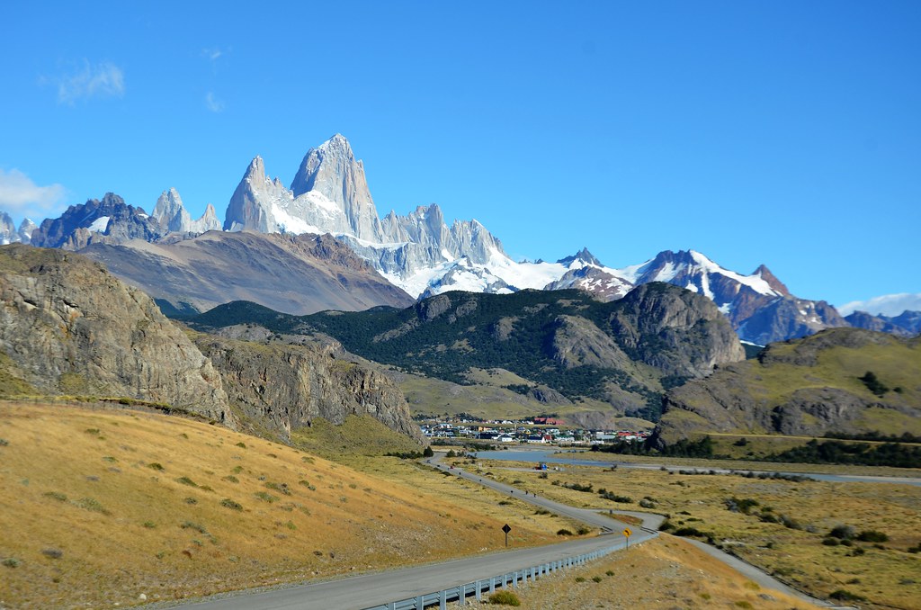
A jagged spire of sheer granite soaring above the Patagonian steppe, Monte Fitz Roy is one of the most beautiful — and, for climbers, most feared — mountains on Earth; though only 3,405m high, its vertical rock walls and the ferocious, ever-changing Patagonian weather make it one of the hardest peaks in the world to summit.

It presides over the little village of El Chaltén, Argentina’s self-styled “trekking capital,” from where day-hikers set out for the famous Laguna de los Tres, a glacial lake at the mountain’s foot; the indigenous Tehuelche called it Chaltén, “the smoking mountain,” for the banner of cloud that streams from its summit and once made them think it was a volcano.

Its dramatic silhouette is far more famous than most people realise — for the jagged skyline of Fitz Roy is the logo of the outdoor-clothing giant Patagonia, meaning this remote Argentine peak is stitched onto millions of jackets and backpacks around the world.

4 – Perito Moreno Glacier

Wikimedia CommonsCC-BY-SA-3.0 / GFDL

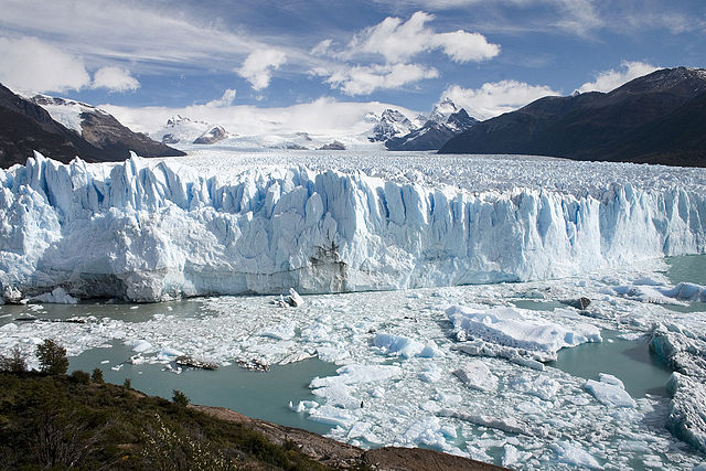
A colossal river of ice flowing down from the Southern Patagonian Ice Field — the third-largest freshwater reserve on Earth — the Perito Moreno Glacier ends in a jagged blue-white wall some 5km wide and 70m high, towering over the waters of Lago Argentino; for most of the last century it was famous as one of the very few glaciers on the planet that wasn’t shrinking.

It’s also one of the most accessible great glaciers anywhere: a network of boardwalks lets you stand right in front of the ice, and the truly adventurous can strap on crampons and trek across its cracked, gleaming surface — all to the soundtrack of house-sized blocks of ice calving off the face and thundering into the lake.

Every few years the glacier stages an astonishing show — it advances until it dams an arm of the lake, the trapped water carves a great tunnel through the ice, and eventually the resulting bridge of ice collapses in a spectacular, thunderous rupture that draws crowds from around the world to watch.

5 – Calchaqui Valley

Wikimedia CommonsCC-BY-SA-3.0 / GFDL

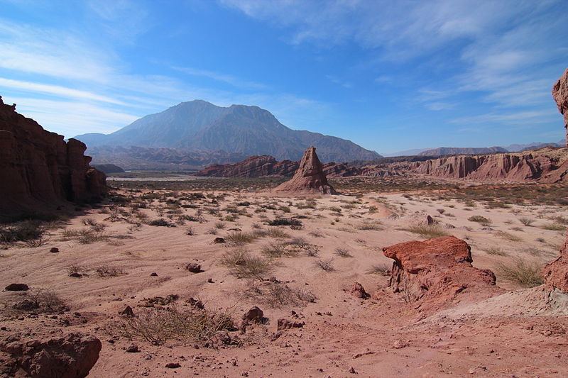
A chain of dramatic, sun-baked valleys threading through the mountains of northwest Argentina, the Calchaquí Valleys are a landscape of ochre-and-red rock, giant cacti and sleepy adobe villages, named after the Diaguita people who fiercely resisted Spanish conquest here for over a century.

The scenic Ruta 40 winds through it past colonial towns like Cachi and the wine capital Cafayate, and through the Quebrada de las Conchas, a gorge of wind-sculpted red sandstone with a natural rock “Amphitheatre” so acoustically perfect that concerts are held inside it.

Above all, this is high-altitude wine country: its vineyards, bathed in fierce mountain sunlight, climb to some of the greatest heights on Earth — one estate near Molinos grows grapes at over 3,000m — producing intense reds and the aromatic, floral white Torrontés that has become one of Argentina’s signature wines.

6 – Mt. Aconcagua

Mt.-Aconcagua
Wikimedia CommonsCC-BY-SA-3.0 / GFDL

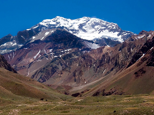
Rising to 6,961m in the Andes of western Argentina, Aconcagua is the “Roof of the Americas” — the highest mountain in the entire Western Hemisphere, and the tallest peak anywhere on Earth outside the great ranges of Asia; one of the fabled “Seven Summits.”

Its snow-streaked pyramid dominates the sky near the Chilean border, drawing some 3,000 climbers a year to attempt it; below, the approach valleys, with their mule trains and high camps, wind up through a stark, wind-blasted world of scree and glacier.

Aconcagua holds a curious distinction: it is the highest mountain on Earth that can be climbed with no real technical skill at all — its normal route is essentially a very long, very high walk — and yet the thin air near 7,000m, the brutal cold and the fierce winds catch out the unprepared, so that the “walkable” giant still claims several lives every year.

7 – Cueva de las Manos

Wikimedia CommonsCC-BY-SA-3.0 / GFDL

Hidden in a remote Patagonian canyon in the far south of Argentina lies one of the oldest and most haunting artworks in all the Americas — the Cueva de las Manos, the “Cave of the Hands,” where prehistoric hunter-gatherers left their mark on the rock as long as 9,000 years ago.

Across the cliff face, in vivid reds, ochres, whites and blacks that have survived the millennia, are hundreds of stencilled human hands, alongside lively scenes of hunters chasing herds of guanaco — a UNESCO World Heritage Site, and a startlingly direct connection to the people who roamed this land at the dawn of history.

The hands were made by pressing a palm to the rock and blowing pigment around it through a hollowed bone — and almost every single print is of a left hand, which tells us something charmingly human across nine thousand years: the artists, like most of us, were right-handed, and held the blowing-pipe in their stronger hand.

8 – Pucará de Tilcara

Pucará-de-Tilcara-2
Wikimedia CommonsCC-BY-SA-3.0 / GFDL

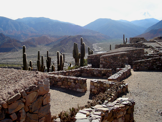
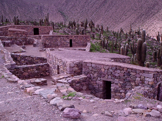
On a strategic hilltop above the multicoloured gorge of the Quebrada de Humahuaca, in the far northwest of Argentina, stand the ruins of the Pucará de Tilcara — a pre-Inca stone fortress-town built some 900 years ago by the Omaguaca people, warriors and farmers who watched over this ancient trade route through the Andes.

Rebuilt in part by archaeologists, its maze of small, windowless stone houses, corrals and ceremonial platforms — studded with towering cardón cacti and commanding sweeping views over the valley — was later seized by the Incas as they pushed their empire south; it now forms part of a UNESCO World Heritage Site.

There’s an odd, telling twist at the summit: the early-20th-century archaeologists who excavated the fort crowned it with a monument to themselves — a Mayan-style pyramid utterly foreign to the Andes — inscribed in memory of a “dead people,” a phrase that still stings the local indigenous community, whose living culture is anything but.

9 – Plaza de Mayo – Buenos Aires

Wikimedia CommonsCC-BY-SA-3.0 / GFDL

The beating political heart of Argentina, Plaza de Mayo in Buenos Aires has been the stage for the nation’s history for over two centuries — it takes its name from the May Revolution of 1810, the uprising that set Argentina on the road to independence from Spain.

Around the square stand the landmarks of the nation: the Cabildo, the colonial town hall; the cathedral where Pope Francis once presided and where independence hero General San Martín lies buried; and, above all, the Casa Rosada — the “Pink House” presidential palace, from whose balcony Eva “Evita” Perón once thrilled vast crowds of her devoted followers.

The square is best known today for a quieter but unbreakable act of courage: since 1977, the Mothers of the Plaza de Mayo — women whose children were “disappeared” by the military dictatorship — have marched around its central monument every single Thursday in their white headscarves, demanding to know the fate of their children, in one of the world’s most enduring human-rights vigils.

10 – Ushuaia

Wikimedia CommonsCC-BY-SA-3.0 / GFDL

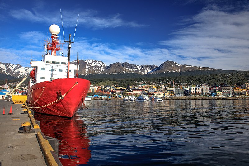
Clinging to the shore of the Beagle Channel beneath jagged, snow-streaked peaks, at the very bottom of South America, Ushuaia is the southernmost city on Earth — “El Fin del Mundo,” the End of the World — and the main launching point for expeditions across the stormy seas to Antarctica.

It’s a place of raw, end-of-the-earth beauty: boat trips glide down the Beagle Channel past sea lion colonies and the lonely “Lighthouse at the End of the World,” while the Tierra del Fuego National Park, where the Pan-American Highway finally runs out, offers forests, peat bogs and glacier-fed lakes.

The city owes its very existence to a prison — Argentina banished its most dangerous convicts to this remote spot, and it was those prisoners who built the town itself, hauling timber out of the forest on what survives today as the “End of the World Train,” the southernmost railway on the planet.

11 – Jesuit Block & Estancias of Córdoba

Tomás Hurtado / CC-BY-SA-3.0 / GFDL

A single city block in the middle of Córdoba, Argentina’s second city some 700 km north-west of Buenos Aires, which from 1599 served as the headquarters of the Jesuits’ enormous Province of Paraguay and where the order founded a university in 1613 — among the oldest in the Americas — bankrolling the whole enterprise from working estancias out in the sierras until Charles III expelled the Jesuits from his empire in 1767.

The block itself holds the Compañía de Jesús church, the private Domestic Chapel, the old university with its rare-book collection and the Monserrat school, while the five listed estancias at Alta Gracia, Jesús María, Santa Catalina, Caroya and La Candelaria are scattered through the hills beyond — Alta Gracia being the easy half-day run from the city. Che Guevara grew up in the town of Alta Gracia, and his childhood home is a museum a short walk from the estancia.

The man who built the church was a boatbuilder by trade rather than an architect, so he roofed the nave the only way he knew how, with a great vault of Paraguayan cedar assembled like the upturned hull of a ship — which is still the thing everyone stands underneath and stares at.

12 – San Ignacio Miní

 Juan / CC-BY-SA-3.0 / GFDL

The best-preserved of Argentina’s Jesuit-Guaraní missions, in Misiones province about 60 km from Posadas, founded in 1610 far to the north in what is now Brazil and then abandoned under repeated raids by slave hunters from São Paulo, after which the Jesuits and thousands of Guaraní trekked south through the forest and finally settled on this site in 1696.

What survives is a whole town in deep red sandstone: a vast central plaza, the shell of a 74-metre church designed by the Italian priest Juan Brasanelli with a façade carved in a mix of European baroque and Guaraní flowers and animals, and the long ranks of workshops and family dwellings that housed several thousand people.

After the expulsion of 1767 the community gradually dispersed and the forest simply took the place back — the ruins were not found again until 1897, only drew national attention after the poet Leopoldo Lugones visited in 1903, and were not properly restored until the 1940s. Amazingly, the Guaraní missions ran their own printing presses in the forest.

LEAVE A REPLY

Please enter your comment!
Please enter your name here

This site uses Akismet to reduce spam. Learn how your comment data is processed.