
Wikimedia Commons / CC-BY-SA-3.0 / GFDL
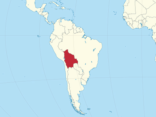
Capital: Sucre (constitutional) / La Paz (seat of government)
Population: 11.3 million+
Language: Spanish/Guaraní/Aymara/Quechua
1 – Lake Titicaca (also above)
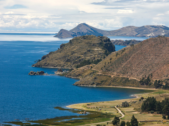
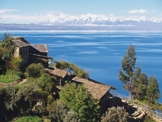
Shimmering a deep, impossible blue high in the Andes on the border with Peru, Lake Titicaca is the highest navigable lake in the world — an inland sea at 3,800m, ringed by snow-capped peaks and sacred to the Andean peoples for thousands of years.
On the Bolivian side, the pilgrim town of Copacabana is the gateway to the lake’s islands, chief among them the Isla del Sol, “Island of the Sun,” a car-free world of ancient stone ruins, terraced hillsides and Inca roads, where Aymara communities still farm as their ancestors did.
To the Incas, this was where the world began: legend held that the sun itself first rose from these waters, and that Manco Capac and Mama Ocllo, the founders of the Inca Empire, emerged from the lake by the Isla del Sol to go forth and build their civilisation — making this remote highland lake the mythical cradle of one of history’s great empires.
2 – Valle de la Luna
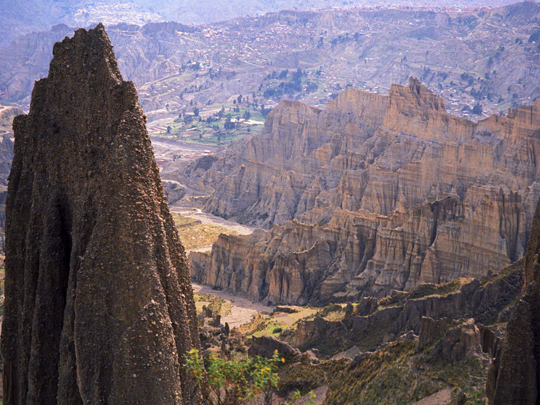
Just outside La Paz — the world’s highest capital city — lies the Valle de la Luna, the “Valley of the Moon”: a bizarre, otherworldly maze of pale, jagged spires and deep canyons that looks less like Earth than the surface of another planet.
Despite the name, it isn’t really a valley at all, but the eroded skeleton of ancient hills of soft clay and sandstone, sculpted by wind and rain into a forest of stone pinnacles that glow in shifting shades of cream, red and violet as the sun moves; short trails thread between the towers, past hardy cacti and darting, rabbit-like viscachas.
The valley owes its evocative name to a man who knew a thing or two about moonscapes: Neil Armstrong, the first human to set foot on the Moon, is said to have visited in 1969, shortly after Apollo 11, and remarked that the eerie terrain reminded him of the lunar surface — and the name stuck.
3 – Salar de Uyuni
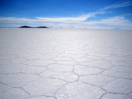
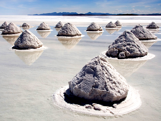
High on the Bolivian altiplano lies the Salar de Uyuni, the largest salt flat on Earth — a blinding-white sea of salt, the ghost of an ancient lake, stretching flat and featureless to the horizon over an area larger than some countries.
In the dry season its crust cracks into a mosaic of perfect hexagonal tiles, dotted with islands of giant, thousand-year-old cacti and hotels built entirely from blocks of salt; when the rains come, a thin film of water turns the whole flat into the world’s largest mirror, reflecting the sky so flawlessly that visitors seem to walk among the clouds — and beneath it all lies the greatest reserve of lithium on the planet, the metal that powers the world’s batteries.
The salar is so vast and so astonishingly level — barely a metre of variation across thousands of square kilometres — that it is one of the flattest places on the entire planet, and space agencies use its surface to calibrate the instruments of their Earth-observing satellites from orbit.
4 – Sucre
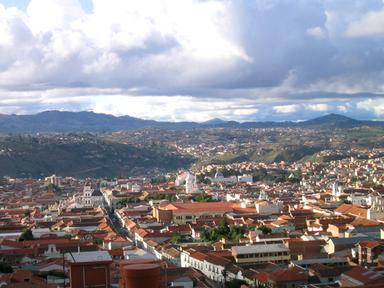
Sucre is Bolivia’s constitutional capital and its most beautiful city — the elegant “White City,” a UNESCO World Heritage Site of gleaming whitewashed colonial mansions, baroque churches and palm-shaded plazas, where the young republic of Bolivia declared its independence from Spain in 1825.
It was here, in the handsome Casa de la Libertad, that the declaration was signed, and the city itself was renamed after Antonio José de Sucre, the general who helped win the country’s freedom and became its first president; today its sunny, temperate streets, grand old university and rooftop convent views make it one of the loveliest colonial cities in the Americas.
Just outside town, a towering limestone cliff is covered in more than 5,000 dinosaur footprints — the largest such collection on Earth — laid down 68 million years ago on the flat shore of an ancient lake, then tilted almost vertical by the rising of the Andes, so that today the dinosaurs appear, astonishingly, to have walked straight up the wall.
5 – Tiwanaku
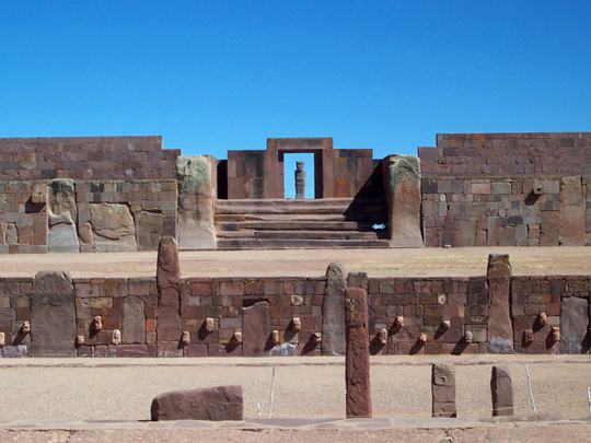
High on the windswept altiplano near Lake Titicaca stand the ruins of Tiwanaku — the heart of one of the great civilisations of the ancient Americas, a powerful Andean empire that flourished for centuries and reached its height around 1,300 years ago, long before the Inca ever rose to power.
A UNESCO World Heritage Site, it’s a place of monumental stone: the stepped Akapana pyramid, the raised temple court of Kalasasaya with its towering carved monoliths, and, above all, the Gate of the Sun — a ceremonial doorway hewn from a single 10-ton block of stone and etched with a mysterious sun deity; so revered were these ruins that the Incas, arriving centuries later, believed the world itself had been created here.
Nearby lies Puma Punku, whose scattered stone blocks are cut with such uncanny precision — dead-flat faces, razor-sharp right angles, perfectly drilled channels — that they look almost machine-made, a feat of ancient engineering so astonishing it has fuelled a century of wild theories about who could possibly have built it.
6 – Jesuit Missions of Chiquitos
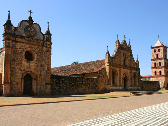
Deep in the tropical lowlands of eastern Bolivia lie six extraordinary towns — the Jesuit Missions of Chiquitos, a UNESCO World Heritage Site founded in the late 1600s and 1700s, where Jesuit priests gathered the indigenous Chiquitano people into self-governing “reductions,” part utopian community, part refuge from slave-raiders.
Unlike the ruined Jesuit missions elsewhere in South America, these survived intact — not lifeless ruins but living villages, where the descendants of the Chiquitano still worship in the same magnificent churches: great barn-like structures of carved and painted wood, their walls and altars a dazzling fusion of European baroque and indigenous artistry.
Their greatest treasure is music: the Jesuits taught the Chiquitano European baroque music so well that, after the priests were expelled in 1767, the villagers kept composing, copying and playing it for over two centuries — until a lost archive of some five thousand pages of baroque scores was rediscovered here, a hidden musical world now brought back to life at a famous festival held in the churches themselves.
7 – Potosí
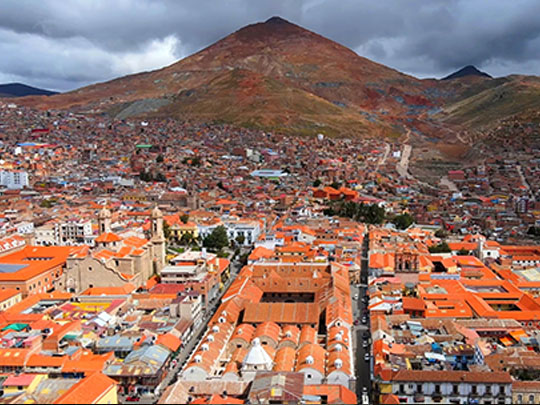
A city on the southern Bolivian altiplano at around 4,000 metres, founded in 1545 at the foot of Cerro Rico after silver was found in the mountain, and for the next two centuries the single richest source of silver on Earth — by some estimates it produced around 60 per cent of the world’s silver in the later 1500s, bankrolling the Spanish crown’s wars across four continents, while the men who dug it were conscripted or brought in as enslaved Africans and died in the tunnels in numbers no one has ever managed to count.
What that money built is still standing and listed by UNESCO: a dense colonial centre of baroque churches and merchants’ houses, and above all the Casa Nacional de la Moneda, the vast royal mint that turned the ore into coin and now holds the original presses, colonial paintings and a numismatic collection that ranks among the best in South America.
Coins struck here circulated from Manila to Amsterdam, and the city’s name became a byword for riches in Spanish — Cervantes has Don Quixote use the phrase vale un Potosí, worth a Potosí, which Spaniards still say today, four centuries after the mountain that inspired it began to run dry.
8 – La Paz
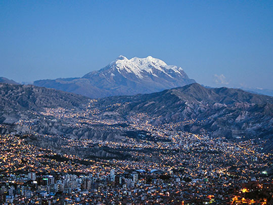
Wedged into a canyon at around 3,600 m beneath the peaks of Illimani, La Paz was founded in 1548 as a staging post on the silver road running from Potosí to the coast, and has been the country’s political stage ever since — besieged for six months by Túpac Katari’s Aymara army in 1781, then the scene of the rising of 16 July 1809 led by Pedro Domingo Murillo, who was hanged the following January on the square that now bears his name.
Plaza Murillo is still where everything happens, ringed by the cathedral, the congress and the old presidential palace — from whose balcony a crowd threw President Gualberto Villarroel in 1946 before hanging him from a lamppost below — with the colonial museums of Calle Jaén, the Witches’ Market and the San Francisco basilica all within a breathless walk.
The commuter network here is a cable car: Mi Teleférico, the largest urban system of its kind in the world, slung across the canyon to the sprawl of El Alto on the rim above because the gradients defeat buses, and for the price of a bus fare it gives you the best view in Bolivia.
9 – The Ruta del Che
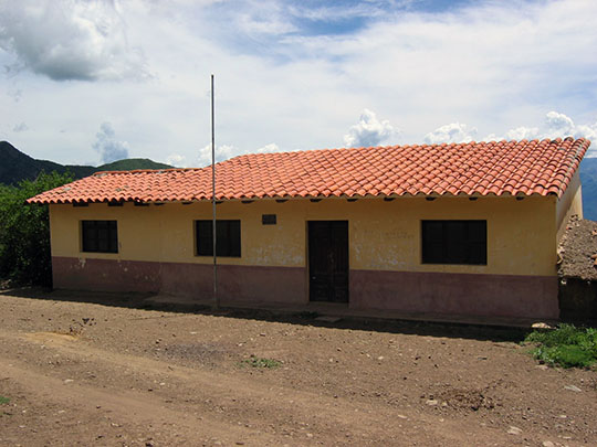

A string of villages in the hills of Santa Cruz department where Che Guevara’s Bolivian campaign ended: he was wounded and captured in the Quebrada del Churo ravine on 8 October 1967 by a US-trained Bolivian ranger unit, held overnight in the schoolhouse at La Higuera, and shot there the following day on orders from the army high command.
The route runs from Vallegrande, where his body was flown by helicopter and laid out in an open-air hospital laundry for the world’s press, on to La Higuera itself — the schoolhouse is now a museum, the laundry a shrine covered in visitors’ scratched messages, and a mausoleum stands beside the airstrip — across hours of rough unmade road through empty mountain country.
The army buried him in secret beside that airstrip precisely so that the place could never become a site of pilgrimage, which is exactly what it became: the grave was located in 1997 and the remains returned to Cuba, and a village of barely a hundred people now receives travellers who leave offerings to “Santo Ernesto”.