
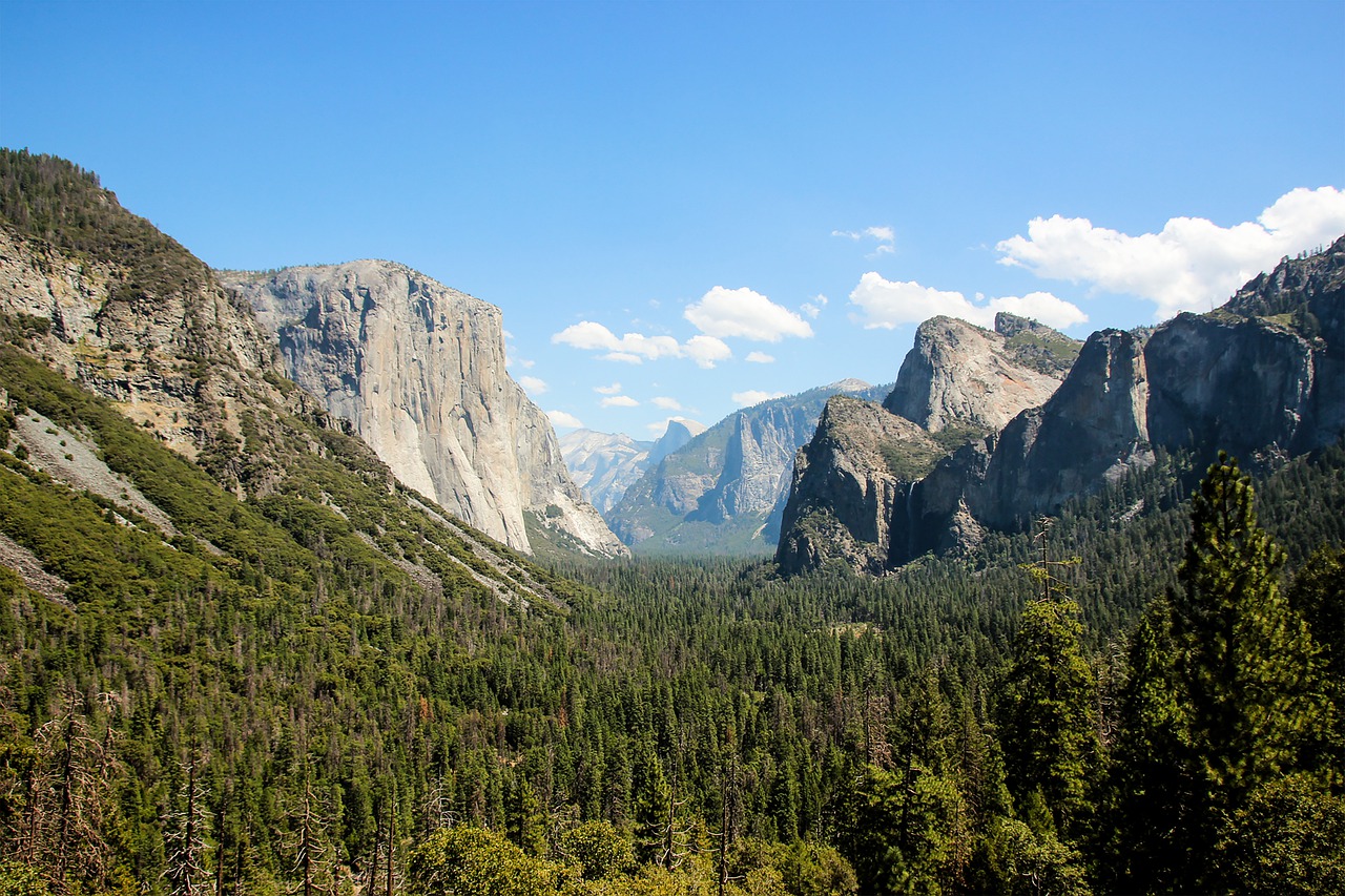
Wikimedia Commons / CC-BY-SA-3.0 / GFDL
Capital: Sacramento
Population: 39.5 million+
Language: English
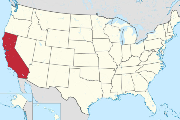
1 – Yosemite National Park (also above)

Yosemite National Park fills a stretch of the Sierra Nevada east of San Francisco, and in May 1903 John Muir took President Theodore Roosevelt camping there for three nights — under the Grizzly Giant sequoia, in snow near Sentinel Dome and in a meadow below Bridalveil Fall — which helped put Yosemite Valley back under federal control in 1906.
Yosemite’s classic viewpoints are Tunnel View, Glacier Point and the restored Mariposa Grove of giant sequoias, and to stay inside the valley there’s the Ahwahnee Hotel of 1927 — which for three years was called “The Majestic Yosemite Hotel”, after a trademark fight with a former concessioner that ended in 2019 with a $12 million payout and the old name back.
Muir’s great defeat was Hetch Hetchy, a second Yosemite-like valley flooded by O’Shaughnessy Dam, which still supplies most of San Francisco’s water, and its engineer, Michael O’Shaughnessy from Co. Limerick, died in 1934 just 16 days before that water first reached the city — while in 1899–1904 Black cavalry and infantry, the Buffalo Soldiers, patrolled Yosemite before there were rangers.
2 – Big Sur
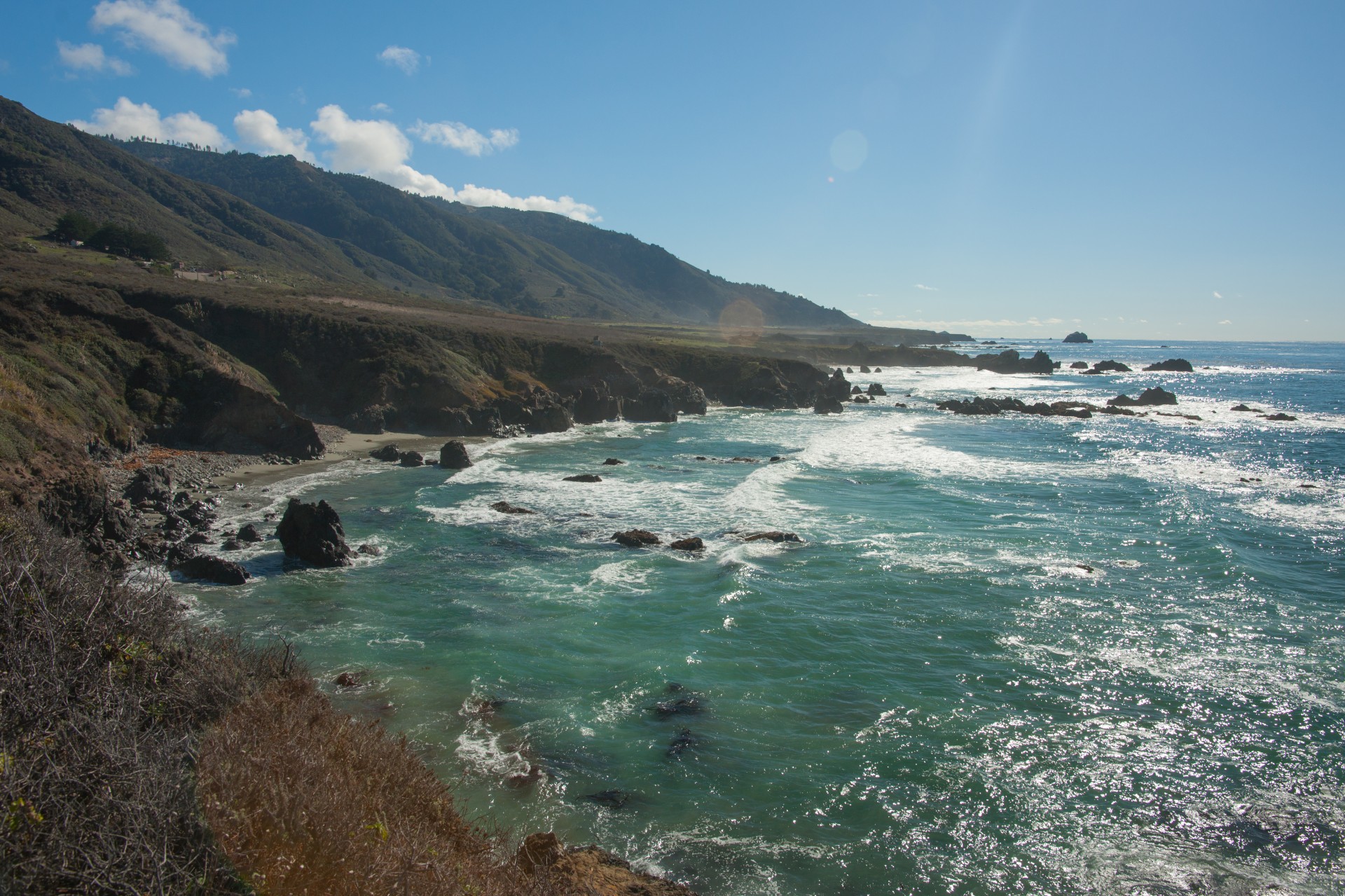
Big Sur is the roughly 70–90-mile stretch of coast where the Santa Lucia Mountains drop straight into the Pacific between Carmel and San Simeon, named from the Spanish el sur grande, “the big south”, and homeland of the Esselen people, who in 2020 bought back 1,199 acres of it, their first land since colonisation.
In Big Sur you can drive the coast road past redwood canyons and headlands, visit the Point Sur Lighthouse of 1889, the Henry Miller Memorial Library and Nepenthe, and walk the redwoods of Pfeiffer Big Sur State Park, with Cone Peak rising 5,155 feet only about three miles from the sea — one of the steepest coastal slopes in the contiguous US.
Big Sur has drawn writers looking for the edge of the world: Henry Miller lived here from 1944 to 1962 and Jack Kerouac wrote Big Sur (1962) about a stay in 1960, and since 1997 the California condor has been released back into these mountains, though a wildfire in 2020 killed ten of the free-flying birds.
3 – Los Angeles
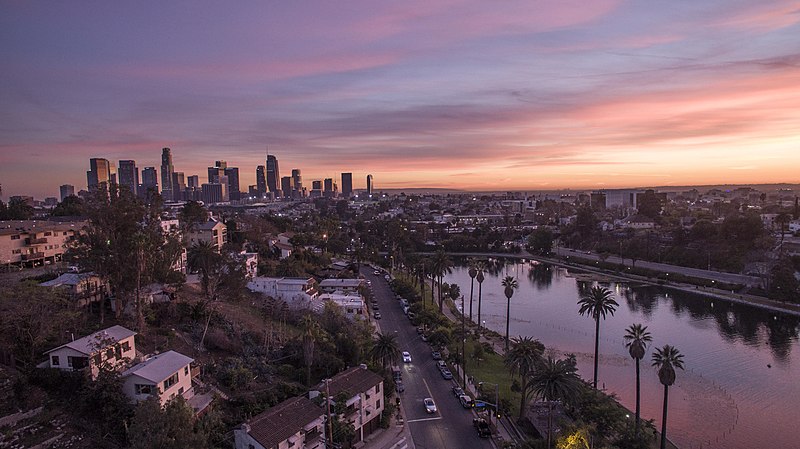
Los Angeles was founded in 1781 as the Pueblo de la Reina de los Ángeles by 44 settlers from northwest Mexico, more than half of them of African descent — and the famous long name ending “de Porciúncula” is a later invention, as Porciúncula was the name of the river.
In Los Angeles you can walk Olvera Street in the old pueblo, look out from the 1935 Griffith Observatory over the Hollywood Sign, which went up in 1923 as an advert reading “HOLLYWOODLAND” and lost the “LAND” in 1949, and drive Mulholland Drive along the ridge of the Santa Monica Mountains.
Mulholland Drive is named for William Mulholland, born in Belfast in 1855, the self-taught engineer whose Los Angeles Aqueduct brought water from the Owens Valley in 1913 (“There it is — take it”), whose St Francis Dam collapsed in 1928, killing around 430 people, and whose water story was reworked into the film Chinatown (1974).
4 – San Diego
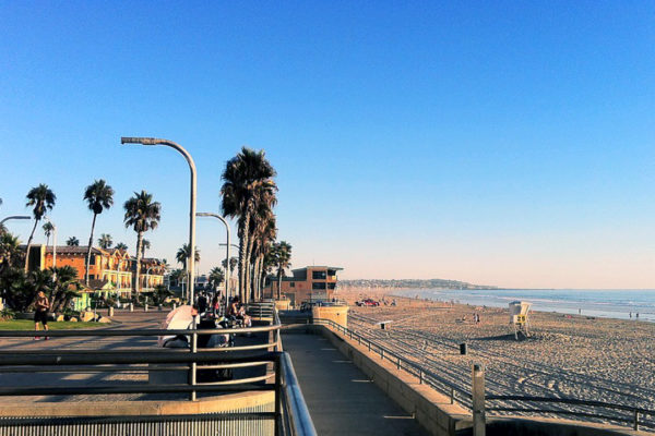
San Diego is California’s southernmost city, on the border with Mexico, and where its history begins: Juan Rodríguez Cabrillo sailed into the bay on 28 September 1542, the first European to land on what’s now the US west coast, and in 1769 Junípero Serra founded Mission San Diego de Alcalá, the first of California’s 21 missions.
In San Diego you can wander Balboa Park’s Spanish-style buildings from the 1915 Panama–California Exposition and the San Diego Zoo, which began with animals left over from it, tour the aircraft carrier USS Midway, and cross to Coronado’s Hotel del Coronado of 1888, where Some Like It Hot was filmed.
Portugal long claimed Cabrillo and gave the statue at his monument, but recent archival research points to Palma del Río in Spain, and San Diego’s early history has an Irishman who stayed by chance: Philip Crosthwaite from Athy, Co. Kildare, lost a coin toss for the last berth home in the 1840s and became the county’s first treasurer and later its sheriff.
5 – San Francisco & Alcatraz Prison

San Francisco went from under 1,000 people to around 25,000 between 1848 and 1849 as the Gold Rush hit, and it was largely built by the Irish: Jasper O’Farrell, said to be from Co. Wexford, laid out Market Street in 1847, and Dublin-born John Mackay was one of the Silver Kings whose Nevada fortune poured into the city.
In San Francisco you can ride the cable cars, walk Chinatown and North Beach, and take the ferry to Alcatraz, a federal prison from 1934 to 1963 that held Al Capone, and earlier home to the first US lighthouse on the west coast, lit in 1854, and occupied by Native American activists from 1969 to 1971.
Alcatraz’s most famous inmate, Robert Stroud, the “Birdman of Alcatraz”, never kept birds there — his canaries were at Leavenworth — and of the 36 men who tried to escape, Frank Morris and the Anglin brothers in June 1962 were never found, with a 2014 tide study suggesting that if they left around midnight, they could have made it.
6 – Golden Gate Bridge
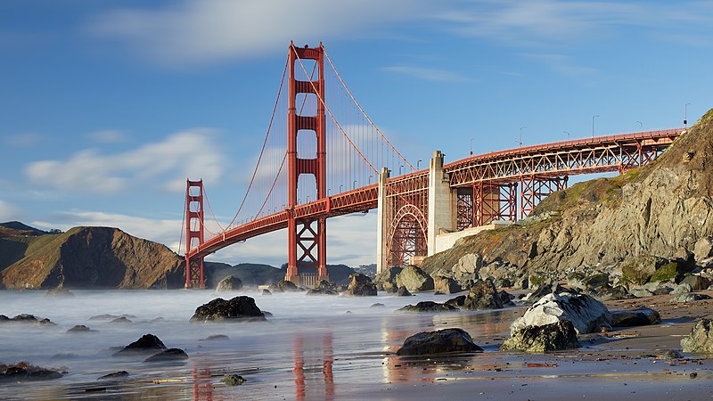
The Golden Gate Bridge spans the mile-wide strait between San Francisco and Marin County, a channel John C. Frémont named “Chrysopylae”, the Golden Gate, in 1846, two years before anyone found gold, and when the bridge opened on 27 May 1937 its 4,200-foot main span was the longest in the world, a record it held until 1964.
You can walk or cycle across the Golden Gate Bridge, see it from Fort Point below the southern tower — where Kim Novak leaps into the bay in Vertigo — or from Marshall’s Beach and the Marin Headlands, and its colour, International Orange, was the choice of architect Irving Morrow, after the Navy had wanted black and yellow stripes.
The engineer Charles Ellis did most of the calculations before chief engineer Joseph Strauss fired him and took the credit, and the bridge district only recognised Ellis in 2007, with a plaque in 2012, while the safety net under the construction saved 19 men, but in February 1937 ten died when a scaffold tore through it.
7 – Santa Cruz
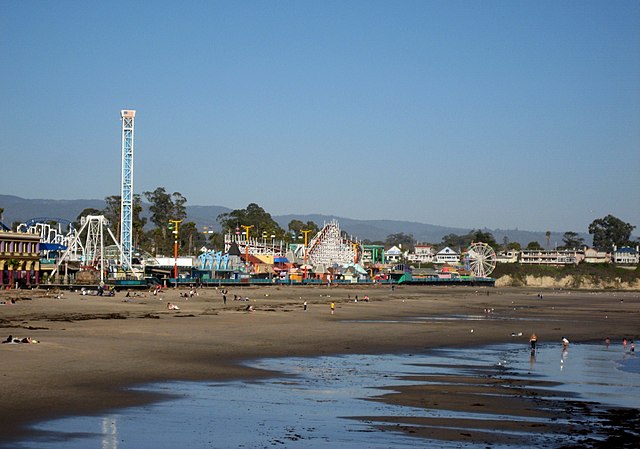
Santa Cruz sits at the northern tip of Monterey Bay, a mission town founded in 1791 that became a seaside resort, and the first documented surfing on the US mainland happened here in July 1885, when three Hawaiian princes at boarding school nearby rode redwood boards at the mouth of the San Lorenzo River.
The Santa Cruz Beach Boardwalk, opened in 1907, is California’s oldest surviving amusement park, with the Looff Carousel of 1911 and the wooden Giant Dipper roller coaster of 1924 — together a National Historic Landmark — and surfers still line up at Steamer Lane off the lighthouse point.
The Looff Carousel still has a working brass-ring dispenser, one of only about 20 left in the world, and the Boardwalk starred as “Santa Carla” in the vampire film The Lost Boys (1987), while the 1989 Loma Prieta earthquake, centred in the hills nearby, wrecked much of downtown Santa Cruz.
8 – Santa Anita Canyon
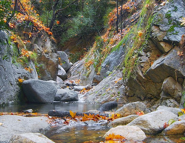
Big Santa Anita Canyon cuts into the San Gabriel Mountains above Arcadia, on the northern edge of Los Angeles, in the Angeles National Forest, and it’s one of the last places that recalls LA’s “Great Hiking Era” of the early 1900s, when city people walked up into the mountains to rustic camps and cabins.
From the Chantry Flat trailhead, an easy walk leads to Sturtevant Falls, about 50–60 feet high, past dozens of century-old cabins reachable only on foot and supplied by mules from Adams’ Pack Station, billed as the last working pack station in Southern California, and on to Sturtevant Camp, founded in the 1890s.
The 2020 Bobcat Fire destroyed 17 of the Santa Anita Canyon cabins and closed the area for four years, and the canyon’s name comes from the old Rancho Santa Anita, which also named the racetrack in Arcadia where in 1942 more than 18,000 Japanese Americans were held, thousands of them living in horse stalls.
9 – McWay Cove
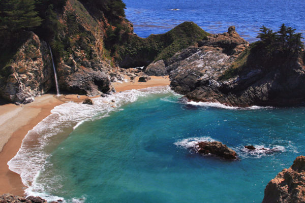
McWay Cove lies in Julia Pfeiffer Burns State Park on the Big Sur coast, where McWay Falls drops about 80 feet onto a small beach — one of only two waterfalls in California that reach the ocean, though these days McWay only does so at high tide.
You see McWay Cove from the cliff-top overlook just off the coast road, because the beach and cove are off-limits, and above the falls are the remains of the Waterfall House, built in 1940 by Lathrop and Hélène Brown, who gave the land to the state on condition it was named for their friend Julia Pfeiffer Burns, a local pioneer rancher.
The famous beach at the foot of McWay Falls isn’t old at all: until 1983 the water fell straight into the sea, when landslides that winter, and the spoil from rebuilding the road above, washed down and built the sand that’s there today.
10 – Pacific Coast Highway
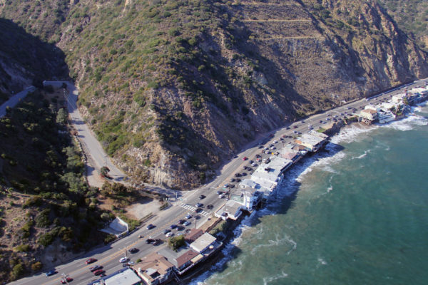
The Pacific Coast Highway, as most people call California’s coastal State Route 1, runs some 656 miles from near Mexico to Mendocino County, the longest state highway in California, though legally only the stretch between Dana Point and Oxnard in Southern California is called Pacific Coast Highway.
The most spectacular part of the Pacific Coast Highway is through Big Sur, opened on 27 June 1937, over the concrete arch of the 1932 Bixby Bridge, 260 feet above the creek, and south to Hearst Castle at San Simeon.
Much of the Big Sur road was built by convicts from San Quentin, paid $2.10 a day but left with about 34 cents after being charged for their own food and guards, and it’s been fighting the cliffs ever since — the Mud Creek slide of 2017 buried it 65 feet deep and added about 13 acres of new land, and the latest slide closure ran until January 2026.
11 – The Donner Party and Lake Tahoe
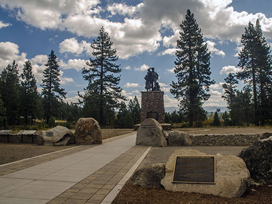
Lake Tahoe sits high in the Sierra Nevada on the California–Nevada border, and just north of it, at what’s now Donner Lake near Truckee, the 87 emigrants of the Donner Party were trapped by snow in late 1846 after taking an untried shortcut, and only about 45 of them lived to reach California.
Donner Memorial State Park has the Pioneer Monument of 1918, standing near the site of the Breen family’s cabin, and a visitor centre on the emigrants’ story, while Lake Tahoe itself, about 1,645 feet deep and the second-deepest lake in the US, has Emerald Bay, the Vikingsholm mansion and the ski slopes of the 1960 Winter Olympics.
The best record of that winter is the diary of Patrick Breen, born in Co. Carlow in 1795, and all nine of the Breens survived — while the party’s organiser, James Reed, was born in Co. Armagh, and Mark Twain later called Lake Tahoe “the fairest picture the whole earth affords”.
12 – Painted Ladies San Francisco
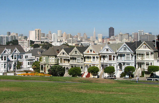
The Painted Ladies are the row of seven Queen Anne Victorian houses at 710–720 Steiner Street, facing Alamo Square in San Francisco, built between 1892 and 1896 by developer Matthew Kavanaugh, who lived next door at 722.
From Alamo Square’s hilltop park you get the classic view of the Painted Ladies in front of the downtown skyline, and the wider neighbourhood is full of other brightly painted Victorians — though tour buses with more than nine seats have been banned from the surrounding streets since 2013.
The bright colours are recent: the trend began in 1963, the name comes from a 1978 book, and around 16,000 of San Francisco’s Victorian houses were demolished in the mid-20th century — and the Full House family didn’t live here at all, as their house is at 1709 Broderick Street; the Painted Ladies only appear in the opening credits.
13 – Sequoia National Park
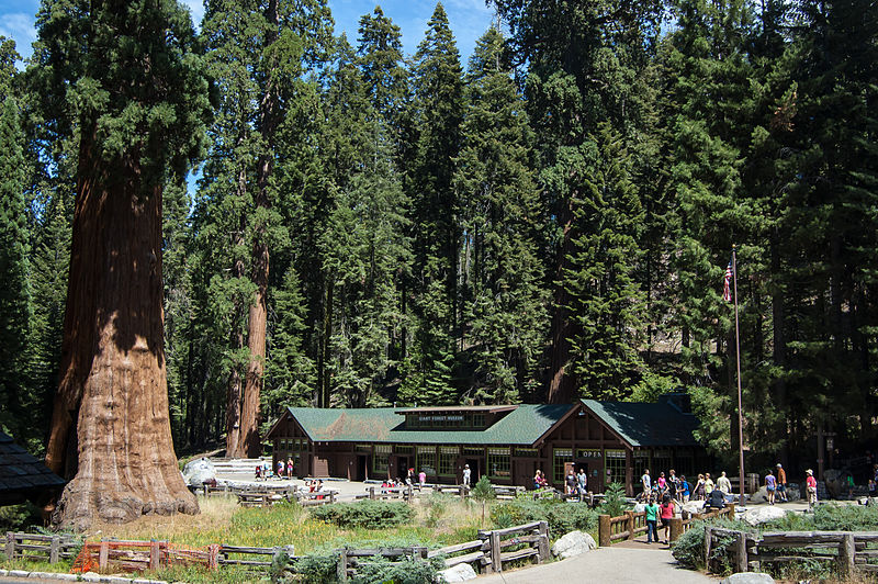
Sequoia National Park, in the southern Sierra Nevada, was created on 25 September 1890 as the second-oldest surviving US national park, and protects the General Sherman Tree, by volume the largest tree on Earth, about 275 feet tall and more than 2,000 years old.
In Sequoia you can walk among the giants of the Giant Forest, climb the 350 steps up Moro Rock, tour Crystal Cave in summer, and look east to Mount Whitney on the park’s boundary, at 14,505 feet the highest peak in the contiguous United States.
Before the park, a socialist commune, the Kaweah Colony, called General Sherman the “Karl Marx Tree”, and lost their land when the park was created — and the 2020 and 2021 fires killed somewhere between 13% and 19% of all the large giant sequoias on Earth, which is why General Sherman’s base was wrapped in foil in 2021.
14 – Sutter’s Mill, Coloma
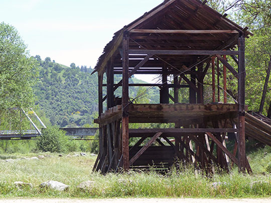
Sutter’s Mill stood on the South Fork of the American River at Coloma, in the Sierra foothills, where James Marshall, building a sawmill for John Sutter, found gold in the tailrace in January 1848 and set off the California Gold Rush — just days before Mexico signed California away to the United States in the Treaty of Guadalupe Hidalgo, with neither side knowing.
Marshall Gold Discovery State Historic Park at Coloma has a working replica of the mill near the original site, the discovery spot on the river, the old miners’ town, and on the hill above, the Marshall Monument of 1890, whose statue of Marshall points down at the place he found gold.
Marshall couldn’t remember the exact day he found gold — the accepted date of 24 January comes from a misspelled diary entry by mill worker Henry Bigler, “this day some kind of mettle was found” — and neither man got rich: Marshall died poor in 1885, and Sutter died in Washington in 1880, two days after Congress adjourned without granting him relief.
15 – Death Valley
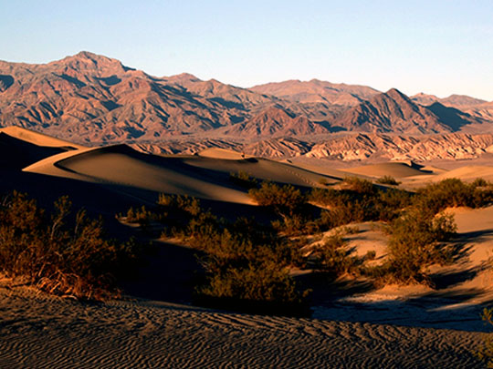
Death Valley, on California’s eastern edge by the Nevada border, is the largest national park in the contiguous US, and holds Badwater Basin, at 282 feet below sea level the lowest point in North America, about 85 miles from Mount Whitney, the highest point in the lower 48.
In Death Valley you can walk the salt flats at Badwater, the Mesquite Flat dunes and Golden Canyon, drive past the colours of Artists Palette and the view from Dante’s View — many of which played the planet Tatooine in Star Wars (1977) — and visit the ruins of the Harmony Borax Works, home of the 20-mule teams of the 1880s.
Death Valley’s 134°F (56.7°C) reading of 1913 is still the official world record, though a 2025 study called it implausible, and the name comes from the lost gold-seekers of 1849 who, climbing out, took off their hats and said “Good bye Death Valley!” — while its Timbisha Shoshone people call it Tümpisa, after the red ochre found there.
16 – Mission San Juan Capistrano
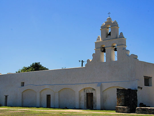
Mission San Juan Capistrano, halfway between Los Angeles and San Diego in Orange County, was founded on 1 November 1776, the seventh of California’s 21 Spanish missions, and built largely by the Acjachemen people — and it turns 250 this November.
At Mission San Juan Capistrano you can see the Serra Chapel of 1782, called the oldest building in California still in use and the only surviving church where Junípero Serra said Mass, and the ruins of the Great Stone Church, finished in 1806, which collapsed during Mass in the earthquake of 8 December 1812, killing about 40 people.
The mission is famous for the swallows that return every 19 March, and the 1940 hit “When the Swallows Come Back to Capistrano” — but the big colony left decades ago after restoration work removed the nests, and since 2012 the mission has played swallow calls on a loop to lure them back.
17 – Sacramento
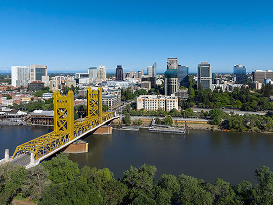
Sacramento has been California’s capital since 1854, on the American and Sacramento Rivers, and grew from Sutter’s Fort, built from 1839 by John Sutter as the heart of his colony of New Helvetia — and the base the Gold Rush and the rescue of the Donner Party were run from.
In Sacramento you can tour the restored State Capitol of 1874, Sutter’s Fort, and Old Sacramento, where the streets were raised by about 10 feet after the great flood of 1862, with the western end of the Pony Express in 1860 and the California State Railroad Museum where the first transcontinental railroad broke ground in 1863.
Sacramento’s Cathedral of the Blessed Sacrament was built by its first bishop, Patrick Manogue from Desart, Co. Kilkenny, a former gold miner whose old mining partner was the Dublin-born John Mackay — and Tower Records started out here in 1960, in the back of a drugstore.
18 – Redwood National Park
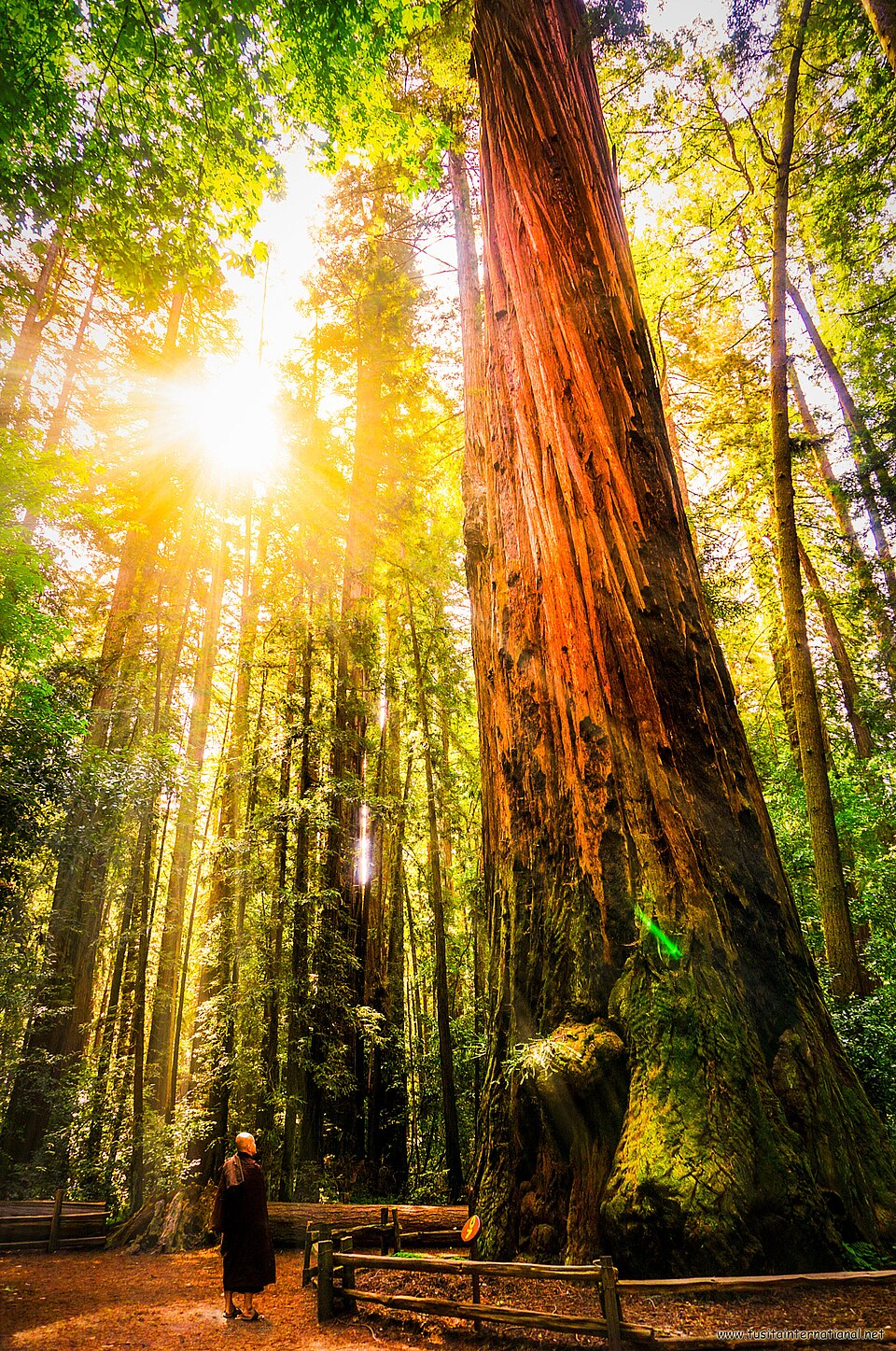
Redwood National and State Parks run along California’s far north coast near Crescent City, a national park since 1968, jointly managed with three state parks since 1994 and a World Heritage Site since 1980, protecting about 45% of the old-growth coast redwood left — about 96% of the original forest was logged.
In Redwood National Park you can walk the Lady Bird Johnson Grove and the fern-walled Fern Canyon, which played prehistoric jungle in The Lost World: Jurassic Park (1997), see Roosevelt elk on the prairies, and get a permit for the Tall Trees Grove, while Hyperion, the tallest known tree on Earth at about 380 feet, is hidden here too — and visiting it can now mean a $5,000 fine.
In 2026 the Yurok Tribe took ownership of ‘O Rew, a former sawmill site at the park’s southern gateway, now restored and run by the tribe — and the Ewoks’ forest in Return of the Jedi wasn’t filmed in the park at all, but on private timber land nearby that was clear-cut months after filming.