
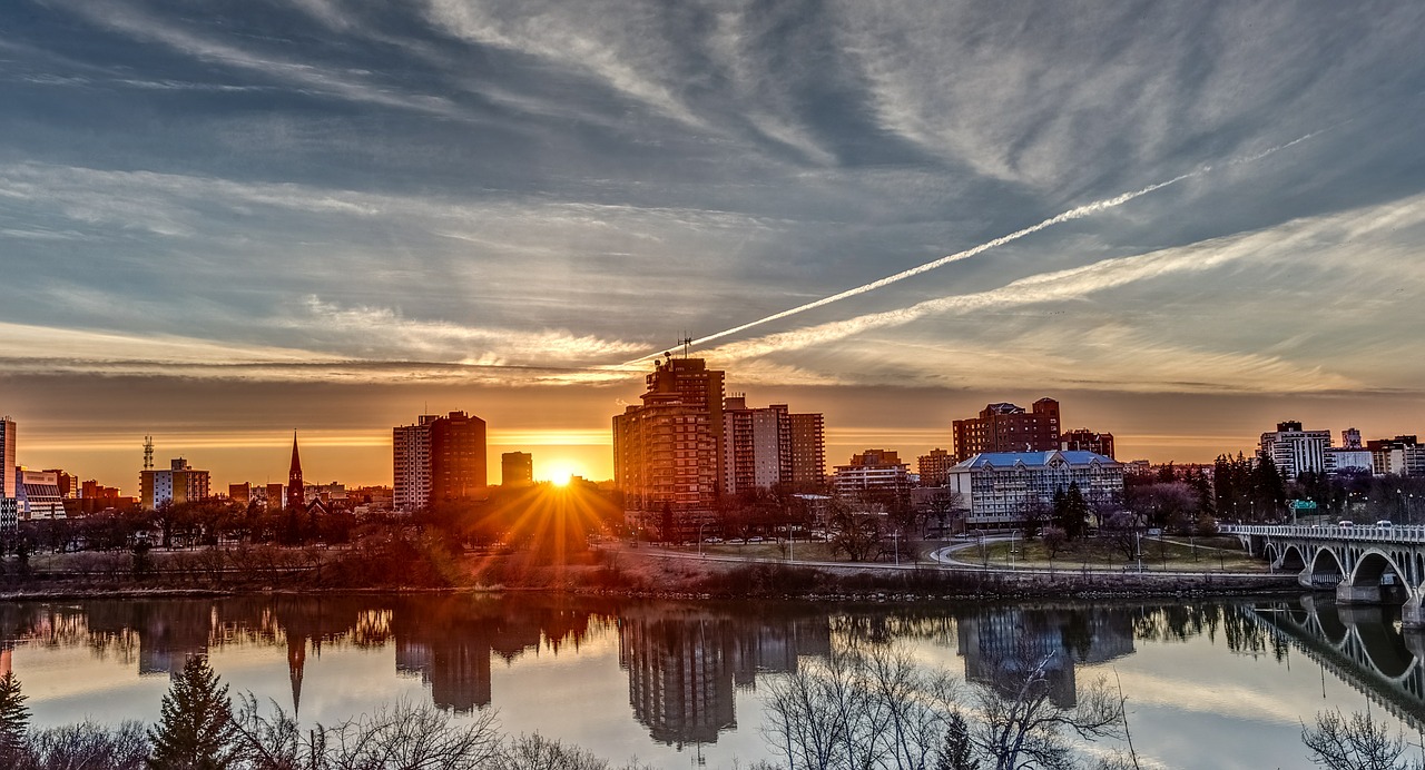
Wikimedia Commons / CC-BY-SA-3.0 / GFDL
Capital: Regina
Population: 1.25 million+
Language: English
Saskatchewan comes from the Cree for “swift-flowing river”.
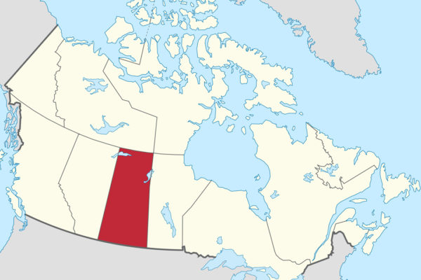
1 – Saskatchewan (also above)

On the South Saskatchewan River, Saskatoon is the province’s largest city, and on 17 April 1903 nearly 2,000 Barr Colonists from Britain arrived here by train and camped in a tent city called “Canvas Town” before trekking west to found Lloydminster.
Saskatoon’s Remai Modern, opened in 2017, holds what it calls the world’s most comprehensive collection of Picasso linocuts, 405 prints in all, the Western Development Museum’s 1910 Boomtown recreates a prairie main street indoors, and trails run along the riverbank below the Bessborough Hotel.
In 1951 Harold Johns’s team at the University of Saskatchewan built one of the world’s first two cobalt-60 cancer-therapy units, finished within days of one in London, Ontario, and Gordie Howe, born in nearby Floral and raised in Saskatoon, has his ashes under his statue outside the city’s SaskTel Centre.
2 – Cypress Hills
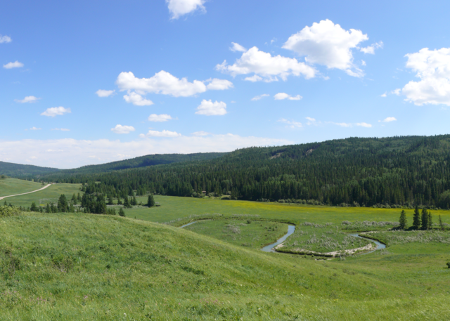
Straddling the Alberta border in the south-west, the Cypress Hills rise to 1,468 metres, the highest ground in mainland Canada between the Rockies and Labrador, with a summit plateau that stood above the last ice sheet — and the “cypress” is the Métis French cyprès, a loose word for pine.
Cypress Hills Interprovincial Park, created in 1989 as Canada’s first park shared by two provinces, is also a dark-sky preserve, and nearby is Fort Walsh, the North-West Mounted Police post built in 1875 by James Walsh, who won the trust of Sitting Bull after the Lakota crossed into Canada.
On 1 June 1873 American wolfers and whisky traders attacked a Nakoda camp on Battle Creek in the Cypress Hills, killing between about 13 and 30 people, and no one was ever convicted — it’s often said the massacre created the Mounties, a force modelled on the Royal Irish Constabulary, but their Act had passed a week earlier, and the killings only hurried them west.
3 – Prince Albert
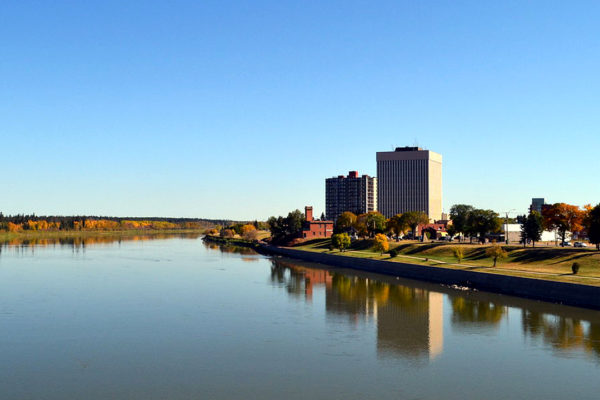
On the North Saskatchewan River at the edge of the boreal forest, Prince Albert, the “Gateway to the North”, began in 1866 as a Presbyterian mission founded by James Nisbet and named after Queen Victoria’s consort, and on 26 March 1885 Prince Albert volunteers were among the police force beaten at nearby Duck Lake, the first battle of the North-West Resistance.
Prince Albert’s Diefenbaker House, home of John and Olive Diefenbaker from 1947 to 1957, is now a museum, and north of town Prince Albert National Park, created in 1927, holds the cabin and grave of Grey Owl at Ajawaan Lake, where he lived from 1931 to 1938.
Prince Albert sent two prime ministers to the Commons — Mackenzie King, who needed a seat in 1926, and Diefenbaker, its MP from 1953 to 1979 — or three if you count Laurier’s brief win in 1896, and the Hudson’s Bay Company’s man here, Lawrence Clarke from Fermoy, County Cork, was accused at the time of pushing the police into that fight at Duck Lake.
4 – Regina
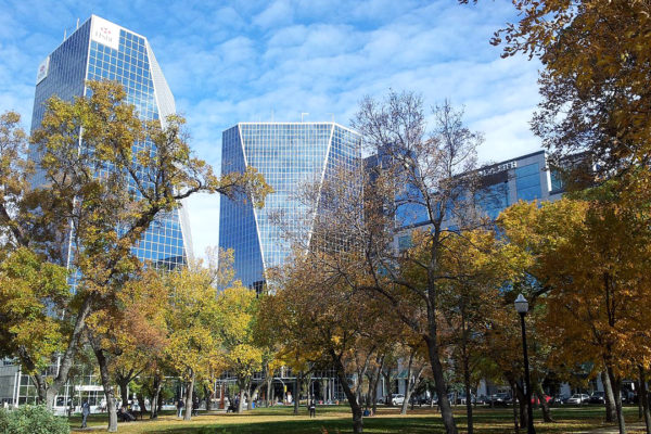
On Wascana Creek on the open prairie, Regina was known as Pile o’ Bones, after the Cree name for the heaps of bison bones there, until Princess Louise named it for her mother, Queen Victoria, in 1882, and it became capital of the North-West Territories and headquarters of the Mounted Police.
Regina’s Legislative Building of 1912 looks over Wascana Centre, at 772 hectares more than twice the size of New York’s Central Park, and at the RCMP’s Depot Division, the force’s training academy, the RCMP Heritage Centre tells the Mounties’ story.
Louis Riel was tried in Regina and hanged here on 16 November 1885, and Nicholas Flood Davin from Kilfinane, County Limerick, whose Regina Leader covered the trial, reportedly got a last interview by dressing as a priest — though his 1879 report urging industrial schools for Indigenous children fed directly into the residential school system.
5 – Grasslands National Park
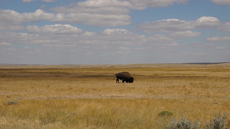
Along the US border in the south of the province, Grasslands National Park, agreed in 1981 and formally proclaimed in 2001, protects mixed-grass prairie in two separate blocks, and in its East Block badlands came the first recorded find of dinosaur fossils in western Canada, in 1874.
Grasslands’ West Block follows the Frenchman River valley, where Canada’s only colonies of black-tailed prairie dogs live, the East Block has the Killdeer Badlands, and the whole park has been a dark-sky preserve since 2009.
Plains bison were released into Grasslands in 2006, and black-footed ferrets, gone from Canada since 1937, were reintroduced here in 2009, though the programme was suspended in 2013 for lack of prey — and at nearby Wood Mountain, Sitting Bull and some 5,000 Lakota sheltered until 1881.
6 – Batoche
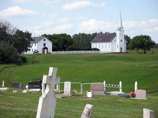

On the South Saskatchewan River between Saskatoon and Prince Albert, Batoche grew from 1872 around Xavier Letendre dit Batoche’s store and ferry on the Carlton Trail, and in March 1885 Louis Riel’s provisional government made it its base, with Gabriel Dumont as military commander.
Batoche’s national historic site keeps the long, narrow Métis river lots, the church of St Antoine de Padoue and its rectory, the only buildings left from 1885, with bullet marks still in the rectory walls, and the cemetery where Dumont is buried, and every summer since 1970 Back to Batoche Days has brought Métis families back.
From 9 to 12 May 1885 about 900 federal troops under General Frederick Middleton, born in Belfast, defeated fewer than 300 Métis, Cree and Dakota fighters at Batoche, with more than 25 killed on both sides, and Riel surrendered three days later — while the “Bell of Batoche”, taken as a trophy and returned in 2013, almost certainly came from Frog Lake in Alberta.
7 – Fort Qu’Appelle
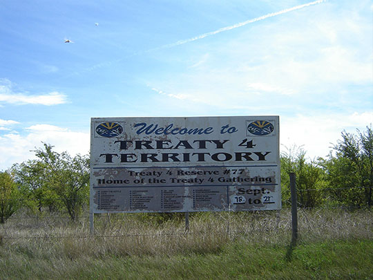
Between Echo and Mission lakes in the Qu’Appelle Valley, Fort Qu’Appelle grew around a Hudson’s Bay Company post of 1864, and here on 15 September 1874 Cree, Saulteaux and Assiniboine chiefs signed Treaty 4 with the Crown, covering about 195,000 km² of southern Saskatchewan and parts of Alberta and Manitoba.
Fort Qu’Appelle’s Hudson’s Bay Company store of 1897 still stands, the Treaty 4 Governance Centre hosts a Treaty 4 Gathering every September, and along the valley lie the Fishing Lakes and Fort San, a tuberculosis sanatorium opened in 1917.
Treaty 4 promised a square mile of reserve for each family of five and $5 a year a head, but at the talks the chiefs protested that the Hudson’s Bay Company had sold their land and asked for the £300,000 it had been paid for Rupert’s Land, which Alexander Morris refused — and in 1884 a residential school opened at Lebret, 6 km away.