
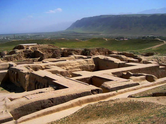
David Stanley / Wikimedia Commons / CC-BY-SA-3.0 / GFDL
Capital: Ashgabat
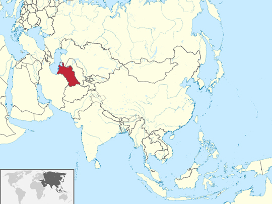
Population: 7 million+ (2022 census; independent reporting suggests far fewer)
Language: Turkmen
1 – Nisa Fortress (also above)
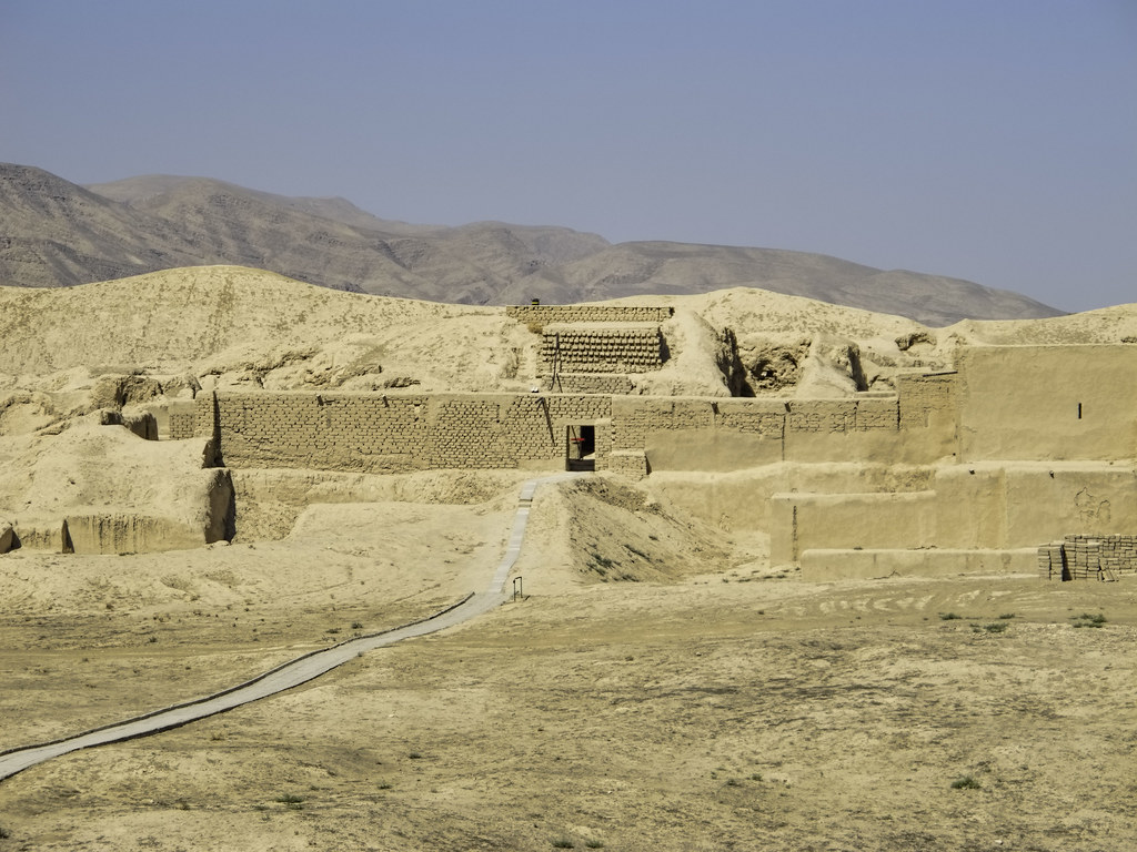
Nisa lies at the foot of the Kopet Dag mountains just outside Ashgabat, and was one of the first capitals of the Parthians, the Iranian dynasty that ruled from the Euphrates to the Indus and held Rome off for centuries — its royal fortress was called Mithradatkirt, after the king Mithradates I; UNESCO listed it in 2007.
Old Nisa is a five-sided citadel of mud-brick walls with more than forty towers on a hilltop, its excavated halls including a round hall seventeen metres across, and New Nisa, the town, lies beside it.
Nisa’s treasures went elsewhere: in 1948 Soviet archaeologists found some forty to fifty carved ivory drinking horns, mostly now in Ashgabat’s National Museum, and more than two thousand clay shards that turned out to be the paperwork of the royal wine cellars — receipts for deliveries, in Parthian, now in the Hermitage.
2 – Gonur Tepe
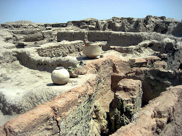
Gonur Tepe lies in the Karakum Desert in the old delta of the Murghab river, in south-east Turkmenistan, a Bronze Age city from roughly 2300 to 1600 BC and the largest site of the so-called Oxus civilisation, a culture almost nobody had heard of before the 1970s.
Gonur Tepe was excavated for four decades by the Soviet-Greek archaeologist Viktor Sarianidi, and you walk among the mud-brick foundations of a palace about 150 metres across, temples and walls, near a royal cemetery where a horse was buried with a four-wheeled wagon around 2200 BC.
Sarianidi argued that Gonur Tepe was a birthplace of Zoroastrianism, with fire temples and vessels holding traces of haoma, the sacred drink — but independent laboratories found the residue was millet, and the “fifth centre of world civilisation” label Turkmenistan now promotes for Gonur is his claim, not the scholars’ consensus.
3 – Neutrality Arch – Ashgabat

The Neutrality Arch was built in central Ashgabat in 1998 to mark Turkmenistan’s permanent neutrality, recognised by the UN in 1995 — a 75-metre tripod topped by a twelve-metre gold statue of President Saparmurat Niyazov, the self-styled Türkmenbaşy, which rotated to face the sun.
After Niyazov’s death his successor had the Neutrality Arch taken down in 2010, and it was rebuilt in 2011 on Ashgabat’s southern outskirts, taller at 95 metres, looking out over the city — the gold statue went with it.
The Neutrality Arch looks over a city that set a Guinness record in 2013 for the most buildings clad in white marble — 543 of them, with 4.5 million square metres of stone — and where, according to RFE/RL, police in 2018 began impounding black cars, whose owners were pushed to repaint them white.
4 – Karakum Desert
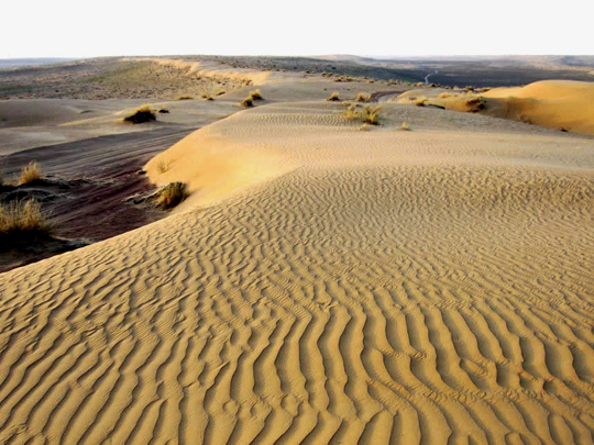
The Karakum, the “black sand,” covers some 350,000 square kilometres — about seven-tenths of Turkmenistan — and its sand dunes, clay pans and saxaul scrub have recorded temperatures above 50°C, at Repetek in 1983.
The Karakum is crossed by the Karakum Canal, dug from 1954 onwards to carry water from the Amu Darya some 1,400 kilometres west for the cotton fields — one of the longest irrigation canals in the world, and a major reason the Aral Sea has shrunk — and the desert is also the home ground of the Akhal-Teke, the lean, golden-coated horse that appears on Turkmenistan’s state emblem.
The Karakum is also where the state says it is building a lake: Golden Century Lake, in the Karashor depression, planned by official accounts at some two thousand square kilometres and fed by thousands of kilometres of drainage channels from the cotton fields — water from the same canal system, collected again in the middle of the desert.
5 – Darvaza Gas Crater
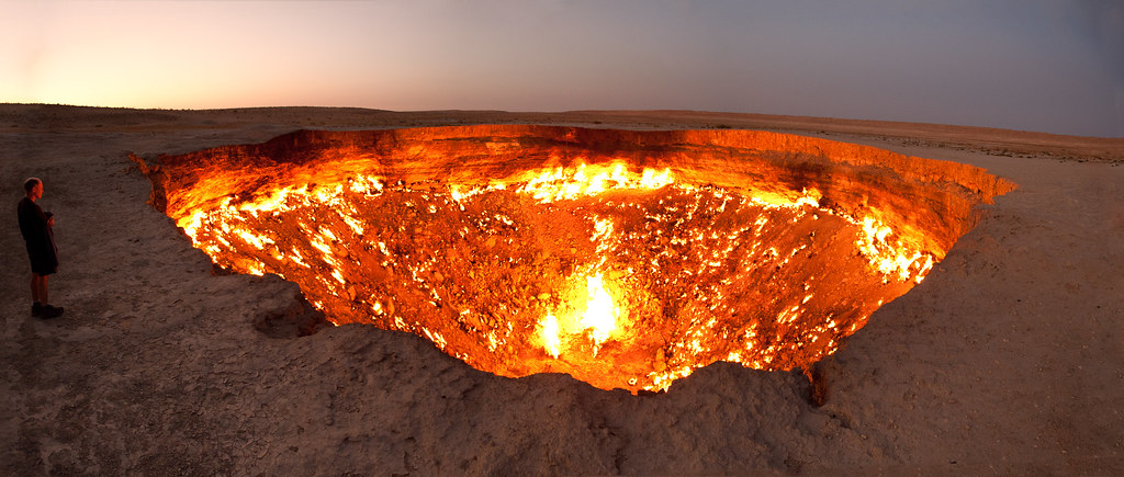
The Darvaza Gas Crater is a burning pit about seventy metres wide and thirty deep in the middle of the Karakum Desert, north of Ashgabat, where natural gas seeping from the ground has been on fire for decades — nicknamed the Door to Hell.
Darvaza is a night-time sight: tours drive out across the desert, camp in yurts on the rim and watch the fires after dark, and in 2013 the Canadian explorer George Kourounis abseiled into it and found bacteria living in the soil at the bottom.
The usual story is that Darvaza began in 1971, when a Soviet drilling rig collapsed into a gas cavern and geologists lit it expecting it to burn out in days — but no Soviet records have been published, other accounts say it collapsed in the 1960s and was lit in the 1980s, and since 2022 the state has been trying to put it out, with recent visitors reporting only scattered flames.
6 – Sultan Sanjar Mausoleum – Merv

The Sultan Sanjar Mausoleum stands among the ruins of Merv in south-east Turkmenistan, built in 1157 for Ahmad Sanjar, the last great Seljuk sultan, when Merv was capital of the Seljuk east and probably one of the largest cities in the world, with perhaps 200,000 people; UNESCO listed Merv in 1999.
The Sultan Sanjar Mausoleum is a brick cube about 27 metres high under a double dome — its turquoise-tiled outer dome is gone — and around it Merv spreads over more than a thousand hectares of walled cities from different eras, including the corrugated mud-brick fortress house of Great Kyz Kala.
When the Mongols took Merv in 1221, the chronicler Ibn al-Athir put the dead at 700,000 and Juvayni at more than 1.3 million — both impossible for a city of perhaps 200,000, but a measure of how complete the destruction was, and the Sultan Sanjar Mausoleum was one of the few buildings left standing.
7 – Kunya-Urgench
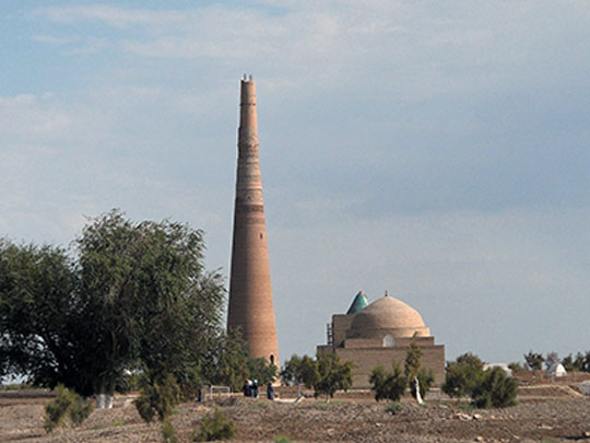

Kunya-Urgench, in northern Turkmenistan by the Uzbek border, is what’s left of Gurganj, capital of Khwarezm, whose shahs ruled an empire from the Caspian to Afghanistan in the late 12th century — until it provoked Genghis Khan; UNESCO listed it in 2005.
At Kunya-Urgench a handful of monuments stand alone in an empty plain: the Kutlug Timur minaret, about 60 metres high and leaning, the tallest medieval minaret in Central Asia outside Afghanistan, the conical-roofed mausoleums of Il-Arslan and Tekesh, and the tiled dome of the Turabek Khanum mausoleum — while women roll down the nearby hill of Kyrk Molla in a fertility ritual.
After the Mongols took Kunya-Urgench in 1221, according to medieval chroniclers, they broke the dam on the Amu Darya and flooded the city — and the river, freed, swung west towards the Caspian for centuries, until it turned back to the Aral in the late 16th century and Kunya-Urgench, left without water, was abandoned for Khiva.
8 – Yangykala Canyon
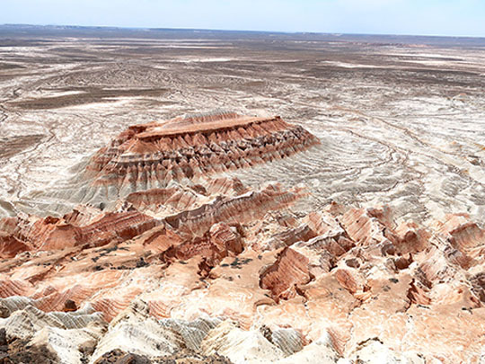
Yangykala Canyon, in the desert of western Turkmenistan about 160 kilometres east of the Caspian port of Türkmenbaşy, is a maze of cliffs between 60 and 100 metres high, layers of marine sediment laid down by an ancient inland sea, the Paratethys, and cut by erosion — the name is usually translated as “fiery fortresses.”
Yangykala Canyon is reached by 4×4 across open desert, about four hours each way with no facilities, and the cliffs — striped red, pink, white and ochre — are at their best at sunset; you can camp on the windy plateau above.
Yangykala Canyon runs down towards Garabogazköl, a huge salt bay of the Caspian that the Soviets cut off with a dam in 1980 to stop the sea losing water — the bay dried out completely within four years, and the dam was taken down in 1992 and the bay filled again.