
Wikimedia Commons / CC-BY-SA-3.0 / GFDL
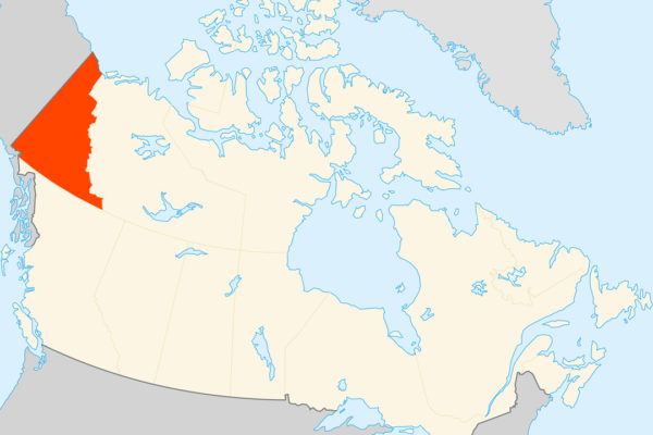
Capital: Whitehorse
Population: 48,000+
Language: English/French (14 First Nations, 8 Indigenous languages).
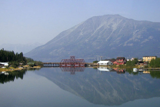
1 – Carcross (also above)
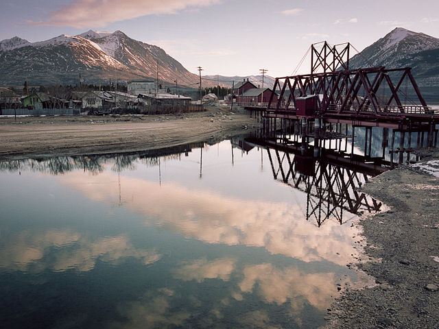
On the narrows between Bennett and Nares lakes, Carcross sits on the gold-rush water route down which, by the Mounties’ count, some 7,000 home-made boats set off for Dawson when the ice broke on 29 May 1898, and from 1911 to 1969 the town was home to the Chooutla residential school.
Just north of Carcross the Carcross Desert’s dunes run beside the South Klondike Highway, Emerald Lake takes its colour from white marl on its bed, and in summer the White Pass & Yukon Route train runs in from Skagway, back since 2007 after 25 years without passengers.
The Carcross Desert, billed as the world’s smallest, is really a field of sand dunes left by glacial lakes, in a climate too wet to count as desert, and Polly, the Caribou Hotel’s parrot, buried in the Carcross cemetery in 1972, was said to be more than 120, an age nobody could prove.
2 – Whitehorse
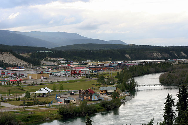
On the Yukon River below Miles Canyon, Whitehorse grew from 1898 at the head of navigation below the White Horse Rapids, named for foam like a white horse’s mane, reached the railway in 1900, and took over from Dawson as capital in 1953, a decade after the Alaska Highway was pushed through in 1942.
Whitehorse’s riverbank has the sternwheeler SS Klondike, rebuilt in 1937 and closed to visitors in 2026 for repairs, the MacBride Museum and the Yukon Beringia Interpretive Centre cover the gold rush and the ice age, and the 366-metre fish ladder at the dam is billed as the world’s longest wooden one.
Robert Service was a bank clerk in Whitehorse when he wrote “The Cremation of Sam McGee”, set on Lake Laberge just north of town — the real Sam McGee, from Ontario, built the road to Carcross and was buried, not cremated — and the railway that made Whitehorse was built by Michael “Big Mike” Heney, nicknamed the “Irish Prince”.
3 – Dawson
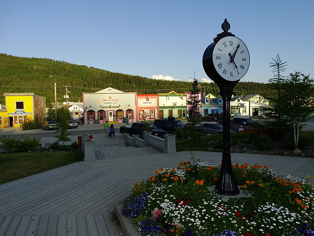
Where the Klondike River meets the Yukon, Dawson City was staked by Joseph Ladue in August 1896 and named for the geologist George Dawson, and by 1898 it held some 16,000 people, with about 30,000 in the goldfields around it out of roughly 100,000 who had set out — and since 2023 it has been part of the Tr’ondëk-Klondike World Heritage Site.
Dawson City’s boardwalks lead to Diamond Tooth Gertie’s, Canada’s oldest legal casino, opened in 1971, to Robert Service’s cabin and to Jack London’s, half of whose logs went to Oakland, and out on Bonanza Creek sits Dredge No. 4 of 1912, the largest wooden-hulled bucket-line dredge in North America.
Belinda Mulrooney from County Sligo built Dawson’s Fairview Hotel and was called the richest woman in the Klondike, Nellie Cashman from Midleton, County Cork, ran a restaurant here, and in 1978 a building site turned up 533 reels of silent film that had been used in 1929 to fill an old swimming pool.
4 – Kluane National Park
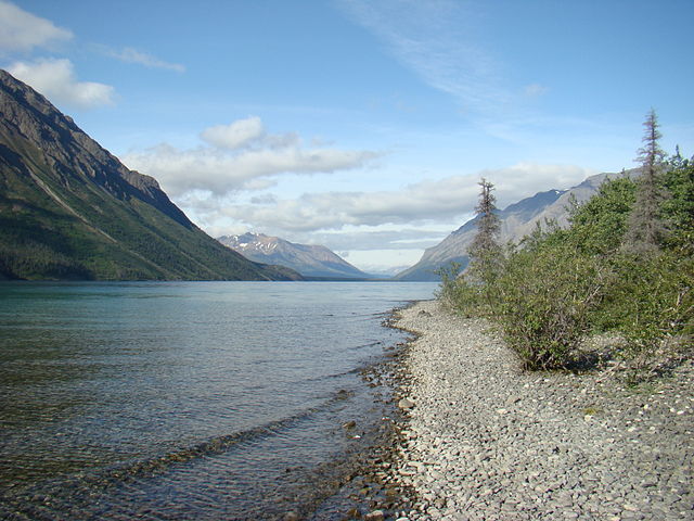
In the south-west corner of the Yukon, Kluane — from the Tlingit for “whitefish country” — became a park reserve in the 1970s and a full national park in 1993 after the Champagne and Aishihik First Nations’ land claim, and with neighbouring parks in Alaska and British Columbia it has been a World Heritage Site since 1979.
Most visitors see Kluane from the road near Haines Junction, from Kathleen Lake, pictured, and its trails, while flightseeing trips cross what UNESCO calls the largest non-polar icefield in the world to Mount Logan, at 5,959 metres Canada’s highest peak and second in North America only to Denali.
In May 2016 the retreating Kaskawulsh Glacier in Kluane sent its meltwater down a different valley in four days, leaving the Slims River nearly dry, the first such river capture documented in our lifetimes, and around 1850 a burst ice dam on the Alsek River unleashed a flood still remembered in Tlingit oral history.
5 – Chilkoot Trail
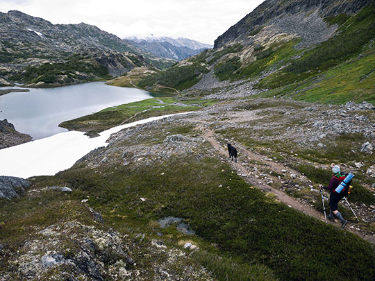
From Dyea in Alaska over the Chilkoot Pass to Bennett in British Columbia, the 53 km Chilkoot Trail never actually enters the Yukon, but in 1897–98 it was the main way in, following a Tlingit trade route that the Tlingit had long controlled and charged others to use.
Today the Chilkoot Trail is a shared US–Canadian historic park, with about 50 overnight hikers allowed over the pass each day, climbing the scree where the 1897–98 aerial tramways once ran, up the Golden Stairs to the summit, and down past lakes to Bennett.
Mounties at the Chilkoot summit from February 1898 turned back anyone without a year’s supplies, close to a ton of goods, so stampeders hauled loads up 1,500 steps cut in the ice, the scene in Eric Hegg’s famous photograph, and on 3 April 1898 an avalanche killed an estimated 60-plus — then the White Pass railway emptied the trail in 1900.
6 – Herschel Island
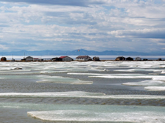

About 5 km off the Yukon’s Arctic coast in the Beaufort Sea, Herschel Island — Qikiqtaruk to the Inuvialuit — was named by John Franklin in 1826 for the Herschel family of astronomers, and from about 1890 American whalers wintered at Pauline Cove, hunting bowhead whales for their baleen.
Herschel Island has been the Yukon’s first territorial park since 1987, reached by charter plane from Inuvik, and at Pauline Cove stand the whalers’ Community House of 1893, the oldest frame building in the Yukon, and the police post set up in 1903 by Francis Fitzgerald, later of the Lost Patrol.
The whalers brought diseases that hit the Inuvialuit hard, and today Herschel Island’s threat is the sea and thawing permafrost — the Community House has been moved twice and raised again in 2023 — while Edinburgh scientists track the shrubs spreading across its tundra.
7 – Tombstone Territorial Park
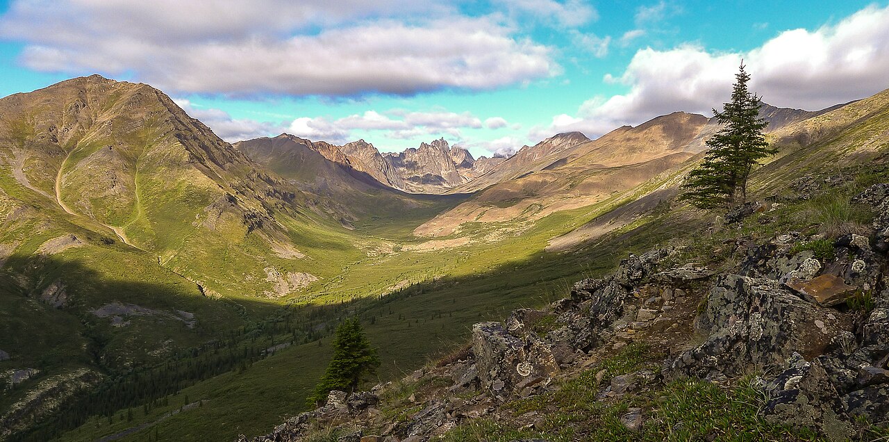
Straddling the Dempster Highway north of Dawson, Tombstone Territorial Park — Ddhäl Ch’èl Cha Nän, “ragged mountain land”, in Hän — covers about 2,200 km², was created under the Tr’ondëk Hwëch’in land-claim agreement of 1998, and is managed jointly with the First Nation.
Tombstone’s interpretive centre is at km 71.5 of the Dempster, and from the road, trails lead to backcountry camps at Grizzly, Divide and Talus lakes beneath Tombstone Mountain, named for its likeness to a grave marker.
The Dempster Highway, opened in 1979, is named after Corporal William Dempster, from Wales, who in March 1911 found the bodies of Inspector Fitzgerald’s Lost Patrol, four Mounties who died after their guide lost the way across the Richardson Mountains — and Travel Yukon now sells Tombstone as the “Patagonia of the North”.