
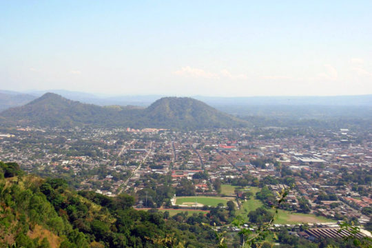
Wikimedia Commons / CC-BY-SA-3.0 / GFDL
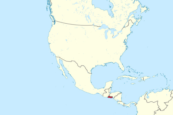
Capital: San Salvador
Population: 6 million+
Language: Spanish. Nawat (Pipil) has approx. 1,000 speakers, nearly all elderly, a surviving member of the Uto-Aztecan family, related to but distinct from Mexican Nahuatl.
1 – Santa Ana (also above)
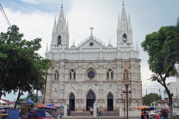
El Salvador’s second city sits in the western highlands about 64 km from the capital, at the centre of the coffee country that made the country rich in the late 1800s and produced the small circle of families who ran it for the century that followed.
Almost everything worth seeing faces Parque Libertad: the Teatro de Santa Ana, paid for by a levy the coffee growers put on their own exports and opened in 1910 with a Verdi opera, plus the Palacio Municipal and the market streets behind it, with the Santa Ana volcano, Lake Coatepeque and Tazumal all short trips out of town.
The cathedral across the square is neo-Gothic — pointed arches, spires, a white European silhouette that looks imported from somewhere a great deal colder — which makes it a genuine oddity in a region of squat colonial baroque; it replaced a 16th-century church lost to a lightning fire, and took roughly half a century to finish.
2 – Tazumal
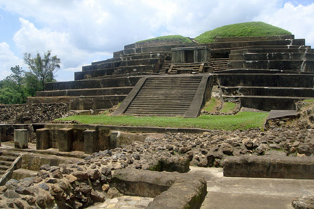
In the town of Chalchuapa in western El Salvador, Tazumal is one cluster within a much larger ancient city, occupied from the Preclassic period until around 1200 AD and trading far enough afield that goods from central Mexico and the Yucatán have turned up in its layers.
There is a stepped pyramid to walk around, a small museum named for the archaeologist who dug it, and the strange sight of a working Catholic cemetery sitting directly on top of the unexcavated part of the site.
That pyramid’s smooth grey surface isn’t Maya at all: in the 1940s and 50s the American archaeologist Stanley Boggs — a grandson of President Warren Harding — sheathed the ruins in tons of Portland cement to preserve them, and in October 2004 heavy rain brought a whole side down, because the concrete had trapped moisture and let tree roots drive metres into the masonry.
3 – San Miguel

The biggest city in eastern El Salvador, founded in 1530 and sitting in the shadow of Chaparrastique, a near-symmetrical cone that is one of the most active volcanoes in the country and dusted the region with ash as recently as the 2010s.
The centre is Parque Guzmán and the cathedral of Our Lady of Peace, and the city works as the gateway to the eastern beaches and the Gulf of Fonseca; the volcano’s lower flanks are all coffee, its summit bare rock.
What San Miguel is really known for is the Carnaval, held on the last Saturday of November and generally reckoned the biggest street party in the country — it started as a celebration of the city’s founding in May, then shifted to line up with the feast of its patron saint, and now closes the whole place down for a night.
4 – San Salvador
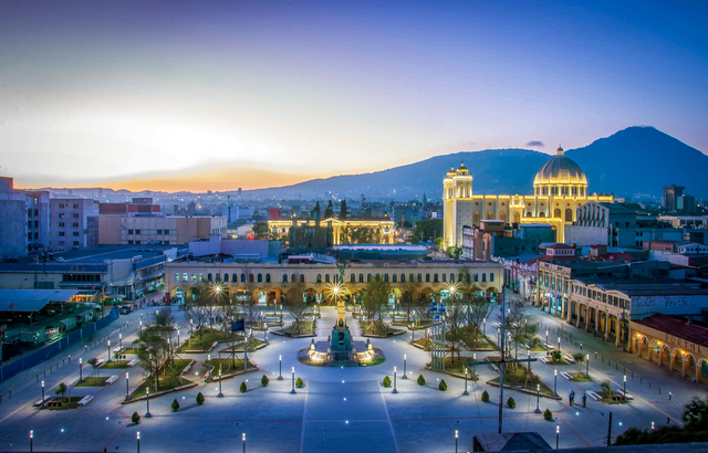
Founded in 1525, moved twice, and finally settled in a basin that locals had already named the Valle de las Hamacas — the Valley of the Hammocks — for how often the ground shakes; it has been wrecked and rebuilt so many times, in 1854, 1873, 1917 and 1986 among others, that essentially no colonial architecture survives anywhere in the city.
The Metropolitan Cathedral, Plaza Libertad and the National Theatre anchor the old centre, the extraordinary Iglesia El Rosario nearby is a bare concrete arc lit through a full spectrum of stained glass, and the Puerta del Diablo lookout above town gives you the whole valley.
On 24 March 1980 Archbishop Óscar Romero, who had spent a year publicly naming what the security forces were doing to civilians, was shot dead while saying mass in a hospital chapel; 44 more people died in the gunfire and crush at his funeral, and in 2018 he was made El Salvador’s first saint.
5 – San Vicente
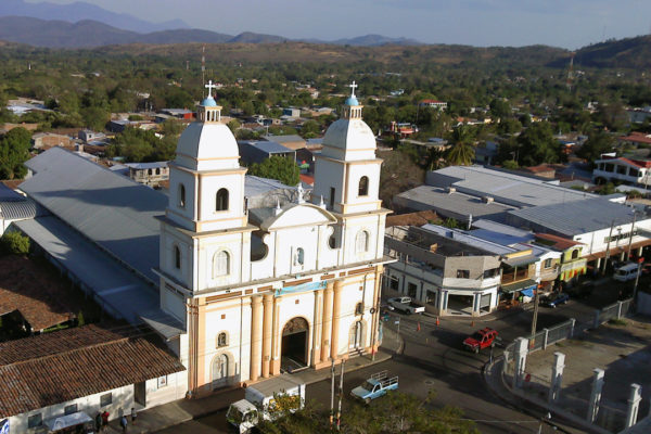
An hour east of the capital beneath the twin-peaked Chichontepec volcano, San Vicente was founded in 1635 by Spanish families and briefly served as the country’s capital in the 1830s.
The plaza holds the Torre Kiosko, an ornate iron clock tower that has become the town’s emblem, along with the cathedral and the older El Pilar church a few blocks off; the Laguna de Apastepeque and the bubbling mud vents known as Los Infiernillos are both nearby.
In February 1833 the Nonualco leader Anastasio Aquino took San Vicente at the head of an indigenous rising against forced labour and land seizures and — so the story goes — walked into the El Pilar church, lifted the crown from a statue of St Joseph and set it on his own head as King of the Nonualcos; he was captured and executed here five months later.
6 – Usulutan
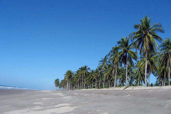
A market town and departmental capital in the south-east, sitting under its own volcano, with a name taken from Nahuat and usually translated as the place of the ocelots.
The real draw is south of town at the Bahía de Jiquilisco, the largest mangrove system in the country and one of the biggest on the Pacific side of Central America — a UNESCO biosphere reserve of channels, islets and sandbars you tour by lancha out of Puerto El Triunfo or Puerto Parada, with frigatebird colonies and four species of nesting sea turtle.
Hawksbill turtles were assumed to be creatures of coral reefs until researchers worked out that the eastern Pacific population lives and nests in mangrove estuaries instead; Jiquilisco turned out to be one of just two rookeries holding most of what remains of them, in an ocean where the species had been all but written off.
7 – Coatepeque Caldera
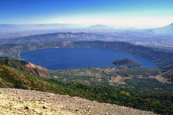
A near-circular lake of about 25 sq km filling a caldera in the western highlands, created by a run of enormous eruptions somewhere between 72,000 and 51,000 years ago, now over 100 m deep, with Santa Ana — the tallest volcano in the country — standing on its western rim.
The shore is lined with houses, boat sheds and restaurants, the water is warm enough to swim in all year, and the island in the middle, Teopán, is a lava dome the Pipil used as a ceremonial site; the road up to Cerro Verde and Los Volcanes national park starts close by.
Every few years, usually between June and August, the entire lake turns a startling turquoise within a matter of days — recorded in 1998, 2006, 2012 and several times since — and nobody has settled the cause, with algal blooms, stirred-up volcanic minerals and agricultural run-off all still in the running.
8 – Joya de Cerén
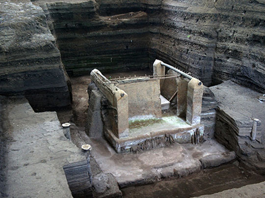
Near San Juan Opico, about 35 km west of the capital, this was an unremarkable Maya farming village until the Loma Caldera vent opened less than a kilometre away around AD 600 and buried it under several metres of ash in a few hours — and nobody knew it was there until 1976, when a bulldozer levelling ground for government grain silos cut straight through a clay wall.
You walk between the excavated shells of about ten buildings sheltered under canopies — houses, storerooms, a communal hall, a sweat lodge and what is thought to have been a shaman’s house — with perhaps two hundred more still under the ash; it is El Salvador’s only UNESCO World Heritage site.
It gets called the Pompeii of the Americas, which is right about the ash and wrong about everything else: no human remains have ever been found here, because the ground shook first and the villagers dropped what they were doing and ran — which is why their sleeping mats, their painted gourds, their pots of beans and a field of manioc planted hours before the eruption are all still here, and they are not.
9 – Suchitoto
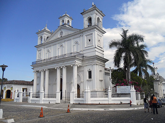

Forty-seven kilometres north of the capital above Lake Suchitlán — the country’s largest lake, and actually a reservoir filled behind the Cerrón Grande dam in 1976 — Suchitoto is the best-preserved colonial town in El Salvador, built on the indigo money that ran the economy for three centuries before coffee took over; the name is Nahuat, usually given as the place of birds and flowers.
Cobbled streets, the white-and-ochre Santa Lucía church of 1853 facing the plaza, galleries and small hotels in restored houses, indigo-dyeing workshops, boat trips out onto the lake for the birdlife, the hexagonal basalt columns behind the Los Tercios waterfall a mile out of town, and the conquest-era ruins of Ciudad Vieja about ten kilometres away.
The town sat on the front line through the 1980s and was very nearly emptied, and the survival of its colonial centre is generally credited to the filmmaker Alejandro Cotto, who is said to have talked both the army and the guerrillas into leaving Suchitoto standing; artists moved in after the 1992 peace accords, and it is now the country’s cultural capital.
Also of note: Northern Morazán was the heartland of the guerrilla side of the 1980–92 civil war, and the road up here is now signposted as the Ruta de Paz, the Peace Route: it takes in the former guerrilla base at Perquín, the museum holding the transmitter that broadcast the clandestine Radio Venceremos, and the memorial at El Mozote, where soldiers killed around a thousand villagers in December 1981.