
Wikimedia Commons / CC-BY-SA-3.0 / GFDL
Capital: Guatemala City
Population: 18.6 million+
Language: Spanish/Q’eqchi’/K’iche’/Mam/Kaqchikel

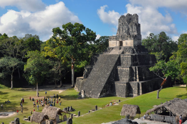
1 – Tikal (also above)

Deep in the Petén rainforest in the far north, Tikal was one of the great powers of the Maya world, lived in for well over a thousand years and home to tens of thousands of people at its height around 700 AD, before it was abandoned and swallowed by jungle.
Six enormous temple-pyramids push up through the canopy — Temple I on the Great Plaza holds a king’s tomb, Temple IV is the tallest at roughly 65 m — and the thing to do is climb one at dawn, when the howler monkeys start up and the forest sounds a great deal more alarming than it looks; Tikal is one of the rare UNESCO sites listed for both its ruins and its wildlife.
This is where George Lucas filmed the rebel base on Yavin 4 for the first Star Wars in 1977: the crew hauled their gear up Temple IV with a pulley system and shot the view east over Temples I, II and III — and the entire Guatemalan sequence lasts under twenty seconds on screen.
2 – Guatemala City
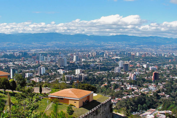
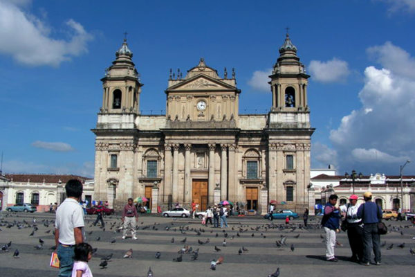
The capital sits in a highland valley at about 1,500 m that has been occupied for a very long time indeed: Kaminaljuyú, one of the earliest major Maya cities and home to a literate elite before anywhere else in the Maya world, stood right here, and most of it now lies under the suburbs, car parks and shopping malls of the modern city.
Zona 1 holds the National Palace, the cathedral and the pedestrianised Sexta Avenida, most of the museums sit out in Zona 13, and the numbering is not arbitrary — the city’s zones spiral outwards from the centre.
The oddest thing in the city is the Mapa en Relieve, a vast open-air concrete relief map of the whole of Guatemala finished in 1905, laid out flat across roughly 1,800 square metres with the vertical scale deliberately exaggerated so the mountains read properly — the survey work behind it took years of trekking the country by donkey and horseback.
3 – Antigua Guatemala
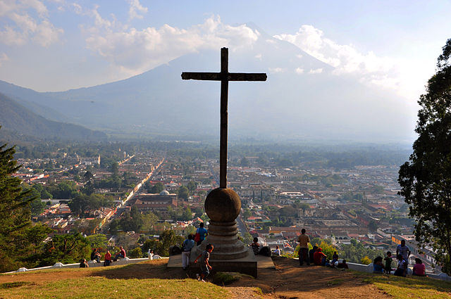
An hour west of the capital in a valley ringed by volcanoes, Antigua was Santiago de los Caballeros, the seat of Spanish authority over everything from Chiapas to Costa Rica for more than two centuries, until the Santa Marta earthquakes of 1773 broke it and the crown ordered the capital moved.
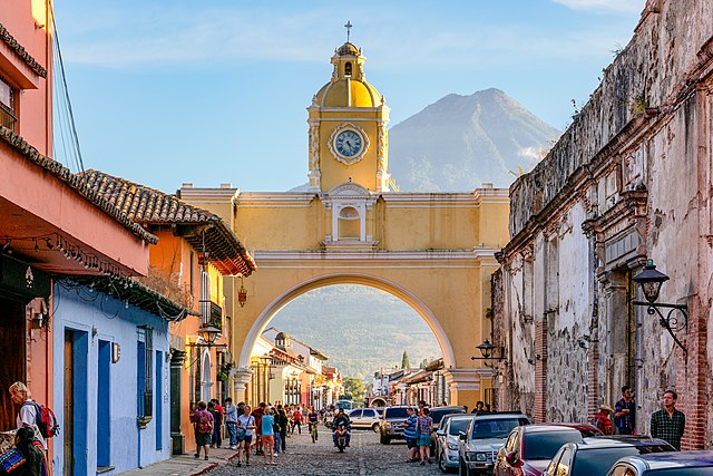
What survives is a grid of cobbled streets and low painted houses set among vast ruined churches and convents — La Merced, Las Capuchinas, the roofless cathedral — along with the yellow Santa Catalina Arch, built in 1694 with an enclosed passage inside it so the convent’s cloistered nuns could reach their school across the street without being seen, and now the most photographed object in the country, with Volcán de Agua framed behind it.
At Easter the town gets carpeted: through the night, families lay alfombras along the processional routes, intricate patterns in dyed sawdust, flowers and pine needles running tens of metres down the street — and then the Holy Week procession walks straight over them and they are gone in minutes.
4 – Quetzaltenango
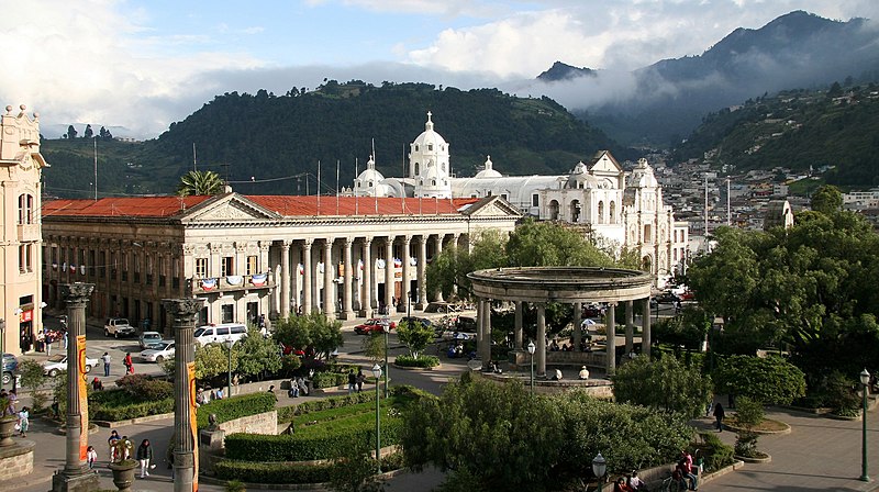
Guatemala’s second city sits at 2,330 m in the western highlands and answers to two names: Xelajú, or Xela, from the K’iche’ who built it, and Quetzaltenango, the name Pedro de Alvarado’s Mexican allies gave it after the Spanish beat the K’iche’ here in 1524; it went its own way briefly in 1838 as capital of the breakaway state of Los Altos, until the Guatemalan army took it back.
The centre is Parque Centro América, rebuilt in heavy neoclassical stone on late-1800s coffee money, with the Teatro Municipal a few blocks away; outside town are the Santa María volcano, whose 1902 eruption was among the largest of the twentieth century, the Santiaguito lava dome below it that has been erupting almost continuously since 1922, and the Fuentes Georginas hot springs.
The K’iche’ leader who died facing Alvarado, Tecún Umán, was made Guatemala’s national hero in 1960, and the legend has a quetzal dropping onto his chest as he fell and its breast staining red — which is one explanation for why the bird is on the flag, on the coins, and why the currency itself is the quetzal.
5 – Lake Atitlan
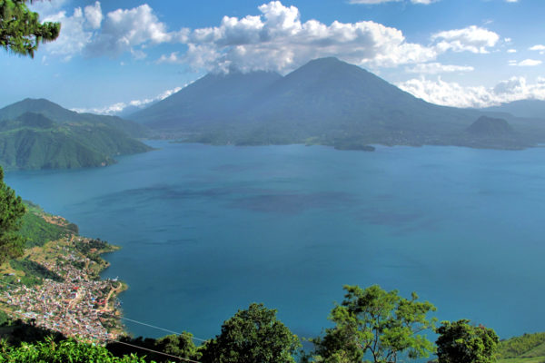
Up in the Sololá highlands, Atitlán fills a caldera left by the Los Chocoyos eruption around 84,000 years ago — an explosion large enough that its ash shows up in ocean sediments on both sides of the Americas — and it is now the deepest lake in Central America, ringed by three volcanoes and a dozen Maya villages.
You move between them by lancha (motorboat): Panajachel is the gateway, San Juan La Laguna has the natural-dye weaving co-operatives, and Santiago Atitlán has Maximón, a cigar-smoking, rum-drinking folk saint who lives in a different household every year; cross early in the day, because the Xocomil wind gets up most afternoons.
In the 1990s a Guatemalan diver named Roberto Samayoa went looking for whatever kept snagging the fishermen’s nets in one corner of the lake and found walls — an entire Maya island town, with plazas, altars and landing docks, drowned about 1,700 years ago as the water rose, and now sitting twenty-odd metres down where divers can still go and look at it.
6 – Chichicastenango


A K’iche’ Maya town in the Quiché highlands at around 2,000 m, and one of the most important religious centres in the Maya world: the church of Santo Tomás was put up in about 1540 directly on top of a Maya temple platform, and both faiths have been using the building ever since.
The market takes over the streets on Thursdays and Sundays and is the largest of its kind in Central America; the church’s eighteen steps stand for the eighteen months of the Maya solar year, and visitors go in by the side door because the front steps belong to the K’iche’ prayer leaders who burn copal on them. Up the hill outside town, offerings are still left at Pascual Abaj, a carved stone face a great deal older than the church.
This is also the reason we still have the Popol Vuh: the K’iche’ creation epic was written down in the 1550s and then kept well hidden, and the only version that survives is the copy a Dominican friar, Francisco Ximénez, was finally trusted with here around 1701 and transcribed with a Spanish translation running alongside it.
7 – Semuc Champey & the Verapaces
The Spanish called this north-central region Tezulutlán, the land of war, because they could not take it by force — so in 1537 the Dominican friar Bartolomé de las Casas talked the crown into letting missionaries go in unarmed instead, and when that worked the whole region was renamed Verapaz, “true peace”.
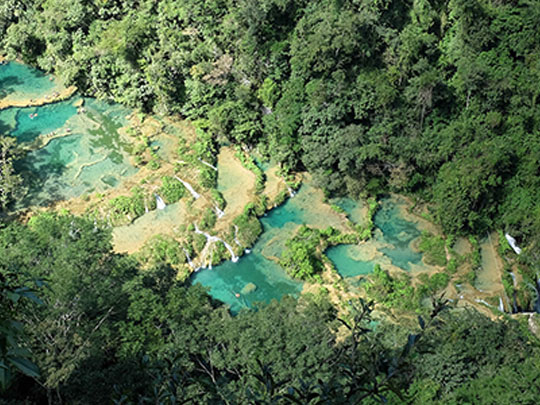
The showpiece is Semuc Champey near Lanquín: a 300 m limestone bridge with a staircase of turquoise pools on top fed by mountain springs, while the entire Cahabón river roars into a sinkhole and runs underneath it — the Q’eqchi’ name means roughly “where the river hides under the earth” — and the standard day out adds the K’anba caves, waded through by candlelight, and tubing on the river.
Cobán, the regional capital, is coffee country with an unexpected accent: German planters moved in from the 1860s, and by 1930 there were around two thousand of them, with their own club, their own school and their own railway down to the coast — the fincas and the oddly Alpine buildings are still there.
8 – Quiriguá
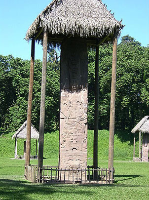

A small site in the lower Motagua valley in Izabal, near the Honduran border, that spent centuries as a minor vassal of Copán — until 738, when its ruler K’ak’ Tiliw Chan Yopaat captured his own overlord, Copán’s great king known as 18 Rabbit, and had him beheaded in the plaza here: a vassal executing his king, with no real precedent in the Maya world.
Quiriguá spent the following decades spending the proceeds, and what remains is the finest set of carved monuments in the Maya world — Stela E stands about 10.6 m above the plaza with another three metres buried as a footing, weighs somewhere around 65 tonnes and is the tallest free-standing stone monument in the pre-Columbian Americas, surrounded by boulders carved into frogs, turtles and mythical beasts.
The reason it all survives in such good order is bananas: the United Fruit Company bought the whole area in 1910 to plant it, and set the ruins aside as a protected zone in the middle of the estate — you still drive in through working banana fields to reach the gate.