
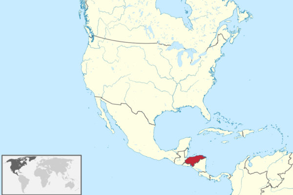
James Willamor / Wikimedia Commons / CC-BY-SA-3.0 / GFDL
Capital: Tegucigalpa
Population: 10.5 million+
Language: Spanish (also Garífuna, Miskito, Lenca, Ch’ortí, Tolupan, Pech, Tawahka, Bay Islands English)
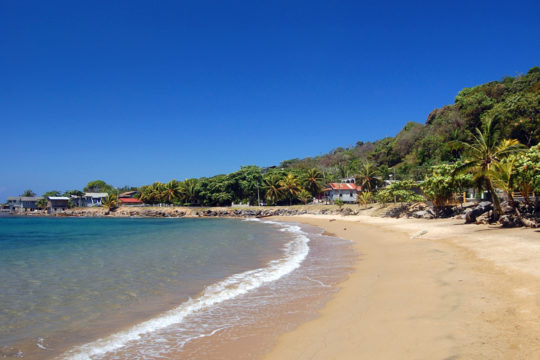
1 – Roatan (also above)
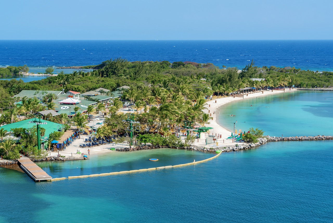
The largest of the Bay Islands, a long thin ridge of hills lying about 60 km off the north coast and sitting right on the Mesoamerican Barrier Reef; Columbus came through in 1502, Spain and Britain then spent two centuries fighting over it, and Port Royal at the east end was a working pirate base with a couple of thousand men in it at its height.
The reef is the whole point — this is one of the cheapest places in the world to get dive-certified, with wall dives dropping away a short swim from shore — and the island runs from resort-heavy West Bay through Coxen Hole to a much quieter east end of mangrove channels, where English is still the first language of a lot of islanders.
In 1797 the British shipped somewhere between two and five thousand Garífuna here from St Vincent after crushing their revolt, and left them on the north shore; the village they founded at Punta Gorda is the root of every Garífuna community from Belize to Nicaragua, and the landing is still marked there each April.
2 – Copan

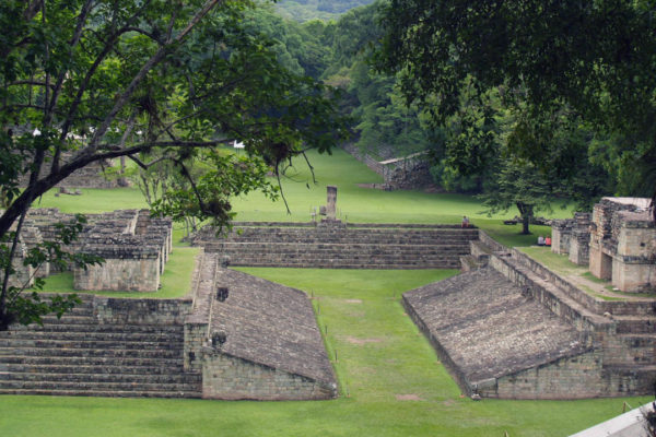
Just inside the Guatemalan border in a fertile western valley, Copán sat at the far south-eastern edge of the Maya world and became its finest sculpture workshop — sixteen kings across some 350 years, and carving good enough that the place gets called the Athens of the Maya.
Altar Q shows all sixteen rulers seated in order, handing authority down the line; there are around four kilometres of tunnels under the acropolis, and buried inside one of them is Rosalila, an earlier temple the Maya packed away whole rather than knock down — the sculpture museum holds a full-size painted replica, which is about the only way anywhere to see what a Maya temple looked like when it was new.
The Hieroglyphic Stairway is the longest Maya inscription in existence — sixty-odd steps, over a thousand carved blocks, roughly 2,200 glyphs — and when archaeologists rebuilt it around 1900 nobody alive could read Maya writing, so most of the blocks went back in the wrong order and epigraphers have been reassembling the sentence ever since.
3 – La Tigra
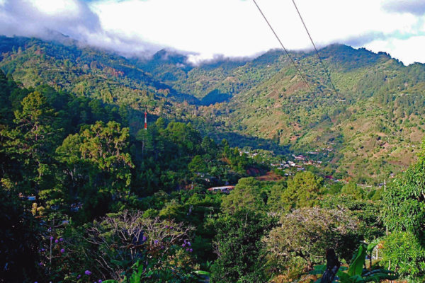
A cloud forest on the ridges about 25 km from Tegucigalpa, and in 1980 the first place in Honduras to be made a national park — in large part because the capital drinks it, with the streams coming off these mountains supplying something like a third of the city’s water.
The trails are well marked and easy to walk without a guide, climbing through oak and cloud forest to waterfalls, and it’s a reliable spot for birds that are hard to find elsewhere, quetzals included; at the eastern entrance stands El Rosario, a half-ruined hillside village of early-1900s buildings where the old mining hospital now serves as the visitor centre.
The whole place was a mine: the New York and Honduras Rosario Mining Company took gold and silver out of these hills from the 1880s until the 1950s and cut the road over the ridge that let the loggers in — and the park’s main trail today is the mule track their bullion went down to Tegucigalpa on.
4 – Pico Bonito
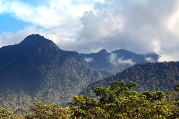
A national park of more than a thousand square kilometres in the Nombre de Dios range behind La Ceiba, established in 1987 and running from sea level up to a 2,435 m summit — the sharpest rise anywhere in Honduras, with something like forty rivers pouring off it into the Caribbean.
Almost everything visitors do happens low down: the Zacate river trail to waterfalls and swimming holes, birding among 400-odd species for toucans and trogons, and whitewater on the Cangrejal, the best rafting in the country, which runs up to class V.
The peak itself — the triangular one you see from La Ceiba, and from the Bay Islands on a clear day — is almost never climbed: there is no trail at all above the cloud forest, expeditions need climbing gear and can take the best part of ten days, and a great deal of the park has never been properly surveyed.
5 – Tegucigalpa
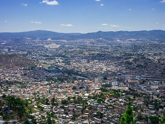
The capital sits in a bowl of hills at about a thousand metres and began in 1578 as a silver camp; it then spent most of the 1800s taking turns with rival Comayagua at being the capital until President Marco Aurelio Soto settled the argument for good in 1880.
The old centre holds the 18th-century cathedral, the Iglesia Los Dolores and the Parque Central, with the Museo para la Identidad Nacional a short walk away, and the whole tangle of it makes far more sense from the Cristo del Picacho statue on the ridge above. Strictly speaking the capital is two cities, since Tegucigalpa and Comayagüela across the Choluteca river were fused into a single Central District in the 1930s.
Out on the eastern edge of town stands the Basílica de Suyapa, built for the patron saint of Honduras — who turns out to be a cedar figurine under three inches tall, found in a field in 1747 by a farmhand who is said to have slept on it overnight without noticing, and who now pulls hundreds of thousands of pilgrims every February.
6 – The Moskitia
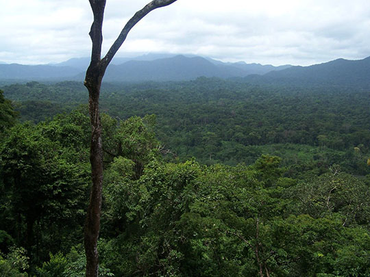
The whole north-eastern corner of the country, effectively roadless and reached by boat or small plane, is the largest wilderness in Central America. The Río Plátano Biosphere Reserve is a UNESCO World Heritage site that, together with Nicaragua’s Bosawás next door, forms the biggest unbroken forest anywhere north of the Amazon, and has sat on UNESCO’s danger list since 2011.
Miskito, Pech, Tawahka and Garífuna communities live in and around the reserve, nearly all travel is by dugout up the rivers or along the coastal lagoons, and the wildlife runs to jaguars, tapirs, giant anteaters, manatees and spider monkeys; community-run trips out of villages like Raistá and Las Marías are how most visitors see any of it.
These forests have been rumoured to hide a lost “White City” since the conquistadors, and in 2012 an airborne laser survey did reveal earthworks under the canopy: a 2015 expedition helicoptered in, uncovered a cache of more than fifty carved stone objects, pointedly declined to claim it was the city of legend, and came home with a disfiguring parasitic disease caught from sand flies.
7 – Trujillo
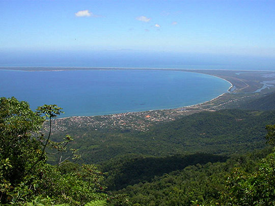
A small town on a deep bay on the Caribbean coast, and about the most historically loaded spot in Honduras: Columbus made his first landfall on the American mainland here on 14 August 1502, the first Catholic mass on the continent was said on this shore, and the Spanish founded a town in 1525 — after which pirates sacked it so persistently that it was abandoned for decades.
The Fortaleza de Santa Bárbara still stands on the bluff above the bay, the Old Cemetery holds the grave of William Walker — the American filibuster who made himself president of Nicaragua and was shot by firing squad here in 1860 — and the Garífuna villages along the coast nearby descend from those the Spanish moved over from the islands.
In 1896 an American bank clerk called William Sydney Porter jumped bail on embezzlement charges and hid out in Trujillo for several months; he later wrote the coast up as the fictional republic of Anchuria under the pen name O. Henry, and in the process coined the phrase “banana republic”.