
Wikimedia Commons / CC-BY-SA-3.0 / GFDL
Capital: San José
Population: 5.1 million+
Language: Spanish & indigenous languages (Bribri, Cabécar, Ngäbere, Maleku, Brunca, Térraba & Mekatelyu).
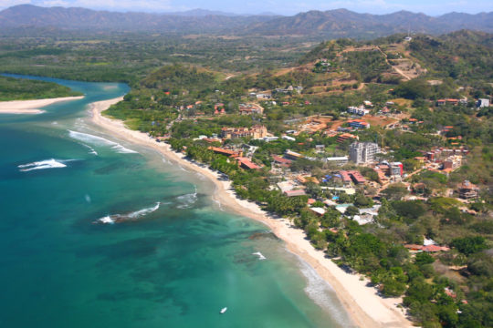
1 – Tamarindo (above)
On the Pacific coast of Guanacaste in the far north-west, Tamarindo was a fishing village that didn’t get mains electricity until the mid-1970s and is now the busiest surf town in the country, which locals call Tamagringo with varying degrees of affection.
The two-mile beach is one of the gentlest places in Central America to learn to surf, boats run north to the much heavier breaks at Witch’s Rock and Ollie’s Point, and the estuary at the top of the beach opens into a mangrove wildlife refuge full of crocodiles and howler monkeys, with the leatherback nesting sands of Playa Grande just across the water.
What changed everything was a film: Bruce Brown’s 1994 surf documentary The Endless Summer II brought Robert August down to these waves, and within a few years the empty line-ups in the footage had a town of hotels and surf schools behind them.
2 – Ujarras
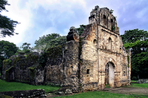
Down at the lowest, wettest point of the Orosi Valley in Cartago province stand the roofless orange limestone walls of Nuestra Señora de la Limpia Concepción, begun in the late 1500s, rebuilt in stone by the 1690s, and generally reckoned the oldest church in Costa Rica.
There is not much left beyond the shell, but it sits in an immaculately kept garden park that Costa Rican families use as a Sunday picnic spot, with the Cachí dam, the Lankester botanical gardens and the still-working 1740s church at Orosi all within a short drive.
The village didn’t fade away — it was ordered out: after a devastating flood in 1833 the assembly decreed that everyone move to higher ground at a spot now called Paraíso, and every April their descendants walk back down to the ruined church for a mass in honour of the Virgin who, legend says, once turned a pirate raid away from the valley.
3 – Corcovado National Park
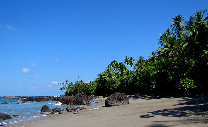
Out on the Osa Peninsula in the remote south-west, Corcovado protects the largest surviving lowland rainforest on the Pacific side of the Americas — National Geographic once described it as the most biologically intense place on earth, and it holds something in the order of 2.5% of the planet’s biodiversity in a patch you could drive across in an afternoon.
You can’t wander in alone: a licensed guide is compulsory, and most people arrive by boat from Drake Bay or by road from Puerto Jiménez to walk between ranger stations like La Leona and Sirena, where Baird’s tapirs plod along the beach at dawn and all four Costa Rican monkey species share the canopy with scarlet macaws.
The park exists because scientists persuaded President Daniel Oduber to block a huge international logging scheme in 1975; the gold panners already working the rivers were allowed to stay on, and were only cleared out in 1986, when their numbers and their hunting had grown past what the forest could carry.
4 – Arenal Volcano
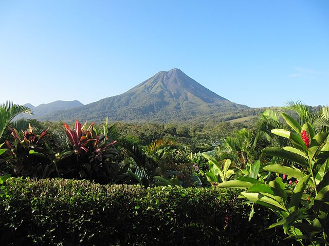
In the northern lowlands near La Fortuna, Arenal is an almost perfect 1,633 m cone that locals used to call Cerro Arenal — Arenal Hill — because it had sat quiet and forested for centuries, right up until the morning of 29 July 1968, when it blew out sideways through its western flank, killed dozens of people and wiped out three villages.
It erupted almost daily for the next four decades and has been quiet since 2010, so the draw now is the hardened 1968 lava fields, the hot springs at Tabacón, the canopy bridges, and Lake Arenal, a reservoir tripled in size by a dam finished in 1979 that drowned two entire towns and now supplies a sizeable slice of the national grid.
The town at the volcano’s foot is La Fortuna, “the fortunate one”, and you will be told it earned the name for sitting on the safe eastern side — a lovely story, except that the town was renamed before 1968, most likely for its flat and unusually fertile farmland.
5 – San José
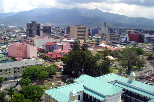
Costa Rica’s capital sits in the Central Valley at about 1,170 m and only took the title in 1823, after a short sharp fight with rival Cartago; it grew rich on coffee shipped out through the Atlantic railway, and was among the first cities anywhere to light its streets with electricity.
The National Theatre is the showpiece, paid for by a levy the coffee barons put on their own exports in the 1890s after the country’s lack of a proper venue reportedly cost it a visit from a touring opera star; the Pre-Columbian Gold Museum sits underneath the Plaza de la Cultura, and the Jade Museum holds the largest collection of American jade anywhere.
The National Museum occupies the old Bellavista Barracks because on 1 December 1948 José Figueres took a sledgehammer to its wall, declared the army abolished and handed the building over to be a museum — and the bullet scars from that year’s civil war are still there in the outside walls.
6 – Tortuguero
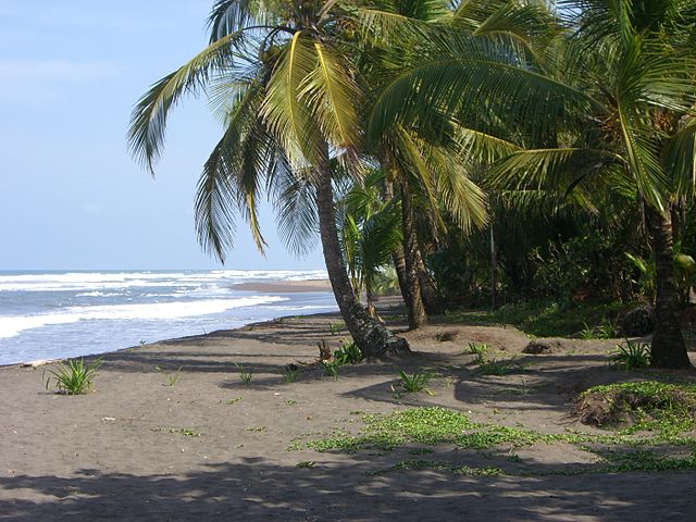
A strip of black sand and jungle canal on the Caribbean coast with no road to it at all, reachable only by boat or small plane, and the most important green turtle nesting beach in the western hemisphere — a colony that had been all but hunted out until the American zoologist Archie Carr began tagging turtles here in the 1950s and campaigning to save them.
Days go on the water, drifting the canals by boat or kayak after caimans, river otters and three kinds of monkey; nights in season mean a licensed guide, no torches and a slow walk up the beach; and the village itself is a car-free sand path with the Sea Turtle Conservancy’s small museum at one end.
The canals everyone photographs were not dug for tourists: logging outfits cut them in the 1940s and 50s to float timber out of the swamp, and the same channels now carry the visitors whose money is the reason the forest is still standing.
7 – Monteverde Sky Walk
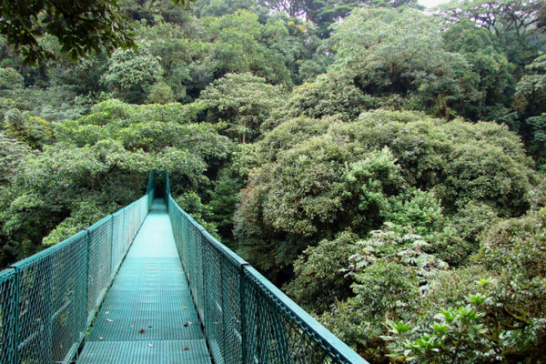
High on the Tilarán range, Monteverde is cloud forest — trees permanently dripping with mist — and it exists as a settlement because a group of Quakers left Alabama in 1951 for a country that had just abolished its army, bought a mountainside, and set aside a third of it to protect their water supply.
The Sky Walk is a chain of suspension bridges strung through the canopy, putting you level with the treetops where resplendent quetzals and three-wattled bellbirds live; around it are the Monteverde and Santa Elena reserves, more orchid species than anywhere else on earth, and the Quakers’ original cheese factory still going in the village.
The forest’s emblem used to be the golden toad, a startlingly orange little amphibian found in a few hectares of Monteverde and nowhere else on the planet; it was described in 1966, last seen in 1989, and is now one of the standard textbook cases of an extinction tied to a warming, drying climate.
8 – Guayabo National Monument
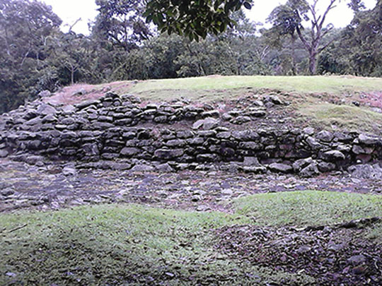
On the rainforested southern slopes of the Turrialba volcano in Cartago province, Guayabo is the largest and most important pre-Columbian site in Costa Rica, a town lived in from around 1000 BC until roughly 1400 AD, when — a century before any Spaniard arrived — its people simply left, with no burnt buildings or mass graves to explain why.
Forest paths lead past circular stone platforms that once held wooden roundhouses, cobbled causeways running out towards settlements several kilometres away, water tanks, tombs and petroglyphs of jaguars and lizards, with a viewpoint above the clearing that makes sense of the layout; only a small fraction of the site has ever been dug.
The real showstopper is the plumbing: the stone aqueducts built here more than a thousand years ago still carry running water, and in 2009 the American Society of Civil Engineers made Guayabo an International Historic Civil Engineering Landmark — the same honour it gives the Panama Canal and the Eiffel Tower.