
Wikimedia Commons / CC-BY-SA-3.0 / GFDL
Capital: Belmopan
Population: 395,000+
Language: English/Spanish/Belizean Kriol

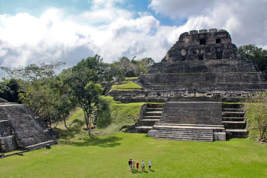
1 – Xunantunich (above)
Perched on a limestone ridge above the Mopan River in western Belize, less than a kilometre from the Guatemalan border, this Maya city was abandoned around 750 AD and then came roaring back between roughly 780 and 890 as a regional power, right as the rest of the Classic Maya world was falling apart.
You cross to it on a hand-cranked cable ferry — a man turns a wheel and hauls you over the river — and then climb El Castillo, at about 40 m the second-tallest structure in Belize, banded with stucco friezes of the sun god, the moon and Venus, with six plazas and a ball court spread out below.
The modern name means “Stone Woman”, after a ghost in white said to have been seen climbing El Castillo and melting into the stonework, but the real prize came in 2016: a royal tomb, and beside it two hieroglyphic panels carved at Caracol in 642 AD, taken as war loot by rival Naranjo and eventually dumped here — an ancient press release, stolen twice.
2 – Ambergris – San Pedro
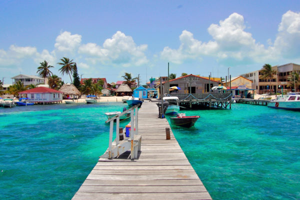
Belize’s largest island is a 40 km strip of sand and mangrove lying just inside the barrier reef, named for ambergris, the waxy sperm-whale secretion that perfumers once paid fortunes for. The Maya ran it as a trading post for centuries, and modern San Pedro was founded in the mid-1800s by mestizo families fleeing the Caste War in Yucatán, which is why the town is Spanish-speaking and Catholic.
Golf carts instead of cars, and the water is the point: Hol Chan Marine Reserve and its cut through the reef, Shark Ray Alley with its nurse sharks and stingrays, and Bacalar Chico at the far northern tip, where boats thread a narrow channel that the Maya are widely said to have dug by hand, slicing the island loose from Mexico.
The island’s other name, La Isla Bonita, was lifted wholesale from Madonna’s 1987 single — she has said the song wasn’t about a real place, but it name-checks San Pedro, and Belize has cheerfully claimed it ever since.
3 – Actun Tunichil Muknal
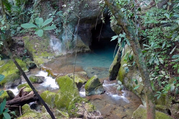
A river cave in the Tapir Mountain Nature Reserve near San Ignacio, understood by the Maya as a mouth of Xibalba, the underworld, and used for sacrifice during the drought-wracked closing century of the Classic period, roughly 700–900 AD; the remains of at least fourteen people, several of them young children, still lie where they were left.
Getting in means a jungle hike, river crossings, a swim through the hourglass cave mouth and a kilometre of wading before you haul yourself up into the dry upper chamber — where you walk in socks, and where cameras have been banned since 2012 after a visitor dropped one onto a thousand-year-old skull.
The calcified skeleton glittering on the chamber floor has been called the Crystal Maiden since the site opened, but analysis points to a young man of about 17 to 20 — a name that outlived the person it was meant to describe.
4 – Caye Caulker
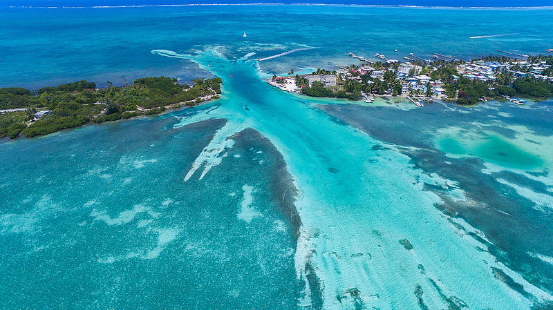
A five-mile sliver of coral sand between Ambergris Caye and Belize City, its name most likely a worn-down version of the Spanish Cayo Hicaco, after the cocoplum thickets, and a working lobster-fishing village for generations before the first backpacker turned up.
There are no cars — just bikes, golf carts and sand streets — and the island motto, painted on half the walls, is “Go Slow”; the social centre is the Split at the north end of the village, and boats leave every morning for the barrier reef and the seahorses and rays of the Caye Caulker Marine Reserve.
The Split isn’t quite the act of God everyone claims: Hurricane Hattie tore a shallow cut through the island in 1961, and the islanders then dredged it deeper and wider so boats could get through, which is why the country’s most photogenic hurricane scar is partly homemade.
5 – Cockscomb Wildlife Sanctuary
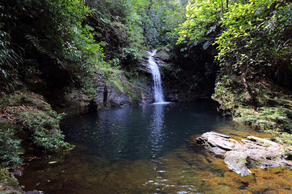
Some 128,000 acres of rainforest folded into the Maya Mountains of southern Belize, declared in 1986 as the world’s first jaguar preserve after a young American zoologist recorded the densest jaguar population anyone had ever found.
You enter through Maya Centre, the village founded by families who moved out of the basin when it was protected; inside there are trails to waterfalls and swimming holes, tubing down South Stann Creek, a multi-day slog up Victoria Peak (1,120 m, Belize’s second-highest summit), all five of the country’s wild cats and around 300 bird species.
That zoologist was Alan Rabinowitz, who stuttered so badly as a child that he could speak fluently only to animals, and who stood at the Bronx Zoo promising a caged jaguar that if he ever found his voice he would use it for them — Cockscomb is what keeping that promise looked like.
6 – Lamanai
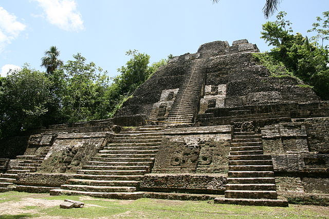
Set on the west bank of the New River Lagoon in Orange Walk District, Lamanai was lived in for roughly 3,000 years, from about 1500 BC through to the Spanish period, making it one of the longest continuously occupied Maya cities anywhere.
Most people arrive by speedboat up the New River past crocodiles and howler monkeys, then walk between the High Temple, the ball court and the Mask Temple with its four-metre limestone face, before reaching the burnt shells of two 16th-century churches the Maya were made to build and then torched, and a Victorian sugar mill whose iron machinery is being slowly crushed by a strangler fig.
Lamanai is one of the very few Maya cities still called something close to its original name — though Spanish friars garbled Lam’an’ain, “submerged crocodile”, into a form that means “submerged insect”, and nobody spotted the mistake until 1978.
7 – Great Blue Hole
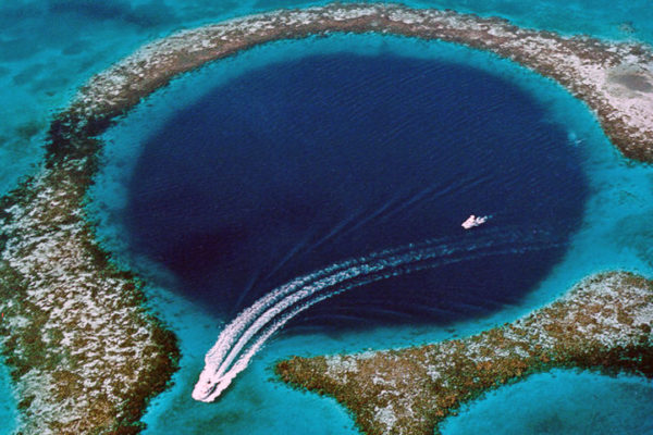
A near-perfect circle 318 m across and 124 m deep in the middle of Lighthouse Reef, about 70 km off Belize City, and not a volcanic vent at all: it is the collapsed roof of a limestone cave system that stood on dry land during the ice ages and drowned as the sea came back up.
Jacques Cousteau brought the Calypso here in 1971 and pronounced it one of the ten best dives on earth; today divers drop to around 40m to swim beneath rows of vast stalactites, all tilted at the same odd angle by an ancient shift of the whole limestone plateau, and most day trips pair it with the red-footed boobies of Half Moon Caye.
In 2018 a submersible expedition carrying Richard Branson and Fabien Cousteau made the first full 3D map of the shaft and found everything below about 90m dead — a layer of hydrogen sulphide seals off the oxygen — along with a drift of suffocated conch shells, a two-litre Coke bottle and a lost GoPro still holding somebody’s holiday photos.
8 – Caracol
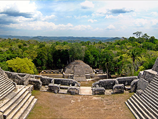

Hidden deep in the Chiquibul Forest of the Maya Mountains near the Guatemalan border, Caracol was the giant of the Belizean lowlands — a city of well over 100,000 people spread across some 200 sq km, bigger than modern Belize City, and in 562 AD it beat Tikal so completely that its rival carved no monuments at all for the next 130 years.
The road in is two or three hours of rough track from San Ignacio, which is why you can often have the place more or less to yourself: at the centre stands Caana, the “Sky Place”, a 43 m acropolis of palaces and temples you can climb, ringed by plazas, ball courts, more than fifty carved monuments and Altar 21, which records the defeat of Tikal.
A logger named Rosa Mai found the ruins in 1937 while looking for mahogany, and 1,300 years after it was finished, Caana is still the tallest structure in the entire country — no modern Belizean building has ever gone higher. LiDAR surveys from 2009 revealed terraced farmland and stone causeways running 10 km out from the centre and proved the city was far larger than anyone had expected.