
Wikimedia Commons / CC-BY-SA-3.0 / GFDL
Capital: Mata Utu
Population: 11,000+
Language: French/Wallisian/Futunan

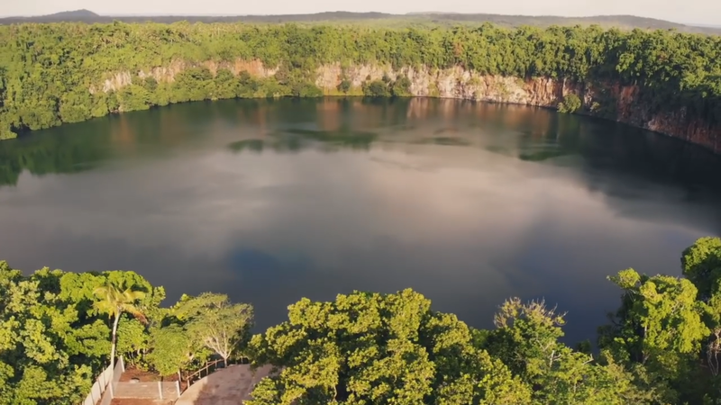
1 – Lake Lalolalo (also above)

An almost perfectly circular crater lake in the southwest of Wallis, some 400 metres across and at least 80 metres deep, ringed by cliffs that drop straight into inky water and by a band of forest that is vao tapu — sacred, and left uncut.
A built lookout gives you the whole thing at once, which is just as well because the cliffs make getting down to the water close to impossible; American forces occupied Wallis from 1942 and are widely said to have dumped surplus gear into the lake when they left, and divers have since brought up wartime ammunition of various calibres.
Down in the dark, sulphurous lower layers lives a species of blind eel found nowhere else on earth — the lake does not mix from top to bottom, so its depths are effectively a separate world that has been left alone long enough to evolve its own inhabitants.
2 – Nukuloa Beach
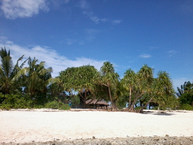
Nukuloa is one of around twenty uninhabited islets strung along the barrier reef that encloses Wallis, a lagoon so wide that the main island sits inside it like a stone in a ring — people have been here since at least 800 BC, and the motu were stepping stones on the sea road between Fiji and Samoa.
Boats run out from the main island for the day: white sand, shallow clear water, snorkelling on the inside of the reef, and the local custom of cooking an umu in the sand — heated stones, taro, yam, breadfruit and fish under banana leaves — and eating it under the coconut palms.
The territory is named after a man who barely stopped here: Samuel Wallis sailed past in 1767, fresh from becoming the first European to reach Tahiti, and gave the island his name, though its people have always called it ‘Uvea — and confusingly, Ouvéa in New Caledonia’s Loyalty Islands was settled from this lagoon in the 18th century and carries the same name in a different spelling.
3 – Talietumu Fort
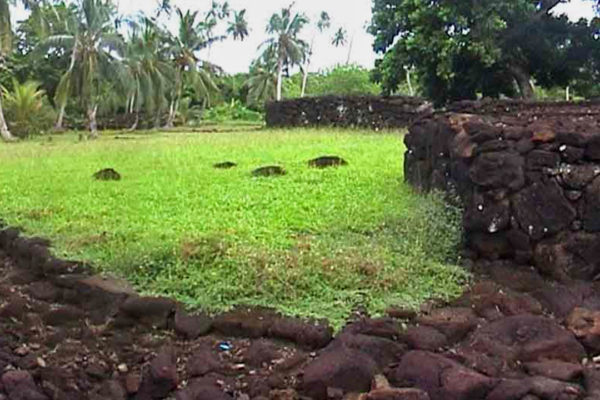
In the south of Wallis stands Talietumu, also called Kolo Nui, a fortified settlement built around 1450 by a Tongan noble line sent here to govern the island — the last and best-preserved stronghold of the period when Wallis was an outpost of the Tongan maritime empire.
Cleared and restored in the 1990s, the site is a walk through dry-stone basalt walls, raised platforms, gateways and a sacred mound, laid out among trees a short drive from Mata Utu.
Two centuries of Tongan rule left more than stonework: they installed a pyramid-shaped chiefdom that has never gone away, so this French overseas collectivity of eleven thousand people contains three customary kingdoms with three reigning kings — Uvea here on Wallis, and Sigave and Alo on Futuna.
4 – Futuna
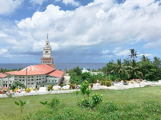

The other half of the territory lies 230 km southwest and could hardly be more different: no lagoon, no barrier reef, just steep green mountains dropping to black sand and surf, with two kingdoms, Sigave and Alo, sharing an island of about three thousand people.
The coast road links the villages, the uninhabited island of Alofi sits across a narrow strait, and the pilgrimage site is the church at Poi, which holds the relics of Saint Pierre Chanel and draws people from across the Pacific every April.
Chanel was a French Marist priest who arrived in 1837 and made few converts until the king’s own son asked for baptism; on 28 April 1841 the king’s men killed him to stop Christianity spreading — and within about two years the entire island had converted, Chanel was canonised in 1954, and the man they killed to keep the faith out is now the patron saint of the whole of Oceania.