
Wikimedia Commons / CC-BY-SA-3.0 / GFDL
Capital: Port Vila
Population: 325,000+
Language: Bislama/French/English – Vanuatu has 138 indigenous languages among roughly 325,000 people, the highest density of languages per head of any country on earth.

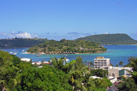
1 – Port Vila (also above)

The capital sits around a deep harbour on Efate, and for most of the twentieth century it ran the strangest colonial arrangement anywhere: from 1906 to 1980 Britain and France governed the New Hebrides jointly, giving the islands two police forces, two school systems, two currencies, two prisons and three sets of law at once.
The waterfront market trades from Monday morning to Saturday noon, the National Museum opposite parliament holds slit gongs and sand drawings, and Iririki and Hideaway islands are minutes offshore.
The joint administration was so unwieldy that residents nicknamed it the Pandemonium — when the French built new hilltop offices and it emerged that the Tricolour was flying higher than the Union Jack, they had to saw a length off the flagpole — and the ni-Vanuatu themselves, in whose islands all this was happening, were given neither British nor French nationality until independence in 1980.
2 – Champagne Beach
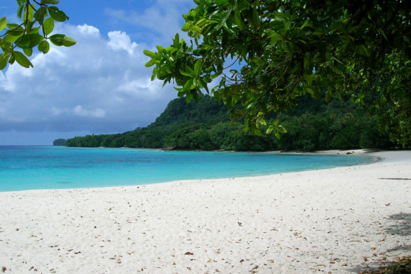
A horseshoe of white sand near Hog Harbour on the east coast of Espiritu Santo, the largest island in the country and the place where half a million American servicemen passed through a vast rear base during the Pacific war.
The sand is fine enough to squeak, the water fizzes faintly in the shallows at low tide, and within an easy drive are the limestone blue holes inland, the wreck of the liner President Coolidge, and Million Dollar Point, where the departing Americans bulldozed thousands of tonnes of equipment into the sea in 1946 rather than sell it cheap.
One of the men stationed here was a young naval officer called James Michener, who wrote Tales of the South Pacific out of it; the island you see floating on the horizon from this coast is Ambae, generally taken to be the model for Bali Ha’i, which means half the world has hummed about a place visible from this beach.
3 – Chief Roi Mata’s Domain
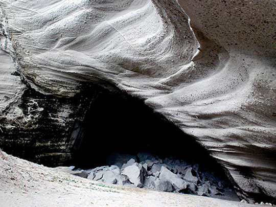
Spread across three sites west of Port Vila — a residence on Efate, a cave on Lelepa, and a small island called Artok — this is where the paramount chief Roi Mata lived, died and was buried in the early 1600s, and it became Vanuatu’s first and so far only World Heritage site in 2008.
Community-run tours from Mangaliliu take you by boat to the cave where he died, its walls painted with rock art including a whale, and on to the burial island, which has been under a customary tapu for four hundred years and is largely untouched as a result.
The site was found by following a story: French archaeologist José Garanger dug in 1967 where local oral tradition said the grave lay, and found Roi Mata exactly there, surrounded by around fifty other burials whose positions matched the tradition that his retinue went into the ground with him, many of them alive.
4 – Mount Yasur – Tanna
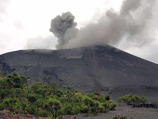

A 361-metre cone at the southeastern end of Tanna, sitting inside a much older caldera, Yasur has been erupting more or less without pause for at least eight hundred years — Cook was drawn towards Tanna by its glow in 1774, anchored beneath it at Port Resolution, and noted in his journal that it went on thundering every four or five minutes all evening.
A rough track crosses a grey ash plain to a car park below the rim, and a short climb from there puts you at the edge of a crater 400 metres across watching lava thrown into the air several times an hour, best in the half hour after sunset; the same volcano has lifted the harbour at Port Resolution more than 20 metres in the past century.
Yasur is also the centre of the John Frum movement, which began on Tanna around 1940 and grew after American forces arrived with more cargo than the island had ever seen: followers hold that John Frum lives inside the volcano and will one day come out of it, and each 15 February they gather at Sulphur Bay below the cone to raise the American flag and march with bamboo rifles.
5 – Siri Falls – Gaua
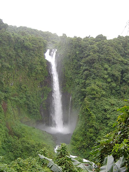
On Gaua in the remote Banks Islands, far up in the north of the country, Siri drops around 120 metres in a single fall — the tallest in Vanuatu — and it is fed by Lake Letas, the largest lake in the country, which fills the crater of an active volcano at the island’s centre.
Getting there means a flight to a grass airstrip and a walk of a few hours through jungle, and the full circuit crosses the lake by outrigger canoe to climb Mount Garet, which still steams.
Gaua is where water music comes from: women stand waist-deep in a pool or the lagoon and play the surface itself, cupping, slapping and swishing the water into layered percussion — a form invented and perfected here in the Banks and now performed across Vanuatu and abroad.