

Wikimedia Commons / CC-BY-SA-3.0 / GFDL
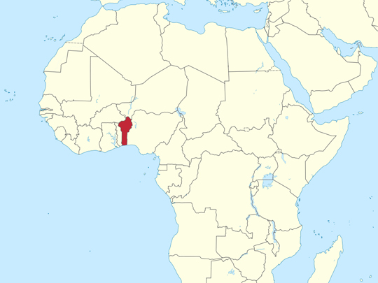
Capital: Porto-Novo
Population: 14 million+
Language: French (Fon, Yoruba, & over 60 other languages spoken)
1 – Atakora Mountains (above)
A chain of ancient quartzite ridges running across Benin’s remote northwest along the borders with Togo and Burkina Faso, cloaked in dry savanna, baobabs and hidden waterfalls, with the town of Natitingou as its hub.
The big draw is the Tata Somba — extraordinary two-storey fortified houses of mud and thatch built by the Betammaribe people, best seen around Boukombé and the UNESCO-listed Koutammakou landscape that spills over into Togo; cool off afterwards at the Tanougou and Kota falls.
The Betammaribe — whose name roughly means “those who shape the earth” — retreated into these hills centuries ago to escape the slave raids of the kingdom of Dahomey, building their homes as little clay fortresses; most still live in them today.
2 – Pendjari National Park
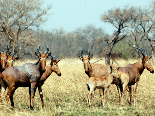
In Benin’s far northwest where it meets Burkina Faso and Niger, Pendjari is the heart of the vast W-Arly-Pendjari complex — a UNESCO World Heritage Site and the largest intact savanna ecosystem left in West Africa.
Long the region’s finest safari, it shelters West Africa’s biggest elephant herds along with buffalo, hippo, roan antelope, leopard and more than 460 bird species, all now guarded by the non-profit African Parks; game drives centre on the Pendjari River and its floodplains.
It’s one of the last refuges on Earth for the critically endangered West African lion — a genetically distinct lion of which only a few hundred survive, with roughly a quarter of them living right here.
3 – Ganvié
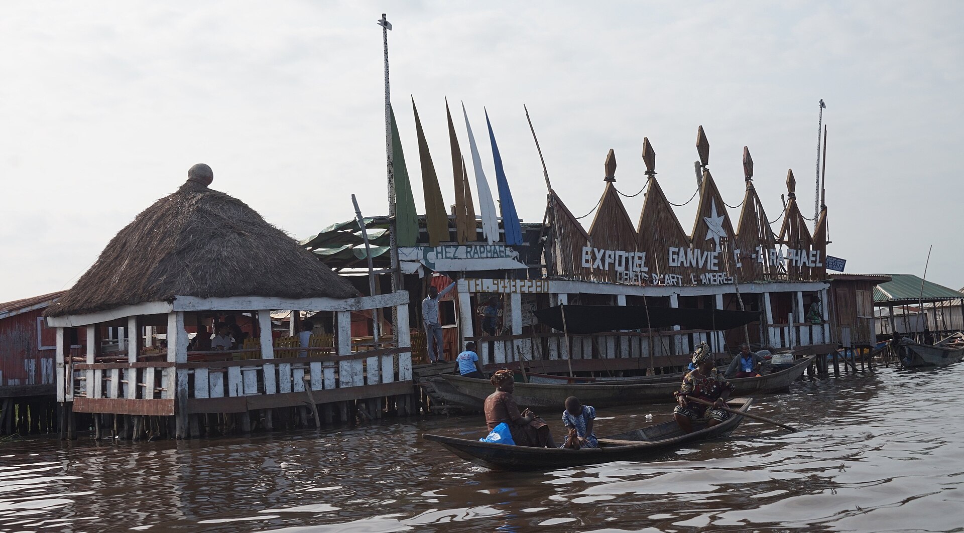
Ganvié is the largest lake and stilt village in Africa, situated on Lake Nokoué, just north of Cotonou.
The Tofinu people built that stilt village out on Lake Nokoué specifically to escape Dahomey’s slave-raiders, who by religious taboo were forbidden to attack anyone living on water.
The name Ganvié translates from the Fon language to mean “I was rescued here” or “we survived”.
4 – Cotonou

Strung along a sandbar between the Atlantic and Lake Nokoué, Cotonou began as a Fon fishing village under Dahomey — its name is usually translated from the Fon as “mouth of the river of death” — and grew after the French arrived into Benin’s largest city and its seat of government, though Porto-Novo keeps the official title.
Lose an afternoon in Dantokpa, over 20 hectares and the largest open-air market in West Africa, with a whole quarter given over to vodun supplies; then the red-and-white striped Notre-Dame cathedral and the contemporary African art of the Fondation Zinsou.
The city runs on zémidjans, the motorbike taxis whose name means roughly “take me quickly” in Fon — an estimated 72,000 of them here, their drivers in numbered shirts colour-coded by town, which is why Cotonou is a city of yellow.
5 – Abomey
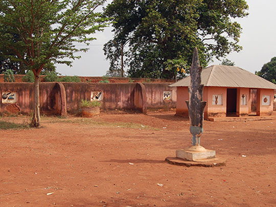
Ninety minutes inland from the coast, Abomey was the capital of the Kingdom of Dahomey from the 17th century until the French conquest of 1892 — the state whose slave raids drove the Betammaribe into the Atakora hills and the Tofinu out onto Lake Nokoué.
Twelve successive kings each built a palace inside one walled compound of some 44 hectares, UNESCO-listed since 1985; the earthen walls carry polychrome bas-reliefs recording each king’s emblems and victories, and the site takes in the royal tombs, the appliqué workshops and the Historical Museum.
French troops looted and burned the palaces in 1892 and carried 26 royal treasures back to Paris, where they stayed for 129 years until France formally handed them over in November 2021 — a homecoming that became the subject of Mati Diop’s documentary Dahomey, which won the Golden Bear at Berlin in 2024.
6 – Ouidah
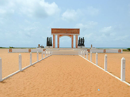

Forty-five minutes west of Cotonou, Ouidah was the port of the Hueda kingdom before Dahomey took it in 1727, and by the late 17th century something in the order of 10,000 people a year were being shipped from here — one of the busiest slaving ports on the Atlantic.
Walk the four-kilometre Route des Esclaves from the old auction square to the Door of No Return on the beach, passing the Tree of Forgetfulness and the memorial to the mass grave; the town is also a centre of vodun, with the Temple of Pythons, the Sacred Forest of Kpassè and a national holiday of processions every 10 January.
The history museum occupies a Portuguese fort that stayed Portuguese: France left it alone when it took Dahomey, and by 1958 Guinness was listing it as the smallest colony on Earth, garrisoned by an officer and a handful of men, until Dahomey seized it in August 1961.