
Wikimedia Commons / CC-BY-SA-3.0 / GFDL
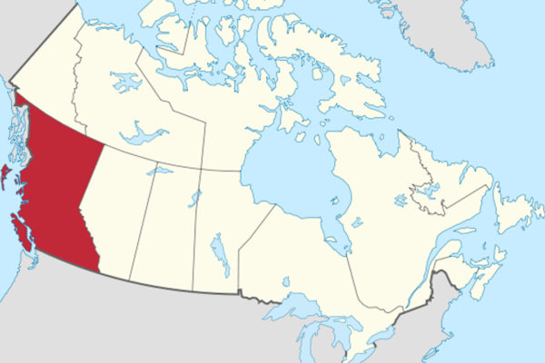
Capital: Victoria
Population: 5.7 million+
Language: no official language in law. It is home to 34 First Nations languages.
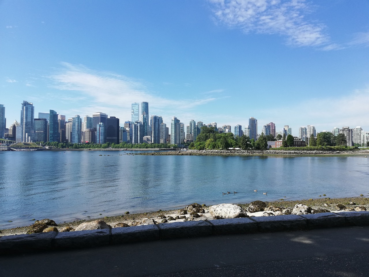
1- Vancouver (also above)
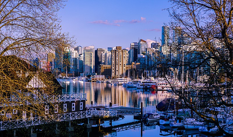
On Burrard Inlet, Vancouver is Canada’s busiest port, handling a record 170 million tonnes of cargo in 2025, and its Chinatown, settled in the 1880s, became the front line of Canada’s long effort to keep Asian immigrants out.
Walk Vancouver’s Chinatown, a National Historic Site, past the Sam Kee Building — billed as the world’s narrowest, though its 1.5 metres is actually its depth — into the Dr Sun Yat-Sen Classical Chinese Garden, opened in 1986 as the first full-scale classical Chinese garden outside China, then on to the Komagata Maru memorial at Coal Harbour.
Chinese arrivals in Vancouver paid a head tax that rose from $50 in 1885 to $500 by 1903, and from 1 July 1923 — remembered as “Humiliation Day” — they were all but barred until 1947, while in 1914 the Komagata Maru sat in the harbour for two months with 376 Indian passengers aboard, all but about twenty of whom were refused entry.
2 – Victoria
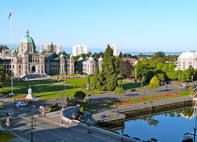
At the southern tip of Vancouver Island, Victoria began as a Hudson’s Bay Company fort in 1843 on Lekwungen land, boomed when the first boatload of Fraser River gold-seekers landed on 25 April 1858, and was chosen over New Westminster as capital of British Columbia in 1868.
Victoria’s Inner Harbour is framed by the Parliament Buildings, opened in 1898 and outlined at night by more than 3,000 bulbs, and the Empress Hotel, with Canada’s oldest Chinatown and narrow Fan Tan Alley a few streets away and Craigdarroch Castle, which its coal-baron owner Robert Dunsmuir died before finishing, up the hill.
The Parliament Buildings were designed by Francis Rattenbury, who won the competition at 25 and went on to start the Empress, and who was beaten to death at his home in Bournemouth in 1935 — the family’s 18-year-old chauffeur, who was his wife’s lover, was convicted.
3 – Black Tusk Trail
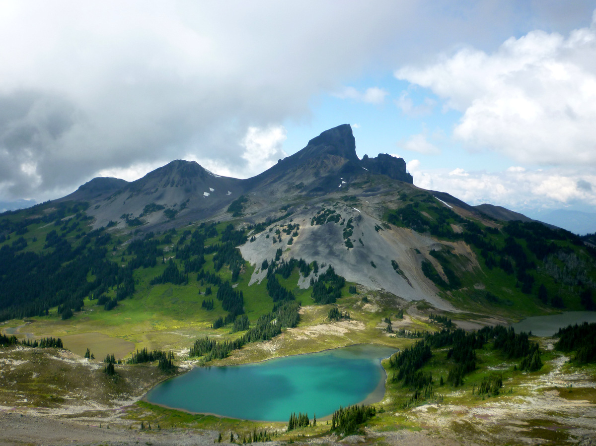
In Garibaldi Provincial Park, between Squamish and Whistler, the Black Tusk is a 2,319-metre spire of dark volcanic rock that the Squamish people call the landing place of the Thunderbird — long described as a volcanic plug, though a 2024 BC Geological Survey study says it formed when lava erupted beneath the ice-age ice sheet.
The Black Tusk trail from Rubble Creek is a round trip of about 29 km with some 1,740 metres of climbing, past Taylor Meadows and high above Garibaldi Lake, though BC Parks advises against the final scramble up the loose rock of the tusk itself.
Garibaldi Lake is held back by The Barrier, a wall of lava that cooled against the ice at the end of the last ice age and partly collapsed in 1855–56, and in May 1980 — the month Mount St Helens erupted — the province declared the village of Garibaldi beneath it unsafe to live in.
4 – Lake Magog

In Mount Assiniboine Provincial Park, protected in 1922 and part of the Canadian Rocky Mountain Parks World Heritage Site, Lake Magog lies at the foot of Mount Assiniboine (entry 6), with no road anywhere near it.
You reach Lake Magog either on foot, about 27 km from the Mount Shark trailhead over Assiniboine Pass, or by helicopter on set days in summer, and stay at the lakeside campground, the Naiset Cabins or Assiniboine Lodge, ideally in September when the larches turn gold.
Assiniboine Lodge above Lake Magog was built by the Canadian Pacific Railway in 1928 at the urging of the Norwegian ski pioneer Erling Strom, who spent some fifty years there, and it’s billed as the first backcountry ski lodge in the Canadian Rockies — owned now by BC Parks and still taking guests.
5 – Whistler
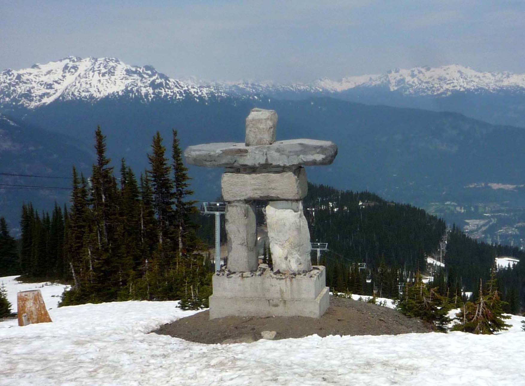
Two hours up the Sea-to-Sky Highway from Vancouver, Whistler was built to win an Olympics — local promoters bid for the 1968 Winter Games before there was a ski hill, Whistler Mountain opened in January 1966, and the Games finally came in 2010.
Whistler Blackcomb is the largest lift-served ski area in North America, at more than 8,000 acres, linked since 2008 by the Peak 2 Peak Gondola, the slopes turn into a bike park in summer, and the Squamish Lil’wat Cultural Centre, opened in 2008, tells the story of the two nations whose land this is.
Whistler Mountain was officially London Mountain until 1965, though locals had long named it after the shrill whistle of its hoary marmots — and the Peak 2 Peak’s 3 km unsupported span, a world record when it opened, was overtaken in 2017 by a cable car on Germany’s Zugspitze.
6 – Mount Assiniboine
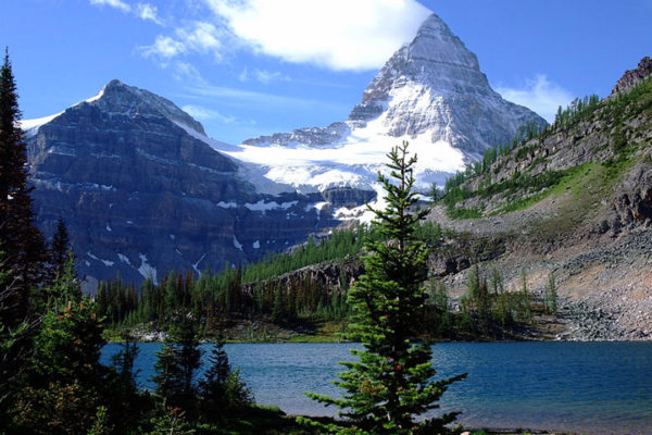
On the Continental Divide between British Columbia and Alberta, Mount Assiniboine is at 3,618 metres the highest peak in the southern Continental Ranges of the Rockies, named by the surveyor George Dawson in the mid-1880s after the Assiniboine people.
Mount Assiniboine’s steep pyramid, the “Matterhorn of the Rockies”, is best seen from Lake Magog (entry 4) or from Nub Peak above it, and reaching the summit is a serious alpine climb rather than a hike, usually by the north ridge.
The first ascent of Mount Assiniboine was made in 1901 by James Outram, a former Church of England vicar, with the Swiss guides Christian Bohren and Christian Häsler, going up the south-west face and down the north ridge — and the first to climb it alone, in 1925, was Lawrence Grassi, an Italian coal miner from Canmore.
7 – Squamish

At the head of Howe Sound, Squamish takes its name from the Skwxwú7mesh, the Squamish Nation, and grew as a logging and railway town long before the highway from Vancouver arrived in the 1950s.
Squamish is dominated by the Stawamus Chief, a granite dome rising about 700 metres above town, with 335-metre Shannon Falls beside it, the Sea to Sky Gondola above, and in winter bald eagles at Brackendale — 3,769 counted in a single day in 1994.
The Chief is often called the world’s second-largest granite monolith, a claim that only works if you compare it with Gibraltar, which is limestone — and the climb that put Squamish on the map came in 1961, when Jim Baldwin and Ed Cooper took six weeks to finish the Grand Wall while drivers pulled over on the new highway to watch.
8 – Pacific Rim National Park
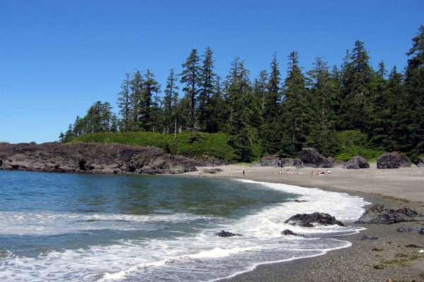
On the west coast of Vancouver Island, Pacific Rim National Park Reserve was created in 1970 in the territory of nine Nuu-chah-nulth nations, and it’s a “reserve” rather than a national park because Indigenous claims to the land are still to be settled.
Pacific Rim comes in three parts — the surf beaches of Long Beach between Tofino and Ucluelet, the hundred-plus islands of the Broken Group for sea kayakers, and the 75 km West Coast Trail, open from May to September by reservation only.
The West Coast Trail began as a lifesaving route, built from 1907 after the SS Valencia struck a reef near Pachena Point in January 1906 and about 136 people died close to shore, every woman and child aboard among them.
9 – English Bay
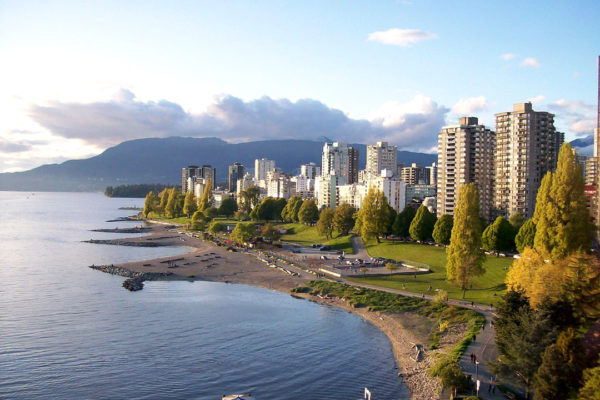
On the edge of Vancouver’s West End, a short walk from downtown, English Bay was named around 1859 for the meeting there in 1792 of George Vancouver and two Spanish captains — which is why the beaches across the water are Spanish Banks.
English Bay’s beach is overlooked by the Sylvia Hotel of 1912, the Inukshuk built by Alvin Kanak for Expo 86, and the fourteen grinning bronzes of Yue Minjun’s A-maze-ing Laughter, and every New Year’s Day since 1920 it hosts the Polar Bear Swim.
English Bay’s first official lifeguard, Joe Fortes, arrived from Trinidad in 1885, taught generations of Vancouver children to swim and is credited with saving 29 lives, and the fountain put up for him in 1927 reads “Little children loved him.”
10 – SGang Gwaay, Haida Gwaii
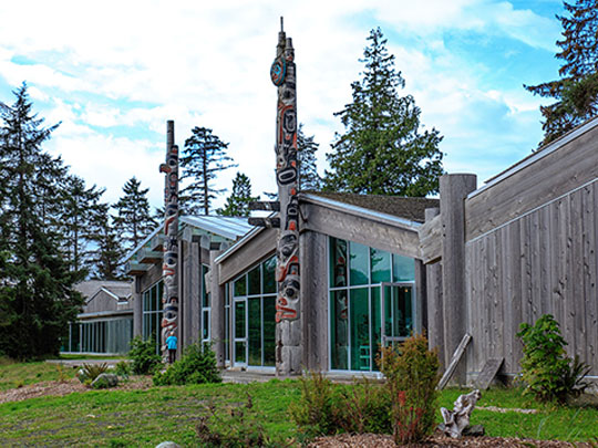
On a small island off the southern tip of Haida Gwaii, SGang Gwaay — “Wailing Island”, for the sound of the tide forced through a hole in the rock — was a Haida village of around 300 people, emptied after the smallpox brought from Victoria in 1862 cut the Haida population by about 70%, and UNESCO listed it in 1981.
SGang Gwaay is reached only by boat, kayak or floatplane into Gwaii Haanas, where Haida Gwaii Watchmen live on the island through the summer and no more than 12 visitors may be ashore at once, walking among the outlines of cedar longhouses and the mortuary and memorial poles still standing where they were raised.
In 1957 museum collectors took about a dozen poles from SGang Gwaay, paid for at $50 a section under a band council resolution whose consent is now questioned, but the Haida have chosen to let the poles left behind decay and return to the earth — and one of those taken away came home in 2019.