
Wikimedia Commons / CC-BY-SA-3.0 / GFDL
Capital: Quito
Population: 17 million+
Language: Spanish (also Kichwa & Shuar)
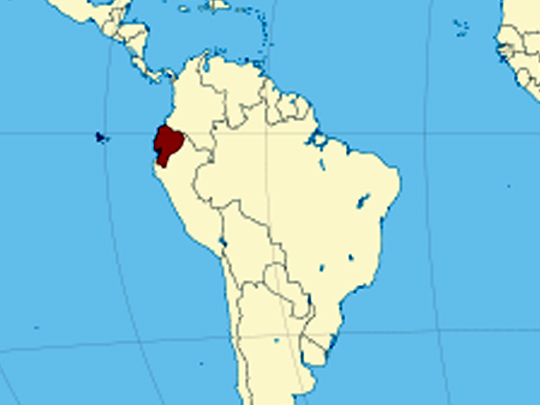
1 – Galápagos Islands (also above)
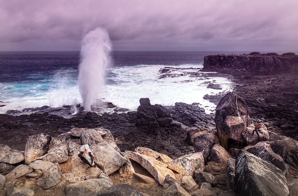
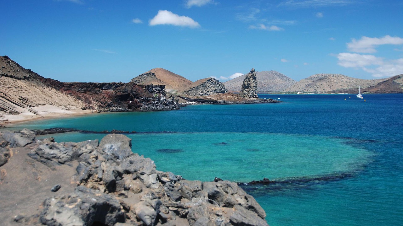
A volcanic archipelago roughly 1,000 km off Ecuador’s Pacific coast, blundered into in 1535 by the Bishop of Panama when currents dragged his ship off course, then used for two centuries as a pirate and whaling larder before Charles Darwin’s 1835 visit turned it into the birthplace of evolutionary theory.
Most trips revolve around Santa Cruz (the Charles Darwin Research Station and the highland tortoise reserves), Isabela (the huge Sierra Negra caldera, plus the world’s only equatorial penguins), Bartolomé for the Pinnacle Rock view and Española for the waved albatross colony — though it’s snorkelling alongside sea lions and marine iguanas that everyone actually talks about afterwards.
On Floreana there’s a wooden barrel that has worked as a post office since about 1793, when homesick whalers began leaving unstamped letters for homebound crews to hand-deliver, and visitors still use the same honour system today — so your postcard goes home in a stranger’s rucksack, sometimes months later.
2 – Vilcabamba
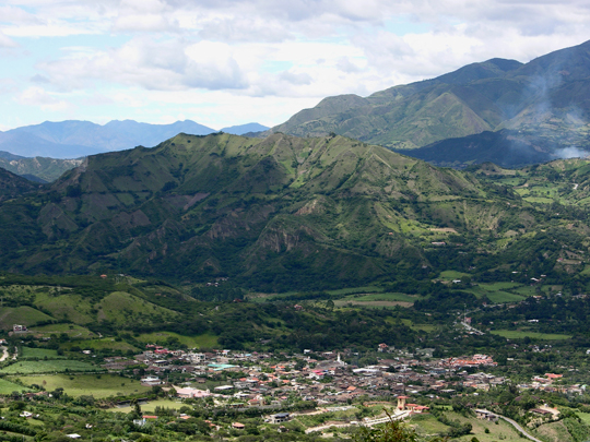
A small town in a warm, sheltered valley in Loja province in Ecuador’s far south, sitting at around 1,500 m and long nicknamed the “Playground of the Inca” for its reputation as a bolthole for Inca nobility.
It’s a walking and horse-riding base above all: the Mandango ridge — “the Sleeping Inca” — looms over the village with a steep, narrow loop trail across its face, waterfalls hide in the side valleys, and the cloud forest of Podocarpus National Park, with its mountain tapir and 550-plus bird species, begins just to the east.
Vilcabamba became world-famous in the 1970s as the “Valley of Longevity”, with residents claiming to be 120 and older — but when researchers went through the parish records they found not a single centenarian, the oldest resident was 96, and villagers had been quietly inflating their ages, partly because in that culture age brought respect.
3 – El Panecillo – Quito
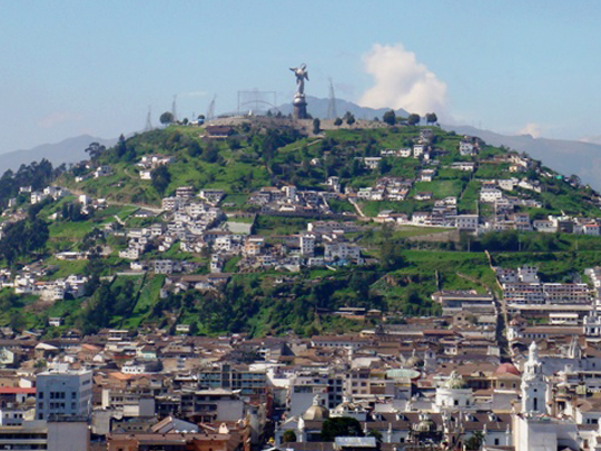
The loaf-shaped hill rising in the middle of Quito, known to the Quitu people as Yavirac and crowned by an indigenous sun temple until the Spanish demolished it, later used as a fortified high point over the colonial city.
The reason to go up is the Virgen de Quito, a roughly 41-metre statue assembled from some 7,000 numbered aluminium pieces in the mid-1970s, with a small chapel and staircases inside the base leading to viewing platforms over the old town and the ring of volcanoes around it.
She’s a supersized copy of Bernardo de Legarda’s 30-centimetre wooden Madonna of 1734 — caught mid-dance, standing on a globe and crushing a serpent — and, most unusually, she has wings, which is why Quiteños will tell you she’s the only winged Virgin Mary in the world.
4 – Pichincha Volcano
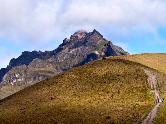
An active stratovolcano immediately west of Quito, whose eastern slopes the capital is built across, and the site of the Battle of Pichincha on 24 May 1822, where Sucre’s army broke the Spanish royalists and effectively won Ecuador’s independence.
Two summits give you two very different days out: Rucu Pichincha (4,698 m, “old man” in Kichwa) is reached by riding the TelefériQo cable car straight out of the city to about 4,000 m and walking up from there, while Guagua (“baby”, 4,784 m) is approached from the village of Lloa and rewards you with a look into a steaming, fumarole-lined caldera.
The mountain is no museum piece — Guagua erupted in 1999 and rained ash on the capital below, and its 1660 blast is reckoned to have buried Quito under roughly 30 cm of the stuff.
5 – Basílica del Voto Nacional – Quito
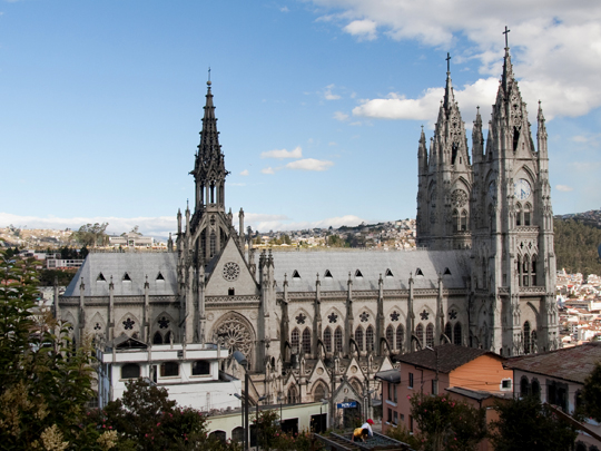
A vast neo-Gothic church in Quito’s UNESCO-listed historic centre, begun in 1892 as a national vow dedicated to the Sacred Heart, and generally reckoned the largest neo-Gothic church in the Americas.
Two things make it worth the ticket: the climb, which ends with ladders and exposed walkways high above the nave and a 360-degree view over the city, and the gargoyles, which swap Europe’s demons for Ecuadorian wildlife — iguanas, armadillos, Andean condors, monkeys and Galápagos tortoises jutting from the stonework.
Local legend holds that the day the basilica is finally finished, the world ends — which is the reason usually given for why it has been left deliberately incomplete, blessed by John Paul II in the 1980s but with details still conveniently unresolved.
6 – Cotopaxi National Park
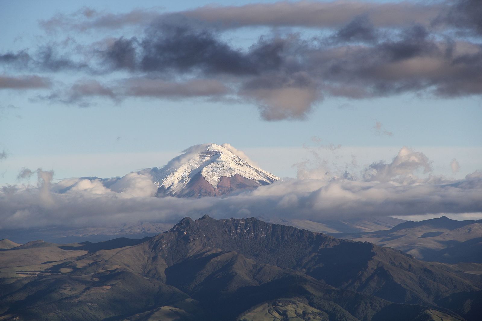
A high páramo grassland park about 50 km south of Quito wrapped around Cotopaxi (5,897 m), one of the world’s highest active volcanoes, whose eruptions have flattened the nearby town of Latacunga more than once when meltwater from its glacier turned into mudflows.
The classic day is a drive across the plateau past Limpiopungo lagoon, then the short, lung-punishing walk from the car park up to the José Ribas refuge at around 4,800 m and on to the glacier’s edge, with wild horses on the grasslands and condors overhead.
Alexander von Humboldt tried to climb it in 1802, got to about 4,500 m and pronounced the mountain unclimbable — a verdict that stood for 70 years until the German geologist Wilhelm Reiss and his Colombian companion Ángel Escobar reached the summit in 1872.
7 – Quilotoa Crater
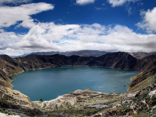
A three-kilometre-wide caldera in the western Ecuadorian Andes, created when the volcano collapsed in on itself after a colossal eruption around 1280 that sent mudflows all the way to the Pacific and spread ash across the northern Andes.
You arrive at a rim viewpoint at roughly 3,900 m, and from there it’s a half-hour descent to the shore against an hour or more grinding back up (mules wait at the bottom for anyone who regrets it), with kayaks for hire on the water and the multi-day Quilotoa Loop threading through Kichwa villages for those with time.
That astonishing green isn’t tropical-lagoon water: it comes from dissolved volcanic minerals, the lake is cold, acidic and 250 m deep with fumaroles still venting on its floor, so almost nothing lives in it and swimming is firmly discouraged.
8 – Cuenca
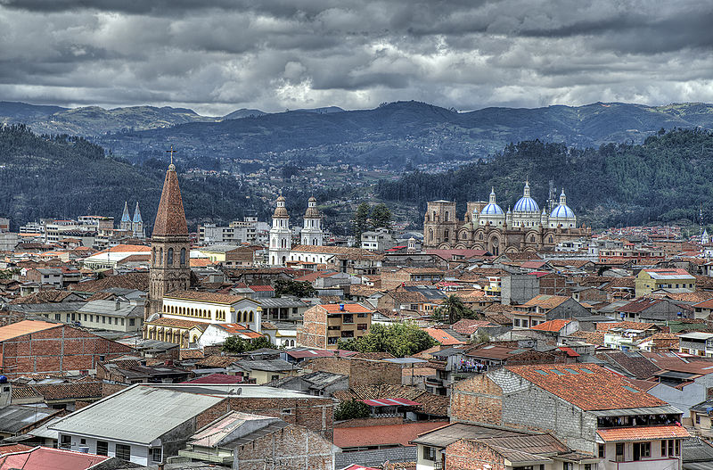
amalavida.tv / Wikimedia Commons / CC-BY-SA-3.0 / GFDL
Santa Ana de los Ríos de Cuenca sits at about 2,550 m in the southern Andes on four rivers, founded by the Spanish in 1557 on top of the Inca city of Tomebamba, which had itself been built over the Cañari settlement of Guapondelig — three civilisations stacked on one site, and a UNESCO World Heritage centre since 1999.
The old town is all cobbles and balconies, anchored by the blue-and-white domed New Cathedral, whose towers were left stumpy after someone worked out the foundations would never take their planned height, with the Inca ruins and museum at Pumapungo a short walk away and the lake-strewn moorland of El Cajas National Park half an hour west.
The Panama hat is not Panamanian at all — it’s woven from toquilla straw in and around Cuenca, and got its misleading name because the hats were shipped out through Panama, a misnomer sealed for good when Theodore Roosevelt was photographed wearing one at the canal works in 1906.
9 – Mitad del Mundo Monument
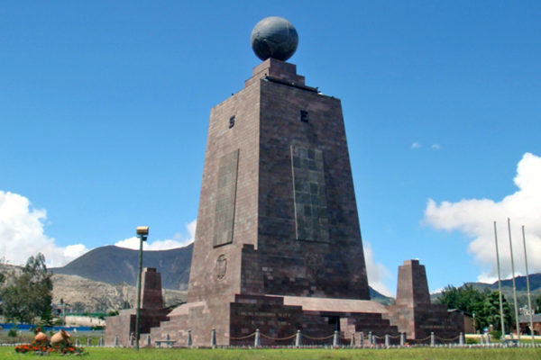
A monument complex 26 km north of Quito at San Antonio de Pichincha, marking the equator line fixed by the Franco-Spanish Geodesic Mission of the 1730s — the expedition that measured a degree of latitude here, proved the Earth bulges at the middle, and left the country with its name.
The centrepiece is a 30-metre trapezoidal tower topped by a brass globe, with an ethnographic museum inside and a painted yellow line running out across the plaza for the obligatory foot-in-each-hemisphere photograph; the rival Intiñan museum next door trades on being closer to the real thing.
Modern GPS puts the true equator roughly 240 metres from the painted line — meaning generations of visitors have straddled the “middle of the world” with both feet firmly in the same hemisphere.
10 – Ingapirca
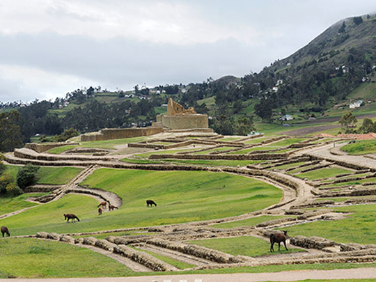
Ecuador’s largest and most important pre-Columbian site sits at around 3,100 m in Cañar province, a couple of hours north of Cuenca, and its name is Kichwa for “Inca wall” — a ceremonial, administrative and solar-observation centre raised where the Cañari already had a temple of their own, after Huayna Capac’s armies finally broke their long resistance late in the 15th century.
The whole history is legible in the stonework: rough mortar-bound Cañari walls at the base, then the precise mortarless green andesite of imperial Inca masonry above, with storehouses, terraces, aqueducts and the Acllahuasi where the chosen women wove and brewed chicha for the festivals.
The centrepiece, the Temple of the Sun, is elliptical, curved around a great natural boulder — and it is the only elliptical temple the Incas are known to have built anywhere, in an empire that otherwise worked almost entirely in straight lines and right angles.
11 – Guayaquil
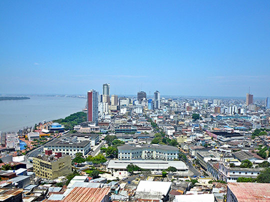

Ecuador’s largest city and its main port, founded on the Guayas estuary in 1538, and the place where on 26 and 27 July 1822 the two liberators of South America met: Bolívar coming from the north, San Martín from the south, shut in a room together having agreed in advance that nobody else would be present and no record would be kept.
Nobody knows what passed between them, and historians have been arguing about it for two centuries — but San Martín left Guayaquil, walked away from the war he had spent a decade fighting, and sailed for Europe, leaving Bolívar to finish liberating the continent alone.
The city is best taken from the water and the hills — the Malecón 2000 promenade running along the river, the repainted clapboard houses of Las Peñas climbing 444 steps to the lighthouse on Cerro Santa Ana, and the land iguanas that lounge underfoot in Parque Seminario in the middle of downtown.
12 – Otavalo
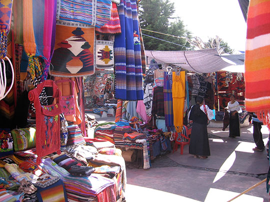
A Kichwa town ringed by volcanoes in the northern highlands about two hours from Quito, whose people were weaving and trading long before the Inca arrived in the 1490s, and who were then forced under Spanish rule into the obrajes — colonial textile workshops that ran on indigenous labour and made the region’s cloth famous at its weavers’ expense.
Saturday is the day to come: the Plaza de los Ponchos spills out into the surrounding streets with weavings, alpaca knits, felt hats and instruments, a livestock market runs on the edge of town from first light, and the Peguche waterfall, the Cuicocha crater lake and the leather workshops of Cotacachi are all within half an hour.
The Otavaleños took the craft that had been forced on them and made it their own, exporting textiles across the world and travelling to sell and play Andean music on the streets of Europe and North America — building one of the most prosperous indigenous communities anywhere in the Americas.
13 – Yasuní National Park
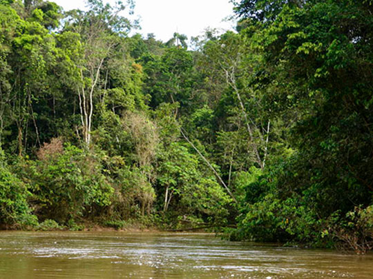
Around a million hectares of Amazon rainforest in Ecuador’s north-east, protected as a national park since 1979 and a UNESCO biosphere reserve since 1989, and home to the Waorani as well as the Tagaeri and Taromenane, who live in voluntary isolation from the outside world.
It is arguably the most biodiverse place on the planet: a single hectare holds more tree species than the whole of North America, alongside some 600 bird species, 139 amphibians and 121 reptiles, and lodges along the Napo river run canoe trips out to the clay licks where hundreds of parrots gather at first light.
In August 2023 Ecuadorians voted in a national referendum to leave the oil beneath Yasuní in the ground — reckoned to be the first time any country has voted to abandon proven reserves it was already pumping — though the wells have been slow to close since.