

Wikimedia Commons / CC-BY-SA-3.0 / GFDL
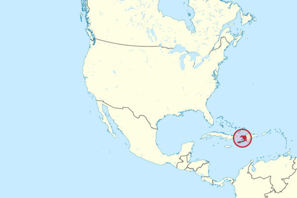
Capital: Port-au-Prince
Population: 11.8 million+
Language: Haitian Creole/French
1 – Citadelle Laferrière (above)
On a mountaintop 900 metres above the northern plain stands the largest fortress in the Americas, begun in 1805 by Henri Christophe — a former slave who became a general in the revolution and then crowned himself king — to stop the French ever coming back.
It’s an hour’s climb or mule ride up from Milot, and at the top you get walls up to four metres thick, stores for thousands of troops, and one of the great views in the Caribbean, out over jungle and mountains to the sea.
It was finished in 1820, cost thousands of lives to build, and was never attacked once — Napoleon never tried again — and the cannon still standing in its galleries were captured from half the armies of Europe.
2 – Cap-Haïtien
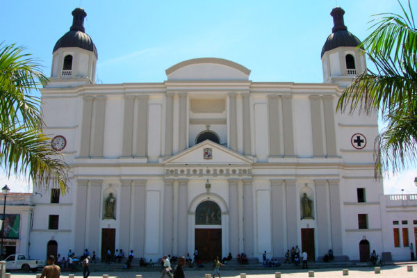
Haiti’s second city sits on the north coast below the mountains, and as Cap-Français it was the capital of Saint-Domingue, the richest colony in the world — a place of stone houses, paved streets and theatres that Europeans called the Paris of the Antilles.
What survives is a grid of balconied 18th and 19th-century buildings between the harbour and the hills, with Sans-Souci, Christophe’s ruined palace, and the Citadelle a short way inland at Milot.
All that colonial wealth rested on sugar and on the largest enslaved population in the Caribbean — and it was on the plain behind this city, in 1791, that the uprising began which would end thirteen years later in the first black republic in the world.
3 – Fort-Liberté
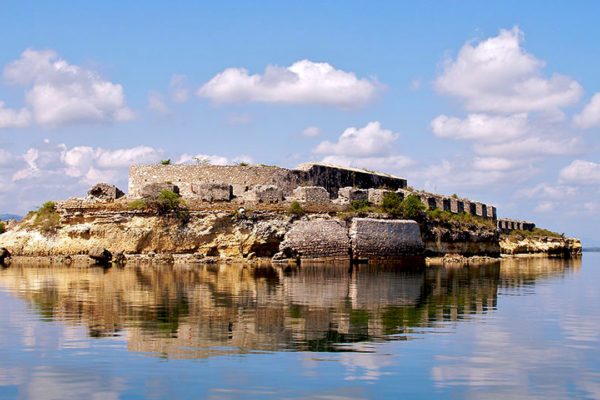
On a long, almost enclosed bay near the Dominican border sits one of the oldest towns in Haiti, founded by the Spanish in the 16th century and refounded by the French in the 1730s as Fort-Dauphin.
Forts ring the bay — Fort Dauphin itself at the end of the main street, plus Saint-Charles, Saint-Frédéric and the battery on the cove — and there’s an 18th-century fountain still standing in the old parade ground.
The town has been called Bayaja, Fort-Dauphin, Fort Saint-Joseph and Fort-Royal, and took its present name in 1820 — the change marking the day in November 1803 when Haitian independence was proclaimed here, weeks before it was declared for the whole country.
4 – Jacmel
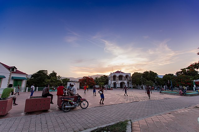
A coffee port on the south coast, Jacmel grew rich in the 19th century and spent the money on iron-framed townhouses with deep verandas and wrought-iron balconies, shipped in from France and Belgium.
The old town is all faded colour and shuttered merchant houses, with workshops turning out papier-mâché, and the blue pools of Bassin Bleu a rough ride up into the hills behind.
Jacmel’s Carnival is famous across the Caribbean for its papier-mâché masks — huge animal heads made in the town’s studios — and the architecture here is often said to have influenced the look of New Orleans.
5 – Port-au-Prince
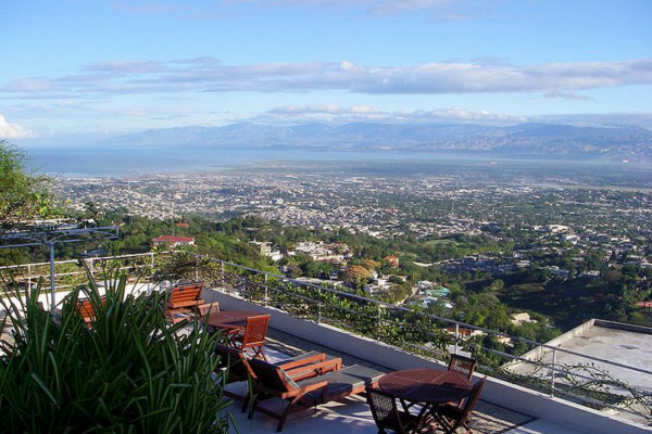
Haiti’s capital, made the seat of government in 1770, spreads up from a bay in the crook of the island’s two peninsulas and holds a quarter of the country’s population.
The city is a dense sprawl of markets, murals and hillside neighbourhoods, its landmarks including the iron-framed Marché en Fer and the open ground of the Champ de Mars with its monuments to the revolution.
On 12 January 2010 an earthquake struck a few miles away and destroyed much of the city, including the cathedral and the presidential palace — one of the deadliest natural disasters ever recorded, and the event by which most outsiders now know the place.
6 – Jérémie
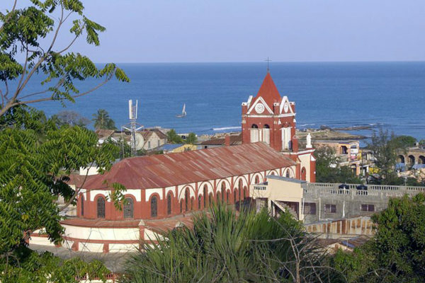
Out at the far western tip of the southern peninsula, Jérémie was founded in 1756 and is so cut off by mountains that until recently it was easier to reach by sea than by road.
It’s a quiet town of wooden houses above a river mouth, with beaches and waterfalls in the Grand’Anse country around it.
They call it the city of poets, for the number of writers born here — and in 1762 so was Thomas-Alexandre Dumas, son of an enslaved woman and a French nobleman, who became a general under Napoleon and whose son wrote The Three Musketeers.
7 – Coastline
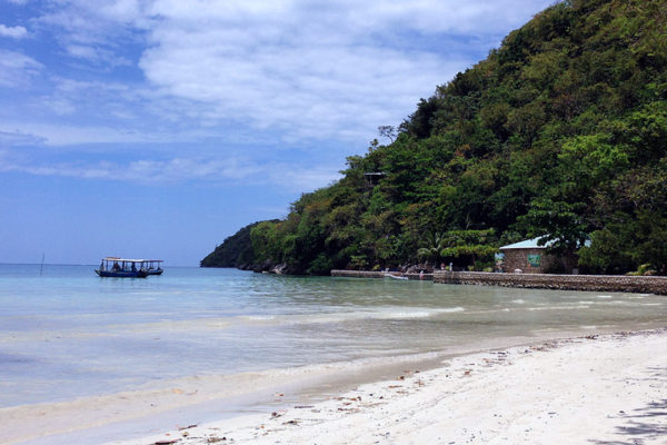
Along the coast east of Jacmel, on Haiti’s southern shore, the road runs past a string of small beaches and fishing settlements backed by coconut palms and hills.
These are the beaches Haitians themselves use — Raymond-les-Bains, Ti Mouillage and their neighbours — with fried fish sold under the trees and almost nothing built on them.
Haiti has more coastline than almost any of its neighbours and had a real tourist industry in the 1950s and ’60s, when Port-au-Prince drew writers and film stars; almost none of that remains, which is why this coast still looks the way it does.
8 – Labadee
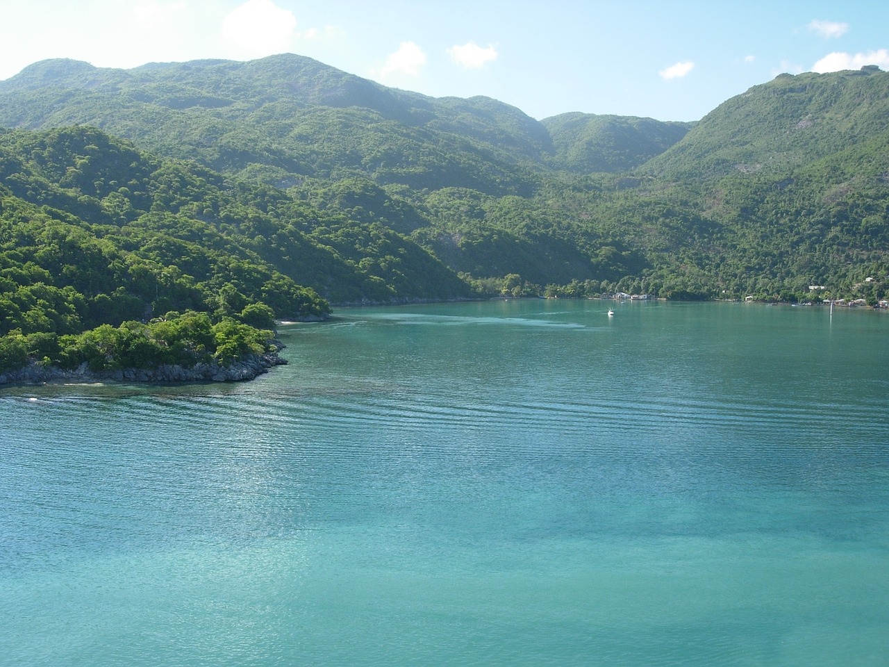
A peninsula of white sand and green hills on the north coast, a few miles west of Cap-Haïtien, leased in the mid-1980s by the Duvalier government to a cruise line for the exclusive use of its passengers.
The resort has beaches, a roller coaster and one of the longest over-water ziplines in the world, and its ships have called there on and off for decades.
It is double-fenced and privately guarded: passengers can’t leave and locals can’t come in, food is brought ashore from the ships, and in the 1990s it was reported that many visitors didn’t realise they were in Haiti at all, because the cruise line’s material referred only to Hispaniola.