
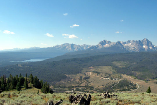
Wikimedia Commons / CC-BY-SA-3.0 / GFDL
Capital: Boise
Population: 2 million+
Language: English
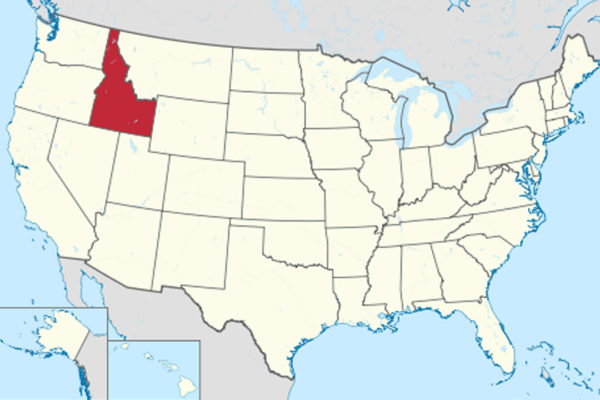
1 – Sawtooth Valley (above)
Sawtooth Valley, in the mountains of central Idaho, lies beneath the Sawtooth Range, with more than 50 peaks over 10,000 feet, and the first outsider known to have seen it was the Scottish fur trader Alexander Ross in 1824 — while a silver rush in 1879 built Sawtooth City and Vienna, both nearly empty within a decade.
In the Sawtooth National Recreation Area you can look down the valley from the overlook at Galena Summit, 8,701 feet up, hike to some of the nearly 400 lakes of the Sawtooth Wilderness, and visit the Sawtooth Fish Hatchery, whose young Chinook salmon swim more than 900 miles to the Pacific.
The Sawtooth NRA was created in 1972 after a fight over a planned open-pit molybdenum mine at Castle Peak in the nearby White Cloud Mountains, which helped elect Cecil Andrus governor in 1970 — the White Clouds became wilderness in 2015 and were renamed after Andrus in 2018 — and Clint Eastwood filmed Pale Rider in the Boulder Mountains in 1984.
2 – Shoshone Falls
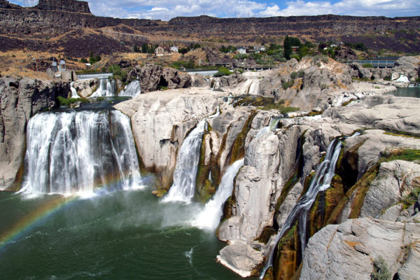
Shoshone Falls drops 212 feet over a horseshoe of basalt about 900 feet wide on the Snake River at Twin Falls, in southern Idaho — taller than Niagara — and it was the natural upstream limit for salmon, carved out when ancient Lake Bonneville burst its banks near the end of the last ice age.
At Shoshone Falls Park you can watch from viewing platforms on the canyon rim, best in spring, and a few miles away the Perrine Bridge, 486 feet above the river, may be the only structure in the US where BASE jumping is allowed year-round without a permit.
Since Milner Dam was built upstream in 1905, irrigation can stop Shoshone Falls completely in late summer, and about a mile west Evel Knievel’s rocket-powered Skycycle failed to clear the Snake River Canyon on 8 September 1974, when its parachute opened too early — Eddie Braun finally made the jump in 2016, in a rocket built by the son of Knievel’s designer.
3 – Coeur d’Alene
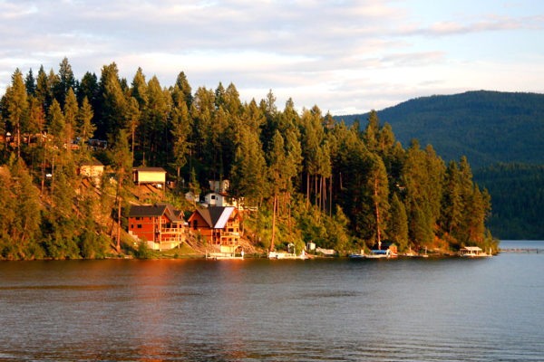
Coeur d’Alene, in the Idaho Panhandle on a lake 25 miles long, takes its name from the French for “heart of an awl”, traditionally said to describe the Schitsu’umsh people as sharp traders, and the city grew around Fort Sherman of 1878 — in 2001 the US Supreme Court confirmed that the southern third of the lake belongs to the Coeur d’Alene Tribe.
In Coeur d’Alene you can walk Tubbs Hill, stroll the resort’s floating boardwalk, billed as the world’s longest, see its floating golf green, watch wintering bald eagles, and drive east to the Old Mission at Cataldo, built in 1850–53 by Coeur d’Alene people without nails — Idaho’s oldest standing building.
East of Coeur d’Alene, the silver mines of the Silver Valley saw labour wars in 1892 and 1899, when miners hijacked a train and blew up the Bunker Hill company’s mill with some 3,000 pounds of dynamite, and a union leader, Ed Boyce, born in Co. Donegal, was jailed after the first strike and became president of the Western Federation of Miners.
4 – Upper Mesa Falls

Upper Mesa Falls drops 114 feet across the Henrys Fork of the Snake River in eastern Idaho, near Ashton and Yellowstone, falling over a layer of volcanic rock called the Mesa Falls Tuff, laid down about 1.3 million years ago by the second of the Yellowstone hotspot’s three giant caldera eruptions.
At Upper Mesa Falls a short walkway leads to viewing points beside the falls, about 200 feet wide, and the Big Falls Inn of the early 20th century, once a hotel and dance hall on the road to Yellowstone, is now the visitor centre, with Lower Mesa Falls, 65 feet high, just downstream on the Mesa Falls Scenic Byway.
Upper and Lower Mesa Falls are among Idaho’s last major waterfalls never harnessed for irrigation or hydropower, according to the Forest Service, though claims that they’re the last undisturbed falls in the whole Columbia River system overstate it — a dam upstream at Island Park regulates the river.
5 – McCall
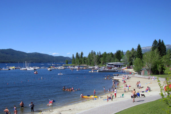
McCall, on Payette Lake in the mountains of west-central Idaho, was settled around 1889 by Tom McCall, who traded for 160 acres by the lake, and it was a logging town for most of the 20th century, until the Hoff & Brown mill closed in 1977.
In McCall you can ski at Brundage Mountain, explore the peninsula of Ponderosa State Park, and come in February for the Winter Carnival, with its giant snow sculptures, first held in 1924 and revived in 1965, while the McCall Smokejumper Base, opened in 1943, is one of nine in the US.
McCall’s lake monster, first reported by settlers in 1920 and covered nationally in 1944 as “Slimy Slim”, was renamed Sharlie in a 1954 newspaper contest, after a radio catchphrase, “Vas you dere, Sharlie?” — and the teacher-astronaut Barbara Morgan taught in McCall’s schools.
6 – Clearwater National Forest
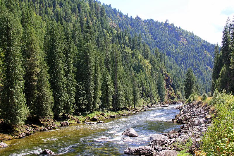
Clearwater National Forest, in the mountains of north-central Idaho, was set up in 1908 and since 2012 has been run with its neighbour as the Nez Perce–Clearwater National Forests, and in September 1805 Lewis and Clark struggled across it on the Lolo Trail, starving, until Clark reached Weippe Prairie, where the Nez Perce fed them.
In the Clearwater you can drive the Lolo Motorway, a rough dirt road built in 1925–34 along the ridgetop route of the old trail, walk among giant cedars in the Bernard DeVoto Memorial Grove, and head into the Selway-Bitterroot, one of the first wilderness areas protected in 1964.
Lewis and Clark ate colts, a coyote, crayfish and “portable soup” on the Lolo Trail, and counted 20 pounds of candles among their provisions — though no journal says they ate them — and in 1877 the Nez Perce bands who had once fed them fled the US Army along the same trail.
7 – Boise
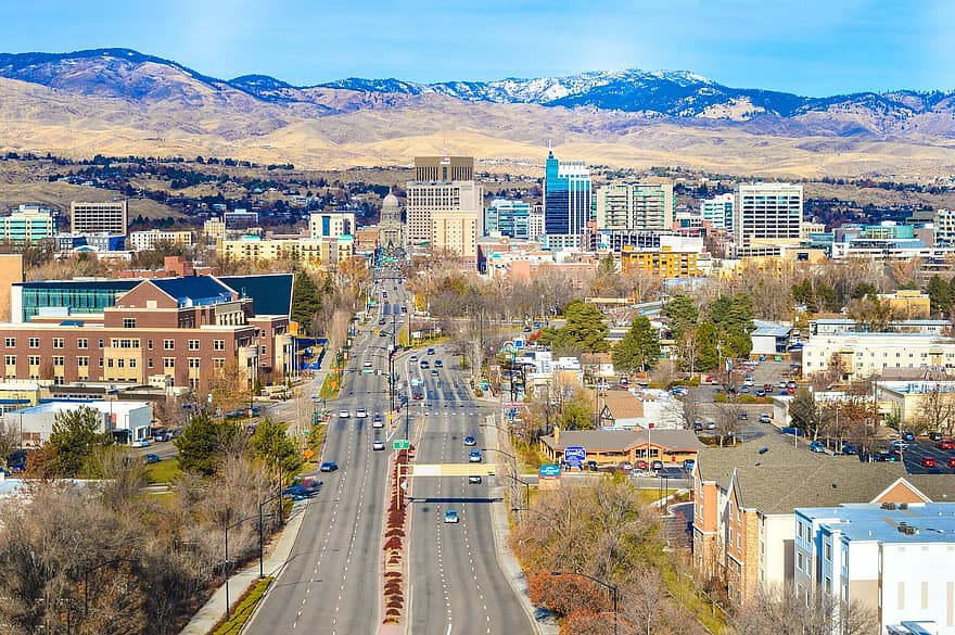
Boise, on the Boise River in southwest Idaho, takes its name from la rivière boisée, “the wooded river”, the name French-Canadian trappers gave it — not, as the story goes, from explorers crying “Les bois!” — and it grew from an army fort of 1863 to become capital in 1865, after the territorial seal and papers were taken from Lewiston, stolen as Lewiston tells it.
In Boise you can tour the Idaho State Capitol of 1905–20, which its commission says is the only US capitol heated by geothermal water, eat chorizo on the Basque Block, heart of one of the largest Basque communities in the US, walk the Boise River Greenbelt, and see the blue turf at Boise State’s stadium, the world’s first non-green artificial field in 1986.
Boise’s oldest family home is a log cabin built in 1863 by the Irish-born miner John O’Farrell for his 17-year-old bride, Mary Ann Chapman, and it was also the town’s first place of Catholic worship — it still stands on Fort Street.
8 – Craters of the Moon National Monument

Craters of the Moon National Monument and Preserve covers a vast field of lava flows and cinder cones on the Snake River Plain of central Idaho, formed along a crack in the earth called the Great Rift in eight eruptive periods from 15,000 to about 2,100 years ago, and protected since 1924.
At Craters of the Moon you can drive the seven-mile Loop Road, climb Inferno Cone, peer into spatter cones and explore lava tubes such as Indian Tunnel with a free permit, and it’s also an International Dark Sky Park.
The Apollo 14 astronauts Alan Shepard, Edgar Mitchell, Joe Engle and Gene Cernan came to Craters of the Moon in August 1969 to learn volcanic geology before going to the Moon, and the US Geological Survey expects the Great Rift to erupt again, probably within the next thousand years.
9 – Sandpoint and Schweitzer
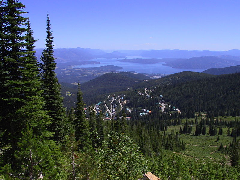
Sandpoint stands on Lake Pend Oreille in the Idaho Panhandle, Idaho’s largest lake and 1,152 feet deep, and takes its name from the “Sand Point” noted by the explorer David Thompson in 1809, when he built Kullyspell House nearby, the first documented trading post in what’s now Idaho.
Above Sandpoint, Schweitzer Mountain Resort, opened in 1963 and named after a Swiss hermit who lived on the mountain, has about 2,900 acres of skiing, which it says makes it Idaho’s largest, and you can swim, sail or fish on the lake from Sandpoint’s City Beach.
During the Second World War more than 293,000 recruits trained at the Farragut Naval Training Station at the south end of Lake Pend Oreille, the world’s second-largest naval training centre, and the US Navy still tests large-scale submarine models in the lake’s deep, quiet water.
10 – Bald Mountain, Sun Valley
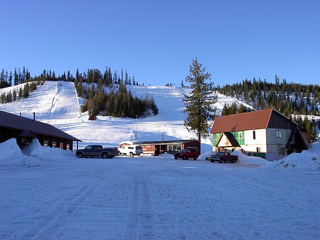
Bald Mountain, “Baldy”, rises to 9,150 feet above Ketchum and Sun Valley in central Idaho, and Sun Valley was built in 1936 by the Union Pacific chairman Averell Harriman, after an Austrian count, Felix Schaffgotsch, rejected Mount Hood, Yosemite and Jackson Hole and chose the old ranch here — Baldy’s own lifts opened in 1939.
On Bald Mountain you can ski 3,400 vertical feet from the summit down to Ketchum, and in town stay at the Sun Valley Lodge or visit Ernest Hemingway’s grave in Ketchum Cemetery — he died at his home here in July 1961.
Sun Valley opened the world’s first chairlifts in December 1936, designed by a Union Pacific engineer, James Curran, the son of Irish immigrants, who got the idea from conveyors used to load bananas onto ships, and Hemingway worked on For Whom the Bell Tolls in Room 206 of the Lodge in 1939 — though he finished it in New York.
11 – Stanley

Stanley, a village of about 120 people on the Salmon River beneath the Sawtooth Range in central Idaho, is named after Captain John Stanley, the oldest man in a party of 23 gold prospectors who came through the basin in 1863, though the town wasn’t laid out until 1919.
Stanley is the base for whitewater rafting on the Salmon, for Redfish Lake Lodge and the trails of the Sawtooths, and about 12 miles east, where the Yankee Fork joins the river, you can see what’s left of the Sunbeam Dam.
The Sunbeam Dam, built around 1910 to power a gold mill, ran for about a year and was blown open in 1934 to let the salmon through — it’s reputedly the only dam ever built on the main Salmon — and Stanley’s thermometers have ranged from −54°F to 98°F, while an earthquake of magnitude 6.5 nearby in March 2020 was the second-strongest in Idaho’s records.
12 – Old Idaho State Penitentiary

The Old Idaho State Penitentiary, on the eastern edge of Boise, held more than 13,000 prisoners between 1872 and 1973, inside sandstone walls the inmates quarried and built themselves, and it closed after riots in 1971 and 1973.
At the Old Pen you can walk the cell blocks, the Women’s Ward of 1920 and the Gallows Room, where Raymond Snowden was hanged in 1957 — the only execution carried out there, and the last of ten at the prison.
The Old Pen’s most famous inmate, Harry Orchard, killed the former governor Frank Steunenberg with a bomb in 1905 and confessed to the Pinkerton detective James McParland, born in Ireland, who had earlier infiltrated the Molly Maguires in Pennsylvania — the union leader Big Bill Haywood was acquitted in 1907, defended by Clarence Darrow, and Orchard died in the prison in 1954.
13 – Silver Valley and Wallace
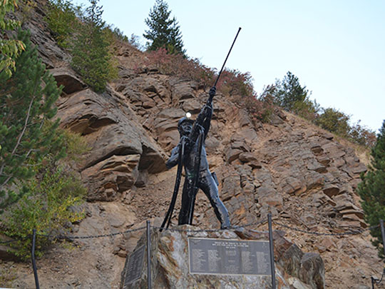

The Silver Valley, in the mountains of the Idaho Panhandle along Interstate 90, has produced more silver than any other district in the US, over 1.2 billion ounces since 1884, and on 2 May 1972 a fire in the Sunshine Mine killed 91 miners, the worst US hard-rock mining disaster since 1917.
Wallace, the Silver Valley’s old mining capital, is so full of historic buildings that almost the whole town is on the National Register, and you can visit the Northern Pacific Depot Museum, the Wallace District Mining Museum and the Oasis Bordello Museum, a brothel until 1988.
Wallace had the last traffic light on Interstate 90 between Seattle and Boston, until a viaduct opened in 1991 and the light was given a funeral with a horse-drawn hearse and bagpipes, and in 2004 its mayor declared the town the “Center of the Universe” to mock the EPA — while Lana Turner was born in Wallace in 1921 and Dante’s Peak was filmed here.
14 – Hells Canyon
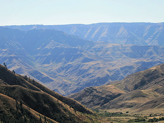
Hells Canyon carries the Snake River along the border of Idaho and Oregon and, at 7,993 feet, is North America’s deepest river gorge, deeper than the Grand Canyon, and on 31 May 1877 the Nez Perce crossed the flooded river at Dug Bar on rafts of horsehide pulled by swimming horses.
Hells Canyon National Recreation Area, created in 1975, covers 652,000 acres, and you can take a jetboat upriver through the rapids, or ride the weekly mail boat, one of the last of its kind in the US, while three Idaho Power dams, built from 1959 to 1967, hold back the river further up.
In May 1887 up to 34 Chinese gold miners were murdered at Deep Creek in Hells Canyon by a gang of horse thieves and local schoolboys, three of whom were acquitted in 1888 — the court papers turned up in an old safe in 1995, and a memorial in English, Chinese and Nez Perce went up in 2012.
15 – Snake River Canyon
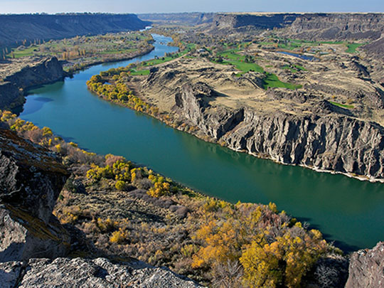
Snake River Canyon cuts through the lava plain of southern Idaho at Twin Falls, and upstream at Caldron Linn, on 28 October 1811, John Jacob Astor’s overland expedition to the Pacific wrecked a canoe in the rapids they called the “Devil’s Scuttle Hole”, drowning a voyageur, Antoine Clappine, and forcing them to abandon the river.
From the Canyon Rim Trail at Twin Falls you can walk behind Perrine Coulee Falls, about 200 feet high, see the original Twin Falls, now a single fall since the other was diverted for a power plant in the 1930s, and downstream watch the Thousand Springs pouring out of the canyon wall from the vast aquifer under the plain.
Snake River Canyon’s farms were started by I. B. Perrine, from Indiana, who arrived in 1884 and ranched at Blue Lakes on the canyon floor before pushing for the irrigation dam that made Twin Falls, and downstream at Hagerman a rancher found the bones in 1928 of a 3- to 4-million-year-old horse, now Idaho’s state fossil.
16 – Nez Perce National Historical Park
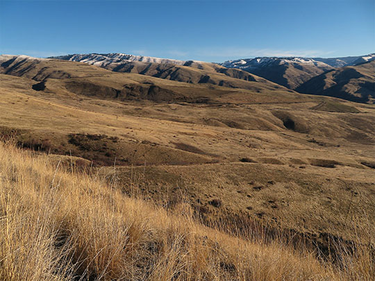
Nez Perce National Historical Park, set up in 1965, links 38 sites across Idaho, Oregon, Washington and Montana that tell the story of the Nez Perce, or Nimiipuu, whose treaty of 1863 cut their land from 7.7 million acres to 760,000 and led to the war of 1877.
At the park’s headquarters at Spalding, near Lapwai, there’s a museum and the site of the mission founded in 1836 by Henry and Eliza Spalding, whose press printed a reader in the Nez Perce language in 1839, and you can see Heart of the Monster at Kamiah, the mound from the Nez Perce creation story, and White Bird Battlefield.
The war began at White Bird on 17 June 1877, when 34 US soldiers were killed and no Nez Perce, and at Big Hole in Montana that August one of the officers killed was Captain William Logan from Ardee, Co. Louth — and historians still argue over how much of Chief Joseph’s “I will fight no more forever” surrender speech was his own words.