
Wikimedia Commons / CC-BY-SA-3.0 / GFDL
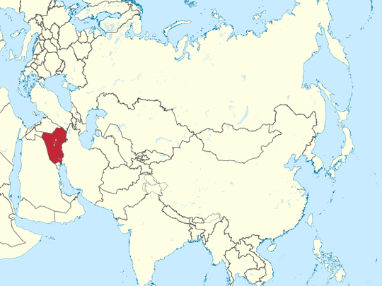
Capital: Baghdad
Population: 46 million+
Language: Arabic/Kurdish (also Turkmen and Syriac)
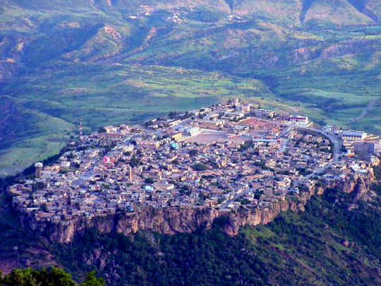
1 – Amadiya (also above)
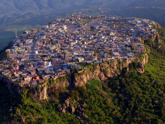
Amadiya sits on top of a mesa in the Duhok governorate of Iraqi Kurdistan — a flat plateau roughly a kilometre long by half a kilometre wide, standing a thousand metres above the valley with cliffs on every side. There has been a settlement up there since before 3000 BC, and from 1376 to 1843 it was the seat of the semi-autonomous Bahdinan emirate.
Because Amadiya cannot expand, it has stayed the size of its own rock: around ten thousand people, one ring road and one petrol station. The Bahdinan Gate, a carved stone arch reached by a winding stair cut up the cliff, is all that survives of the fortress; the twelfth-century Great Mosque and minaret stand in the middle, with the ruins of a synagogue and the Qubahan madrasa nearby.
Amadiya is widely described as the home of the Three Wise Men, who are said to have set out from here for Bethlehem. It is local tradition and there is no evidence for it. What is documented is better: Muslims, Christians and a large Jewish community lived here together for centuries, until almost all the Jewish families left for Israel around 1951.
2 – Babylon
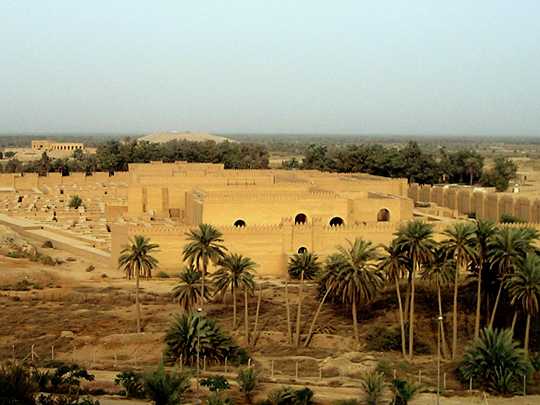
Babylon stands on the Euphrates about 85 kilometres south of Baghdad, first named on a clay tablet in the twenty-third century BC and at its greatest under Nebuchadnezzar II in the sixth, when it was probably the largest city on earth. It took decades of Iraqi lobbying before UNESCO finally inscribed Babylon in 2019. What you walk through at Babylon is a strange mixture.
There is the excavated Processional Way and the basalt Lion of Babylon; and there is a full-size replica Ishtar Gate at the entrance, built because the original glazed-brick gate was removed to Berlin by German excavators before the First World War and stands in the Pergamon Museum.
From 1983 Saddam Hussein rebuilt Babylon’s walls on top of the ruins with some sixty million new bricks and, on being told that Nebuchadnezzar had stamped his name into his, had his own stamped into these. The slogan of the time was “yesterday Nebuchadnezzar, today Saddam Hussein”. In 2003 coalition forces then built a military camp with a helipad directly on the site.
3 – Ziggurat of Ur
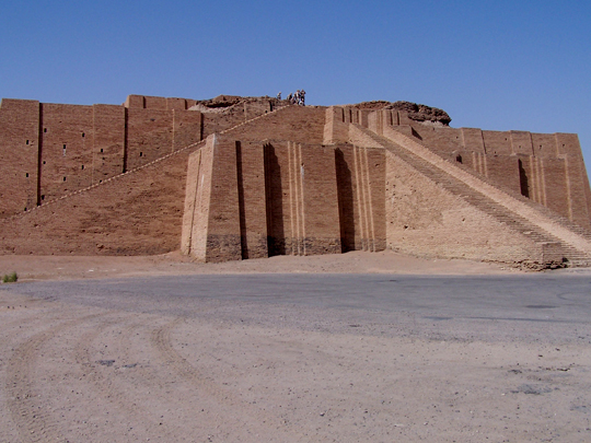
The Ziggurat of Ur was raised around 2100 BC by King Ur-Nammu for Nanna, the moon god, at the centre of a Sumerian city near modern Nasiriyah that was among the largest settlements anywhere in its day. The lower stage standing today was rebuilt in the 1980s over Ur-Nammu’s original brickwork, which survives underneath.
The ziggurat is what you see from a distance, but the site at Ur also holds the royal cemetery, the excavated streets and houses of the city, and a building traditionally identified as the house of Abraham — Genesis places him in “Ur of the Chaldees”. Pope Francis held an interfaith service here in 2021.
Leonard Woolley dug at Ur from 1922 to 1934 for the British Museum and the University of Pennsylvania, and found sixteen royal tombs with attendants buried beside their rulers — a story that competed with Tutankhamun for newspaper space. It drew visitors too, one of them a recently divorced Agatha Christie, who met Woolley’s assistant Max Mallowan here in 1930, married him, and later set Murder in Mesopotamia on a dig.
4 – Rawanduz Valley – Kurdistan
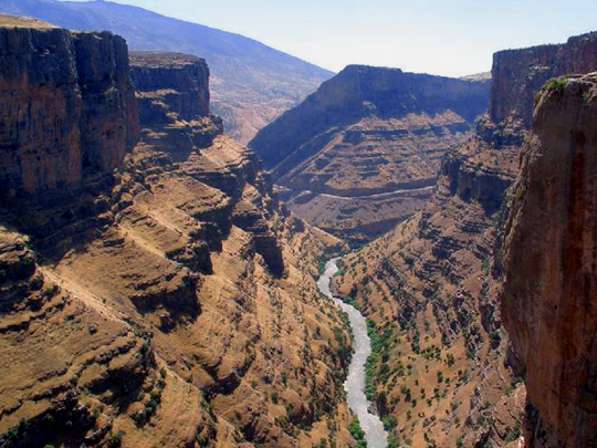
The Rawanduz valley lies in the mountains northeast of Erbil, where the river has cut a gorge several hundred metres deep through the Zagros. The town of Rawanduz sits above it, and the surrounding district holds the Gali Ali Beg and Bekhal waterfalls and the cable car up Korek mountain.
The Gali Ali Beg waterfall in the Rawanduz valley is printed on the 5,000 Iraqi dinar note, which makes it the most widely circulated image in the country. The road through the gorge runs in tunnels and along ledges blasted into the cliff face, and in summer the whole valley fills with Iraqi families escaping the heat of the south.
That road is the Hamilton Road, built between 1928 and 1932 by a New Zealand engineer, Archibald Milne Hamilton, through country that had no roads at all — a route from Erbil through the Rawanduz gorge to the Iranian border. He wrote a book about doing it, Road Through Kurdistan, and the road still carries his name nearly a century on.
5 – Great Temple of Hatra
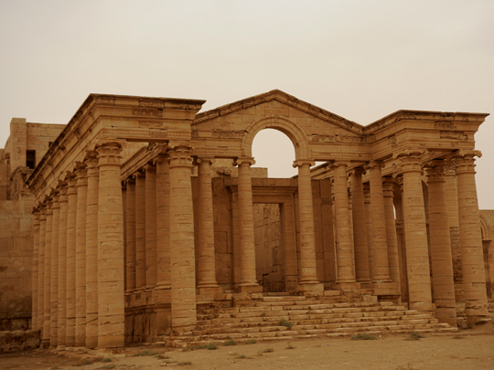
Hatra stands in open desert about 90 kilometres southwest of Mosul: a circular city two kilometres across, ringed by a double wall and more than 160 towers. It grew rich in the first and second centuries AD taxing caravans crossing between the Roman and Parthian empires, and became the capital of a small Arab kingdom.
At the centre of Hatra is the temenos, a walled sacred precinct holding the great temple — vaulted iwans with columns some thirty metres high, in a style that mixes Hellenistic and Roman architecture with Parthian and Arabian decoration, and gods drawn from all of them. It is the best-preserved Parthian city anywhere.
Hatra’s walls held off two Roman emperors, Trajan in 116 and Septimius Severus twice in 198, before the city finally fell to the Sassanians in the 240s. Eighteen centuries later ISIS took Hatra in 2014, used it as a training camp and filmed the destruction of its sculptures; it was retaken in 2017 and restoration has been under way since. The opening scene of The Exorcist was shot here in 1973.
6 – Taq-i Kisra
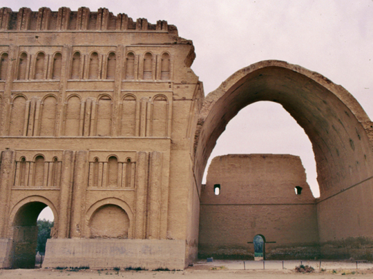
Taq-i Kisra is the throne hall of the Sassanian palace at Ctesiphon, on the Tigris about 35 kilometres southeast of Baghdad. Ctesiphon was the Persian capital for most of seven centuries and, for a time, among the largest cities in the world, until the Arab armies took it in 637.
What stands at Taq-i Kisra is a single brick vault, roughly 37 metres high and spanning about 26, built with no centring and no reinforcement — the largest unsupported brick arch ever constructed, and still the largest some fifteen hundred years later. The bricks are laid leaning at an angle so that each course rests on the one before it. Half of it is gone.
The northern wing of the facade collapsed in a flood in 1888 and was never rebuilt, which is why every photograph of Taq-i Kisra looks lopsided: a wall of blind arcading on one side of the arch and open sky on the other. What remains has stood through the fall of one empire, the arrival of another, and the century and a half since the flood.
7 – Samarra
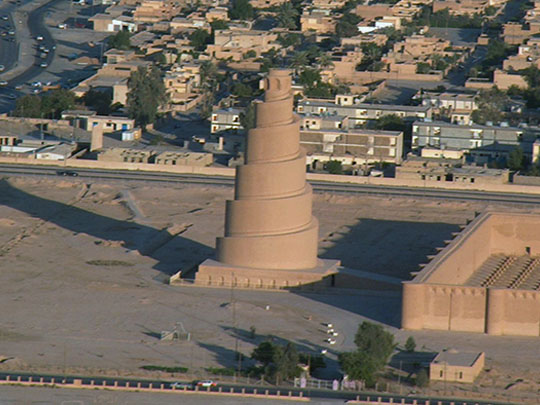
Samarra stands on the Tigris about 125 kilometres north of Baghdad, and for fifty-six years in the ninth century it was the capital of the Abbasid empire — the caliphs left Baghdad for Samarra in 836 and did not return until 892. What they built in that time ran more than forty kilometres along the river, and most of it has never been built over since.
The Great Mosque of Samarra was the largest mosque in the world when it went up in the 850s, and its outer walls still stand. Beside them is the Malwiya: a minaret 52 metres high in the form of a spiral ramp winding up the outside of a cone, with no interior stair at all. A second, smaller spiral stands at the Abu Dulaf mosque north of the city.
The Malwiya at Samarra looks like a ziggurat, and people have argued for a century over whether that is deliberate — a ninth-century Islamic minaret deliberately echoing Mesopotamian towers raised two and a half thousand years earlier, or simply the most efficient way to get height out of brick. UNESCO inscribed Samarra in 2007 and put it on the danger list the same day.
8 – Erbil Citadel
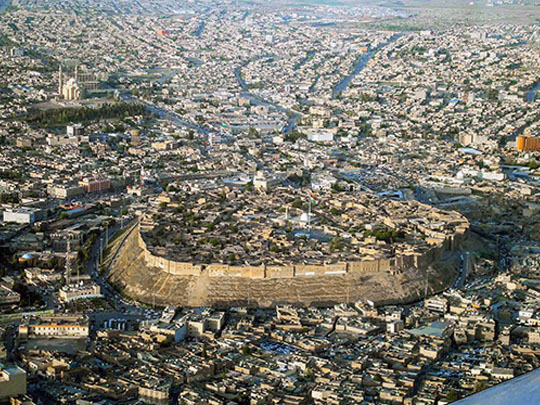
Erbil Citadel stands on an oval tell about thirty metres above the middle of Erbil, the capital of the Kurdistan Region — a mound made entirely of its own wreckage, each settlement raised on the flattened remains of the one before, for at least six thousand years and by some counts eight.
It appears in the Ebla tablets as Urbilum around 2300 BC. What stands on Erbil Citadel today is largely Ottoman: a warren of courtyard houses and cul-de-sacs, a hammam, a grand mosque, and a continuous nineteenth-century wall of blank house facades round the rim that reads from below as a fortification.
There is a textile museum, the restored Chalabi House, and a view over a city that is not permitted to build high enough to look down on it. In 2006 and 2007 the authorities moved every family off Erbil Citadel so it could be restored — every family but one, allowed to stay so that the record of continuous habitation would not be broken. Alexander beat Darius III at Gaugamela within sight of this mound in 331 BC, and somebody has been living on it ever since. UNESCO listed it in 2014.
9 – Baghdad
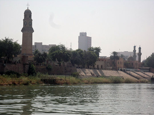
Baghdad was founded in 762 by the Abbasid caliph al-Mansur as a perfect circle — the Round City, formally Madinat al-Salam, the City of Peace, with four gates pointing at Basra, Kufa, Khurasan and Damascus. Within fifty years it was probably the largest city on earth, and the House of Wisdom inside it was turning Greek, Persian and Indian learning into Arabic. None of that survives.
What Baghdad has instead is the thirteenth-century Mustansiriya madrasa, the Abbasid Palace, the Iraq Museum — looted in 2003, reopened in 2015 — the Kadhimiya shrine, and Al-Mutanabbi Street, where books have been sold on roughly the same spot since the ninth century. The Mongols are usually blamed for the end of the Round City, and they did sack Baghdad in 1258.
But the last physical traces of al-Mansur’s circle were cleared in the 1870s by an Ottoman governor, Midhat Pasha, to make room for schools, hospitals and a water supply. A car bomb tore through Al-Mutanabbi Street in 2007; its booksellers had it open again the following year.
10 – The Mesopotamian Marshes
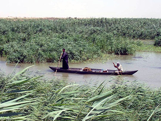

The Mesopotamian Marshes — the Ahwar — lie where the Tigris and the Euphrates come together in the far south of Iraq: once some twenty thousand square kilometres of reed bed and open water, and home to the Marsh Arabs, the Ma’dan, whose way of life here runs back to Sumer. UNESCO listed the marshes in 2016 along with the Sumerian cities on their margins, Ur among them.
You go out from Chibayish by mashoof, a long narrow canoe, through channels cut in reeds three and four metres tall, past water buffalo standing chest-deep. The buildings to look for are mudhifs — guest houses made entirely of bundled reeds, arched and lashed without a single nail, and near-identical to the structures carved on Sumerian cylinder seals five thousand years ago.
After the Shia uprising of 1991, Saddam Hussein had the marshes drained: embankments, canals and diversion works that emptied roughly nine-tenths of them and drove out most of the people. Then in April 2003, within weeks of his fall, men from the villages walked out with pickaxes and water pumps and broke the embankments themselves. Most of the water came back. Upstream dams and drought are now taking it again.