
Christopher Brown / CC-BY-SA-3.0 / GFDL

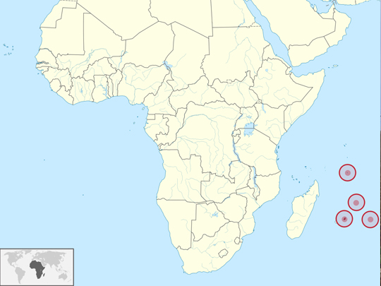
Capital: Port Louis
Population: 1.2 million+
Language: English, French, Mauritian Creole
1 – Le Morne Brabant (also above)
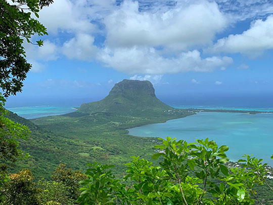
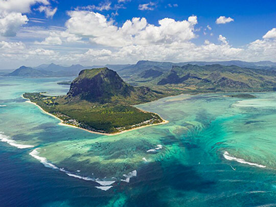
Le Morne Brabant, a 556 m basalt monolith at the south-western tip of Mauritius, was listed by UNESCO in 2008 as a refuge for runaway slaves, or maroons, who through the 18th and early 19th centuries lived in its caves and on its summit, making it a symbol of the slaves’ fight for freedom.
A trail climbs through forest up Le Morne, with a guide strongly recommended for the steep, rocky upper section, and offshore the sand sliding off the reef shelf creates the famous illusion, seen from the air, of an “underwater waterfall”.
Legend says that when police climbed Le Morne after slavery was abolished on 1 February 1835, maroons who feared recapture leapt to their deaths, and Mauritius marks the abolition of slavery each year on 1 February, above all at the foot of the mountain.
2 – Black River Gorges
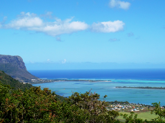
Black River Gorges National Park, proclaimed in 1994 across the mountainous south-west of Mauritius, is the island’s largest national park, about 67 km² of ravines, waterfalls and native forest rising to Black River Peak, at 828 m the highest point in the country.
Some 60 km of trails wind through Black River Gorges, home to species found nowhere else, among them the pink pigeon, the Mauritian flying fox and the echo parakeet, the last surviving native parrot of the Mascarene Islands.
Black River Gorges was the last stronghold of the Mauritius kestrel, once considered the rarest bird in the world with just four known in the wild in 1974, until a rescue led by Carl Jones and the Mauritian Wildlife Foundation brought it back from the brink on the island that lost the dodo.
3 – Tamarind Waterfalls
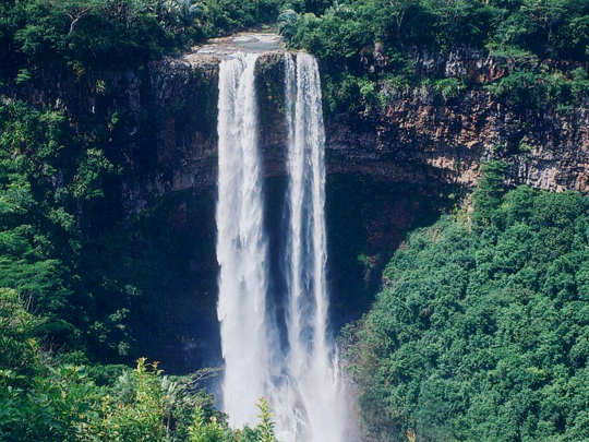
Tamarind Falls, reached from the village of Henrietta in the highlands of central Mauritius, is a staircase of waterfalls tumbling through a lush volcanic gorge.
The hike down to Tamarind Falls is steep and unmarked, so a guide is advised, and the reward is a series of plunge pools beneath the falling water, some of them deep enough for a swim.
Tamarind Falls is known as the Seven Cascades, though more falls lie hidden in the canyon, and the more daring abseil down the rock faces beside the water on guided canyoning trips.
4 – Pieter Both Mountains
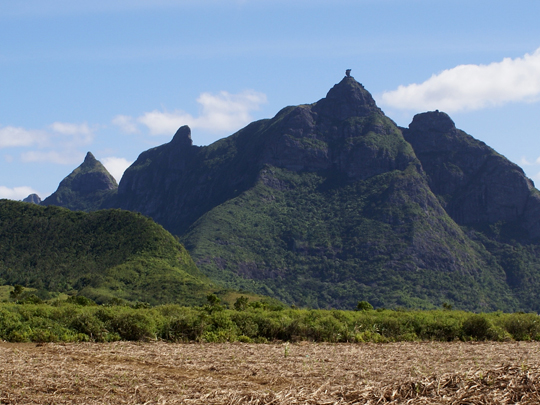
Pieter Both, at 820 m the second-highest peak in Mauritius, rises from the Moka Range crowned by a boulder about 9 m across that looks uncannily like a human head balanced on a neck of rock.
Pieter Both is named after the first Governor-General of the Dutch East Indies, who drowned off Mauritius in 1615 when his ship struck a reef in a hurricane, and climbers reach its stone head by an exposed scramble, with iron rungs fixed to the boulder.
Mauritian folklore says the boulder on Pieter Both is the head of a local herdsman who stumbled on a gathering of fairies and was turned to stone for revealing their secret.
5 – Trou aux Cerfs
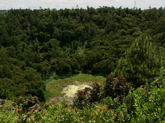
Trou aux Cerfs, in the middle of the highland town of Curepipe, is a volcanic crater about 350 m across and 80 m deep, a reminder that Mauritius is a volcanic island built up over millions of years above the hotspot that also formed Réunion.
A path popular with joggers circles the forested rim of Trou aux Cerfs, above a small lake at the bottom of the crater, with views across Curepipe to the Rempart, the Trois Mamelles and the Moka range.
Trou aux Cerfs has not erupted for several hundred thousand years, so this quiet, tree-lined crater sits peacefully in the middle of a residential town.
6 – Ganga Talao
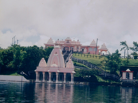
Ganga Talao, or Grand Bassin, is a crater lake about 550 m up in the hills of southern Mauritius and the island’s most sacred Hindu site, revered by the descendants of the Indian labourers brought in the 19th century to work the sugar estates.
The approach to Ganga Talao is guarded by two 33 m statues, of Shiva, unveiled in 2007, and of the goddess Durga, consecrated in 2017, while temples line the shore where pilgrims leave offerings.
In 1972 Prime Minister Sir Seewoosagur Ramgoolam mixed water from the Ganges into the lake and renamed it Ganga Talao, the “Lake of the Ganges”, and every Maha Shivaratri hundreds of thousands of pilgrims come here, many walking for a day or more from their villages.
7 – La Preneuse
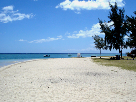
La Preneuse, a sweep of white sand on the west coast near Black River, looking across the bay to Le Morne, takes its name from the French frigate La Preneuse, which sheltered at Black River in 1799 during the long Anglo-French struggle for the Indian Ocean.
The Martello tower at La Preneuse, one of five built by the British in 1832–35 against a feared French attack linked to the abolition of slavery, became a museum of colonial and military history in 2000.
The frigate La Preneuse was driven ashore by two British ships in Tombeau Bay, near Port Louis, in December 1799, where her captain scuttled her, while the towers built later never saw action, their name a mangling of Mortella, a tower in Corsica whose stubborn defence had impressed the British.
8 – Aapravasi Ghat
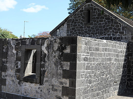
Aapravasi Ghat, on the waterfront in Port Louis, is the depot through which Britain ran its “Great Experiment” after slavery was abolished in 1835, testing whether indentured labourers could replace enslaved workers on the sugar estates, with some 462,000 arriving, most of them from India.
What survives at Aapravasi Ghat, a UNESCO World Heritage Site since 2006, is a fragment of the 1849 depot, including the 16 stone steps up from the harbour, part of the hospital block and the immigration sheds, with an interpretation centre explaining the system.
The system tested at Aapravasi Ghat was copied across the British Empire, moving more than two million indentured labourers worldwide, and about seven in ten Mauritians descend from those who arrived here, whose welfare the Cork-born governor Sir John Pope Hennessy championed in the 1880s.
9 – Grand Port and Mahébourg
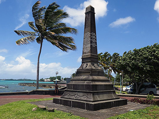

Grand Port, the great bay on the south-east coast of Mauritius, is where a Dutch fleet under Wybrand van Warwijck landed in 1598 and named the island after Prince Maurice of Nassau, and the remains of the Dutch settlement survive at Vieux Grand Port, beside the Frederik Hendrik Museum.
Mahébourg, the town on the bay named after the French governor Mahé de La Bourdonnais, is home to the National History Museum, housed in the colonial mansion where the wounded French and British commanders were treated side by side after the Battle of Grand Port.
In the Battle of Grand Port, in August 1810, Britain lost all four frigates of its squadron, the only naval battle commemorated on the Arc de Triomphe, but within months the island fell to a British campaign shaped by Commodore Josias Rowley of County Leitrim.