

Bernard Spragg. NZ / Wikimedia Commons / CC-BY-SA-3.0 / GFDL
Capital: Wellington
Population: 5.3 million+
Language: English/Māori/New Zealand Sign Language

1 – Milford Sound (also above)

The most famous inlet in Fiordland was known to Māori as Piopiotahi long before Europeans found it, and despite the name it isn’t a sound at all but a fiord — a valley gouged out by glaciers rather than a drowned river valley, which is why the walls plunge straight down into water up to 400 metres deep.
Boats run the 16 km out to the Tasman Sea beneath Mitre Peak, seals haul out on the rocks near the entrance, and after heavy rain hundreds of temporary waterfalls appear down the cliffs and vanish again within hours of it stopping. A little over halfway down Milford Sound, Stirling Falls drop around 150 metres in two stages straight into the fiord from a hanging valley.
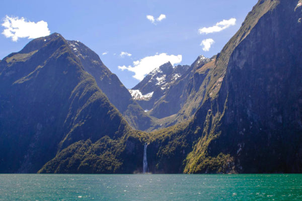
Cook charted this coastline meticulously and still missed it — twice — because the entrance is narrow and tucked behind headlands, and he judged it too small to lead anywhere; a Welsh sealer sheltering from a storm found the way in some decades later and named it after Milford Haven back home.
2 – Auckland
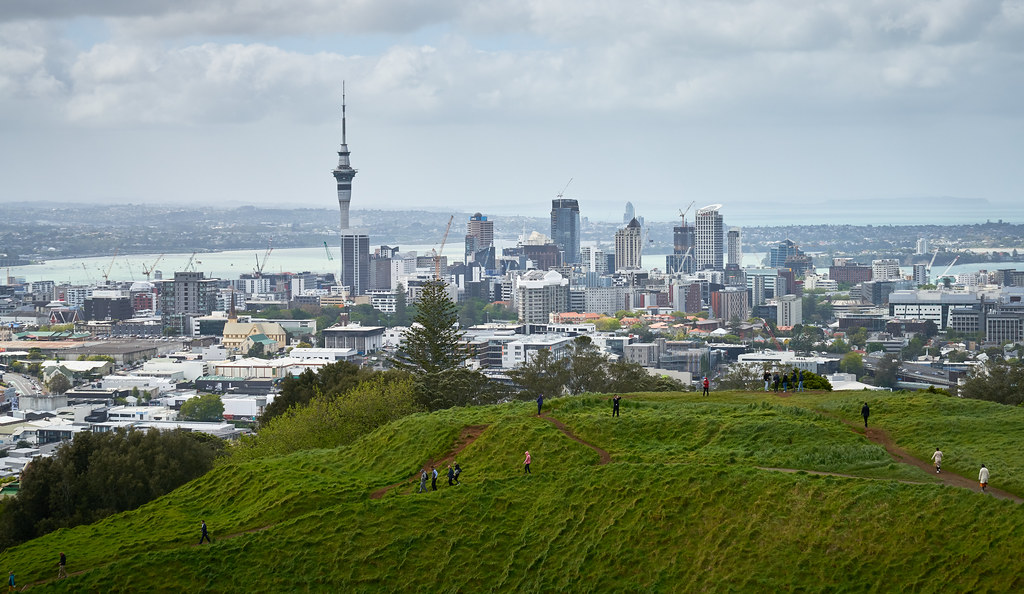
New Zealand’s biggest city sits on a narrow isthmus between two harbours, which is what its Māori name Tāmaki Makaurau refers to — roughly, the place desired by many — and it served as the colonial capital from 1841 until the government moved south in 1865.
The volcanic cones are the thing to climb: Maungawhau/Mount Eden and Maungakiekie/One Tree Hill both give the whole isthmus at a glance, the Sky Tower does the same from the middle of town, and ferries run out across the Hauraki Gulf to Waiheke and Rangitoto.
The city is built on an active volcanic field of more than fifty separate volcanoes fed by one pool of magma below, and each eruption has broken out in a new spot — Rangitoto, the flat-topped island offshore, is the most recent, having erupted only about 600 years ago while Māori were living on the island next door.
3 – Bay of Islands
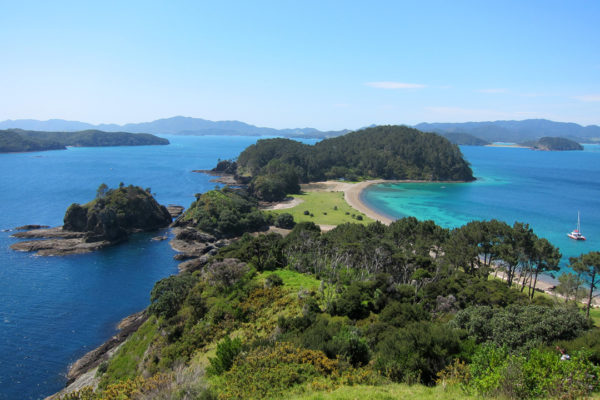
A drowned river system in the far north scattered with 140-odd islands, this was where Māori and Europeans first lived alongside each other in numbers, and where the Treaty of Waitangi was signed on 6 February 1840 — the founding document of the modern country.
The Waitangi Treaty Grounds hold the carved meeting house and an enormous ceremonial waka, Kerikeri has the oldest stone and wooden buildings in the country from the 1820s and 30s, and Russell across the water keeps Christ Church with musket holes still in its walls.
Russell was Kororāreka then, a whaling port so rough it was known as the hell hole of the Pacific — and the chief who was first to sign the Treaty, Hōne Heke, spent the following years cutting down the British flagstaff on the hill above the town, four times.
4 – Castlepoint
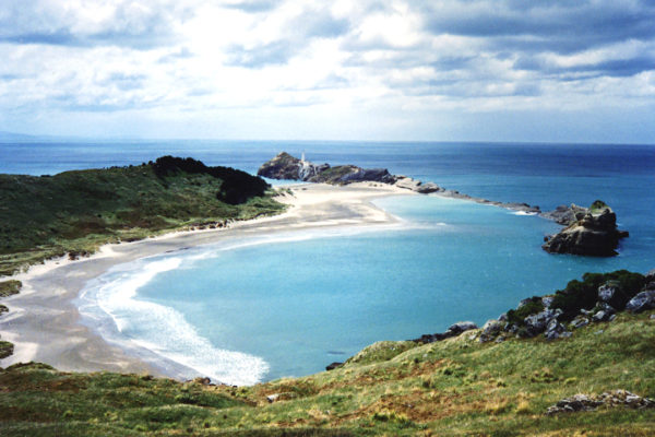
A small settlement on the Wairarapa coast built around a kilometre-long fossil-bearing limestone reef and the 162-metre bluff of Castle Rock, named by Cook in 1770 because from the sea the rock looks like the battlements of a fortress.
Two short walks do everything: one out along the reef to the lighthouse, one round the lagoon and up Castle Rock for the coast in both directions, with fur seals and dolphins regularly offshore and a shrubby daisy on the reef that grows nowhere else in the world.
The lighthouse was cast in iron in Wellington, shipped up the coast and hauled onto the reef by two horses in 1913, and the beach below has hosted a horse race meeting since 1872 — it started with station hands riding farm hacks for bottles of rum and whatever coins were going.
5 – Cathedral Cove
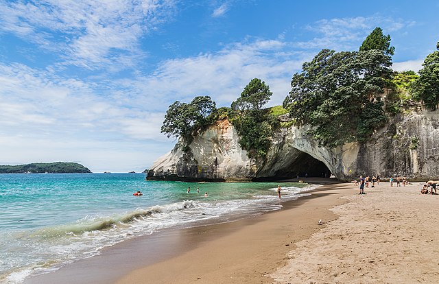
Two pale beaches on the Coromandel Peninsula joined by an arch worn clean through the headland, known as Te Whanganui-A-Hei, the great bay of Hei, after the tohunga who claimed the district for his people after arriving on the Te Arawa canoe.
The cove sits inside a marine reserve created in 1992 where nothing may be fished or taken, which is why the snorkelling is as good as it is, and the pointed sea stack of Te Hoho stands just offshore.
Andrew Adamson used this coastline for Narnia: the arch and the beaches stood in for the ruins of Cair Paravel and, in Prince Caspian, for the spot where the Pevensie children are pulled back into Narnia from a railway platform.
6 – Fox Glacier
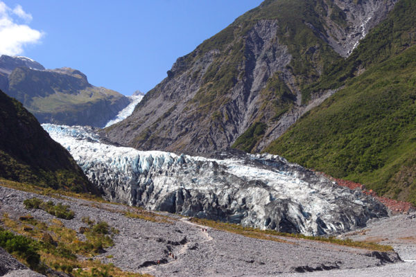
On the West Coast of the South Island, Te Moeka o Tuawe runs about 13 km down from the Southern Alps and ends among tree ferns roughly 300 metres above sea level — one of very few glaciers anywhere that finishes inside temperate rainforest — and carries the name of Sir William Fox, premier in the early 1870s.
The valley walk gives you a distant view, helicopters land parties on the ice higher up, and Lake Matheson a few kilometres away is the mirror lake that reflects Aoraki and Mount Tasman on a still morning.
In Māori tradition the glacier is the resting place of Tuawe, a young man killed in the mountains, and the ice the frozen tears of the woman who mourned him — and for about a quarter of a century from the mid-1980s the glacier bucked the global trend entirely and advanced, at one point gaining a metre a week.
7 – Hobbiton
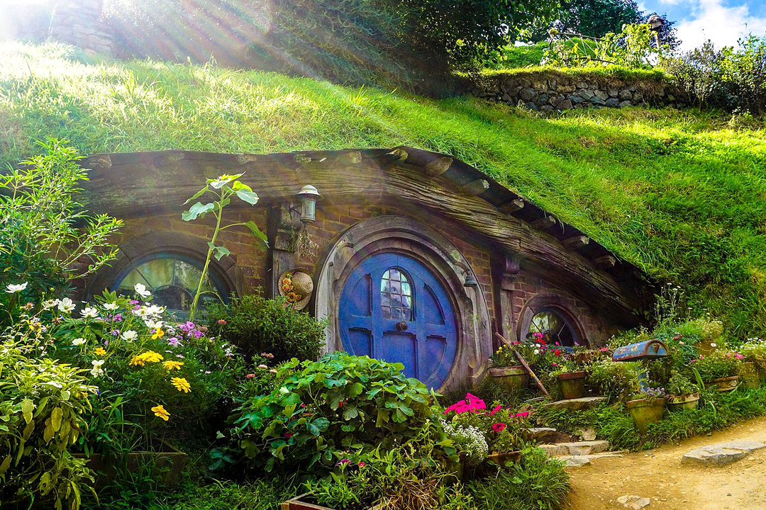
The Shire is a corner of a 1,250-acre working sheep and beef farm outside Matamata in the Waikato, spotted from the air by Peter Jackson’s location scouts in 1998 and built out with help from the New Zealand Army, who bulldozed a road in.
Around forty hobbit holes are set into the hillside with their gardens and props, the Party Tree stands over the field below, and the tour ends at the Green Dragon, added later and serving ales and ciders brewed for the site.
The oak above Bag End is a fake: a real tree was cut down and re-erected for The Lord of the Rings, and when it died before The Hobbit was filmed the crew built a replacement out of steel and silicone and wired on artificial leaves shipped in from Taiwan, one at a time.
8 – Huka Falls
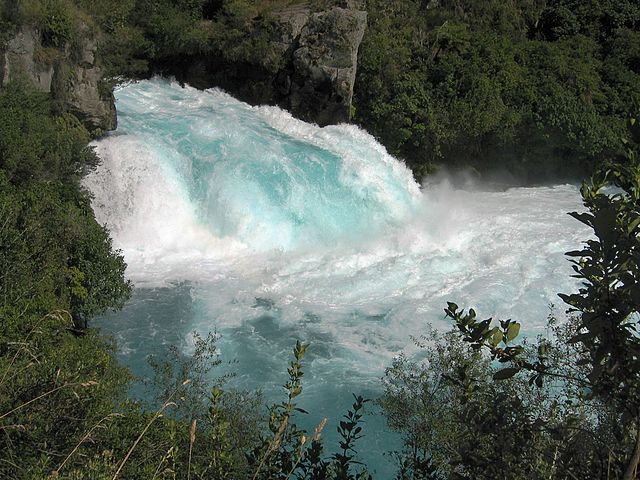
A few minutes north of Taupō, the Waikato — New Zealand’s longest river — leaves the lake and runs straight into a hard volcanic ledge, and the canyon it has carved is cut through sediments laid down before the enormous Ōruanui eruption 26,500 years ago that created Lake Taupō in the first place.
A footbridge crosses right at the top of the chute for the best view, walking tracks run back to town past thermal streams you can sit in, and jetboats come up the river to hold position in the spray at the foot of the drop.
The river is normally about 100 metres wide and is squeezed here into a channel of 15, which turns it into something like a fire hose: roughly 220,000 litres a second come through, enough to fill an Olympic swimming pool in eleven seconds.
9 – Otago
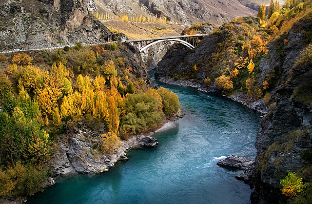
The southeastern region of the South Island took off in May 1861 when gold was found at Gabriel’s Gully, drawing 18,000 miners within three years and turning Dunedin — a small Scottish Free Church settlement named with the old Gaelic name for Edinburgh — into the largest and richest city in the country.
Dunedin kept the buildings that money bought, along with New Zealand’s first university, while inland Central Otago has the schist landscapes, the old goldfield towns and the vineyards of the Kawarau and Gibbston valleys.
The suspension bridge over the Kawarau Gorge was thrown across in the 1880s to get miners to the goldfields, and in 1988 two New Zealanders used it to open the world’s first commercial bungy operation — an idea they had taken from the vine-jumping ritual of Pentecost Island in Vanuatu.
10 – Queenstown
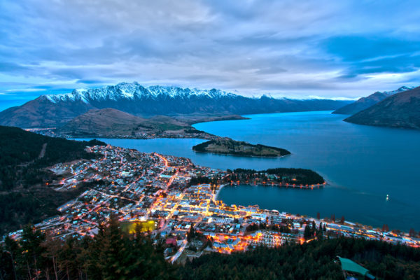
The town sits on a bay of Lake Wakatipu under the wall of the Remarkables, founded on gold in the 1860s and reinvented in the late twentieth century as the place people come to throw themselves off things.
The Skyline gondola gives the classic view over the lake, the coal-fired steamer TSS Earnslaw has been crossing to Walter Peak station since 1912, and the road out to Glenorchy at the head of the lake is one of the great drives in the country.
Lake Wakatipu has a heartbeat: the water rises and falls by 10 to 20 centimetres every twenty-odd minutes, a standing wave that Ngāi Tahu tradition explains as the heart of the giant Matau, burned in his sleep and buried in the trough his body left — the lake’s shape is his, with Glenorchy at his head, Queenstown at his knee and Kingston at his feet.
11 – Rotorua
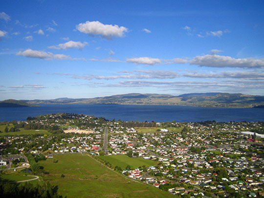
The town sits on its lake in the middle of the North Island’s geothermal belt, on the land of Te Arawa, whose people settled here to use the ground heat for cooking, bathing and warmth, and who turned it into the country’s first proper tourist destination in the 1800s.
Whakarewarewa is a village where families still live over the steam and cook in it, with Pōhutu geyser playing beside it most days; the Government Gardens hold an extravagant mock-Tudor bathhouse built for Edwardian spa patients, and Waimangu and Wai-O-Tapu spread their coloured pools to the south.
The great attraction of the 1880s was the Pink and White Terraces, tiers of silica descending into Lake Rotomahana and advertised as the eighth wonder of the world — Mount Tarawera erupted on 10 June 1886, destroyed them completely, buried several villages and killed well over a hundred people, nearly all of them Māori.
12 – Tasman National Park
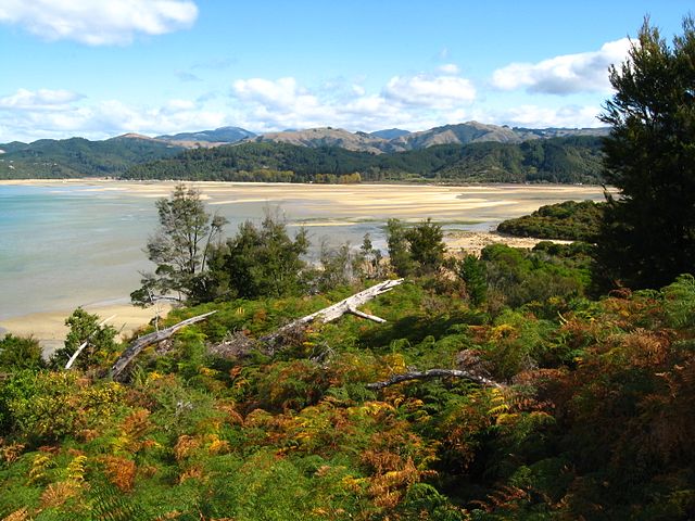
The smallest of New Zealand’s national parks sits at the top of the South Island between Golden Bay and Tasman Bay, and it opened on 16 December 1942, exactly three hundred years after the Dutch navigator it is named for anchored just offshore.
Golden granite beaches, tidal lagoons and clear warm water run the length of the 60 km Coast Track, one of the country’s Great Walks, and water taxis and kayaks let you do it in pieces rather than end to end.
Abel Tasman never actually set foot on New Zealand: waka came out to inspect his ships in 1642, a confrontation left four of his crew dead and casualties among Ngāti Tūmatakōkiri too, and he sailed off calling the place Murderers’ Bay — it was renamed Golden Bay later, with rather more tact.
13 – Tasman Valley
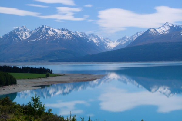
The valley runs up from Aoraki/Mount Cook Village into the heart of the country’s alpine district, where glaciers cover about two-fifths of the national park and Haupapa/Tasman Glacier, the longest in New Zealand at over 20 km, grinds down beneath the highest peaks.
Short tracks from the Blue Lakes car park reach a viewpoint over the glacier’s terminal lake, which has only existed since the 1970s and carries icebergs in summer, and the village below has the Sir Edmund Hillary Alpine Centre — he learned to climb in these valleys before Everest.
The valley sits inside the Aoraki Mackenzie International Dark Sky Reserve, more than 4,000 square kilometres where outdoor lighting has been restricted since the 1980s, and which on its designation in 2012 was the largest reserve of its kind in the world.
14 – Waitomo Caves

A limestone karst system beneath the King Country, long known to local Māori, and systematically explored in 1887 by the Ngāti Maniapoto chief Tāne Tinorau and an English surveyor, Fred Mace, who floated in on a flax raft by candlelight and found the ceiling full of lights.
Boats drift through the Glowworm Grotto in silence beneath a roof of blue-green pinpricks, while Ruakuri next door is walked rather than floated and Waitomo is also where black-water rafting on an inner tube was invented.
The glowworms aren’t worms: they are the larvae of a fungus gnat found only in New Zealand, which glow to lure insects and hang sticky beaded silk threads from the ceiling to catch them — and the caves themselves, taken over by the government in 1906, were handed back to Tāne Tinorau’s descendants in 1989, many of whom now guide there.
15 – Lake Wanaka
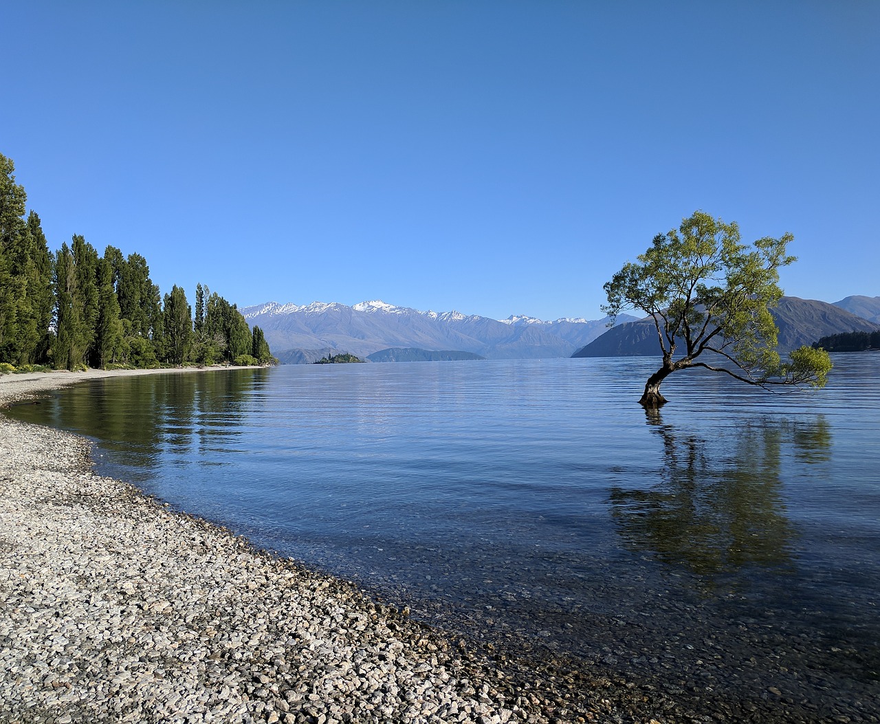
A long glacial lake in Otago at the doorstep of Mount Aspiring National Park, with the town of Wānaka at its southern end — quieter than Queenstown an hour away, and the base for Roys Peak and the Rob Roy Glacier walk.
The lakefront is the draw, along with the climb up Roys Peak for the view down the length of the water, and the Puzzling World illusion rooms on the road out of town.
Standing alone in the shallows is a crack willow that has become perhaps the most photographed tree on earth: it began around 1939 as a cut branch used as a fence post to keep stock out of the lake, took root where it was driven in, and became famous worldwide after a misty photograph of it won New Zealand Geographic’s photo of the year in 2014.
16 – Wellington
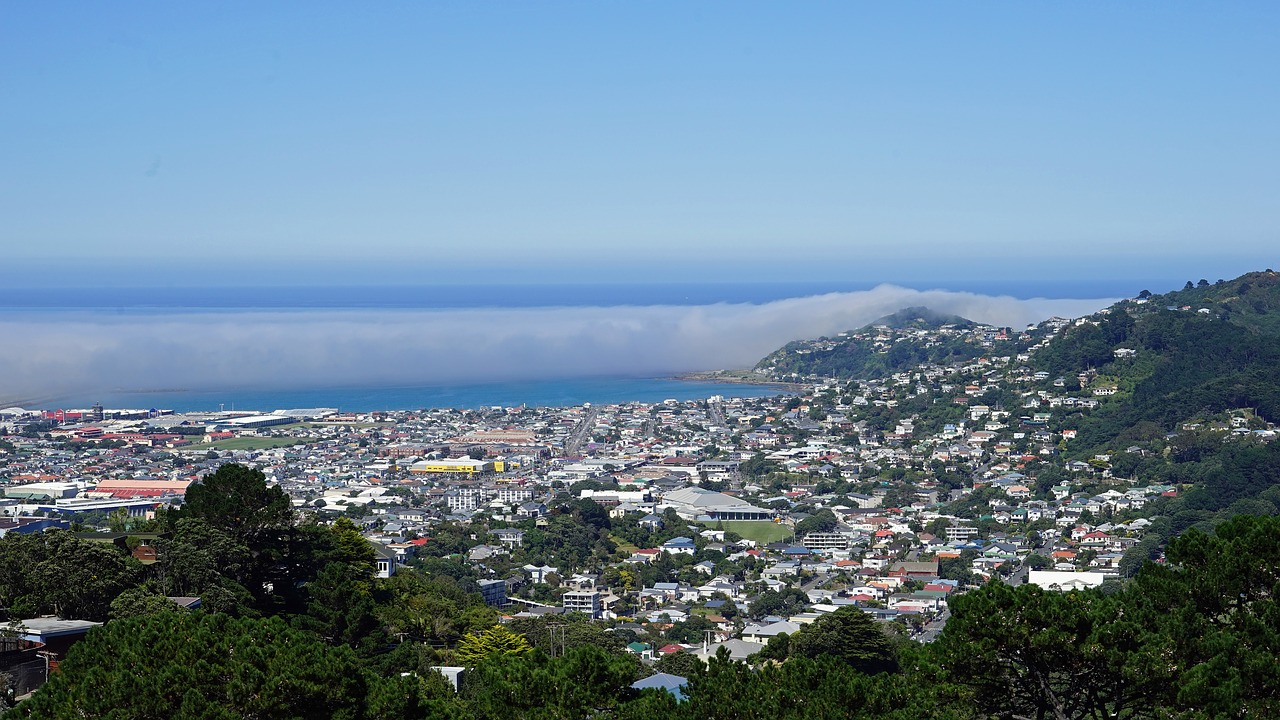
The capital sits on a harbour at the southern tip of the North Island on one of the most active fault systems in the country, and took over from Auckland in 1865 because Parliament wanted a seat closer to the middle of a long, thin nation — it is the southernmost capital city of any sovereign state.
Te Papa on the waterfront is the national museum and free to enter, the 1902 cable car climbs from Lambton Quay to the botanic gardens, Parliament’s Beehive sits at the top of the same street, and the harbour walk runs the whole way round.
The flat land the central city stands on was pushed up out of the harbour: the magnitude 8.2 Wairarapa earthquake of January 1855 lifted the shoreline by around a metre and a half, and brass plaques set into the pavement of Lambton Quay still mark where the water’s edge used to be.
17 – Christchurch
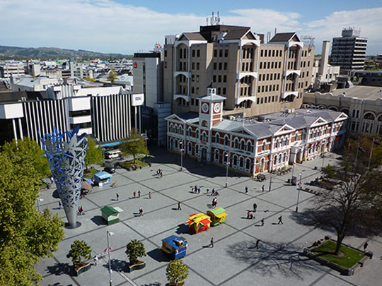
The South Island’s largest city was designed in London before anyone lived in it — the Canterbury Association planned an Anglican settlement around a cathedral and a college, named it after Christ Church in Oxford, and landed the first four shiploads of settlers at Lyttelton in December 1850, on country long used by Ngāi Tahu, who know the place as Ōtautahi.
The Avon winds through the middle with punts on it, Hagley Park and the botanic gardens take up a whole quarter of the centre, a heritage tram loops the streets, and over the Port Hills is Lyttelton, the harbour Scott and Shackleton sailed south from — there’s a statue of Scott in town carved by his widow.
An earthquake struck directly beneath the city at lunchtime on 22 February 2011, killed 185 people and brought down much of the centre; the replacement cathedral that went up afterwards was designed for nothing by the Japanese architect Shigeru Ban and built largely out of cardboard tubes, and it is meant to last fifty years.
18 – Tongariro National Park
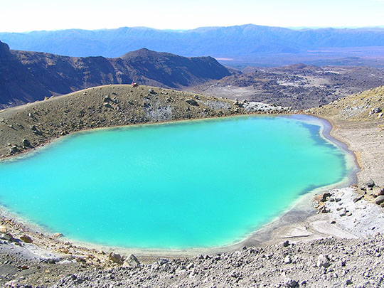
Three active volcanoes — Ruapehu, Ngāuruhoe and Tongariro — stand together on the central plateau, and in September 1887 the chief of Ngāti Tūwharetoa, Horonuku Te Heuheu Tūkino IV, signed a deed placing their summits under Crown protection; the park followed in 1894, and it is now World Heritage listed twice over, for the landscape and for what the mountains mean.
The Tongariro Alpine Crossing runs 19 km past steaming vents, an old crater and the Emerald Lakes and is routinely called the best day walk in the country, Ruapehu carries the North Island’s ski fields, and Ngāuruhoe’s near-perfect cone stood in for Mount Doom, digitally sharpened for the screen.
It was the fourth national park created anywhere in the world and the first to come out of an indigenous act of protection — though “gift” is not quite how Ngāti Tūwharetoa understood it, the intention being a partnership with the Crown to keep the mountains safe, struck at a moment when the land court looked likely to carve them up and sell them off.