
Wikimedia Commons / CC-BY-SA-3.0 / GFDL
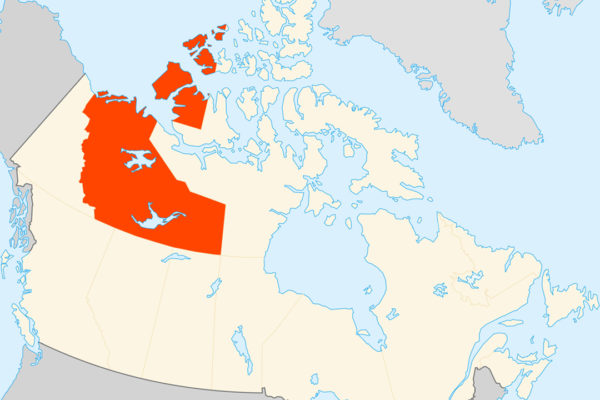
Capital: Yellowknife
Population: 45,000+
Language: English (eleven official languages, and just under half the population is Indigenous).
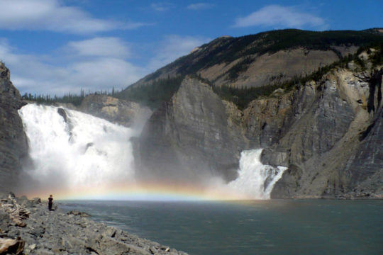
1 – Virginia Falls (above)
On the South Nahanni River in the south-west corner of the Northwest Territories, Virginia Falls is the busiest place in Nahanni National Park Reserve (entry 3) — which by Parks Canada’s count still means only around 1,300 visitor-days a year — and the starting point for most canoe trips down the river.
Floatplanes land on the river above Virginia Falls beside a small campground, and a boardwalk portage leads past the Sluice Box rapids to viewpoints over the drop and down to its base, with trails across the river to Marengo Falls and up Sunblood Mountain.
The limestone spire that splits Virginia Falls is known informally as Mason’s Rock, after the Canadian canoeist and filmmaker Bill Mason, and from the foot of the falls it’s seven to ten days by canoe down through the canyons to Nahanni Butte.
2 – Yellowknife

On the north shore of Great Slave Lake, North America’s deepest at 614 metres, Yellowknife takes its name from the Yellowknives Dene, called after the copper knives they carried, and grew from a 1934 gold strike into the territorial capital in 1967.
Yellowknife’s Old Town has the Bush Pilot’s Monument on The Rock and the houseboats moored on Yellowknife Bay, and in winter the city sits under the auroral oval for long, clear nights of northern lights, with a snow castle built on the frozen bay every year since the mid-1990s.
The Giant gold mine left 237,000 tonnes of arsenic trioxide dust underground on the edge of Yellowknife, now being kept frozen in place in a clean-up estimated at $4.38 billion, and in 1951, before emission controls were fitted, a Dene child died after drinking contaminated snowmelt.
3 – Nahanni National Park

In the Mackenzie Mountains of the south-western Northwest Territories, Nahanni National Park Reserve protects the South Nahanni, a river UNESCO calls “older than the mountains” it cuts through, which kept carving down as the ranges rose and left canyons up to about 1,000 metres deep — and in 2009 the park was made six times larger, to more than 30,000 km².
Beyond Virginia Falls (entry 1), Nahanni’s sights are its four canyons, the Rabbitkettle tufa mounds — mineral terraces built up by a hot spring over some 10,000 years, the largest in Canada and visited only with park staff — the Kraus hot springs, and the granite towers of the Cirque of the Unclimbables, whose Lotus Flower Tower was first climbed in 1968.
The Nahanni’s legend was built by a few outsiders: Raymond Patterson, whose 1928–29 trip became the book The Dangerous River in 1954, and Albert Faille, a Minnesotan prospector who searched the river for gold from 1927 into old age and was filmed by the National Film Board in 1962.
4 – Tsiigehtchic
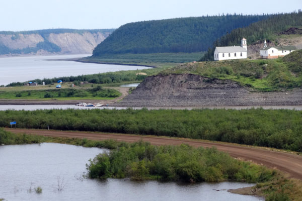
Where the Arctic Red River meets the Mackenzie, Tsiigehtchic — “mouth of iron river” in Gwich’in — is a village of about 140 Gwichya Gwich’in on a site that was a fish camp and meeting place long before missionaries arrived in the 1860s, and it was officially Arctic Red River until 1994.
Tsiigehtchic’s mission church stands on the bluff above the confluence, and the Dempster Highway crosses the Mackenzie nearby on the Louis Cardinal ferry, which also runs traffic across to the village in summer and is replaced by an ice road in winter.
For a few weeks every autumn and spring, while the rivers freeze up or break up, neither ferry nor ice road can run and the Dempster — the only road through Tsiigehtchic — is cut in two, and the village’s land rights rest on the Gwich’in land claim signed in 1992.
5 – Inuvik
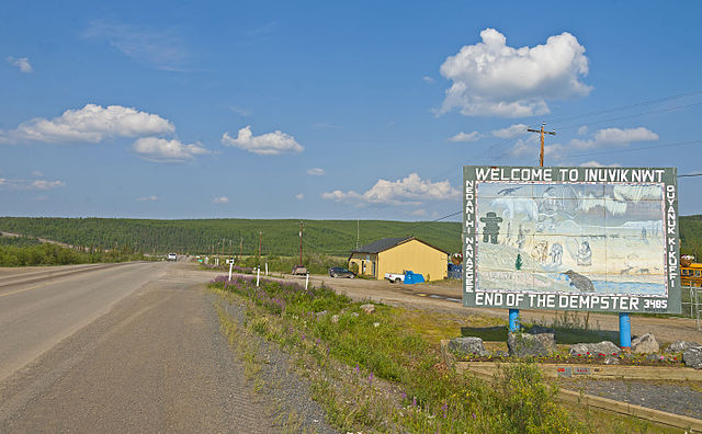
On the East Channel of the Mackenzie Delta, Inuvik was built from scratch between 1955 and 1961 to replace the flood-prone town of Aklavik as the government centre of the western Arctic — though Aklavik refused to move and took the motto “Never Say Die”.
Inuvik’s landmarks are the Igloo Church of 1958–60, designed by a missionary carpenter with no formal architectural training, the community greenhouse inside a former hockey arena, and the end of the Dempster Highway, where since November 2017 a 138 km road has carried on to Tuktoyaktuk, Canada’s first all-season road to the Arctic coast.
Because Inuvik is built on permafrost, its buildings stand on piles and its water and sewage run above ground in insulated boxes called utilidors, and the town gets about 56 days of midnight sun in summer and about 30 days without a sunrise in winter.
6 – Wood Buffalo National Park
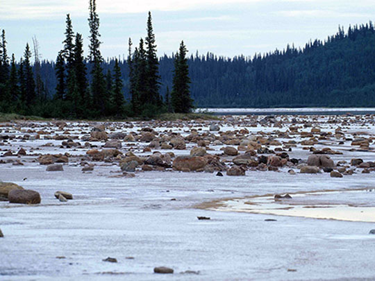

Straddling the border with Alberta, which holds most of it, Wood Buffalo National Park was created in 1922 to protect the last wood bison, then perhaps 1,500 to 2,000 animals, and at 44,800 km² it is Canada’s largest national park and a World Heritage Site since 1983 — though its creation pushed out Métis and Dene families who had hunted there.
Reach Wood Buffalo by Highway 5 to Fort Smith, the park’s headquarters, for salt plains where springs leave mounds of salt, sinkholes in the gypsum karst, the Peace–Athabasca Delta, one of the world’s largest inland deltas, and since 2013 the largest dark-sky preserve in the world.
In 1954 a helicopter crew heading to a fire spotted the lost nesting grounds of the whooping crane in Wood Buffalo, when only about 21 wild birds were left, and the flock that nests here now numbers about 540 — though in 1925–28 the government shipped in 6,673 plains bison that brought disease and interbred with the wood bison the park was made to save.