
Wikimedia Commons / CC-BY-SA-3.0 / GFDL
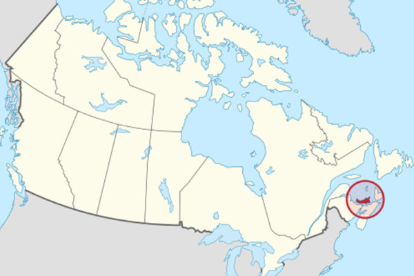
Capital: Charlottetown
Population: 183,000+ (about 28% of Islanders reported Irish origin in the 2021 census).
Language: English
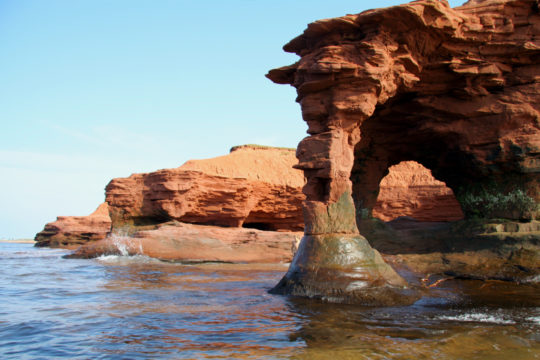
1 – Sandstone Arch (above)
Along the north and west shores of Prince Edward Island, the sea has carved arches and stacks out of soft red sandstone laid down some 300 million years ago, in the Late Carboniferous and Permian, and coloured by iron oxides — the same rock that turns the island’s cliffs, roads and fields red.
The longest runs of red cliff are on the north shore, inside PEI National Park around Cavendish (entry 3) and west at Cape Tryon, where a lighthouse has stood on the clifftop since 1905, and any sandstone arch you find along Prince Edward Island’s coast is temporary by definition.
When post-tropical storm Fiona came ashore in Nova Scotia in September 2022, it was the lowest-pressure storm on record to make landfall in Canada, and UPEI researchers measured 1.5 to 7 metres of Prince Edward Island’s west coast lost in that one storm, and more than 25 metres in parts of Miminegash.
2 – Souris
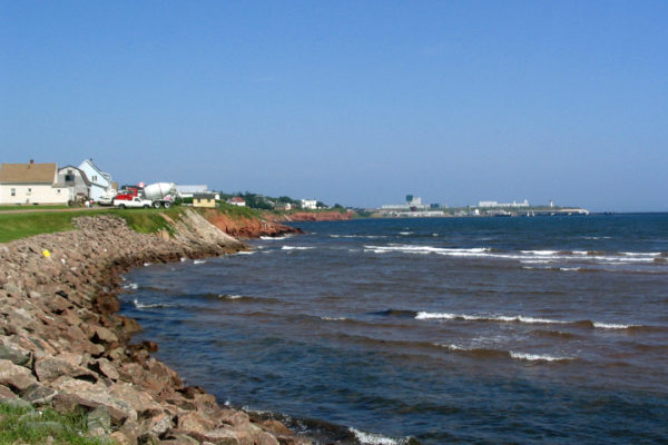
On Colville Bay at the eastern end of Prince Edward Island, Souris — French for “mouse” — is traditionally said to be named for the plagues of field mice that ate Acadian crops in the 1700s, though some historians link it to the Souriquois, an early European name for the Mi’kmaq.
Souris’s wooden lighthouse of 1880 on Knight Point looks over the harbour where the CTMA ferry leaves for the five-hour crossing to Quebec’s Magdalen Islands, and East Point Lighthouse, built in 1867 at the island’s north-eastern tip, is a short drive away.
Just east of Souris at Basin Head, the dry sand squeaks underfoot — the “singing sands”, a sound scientists still can’t fully explain — and the lagoon behind the beach, a marine protected area since 2005, holds a giant form of Irish moss that is thought to grow nowhere else.
3 – Cavendish Beach

On the north shore of Prince Edward Island, Cavendish Beach lies inside PEI National Park, created in 1937 on land that included the farm behind Anne of Green Gables, and several Cavendish families, the owners of Green Gables among them, sold up under threat of expropriation.
Cavendish Beach backs onto red cliffs and dunes, and inland L.M. Montgomery’s Cavendish National Historic Site joins Green Gables to the site of her grandparents’ farmhouse, where she lived from 1876 to 1911 and began writing Anne, with her grave in the Cavendish Community Cemetery nearby.
Montgomery never lived at Green Gables, which belonged to her Macneill relatives David and Margaret, and the house she did live in was pulled down around 1920 — and the oft-quoted “50 million copies” of Anne has no published sales data behind it, with some sources applying it to all her books.
4 – Charlottetown
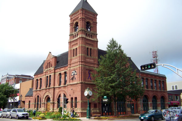
On a sheltered harbour on Prince Edward Island’s south shore, Charlottetown was named for Queen Charlotte, wife of George III, and laid out in 1768 by the Nova Scotia surveyor Charles Morris, with four more squares added in 1771 to make the five that still anchor the downtown grid.
Charlottetown’s Province House, where the 1864 conference met, has been closed since 2015 for a C$138 million conservation project and is due to reopen in late October 2026, and nearby are the Confederation Centre of the Arts, opened by Elizabeth II in 1964, St Dunstan’s Basilica, rebuilt after a fire in 1913, and the shops of Victoria Row.
Anne of Green Gables – The Musical has played the Confederation Centre almost every summer since 1965, which Guinness lists as the longest-running annual musical theatre production, and Charlottetown’s Benevolent Irish Society, founded in 1825, serves an island where about 28% claim Irish roots, many from County Monaghan, who came in the 1830s, before the Famine.
5 – Summerside
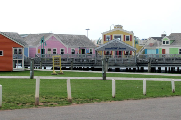
On Bedeque Bay in western Prince Edward Island, on a shore the Mi’kmaq called Eptek, “hot place”, Summerside — now the island’s second city, with about 16,000 people — was known as Green’s Shore until around 1840 and likely took its name from Joseph Green’s inn, Summerside House.
Summerside’s waterfront has the Eptek Arts and Culture Centre and the College of Piping and Celtic Performing Arts of Canada, where students learn the Highland pipes, and just west at Miscouche the Acadian Museum stands close to where the Acadian flag was adopted on 15 August 1884.
Western Prince Edward Island was the cradle of commercial silver-fox farming in the 1880s and 1890s, and in the boom before the First World War a breeding pair could sell for $10,000 and the best for up to $35,000, with Summerside the headquarters of the national breeders’ association until the trade collapsed by the 1940s.
6 – Skmaqn–Port-la-Joye–Fort Amherst
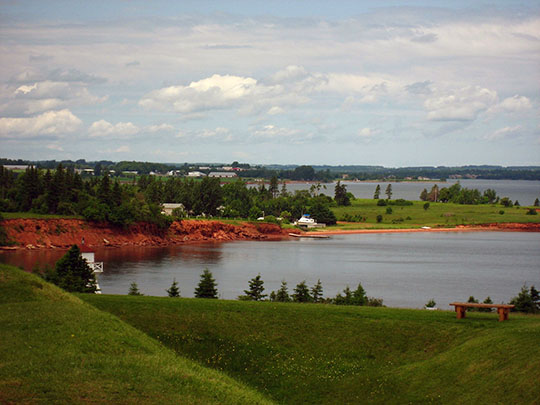
At Rocky Point, on high ground facing Charlottetown (entry 4) across the harbour, Skmaqn–Port-la-Joye–Fort Amherst is where some 300 French colonists landed in 1720 to found Port-la-Joye, which stayed the island’s seat of government under France and then Britain until about 1770.
Skmaqn–Port-la-Joye–Fort Amherst is grassy earthworks rather than buildings — the outline of the French fort, the banks of Fort Amherst, built by Lord Rollo’s troops in 1758 and named for Jeffery Amherst, and the sites of Acadian farms — with around 6 km of trails, a deportation memorial and views across to Charlottetown.
In 1758 the British deported about 3,000 Acadians from the island through Port-la-Joye and roughly half died, mostly of disease aboard ship and in the loss of the Duke William, the Violet and the Ruby, remembered here each December — and the Mi’kmaq name added in 2018, Skmaqn, “the waiting place”, recalls yearly alliance meetings with the French, though some Mi’kmaq leaders objected to pairing it with Amherst’s.
7 – Lennox Island
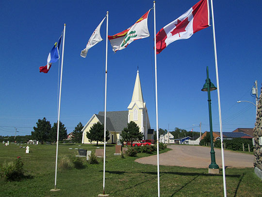
In Malpeque Bay off north-western Prince Edward Island, Lennox Island — L’nui Minegoo, “the people’s island”, in Mi’kmaq — has been a Mi’kmaq gathering place since a chapel to St Anne was built here around 1800, and in 1870 the London-based Aborigines Protection Society bought it from its absentee landlord for £400.
Since 1973 a causeway and bridge have joined Lennox Island to the main island — before that, people crossed by boat or over the ice — and visitors come for the Mi’kmaq Cultural Centre, opened in 2000, St Anne’s Church and the Path of Our Forefathers trail.
Every year on the Sunday nearest 26 July, St Anne’s Sunday brings Mi’kmaq families back to Lennox Island for Mass, a pipe ceremony and a feast, on an island that has lost roughly a fifth to a quarter of its land to the sea since 1880 — not half, as is sometimes said, though rising seas could take half within decades.