
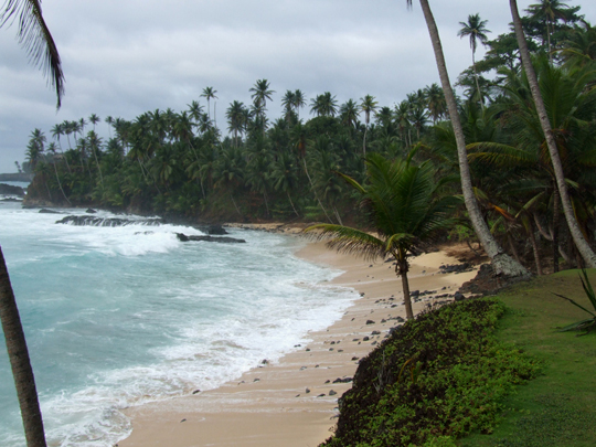
Wikimedia Commons / CC-BY-SA-3.0 / GFDL
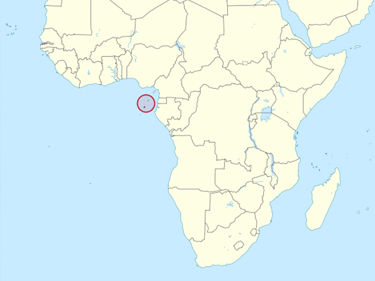
Capital: São Tomé
Population: 240,000+
Language: Portuguese. Forro, a Portuguese-based creole, is also widely spoken.
1 – Ilhéu das Rolas (also above)
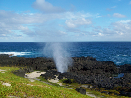
Ilhéu das Rolas, a small, palm-covered islet off the southern tip of São Tomé, has a claim few places can match, for the Equator runs straight across it, as Gago Coutinho’s Portuguese mapping mission of 1915–18 confirmed.
A short boat ride and an uphill walk on Ilhéu das Rolas lead to the Marco do Equador, a monument with a tiled map of the world marking latitude zero, where visitors pose with a foot in each hemisphere, and beyond it lie quiet beaches and a lighthouse.
Standing on Ilhéu das Rolas you weigh about 0.5% less than you would at the North or South Pole, because the spinning Earth bulges at the Equator, putting you some 21 km further from its centre.
2 – Boca do Inferno
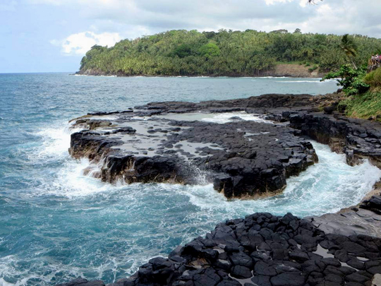
The Boca do Inferno, the “Mouth of Hell”, lies on the east coast of São Tomé between Água Izé and Ribeira Afonso, where the island’s black volcanic rock meets the Atlantic.
When the swell is up, waves surge into the Boca do Inferno and burst out through a gap in the lava rock in a plume of spray, while on calm days it makes a quiet stop on the coast road.
The Boca do Inferno lies a short drive from Roça Água Izé, the cocoa estate said to be where commercial cocoa growing on São Tomé began in the mid-1800s.
3 – Pico Cão Grande
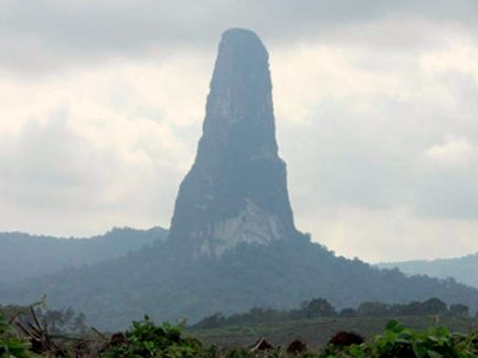
Pico Cão Grande, “Great Dog Peak”, is a slender volcanic needle soaring out of the rainforest of Obô Natural Park in the south of São Tomé, rising some 370 m above the surrounding jungle.
Most visitors admire Pico Cão Grande from the road or hike to its base, for its sheer, moss-slicked walls make it one of Africa’s most demanding big-wall climbs, with a Portuguese team credited with a 1975 ascent and a Japanese team climbing it in 1991.
Pico Cão Grande is a volcanic plug, magma that hardened inside a volcano’s vent and was left standing as the softer rock around it eroded away, and in 2016 climbers put up a 455 m route to its summit called Nubivagant.
4 – The Chocolate Islands
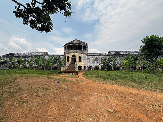
The Chocolate Islands earned their name after cocoa was brought to Príncipe in the 1820s and spread to São Tomé, until by the early 1900s these tiny islands were the world’s largest cocoa producer, grown on great estates called roças with their own hospitals, chapels and railways.
Roça Água Izé on São Tomé’s east coast is said to be where commercial cocoa growing on the island began, its 1928 hospital lying in ruins, while Roça Agostinho Neto, near the capital, is one of the largest and grandest of the Chocolate Islands’ estates.
The cocoa was harvested by contract workers from Angola, Mozambique, and Cape Verde held in conditions little different from slavery, and after Henry Nevinson’s book A Modern Slavery (1906), Cadbury, Fry, Rowntree and Germany’s Stollwerck boycotted the islands’ cocoa in 1909.
5 – Príncipe
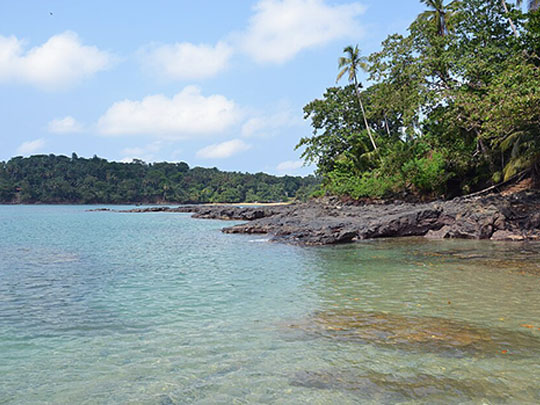

Príncipe, the smaller, later-settled and quieter of the two islands, lies about 130–150 km north of São Tomé, a jungled volcanic island of forested peaks and empty bays, and the whole island has been a UNESCO Biosphere Reserve since 2012.
Santo António, the small capital of Príncipe, sits at a river mouth, while beyond it lie Banana Beach and coves reached only by boat, with forests full of birds found nowhere else, among them the Príncipe kingfisher.
On 29 May 1919, Arthur Eddington photographed a total eclipse from Roça Sundy on Príncipe, and when clouds parted just in time his plates, with those of a parallel expedition at Sobral in Brazil led by Andrew Crommelin of Cushendun, County Antrim, confirmed Einstein’s prediction that gravity bends light.
6 – São Tomé City
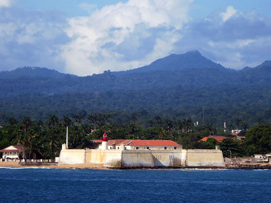
São Tomé City, on Ana Chaves Bay on the north-east coast, was founded by the Portuguese in 1493, and the islands became one of the first plantation economies in the tropics, growing sugar with enslaved African labour.
The 16th-century Fort of São Sebastião, built to guard São Tomé City from pirates, houses the National Museum, and in 1968–70 the city was the base for the airlift of food into Biafra run by the Irish Holy Ghost Father Tony Byrne.
In February 1953, Governor Carlos Gorgulho claimed to have uncovered a plot, and hundreds of São Toméans were killed in what became known as the Batepá massacre, marked each year on 3 February and widely seen as a turning point on the road to independence.