
Wikimedia Commons / CC-BY-SA-3.0 / GFDL
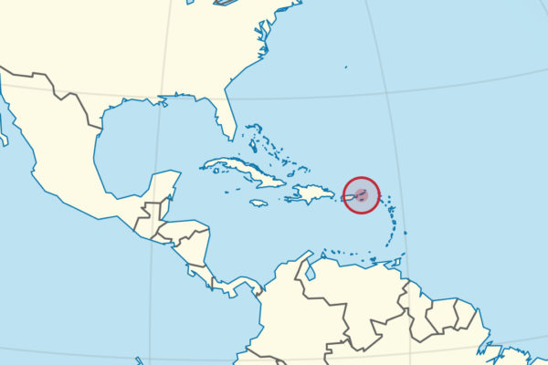
Capital: Charlotte Amalie
Population: 100,000+
Language: English
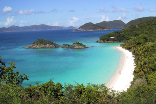
1 – Trunk Bay (above)
On the north shore of St John, Trunk Bay sits inside Virgin Islands National Park, which covers about 60% of the island and exists because Laurance Rockefeller bought the land in the 1950s and gave it to the nation on condition it was never developed.
The beach is a curve of white sand around a small offshore island, and it has an underwater snorkelling trail with plaques set on the seabed identifying the coral; go early, before the boats arrive.
The park’s other side is the ruins in the bush behind: the Annaberg sugar works, and the Reef Bay trail that passes pre-Columbian petroglyphs carved beside a freshwater pool — in 1733 enslaved Akwamu people seized St John and held most of it for months before French troops were brought in to retake it.
2 – Charlotte Amalie
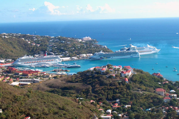
The capital of the territory sits around a deep harbour on St Thomas, founded by the Danes in the 1660s and run for two centuries as a free port where anyone’s ships and anyone’s cargo were welcome, including a good deal of both piracy and slave trading.
Red-roofed warehouses climb the hillside above the waterfront; walk the 99 Steps up through the old town to the 17th-century watchtower known as Blackbeard’s Castle, and look in at the synagogue, one of the oldest in the western hemisphere, which still has a sand floor.
Denmark sold these islands to the United States in 1917 for $25 million in gold, and the handover happened on this waterfront: at four in the afternoon on 31 March the Danish flag came down after more than two centuries, and nobody asked the islanders what they thought — Transfer Day is still marked here every year.
3 – Christiansted
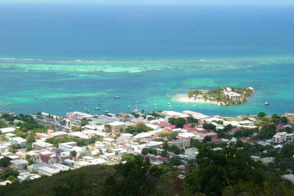
The Danish capital of St Croix, laid out on a grid in the 1730s and now a US national historic site: yellow and pink arcaded buildings, a customs house, a scale house for weighing sugar, and Fort Christiansvaern above the harbour.
Walk the waterfront boardwalk, go through the fort’s cells and cannon, and take a boat out to Buck Island, whose reef is a national monument.
A teenage Alexander Hamilton clerked in a counting house on these streets in the 1770s, learning the shipping trade that made his name — and it was on this island, at Frederiksted in 1848, that enslaved Crucians forced the Danish governor to declare emancipation on the spot, seventeen years before the United States abolished slavery.
4 – Salt River Bay
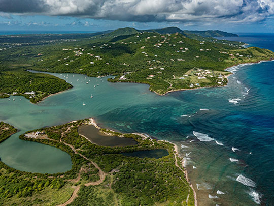

A wide mangrove estuary on the north coast of St Croix, this is the only known place where members of a Columbus expedition set foot on what is now United States soil — a longboat was sent ashore for water on 14 November 1493, during the second voyage.
The park protects the bay, some of the largest mangrove forests in the territory, a submarine canyon offshore and the earth ramparts of Fort Salé, begun in 1641 and one of the few surviving European earthwork forts in the Americas.
The landing party met Kalinago in a canoe and fought them, with casualties on both sides — generally recorded as the first armed resistance by Amerindians to European arrival, and Columbus named the place Cape of Arrows; on the western shore archaeologists later uncovered a Taíno ceremonial ball court, the only one known in the Lesser Antilles.