
Francisco Becerro / Wikimedia Commons / CC-BY-SA-3.0 / GFDL
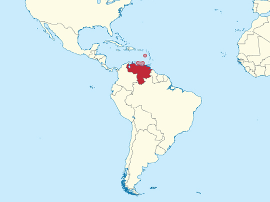
Capital: Caracas
Population: 28.5 million+
Language: Spanish (plus 30 official indigenous languages)
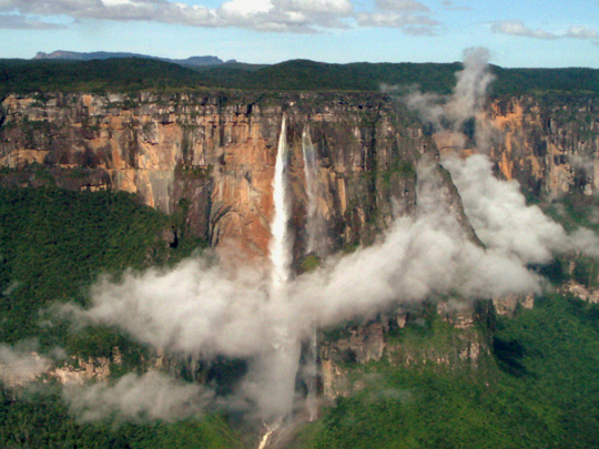
1 – Angel Falls (also above)
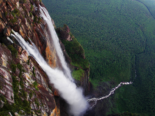
The tallest uninterrupted waterfall on Earth, dropping 979 metres off the rim of Auyán-tepui deep inside Canaima National Park in Bolívar state, so remote that it only reached the outside world in the 1930s; the Pemón have always called it Kerepakupai Merú, roughly the waterfall of the deepest place.
No road goes anywhere near it, so the trip means a flight into Canaima, then hours in a motorised dugout up the Carrao and Churún rivers, a walk through forest to the viewpoint at the base and a night in a hammock — and the falls only run at full strength in the wet season.
The English name belongs to Jimmie Angel, an American pilot hunting for gold who landed on the tepui’s boggy summit in 1937, sank his wheels in the mud and had to walk out with his wife and two companions over eleven days; the aircraft stayed up there for 33 years until helicopters lifted it off.
2 – Mount Roraima
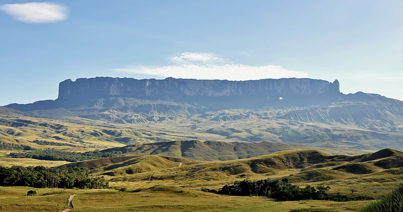
A 2,810-metre sandstone table mountain in the Gran Sabana with most of its summit inside Venezuela, built from rock roughly two billion years old and so long isolated that the plants and animals on top evolved largely on their own; the Pemón word tepui means house of the gods.
Reaching the top takes about six days on foot from the village of Paraitepui, camping under rock overhangs the guides cheerfully call hotels, and the summit is a black maze of eroded stone, peat bogs, carnivorous pitcher plants, cold pools and a quartz-strewn hollow known as the Valley of Crystals, where nights can drop close to freezing on the equator.
The summit’s most famous resident is the pebble toad, a thumbnail-sized black creature that can barely jump and cannot really swim, so when a tarantula closes in it tucks in its limbs, balls up and rolls away down the rock like a dislodged stone.
3 – Caracas
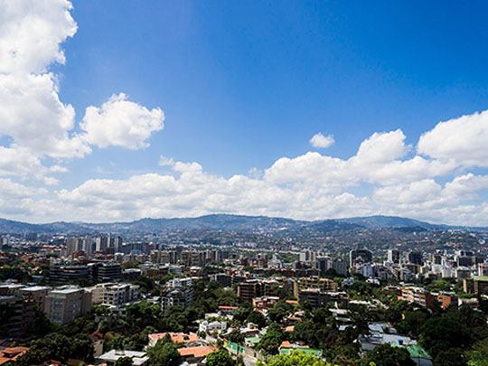

The capital lies in a narrow valley at around 900 m beneath the green wall of the Ávila, founded in 1567, and it is where the independence of northern South America began — Simón Bolívar was born here in 1783, and the revolution that unseated the Spanish governor started on its main square in April 1810.
The colonial core holds the Casa Natal where Bolívar was born and the museum beside it, the Panteón Nacional where his remains now lie, and Plaza Bolívar and the cathedral, while the Ávila rises straight out of the city with a cable car running up to the ridge and views over both the valley and the Caribbean.
Out in the west of the city, the Ciudad Universitaria that Carlos Raúl Villanueva built between the 1940s and 1960s was UNESCO-listed in 2000 — a working campus hung with commissioned work by Léger, Arp and Calder, whose floating acoustic panels drift above the Aula Magna, so students here walk to lectures through a World Heritage site.
4 – Los Roques
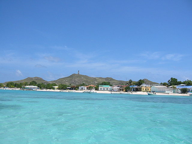
A coral atoll archipelago roughly 160 km north of Caracas: some 300 low cays and sandbanks scattered around a shallow turquoise lagoon, protected as a national park since 1972 and later recognised as a wetland of international importance.
Gran Roque has the airstrip, sand streets and brightly painted guesthouses, and from there small boats run out to Cayo de Agua, Madrisquí and Crasquí for snorkelling over some of the healthiest reef in the Caribbean, with hawksbill turtles, eagle rays and nurse sharks, plus flats that draw fly-fishermen from all over the world.
Of those 300-odd islands only one is inhabited, by a village of around 1,500 people, and the park rules bar cars, high-rises and cruise ships everywhere else — which is precisely why the coral here still looks the way the Caribbean did fifty years ago.
5 – Coro
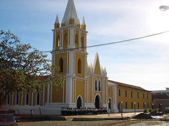

Santa Ana de Coro was founded on 26 July 1527 near the Caribbean coast in Falcón, becoming the first capital of the province of Venezuela and the seat of the first bishopric on the South American mainland, and together with its port at La Vela it was made the country’s first UNESCO World Heritage site in 1993.
Around six hundred historic buildings survive, and the point is what they are made of: not stone but earth — bahareque of woven cane and mud, adobe and rammed earth — worked in Spanish and Mudéjar styles and later in a Dutch manner carried across from Curaçao, with the cathedral, the Balcón de Bolívar and the sand dunes of Los Médanos on the edge of town.
Towns built out of mud are not supposed to last five centuries, and this one is struggling: exceptional rains in 2004 and 2005 did so much damage that UNESCO placed Coro on its List of World Heritage in Danger, where it has stayed ever since.
6 – Llovizna Falls
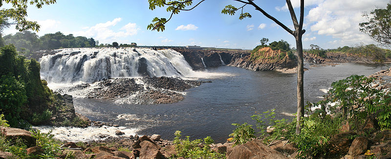
A broad, thundering set of cascades on the Caroní River just before it meets the Orinoco, sitting inside Ciudad Guayana — a planned industrial city stitched together in 1961 around iron, steel, aluminium and hydroelectricity, with the falls left as a park in the middle of it.
The park spreads over a scatter of islands linked by footbridges and walkways that take you close enough to be soaked by the spray the falls are named for (llovizna means drizzle), with forest trails, monkeys overhead, and the neighbouring Cachamay park and the museum built inside the Macagua dam nearby.
This is a waterfall with a tap: the hydroelectric scheme immediately upstream takes much of the river, so Llovizna runs at a fraction of its old volume most of the year and only returns to full roar on the days the floodgates are opened.
7 – Ciudad Bolívar
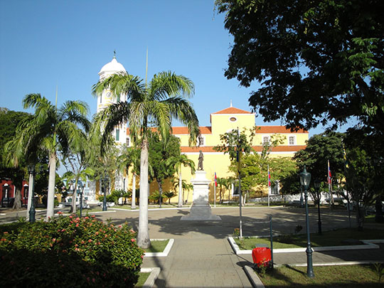
A river port on the Orinoco at the point where the great river squeezes to about a mile across, founded in 1764 and known for most of its life as Angostura, Spanish for the narrows; Simon Bolívar made it his base, and the Congress that opened here in February 1819 proclaimed the republic of Gran Colombia.
The old town is a run of ochre, blue and white colonial houses stepping down to the water, with the Casa del Congreso de Angostura on the main square, a modern art museum devoted to the local-born artist Jesús Soto, and an airport that is the usual jumping-off point for flights to Canaima and Angel Falls.
Angostura bitters were invented in this town in the 1820s by a German army surgeon looking for a cure for upset stomachs, and although production moved to Trinidad long ago, the little yellow-capped bottle behind every cocktail bar in the world still carries the old name of a Venezuelan river port.
8 – Mérida
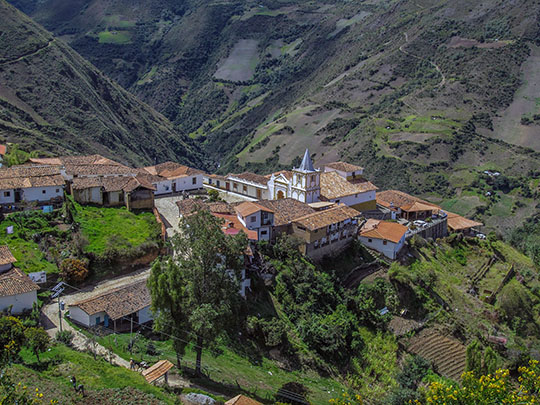
A colonial university city at about 1,600 m in the Venezuelan Andes, founded in 1558 on the old road between the Caribbean coast and Bogotá, home to the Universidad de Los Andes since 1785 and the base for the highest ground in the country, including Pico Bolívar at 4,978 m.
The Mukumbarí cable car climbs from the edge of town in four stages to Pico Espejo at roughly 4,765 m — the highest and longest system in the world — and beyond it lie the páramo of Sierra Nevada National Park, the mountain villages of Los Nevados and Jají, and a whole region of high moorland the rest of the country rarely sees.
These peaks carried the only glaciers in Venezuela, and the last of them, on Pico Humboldt, has now shrunk past the point where scientists will call it a glacier at all — which makes Venezuela, by most reckonings, the first country of the modern era to lose every one it had.
9 – Isla Margarita
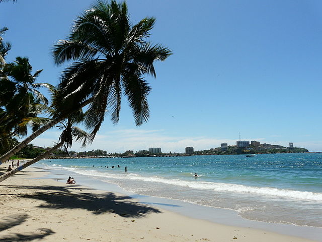
Venezuela’s largest island, about 40 km off the north-east coast, sighted by Columbus in 1498 and named for the pearls in the surrounding oyster beds — beds worked by enslaved indigenous divers under brutal conditions, and which at their peak supplied close to a third of all the tribute flowing from the Americas to the Spanish crown.
The draw now is beaches and forts: Playa El Agua for swimming and El Yaque for some of the most reliable windsurfing anywhere, the mangrove channels of La Restinga lagoon, duty-free shopping in Porlamar, and the stout Castillo San Carlos Borromeo at Pampatar and hilltop Santa Rosa above La Asunción.
On Cubagua, the small island just offshore, lie the ruins of Nueva Cádiz, the first Spanish town founded on the South American mainland — abandoned within a generation once the oyster beds were stripped bare and an earthquake finished the job in the 1540s.
10 – Los Llanos
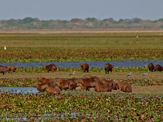
An enormous seasonally flooded savanna spreading across the Orinoco basin in the centre and west of the country, cattle country since the 1500s worked from vast ranches called hatos — and the home of the llaneros, whose horsemen under José Antonio Páez threw in with Bolívar and whose lance charges helped settle Venezuelan independence at Carabobo in 1821.
For sheer density of visible wildlife there is nothing like it in South America: capybara in herds, spectacled caiman, anaconda, giant anteater, scarlet ibis and jabiru storks among 300-odd bird species, best seen in the December-to-April dry season when everything crowds around the shrinking pools.
Capybara is a Lenten dish here, because sometime between the 16th and 18th centuries Venezuelan clergy wrote to the Vatican pointing out that the animal swims, has partly webbed feet and tastes vaguely of fish — and the Church duly classified the world’s largest rodent as one.
11 – Lake Maracaibo
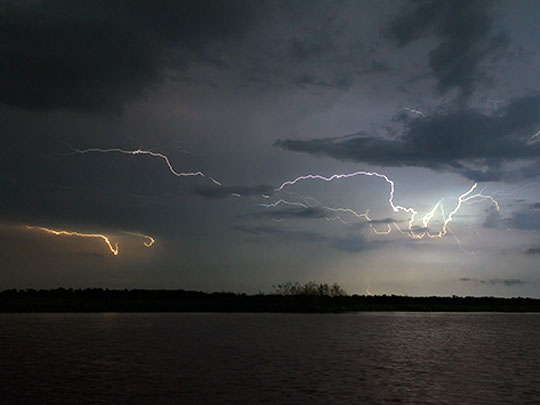
A vast brackish body of water in the north-west, the largest lake in South America and really a tidal estuary open to the Caribbean, ringed by mountains and floored by the oil that has funded the Venezuelan state since a well at Cabimas blew out in 1922 — and it is the reason the country has its name, since the stilt villages along its shores put early Spanish voyagers in mind of Venice.
Palafito settlements like Congo Mirador and Ologá still stand on their poles at the southern end, reached by boat and usually visited on overnight trips from the Andes, with howler monkeys and river dolphins in the surrounding mangroves and the eight-kilometre Rafael Urdaneta bridge spanning the neck of the lake at Maracaibo city.
Where the Catatumbo River enters the lake, storms fire on something like 250 nights a year at up to 28 flashes a minute, the greatest concentration of lightning on Earth — sailors called it the Lighthouse of Maracaibo, and on the night of 24 July 1823 it lit up the Spanish fleet for the patriot squadron that destroyed it, ending Spanish power in Venezuela.