
Wikimedia Commons / CC-BY-SA-3.0 / GFDL
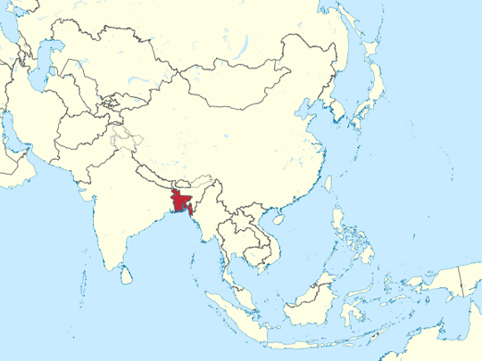
Capital: Dhaka
Population: 170 million+
Language: Bengali
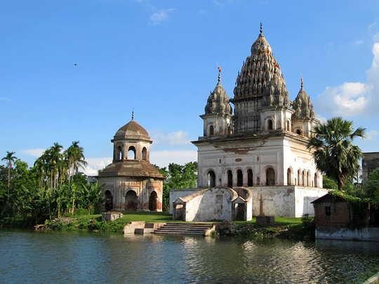
1 – Puthia Temple Complex (also above)
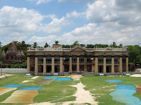
Puthia Temple Complex, about 23 km east of Rajshahi, gathers around a dozen temples and a palace beside a lake and ponds, often described as the greatest concentration of historic Hindu temples in Bangladesh, built by the Puthia Raj family, holders of one of the largest and wealthiest zamindari estates in British Bengal.
At Puthia, look for the great five-spired Shiva temple, commissioned in 1823 by Rani Bhubanmoyi Devi and housing a huge black basalt lingam, as well as the palace built or rebuilt in 1895 by Rani Hemanta Kumari Devi and the Govinda temple, faced in terracotta panels of Krishna and Radha.
Several of Puthia’s finest buildings were commissioned by its ranis, among them Rani Bhubanmoyi Devi, widow of Raja Jagat Narayan Roy, and the family’s great wealth came to an end when a 1950 law abolished the zamindari system.
2 – Somapura Mahavihara, Paharpur
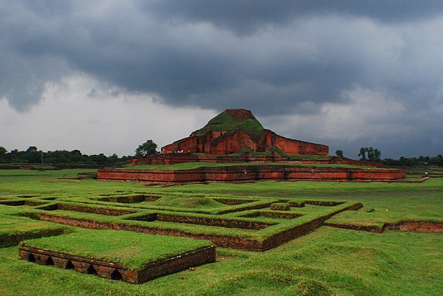
Somapura Mahavihara at Paharpur in Naogaon district is an 11-hectare walled monastery founded in the late 8th century under the Pala king Dharmapala, identified from clay seals bearing its name, and one of the largest Buddhist monasteries south of the Himalayas.
At Somapura Mahavihara, 177 monks’ cells line walls more than 270 m long on each side, enclosing a courtyard where the ruined cross-shaped central temple rises about 21 m, ringed with terracotta plaques, with the finds in the site museum.
UNESCO, which listed Somapura Mahavihara in 1985, credits its cross-shaped, terraced design with influencing Buddhist architecture as far away as Cambodia.
3 – Alutila Cave
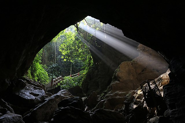
Alutila Cave is a pitch-dark tunnel around 100 m long, running through Alutila hill a few kilometres outside Khagrachhari town in the Chittagong Hill Tracts, and it is known locally as Matai Hakor.
With no lighting inside Alutila Cave, visitors carry torches down a long flight of steps into the hillside and wade along the cold water running across the floor before coming out at the far end.
The Chittagong Hill Tracts around Alutila are home to around a dozen Indigenous peoples, each with its own language and customs, most of them Buddhist, with Hindu and Christian communities, a rare exception in a country that is overwhelmingly Bengali.
4 – Kaptai Lake
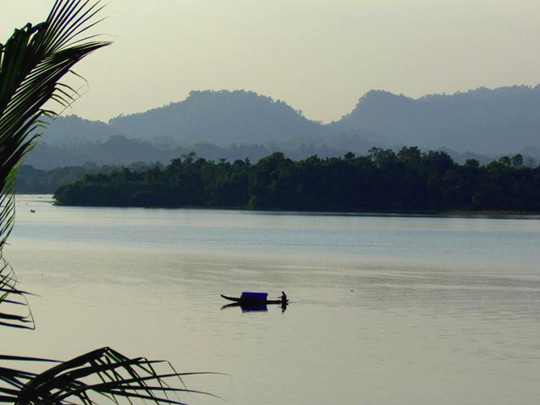
Kaptai Lake, roughly 700 km² of water filling the valleys around Rangamati, is no natural lake, created when the Kaptai Dam on the Karnaphuli River was completed in the early 1960s by the government of East Pakistan with American funding, to feed Bangladesh’s only hydroelectric power station.
Boats cross Kaptai Lake from Rangamati past drowned hilltops turned islands, to a hanging bridge of about 100 m that can go under water when the lake is high and to Rajban Vihara, a large Buddhist monastery founded in the 1970s, while the old Chakma royal palace lies beneath the water.
Kaptai Lake flooded about 40% of the region’s arable land and displaced some 100,000 people, most of them Chakma, leaving a lasting grievance in a region that saw a long insurgency by the Shanti Bahini until a peace accord was signed on 2 December 1997.
5 – Jaflong
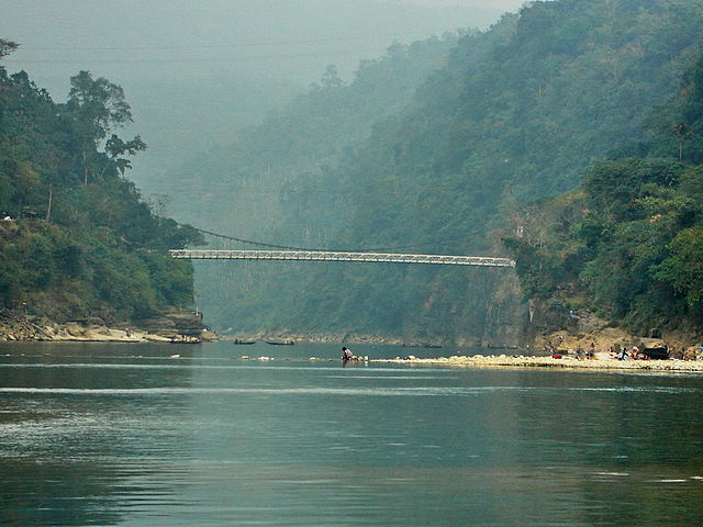
JJaflong, about 60 km from Sylhet, is where the Piyain River flows out of the hills of Meghalaya into Bangladesh, carrying down the stones and boulders that local people collect from the riverbed.
The view at Jaflong runs upstream to the hills of India, with a British-era suspension bridge across the river on the Indian side, tea gardens on the slopes and Khasi villages where betel leaf and areca nut are grown.
The stone that draws people to Jaflong is also its problem, and in 2015 about 15 km² of the area was declared an Ecologically Critical Area, with the courts banning mechanical quarrying to protect the river.
6 – Kantajew Temple
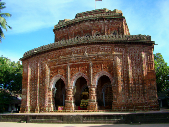
Kantajew Temple stands about 20 km north of Dinajpur, across the Dhepa River in the hamlet of Kantanagar, begun by Maharaja Pran Nath in the early 1700s and completed by his son Ram Nath in 1752, according to its foundation inscription, and dedicated to Krishna and his consort Rukmini.
Some 15,000 terracotta plaques cover the walls of Kantajew Temple in bands around three receding storeys, showing scenes from the Ramayana and the Mahabharata as well as royal processions, hunting parties and even European soldiers with muskets.
Kantajew Temple was built in the navaratna style with nine spires, all of which fell in the earthquake of 1897 and were never rebuilt, and it is widely regarded as the finest terracotta temple in Bangladesh.
7 – Boga Lake
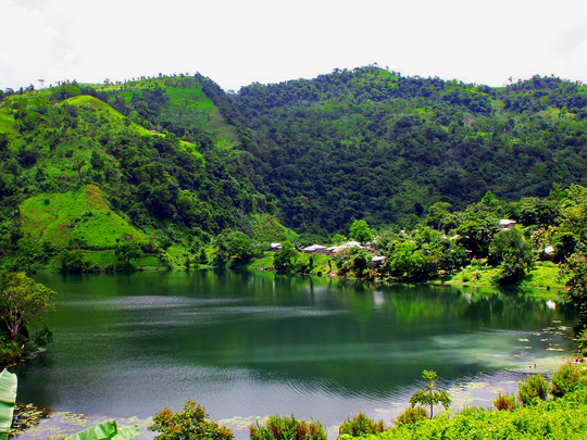
Boga Lake is a deep lake of about 6 hectares at some 380 m in the hills of Bandarban, about 18 km from Ruma and an overnight stop on the trek to Keokradong.
A Bawm village sits beside Boga Lake, and the lake’s origin is debated, with theories ranging from a volcanic crater to a meteorite impact or a landslide, none of them settled.
Local legend tells of a dragon, or boga, that the villagers killed, after which the hilltop collapsed and Boga Lake rose over a village, a story told in different versions by several of the hill peoples.
8 – St. Martin’s Island
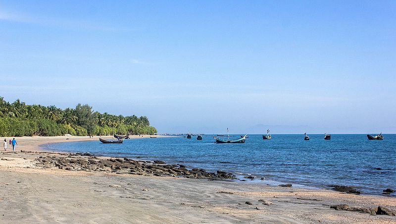
St Martin’s Island, about 8 km² in the Bay of Bengal, lies some 9 km south of the tip of the Teknaf peninsula and about 8 km off the coast of Myanmar, known locally as Narikel Jinjira, Coconut Island, and often called Bangladesh’s only coral island, though researchers describe it as sedimentary rock fringed with coral.
Walk the length of St Martin’s Island past coconut palms and rock pools to the south, where Chhera Dwip, a small islet off the southern tip, is cut off at high tide.
About 66 coral species have been recorded around St Martin’s Island, while olive ridley, green and hawksbill turtles nest on its beaches, though its coral cover has declined sharply since the 1980s.
9 – Sonargaon
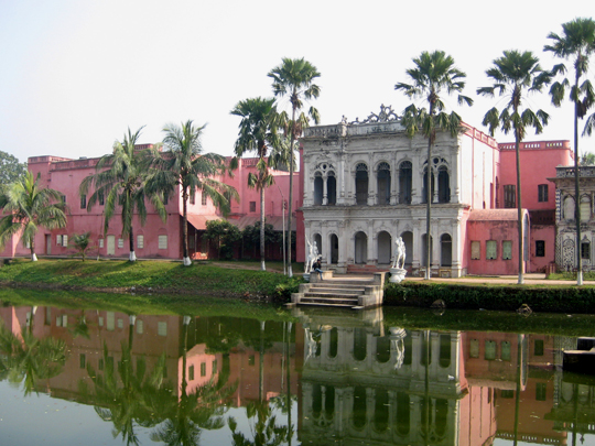
Sonargaon, about 27–30 km southeast of Dhaka, was capital of the Hindu kingdom of Vanga from about the 1260s, of Bengal’s first independent sultanate under Fakhruddin Mubarak Shah from 1338, and later of Isa Khan, who led the Baro-Bhuiyan chieftains against the Mughals.
Sonargaon’s Panam Nagar is a single street of around 50 surviving houses, most built by wealthy Hindu cotton merchants in the 19th century, while the Folk Art and Crafts Museum, founded in 1975 by the painter Zainul Abedin, stands nearby.
Sonargaon was famed for the finest Dhaka muslin, spun from phuti karpas cotton grown along the Meghna at thread counts of 800–1,200, and after production ceased in the mid-19th century, a project begun in 2014 found a matching cotton plant by comparing its DNA with old muslin in London’s Victoria and Albert Museum.
10 – Lalbagh Fort, Dhaka
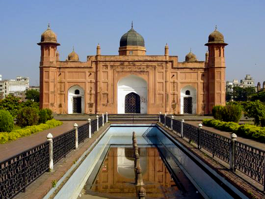
Lalbagh Fort, an unfinished Mughal fort beside the Buriganga in Old Dhaka, was begun in 1678 by Prince Muhammad Azam, son of the emperor Aurangzeb, who was recalled after about 15 months as viceroy of Bengal.
Three buildings stand at Lalbagh Fort, the Diwan-i-Aam with its attached bathhouse, the mosque and, between them, the tomb of Pari Bibi, with inner walls of white marble, glazed tiles and a false dome covered in brass plate.
Lalbagh Fort was never finished because Pari Bibi, daughter of the governor Shaista Khan, who had taken over the works, and betrothed to Prince Azam, died there in 1684, after which Shaista Khan considered the fort ill-omened and left it as it was.
11 – The Sundarbans
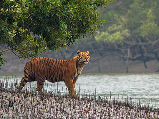
The Sundarbans, the largest single block of tidal mangrove forest in the world, spread across the delta of the Ganges, Brahmaputra and Meghna, covering about 10,000 km², some 60% of it in Bangladesh, and act as a buffer against cyclone storm surges, taking the brunt of Cyclone Sidr in 2007.
Boats from Khulna wind into the Sundarbans down narrow tidal channels, past spotted deer, saltwater crocodiles and rhesus macaques, as well as more than 250 bird species, with Ganges and Irrawaddy dolphins in the wider rivers.
The tigers of the Sundarbans are strong swimmers and notorious for attacking people who enter the forest, which is why the honey collectors pray first to Bonbibi, the Lady of the Forest, revered by Hindus and Muslims alike.
12 – Bagerhat
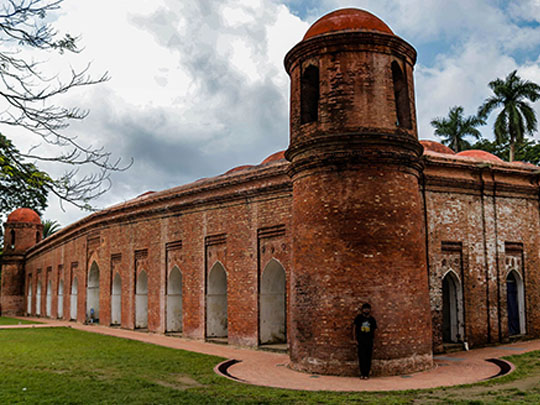
Bagerhat, on the northern edge of the Sundarbans, grew from Khalifatabad, the planned city laid out by the Sufi saint and soldier Khan Jahan Ali in the first half of the 15th century after clearing the mangrove, and its surviving mosques, tombs and tanks were listed by UNESCO in 1985 as the Historic Mosque City of Bagerhat.
Bagerhat’s centrepiece is the Shat Gombuj Masjid, one of the largest mosques of medieval Bengal, a brick hall with 60 pillars, most of them stone, while Khan Jahan’s tomb, where he was buried in 1459, and the great Ghora Dighi tank lie nearby.
Shat Gombuj means “sixty domes”, yet the mosque at Bagerhat has 77 domes over its prayer hall and four more on its corner towers, so the name may come from its 60 pillars or from “saat gombuj”, for its seven rows of domes.