
Wikimedia Commons / CC-BY-SA-3.0 / GFDL
Capital: Pago Pago
Population: 49,000+
Language: English/Samoan

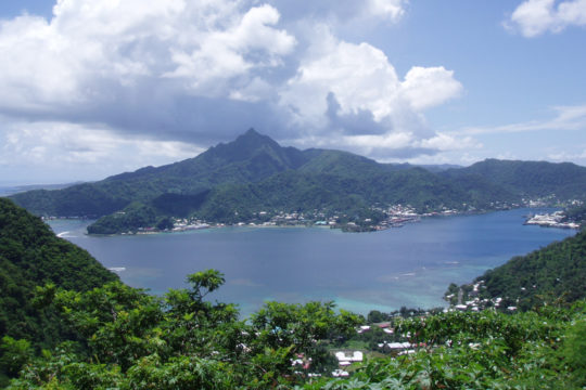
1 – Pago Pago (above)
American Samoa’s capital wraps around a long, fjord-like bay on Tutuila that is really a drowned volcanic crater, the deepest and best-sheltered natural harbour between Hawaii and New Zealand — which is exactly why the US Navy secured a coaling station here in 1872 and ran a naval station from 1900 until 1951.
The waterfront strings together the Fagatogo market, the Fono (the territory’s legislature), the Jean P. Haydon Museum in the old naval commandant’s residence and the trail up to the Blunts Point guns, all of it under Rainmaker Mountain, which wrings famously large quantities of rain out of the clouds.
The writer Somerset Maugham was stuck here for six weeks over the winter of 1916–17 by a quarantine, lodging in a boarding house alongside a missionary couple and a fellow passenger called Miss Thompson — he got the short story “Rain” out of it, which became a hit play and several films, and the building still stands as the Sadie Thompson Inn.
2 – Blunts Point Battery
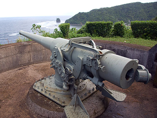
Blunts Point — Tulutulu in Samoan — is the headland guarding the western side of the harbour mouth just beyond Utulei, where two six-inch naval guns were mounted about 60 m above the water at the start of the 1940s, once Pearl Harbor turned this harbour into the critical American link on the supply line to Australia and New Zealand.
A short, steep trail off the coast road climbs to the emplacements, with a concrete magazine cut into the hillside below and the whole harbour entrance laid out in front; the matching battery survives across the water at Breakers Point, and Blunts Point has been a National Historic Landmark since 1987.
The guns never fired at an enemy: the single attack American Samoa saw came on a January night in 1942, when a Japanese submarine shelled the naval station for a few minutes from a position off the north shore where the coastal guns could not be brought to bear — the damage was slight, two men were lightly wounded, and no one came back.
3 – Mount ‘Alava & the National Park of American Samoa
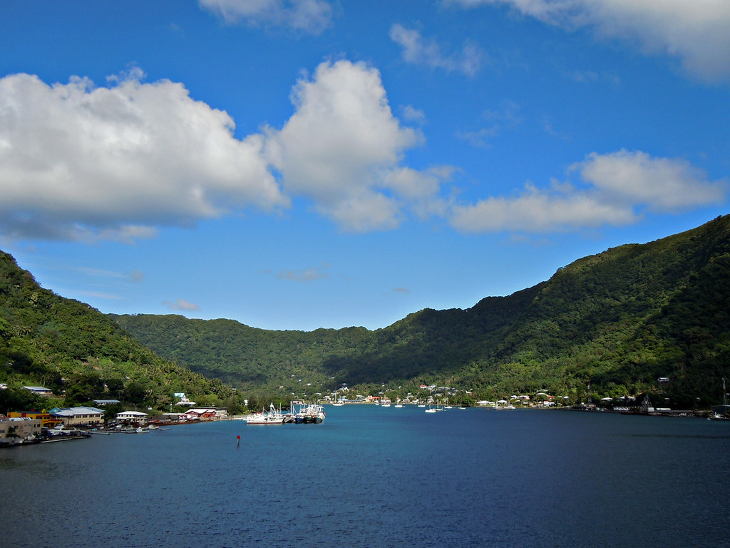
The ridge running above Pago Pago harbour is the Tutuila section of the National Park of American Samoa, the only US national park south of the equator and the only one the federal government does not own: the land is held communally by villages and their matai, who leased it to the Park Service for 50 years in the 1990s.
A steep track from Fagasa Pass climbs through paleotropical rainforest to the roughly 490 m summit and a view straight down the length of the harbour, and the forest is thick with flying foxes — fruit bats with a wingspan approaching a metre that, unusually, soar about in broad daylight.
Until 1980 you could reach the top by cable car on what was reckoned to be the world’s longest single-span aerial tramway, strung over a mile of open water; during Flag Day celebrations that April a US Navy plane clipped the cable and came down at the Rainmaker Hotel, killing the crew and people on the ground, and the terminal has stood empty on the summit ever since.
4 – Vatia & Pola Island

Vatia is a small village on Tutuila’s wild north coast, hemmed in on three sides by the national park, and its bay is guarded by Pola Island — a 120 m basalt sea stack known as the Cockscomb, the eroded core of an old volcanic plug.
A short trail past the village school runs out to the foot of the cliffs, and the Vai’ava Strait dividing stack from shore has been a National Natural Landmark since 1972, with sea arches at the waterline and at least eight seabird species nesting on the rock above.
Brown boobies once bred here in such numbers that their eggs were a Vatia delicacy and the annual hunt had its own name, the A’ega o le Pola — then shotguns replaced the old methods, the birds disappeared from the Pola cliffs altogether, and they have only started coming back since the hunting stopped.
5 – Ofu Beach
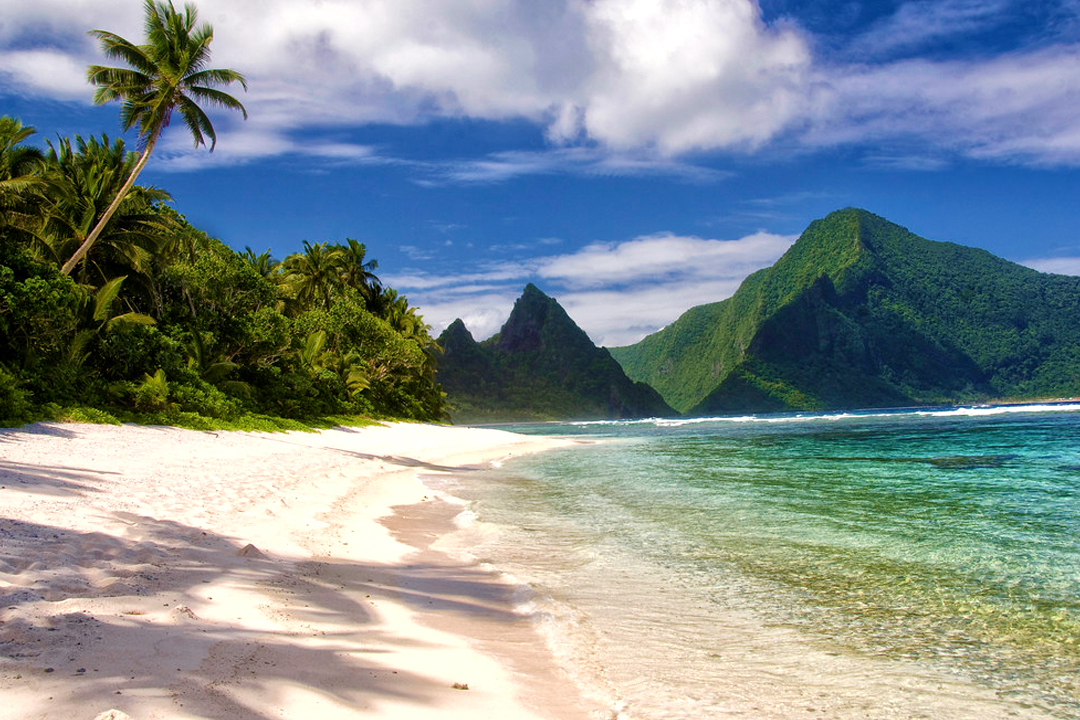
Ofu is one of the Manu’a Islands, roughly 100 km east of Tutuila, and its south shore — two miles of pale sand under the spikes of Sunuitao Peak — is the most photographed stretch of the national park and, with a few hundred people living on Ofu and neighbouring Olosega combined, usually empty.
The reef starts a few metres out with a few hundred fish species and well over a hundred kinds of coral, there is nowhere to hire gear so bring your own snorkel, and a one-lane bridge crosses the Asaga Strait to Olosega — until 1970 people simply waded across at low tide.
The shallow back-reef pools bake when the tide drops, sometimes swinging six degrees in a single tidal cycle and pushing past 34 °C, yet the corals in them keep their colour instead of bleaching — which has made this small lagoon one of the most intensively studied reefs on Earth and a live preview of how coral might cope in warmer seas.
6 – Ta’ū
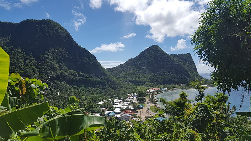
Ta’ū, the largest of the Manu’a Islands, is the eroded stump of a shield volcano whose southern flank collapsed into the sea, leaving some of the tallest sea cliffs in the world; it was the seat of the Tuimanu’a, the paramount title of the Manu’a group, and holds Saua, which Samoan tradition names as the place the Polynesian people set out from.
Roughly half the island is national park: a trail runs from Saua around Si’u Point along that cliff-bound southern coast, Laufuti Falls spills down to the shoreline, and Lata Mountain — over 900 m and the highest point in American Samoa — is climbed from Fiti’uta.
In 1925 a 23-year-old Margaret Mead spent nine months here interviewing dozens of local girls about growing up, and the book she published from it, Coming of Age in Samoa, became one of the most widely read works of anthropology ever written — and one of the most fiercely disputed, with later researchers arguing she had been misled by the young women she talked to.