
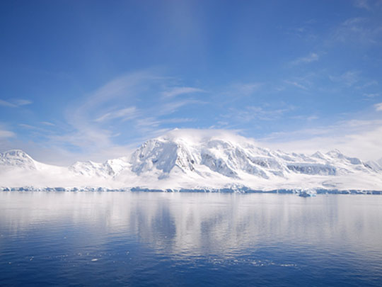
cloudzilla / CC-BY-SA-3.0 / GFDL
Capital: N/A
Population: No permanent residents; about 1,000 research staff in winter, over 4,000 in summer.
Language: N/A
Antarctica is governed under the Antarctic Treaty of 1959, which bans military activity, nuclear explosions and the disposal of nuclear waste, and a 1991 protocol to the Treaty added a ban on mining.
1 – South Georgia
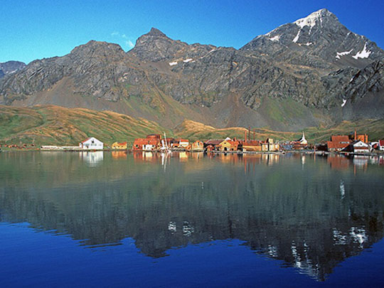
South Georgia, a sub-Antarctic island some 1,400 km east of the Falklands, was the centre of Southern Ocean whaling from 1904 to 1966, and in May 1916, Ernest Shackleton of County Kildare landed here in the 7 m James Caird from Elephant Island, then crossed the unmapped interior with Frank Worsley and Tom Crean of County Kerry to raise help.
At Grytviken on South Georgia, visitors find the whalers’ church of 1913, the South Georgia Museum in the old manager’s villa and Shackleton’s grave, with Frank Wild’s ashes placed beside it in 2011, while St Andrews Bay holds one of the world’s largest king penguin colonies.
Rats and mice brought ashore by sealers preyed on South Georgia’s ground-nesting birds for two centuries, until a helicopter baiting campaign, described as the largest rodent eradication ever attempted, saw the island declared rodent-free in May 2018, letting the endemic South Georgia pipit return.
2 – The Antarctic Peninsula
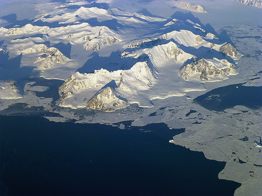

The Antarctic Peninsula, a long arm of mountains reaching north towards South America across the Drake Passage, is the most visited part of Antarctica, and on 30 January 1820, Edward Bransfield of Ballinacurra, County Cork, charted its northern tip, often credited as the first confirmed sighting of the Antarctic mainland.
On the Antarctic Peninsula, Port Lockroy on Goudier Island is a wartime British base restored as a museum and post office beside a gentoo penguin colony, while Deception Island is a flooded volcanic caldera with the rusting Hektor whaling station and a British base wrecked by eruptions in 1967 and 1969.
Port Lockroy was built in 1944 under Operation Tabarin, a secret wartime British operation partly to deny Antarctic anchorages to German raiders and partly to back Britain’s claims against Argentina, whose claim markers its men removed along the way.
3 – Ross Island
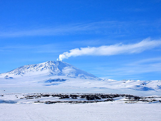
Ross Island, the southernmost island reachable by sea, lies against the Ross Ice Shelf beneath Mount Erebus, about 3,794 m high and the southernmost active volcano on Earth, and Cape Crozier at its eastern tip is named after Francis Crozier of Banbridge, County Down, who commanded HMS Terror when the island was discovered in 1841.
Ross Island holds three huts from the heroic age of polar exploration, Scott’s Discovery hut of 1902 at Hut Point, Shackleton’s 1908 hut at Cape Royds and Scott’s 1911 hut at Cape Evans, while the American McMurdo Station and New Zealand’s Scott Base stand a few kilometres apart.
On 28 November 1979, Air New Zealand Flight 901, a sightseeing flight from Auckland, flew into Mount Erebus on Ross Island, killing all 257 people aboard in New Zealand’s worst peacetime disaster, and the Royal Commission found the flight path had been changed without the crew being told, calling the airline’s evidence “an orchestrated litany of lies”.
4 – Cape Denison


Cape Denison, on the coast of George V Land south of Australia, was the main base of Douglas Mawson’s Australasian Antarctic Expedition of 1911–14, and it is often described as the windiest place on Earth at sea level, with katabatic winds off the ice cap regularly topping 100 km/h.
Mawson’s Huts at Cape Denison, the expedition’s timber living hut and workshop with the magnetograph house nearby, are protected as an Antarctic Treaty historic site, and a full-size replica of the main hut stands on the Hobart waterfront.
On Mawson’s sledging journey, Belgrave Ninnis vanished into a crevasse with most of the food and Xavier Mertz died on the way back, so Mawson reached Cape Denison alone on 8 February 1913, only hours after the expedition ship Aurora had sailed, which cost him another winter on the ice.
5 – The South Pole
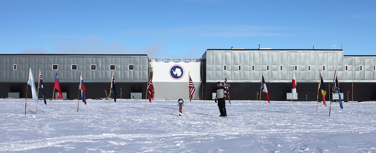
The geographic South Pole lies on ice about 2,700 m thick at an altitude of about 2,835 m, where Roald Amundsen arrived on 14 December 1911, while Robert Falcon Scott’s party of five, who had sent Tom Crean of County Kerry back with the last support party, arrived on 17 January 1912 and died on the return.
The American Amundsen–Scott South Pole Station, opened in November 1956, marks the South Pole twice, with a ceremonial pole, a mirrored sphere ringed by the flags of the 12 original Antarctic Treaty signatories, alongside the geographic pole itself a few metres away, a surveyed marker in the snow.
Because the ice at the South Pole slides about 10 m a year towards the Weddell Sea, the marker is resurveyed every 1 January and replaced with a new one designed and made by the station’s winter crew, so no two are alike.
6 – Elephant Island
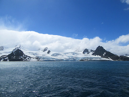
Elephant Island, a mountainous, ice-covered island in the South Shetlands, is where Shackleton’s Endurance crew reached land on 15 April 1916, after about 170 days adrift on the pack ice, before moving some 11 km along the north coast to the spit later named Point Wild.
At Point Wild on Elephant Island, 22 men under Frank Wild lived for about four and a half months beneath two upturned boats set on low stone walls, and the spit is marked by a bust of Luis Pardo, the Chilean naval officer whose small steamer Yelcho rescued them on 30 August 1916.
Tim McCarthy of Kinsale, County Cork, was one of the five men who sailed from Elephant Island with Shackleton in the James Caird on 24 April 1916 to fetch help, and on the fourth rescue attempt all 22 men left behind were brought out alive.