
Wikimedia Commons / CC-BY-SA-3.0 / GFDL
Capital: Nassau
Population: 400,000+
Language: English/Bahamian Creole

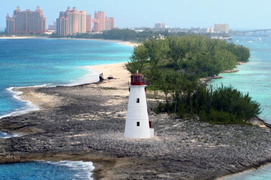
1 – Nassau (also above)

The capital sits on New Providence behind a shallow, well-screened harbour, which is exactly why pirates liked it: from about 1706 to 1718 Nassau ran as a self-governing pirate base, with Blackbeard and Charles Vane among the regulars, until the Crown sent Woodes Rogers to shut it down.
Walk up the Queen’s Staircase, 66 steps cut down through solid limestone by enslaved labourers in the 1790s, to Fort Fincastle on the hill, then come back down to Bay Street for the shops and the old colonial government buildings.
Rogers offered a royal pardon, then hanged eight men who didn’t take it, and gave the colony a new motto — Expulsis Piratis, Restituta Commercia, “pirates expelled, commerce restored” — while Bay Street is still where Junkanoo, the national festival born out of the days off enslaved people were given at Christmas, takes over in the small hours of Boxing Day.
2 – San Salvador
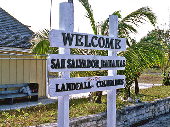
A small, low island out on the eastern edge of the archipelago, San Salvador is the place most widely identified as Guanahani, where Columbus came ashore on 12 October 1492 — the first documented European landfall in the Americas, and the beginning of the end for the Lucayans.
Four monuments at Long Bay mark the supposed landing spot, including a white cross and a memorial that held the Olympic flame on its way to Mexico City in 1968, and there’s a fifth underwater where the anchor is said to have gone down.
The island was called Watling’s Island, after a buccaneer, until the Bahamian legislature officially renamed it in the 1920s — and the claim is still argued, with National Geographic backing Samana Cay in 1986 and scholars having put forward around ten candidate islands in all.
3 – Taino Beach
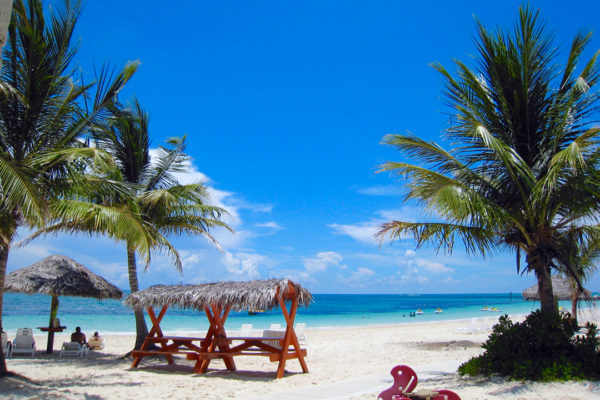
Taino Beach is part of Freeport on Grand Bahama, a city that didn’t exist before 1955, when the government handed an American financier 50,000 acres and a tax-free hand to build a port and a town out of pine forest.
It’s a wide, easy-going stretch of sand with beach bars, a few hotels and boats out to the reef, quieter than Nassau and much less built-up since the hurricanes.
The name remembers the people who aren’t there: the Lucayans, the Taíno branch who lived across these islands and were shipped off to Hispaniola by the Spanish within a generation of Columbus, leaving the whole archipelago effectively empty for over a century.
4 – Hope Town
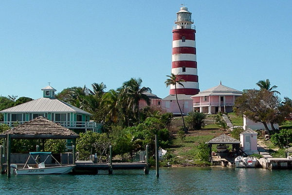
On Elbow Cay in the Abacos, Hope Town was founded in 1785 by Loyalists who left the newly independent United States — the first recorded arrival was Wyannie Malone, a widow from Charleston with four children — and for generations it lived on fishing and on salvaging wrecks off the reef.
The village is all clapboard cottages, picket fences and narrow lanes with no cars, wrapped around a harbour, and you can climb the 101 steps of the red-and-white striped Elbow Reef Lighthouse for the view.
That lighthouse, lit in the 1860s, is one of the last in the world still burning kerosene and still wound by hand — and it came through a direct hit from Hurricane Dorian in 2019 standing.
5 – Coco Bay
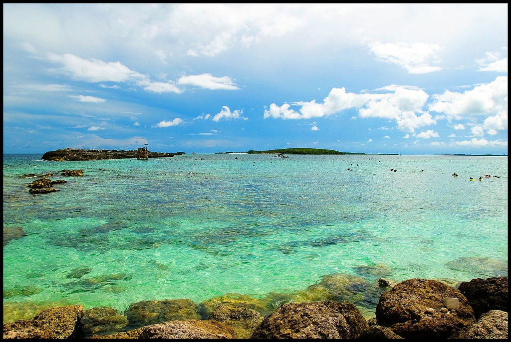
Coco Bay is a sheltered curve of sand at the north end of Green Turtle Cay in the Abacos, whose village of New Plymouth was settled by Loyalists in the 1780s and grew, for a time in the 1800s, into one of the largest towns in the Bahamas.
It’s a calm, shallow bay good for swimming and paddling, with sea turtles and rays that come in to the public dock, and New Plymouth’s museum and sculpture garden a short golf-cart ride away.
That garden is a national monument to the Loyalist settlers and the people they brought as slaves: 24 bronze busts around two life-size girls, one Black and one white, one holding a conch shell and the other a Union Jack.
6 – Eleuthera
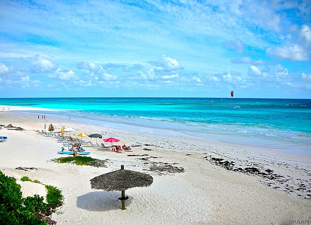
A long, thin island east of Nassau, Eleuthera was settled in 1648 by English Puritans who had been thrown out of Bermuda and named it from the Greek for “free” — the first serious European attempt to settle the Bahamas, and usually counted as the country’s birthplace.
Take the ferry to Harbour Island for the pink sand, stop at Preacher’s Cave where the shipwrecked settlers sheltered, and cross the Glass Window Bridge, where the island narrows to a few metres with dark Atlantic on one side and pale shallows on the other.
The pink comes from crushed shell and coral, and the reef that wrecked the settlers’ ship is still called the Devil’s Backbone — boats heading through it often take on a local pilot.
7 – The Exumas
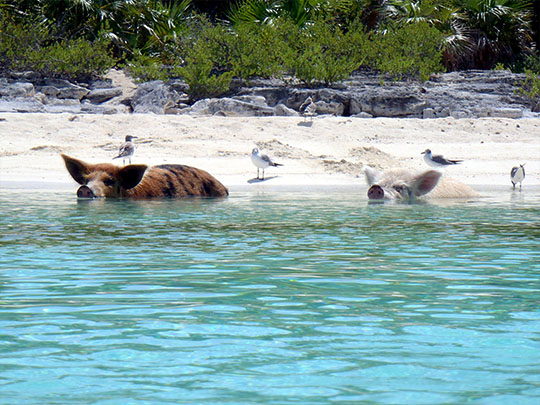

A 130-mile scatter of some 365 cays running south-east from Nassau, the Exumas were settled around 1783 by Loyalists who tried cotton here; the crop failed, but the name of one planter stuck so thoroughly that Rolle is still among the commonest surnames on the islands.
Base yourself in George Town on Great Exuma, then take a boat out to the cays: Thunderball Grotto, a cathedral-like cave named for the Bond film shot in it, the sandbars and iguana beaches, and Big Major Cay, where feral pigs swim out to meet the boats.
The Exuma Cays Land and Sea Park, set up in 1958, is generally described as the world’s first land-and-sea park and the Caribbean’s first no-take reserve — nothing may be fished or removed, and stocks have recovered so well that fish spill over into the waters outside it.