
Wikimedia Commons / CC-BY-SA-3.0 / GFDL
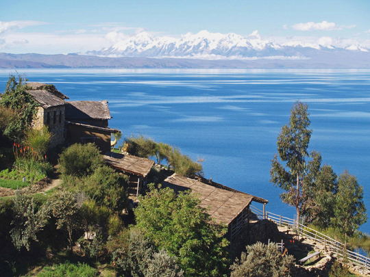
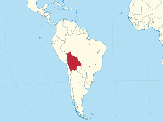
Capital: Sucre (constitutional) / La Paz (seat of government)
Population: 11.3 million+
Language: Spanish, Quechua, Aymara, Guaraní and 33 other official Indigenous languages
1 – Lake Titicaca (also above)
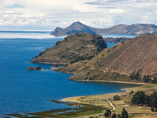
Lake Titicaca lies at about 3,810 m in the Andes on the border between Bolivia and Peru, often called the highest lake in the world navigable by large vessels and sacred to Andean peoples for thousands of years.
On the Bolivian shore of Lake Titicaca the pilgrim town of Copacabana, home of the revered Virgin of Copacabana, is the gateway to the Isla del Sol, an island without cars, laced with Inca roads, terraces and ruins.
Inca legend held that Lake Titicaca was where the sun was born, and that Manco Cápac and Mama Ocllo, the founders of the Inca dynasty, emerged from its waters before setting out to found Cusco.
2 – Valle de la Luna
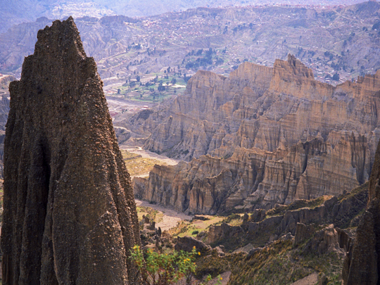
The Valle de la Luna, the “Valley of the Moon”, lies about 10 km from the centre of La Paz, the world’s highest seat of government, a maze of pale, jagged spires and gullies that looks more like another planet than the Andes.
The Valle de la Luna is not really a valley but the eroded remains of hills of soft clay and sandstone, carved by rain and wind into pinnacles, with short trails winding past cacti and the rabbit-like viscachas that live among them.
Local tradition says the Valle de la Luna got its name from Neil Armstrong, who is said to have visited in 1969, the year of the first Moon landing, and remarked that it looked like the lunar surface.
3 – Salar de Uyuni
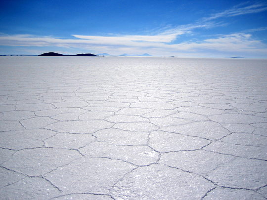
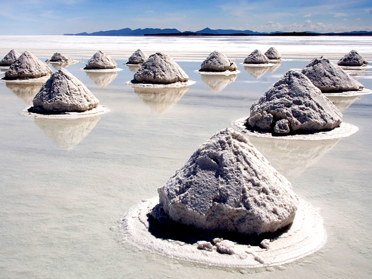
The Salar de Uyuni, high on the Bolivian altiplano, is the largest salt flat on Earth, covering about 10,500 km², a blinding white plain left behind by ancient lakes such as Lake Minchin.
In the dry season, the Salar de Uyuni is a cracked white crust, dotted with islands of giant cacti such as Incahuasi and hotels built from salt blocks, and when the rains come a thin film of water turns it into a vast mirror, while beneath lie some of the world’s largest lithium resources.
The Salar de Uyuni is so level that its height varies by less than a metre across its whole surface, making it one of the flattest places on Earth, so scientists use it to calibrate satellite altimeters such as NASA’s ICESat.
4 – Sucre
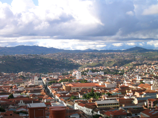
Sucre is Bolivia’s constitutional capital, the UNESCO-listed “White City”, where the uprising of 25 May 1809 was one of the first calls for independence in South America and where Bolivia declared its independence on 6 August 1825, in the city then called Chuquisaca.
The declaration was signed in Sucre’s Casa de la Libertad, and the city was later renamed after Antonio José de Sucre, who succeeded Simón Bolívar as president, with Cork-born Francisco Burdett O’Connor, a veteran of the Irish Legion, serving as an army chief of staff of the young republic.
Just outside Sucre, the limestone cliff of Cal Orck’o carries more than 5,000 dinosaur footprints, about 68 million years old and widely described as the largest dinosaur-track site on Earth, pushed steeply upright by the rise of the Andes, so the dinosaurs seem to walk up the wall.
5 – Tiwanaku
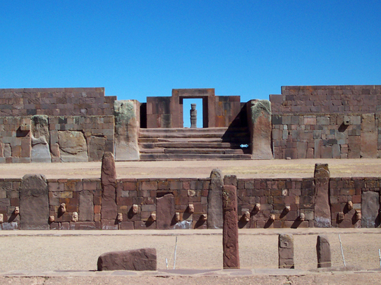
Tiwanaku, on the high altiplano near Lake Titicaca, was the capital of a powerful Andean state that flourished from about AD 500 to 1000, centuries before the Incas, and is a UNESCO World Heritage Site.
Tiwanaku’s monuments include the stepped Akapana platform, the Kalasasaya temple with its carved monoliths, and the Gate of the Sun, cut from a single block of andesite of about 10 tonnes and carved with a mysterious staff-bearing god.
Near Tiwanaku lies Puma Punku, whose precisely cut blocks have inspired claims of lost technology, though archaeologists point out they are local sandstone and andesite, shaped with stone and bronze tools, with unfinished blocks showing each stage of the work.
6 – Jesuit Missions of Chiquitos
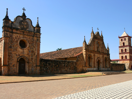
The Jesuit Missions of Chiquitos are six towns in the tropical lowlands of eastern Bolivia, founded between 1691 and 1755, where Jesuit priests gathered the Chiquitano people into self-governing “reductions”, and are listed together as a UNESCO World Heritage Site.
Unlike most missions elsewhere, which fell into ruin, the Jesuit Missions of Chiquitos remain living towns, with great timber-and-adobe churches of carved and painted wood, restored from 1972 by the Swiss architect Hans Roth, while San José’s church is built of stone.
The Chiquitano kept the Jesuits’ baroque music alive after the order was expelled in 1767, and during the restoration of the Jesuit Missions of Chiquitos, more than 5,000 pages of scores came to light, which are played at a festival held in the churches every two years since 1996.
7 – Potosí
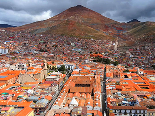
Potosí, at about 4,000 m on the southern altiplano, grew up after silver was found in Cerro Rico in 1545 and for two centuries was the world’s leading silver producer, worked by Indigenous men forced to serve under the colonial mita system, of whom uncounted thousands died.
The UNESCO-listed centre of Potosí is packed with baroque churches and merchants’ houses, and above all the Casa Nacional de la Moneda, the royal mint whose 18th-century building holds the wooden machinery that turned silver into coin.
Potosí became a byword for riches in Spanish, where “vale un Potosí” means “it’s worth a fortune”, and Cervantes has Don Quixote tell Sancho Panza that the mines of Potosí would not be enough to pay him what he deserves.
8 – La Paz
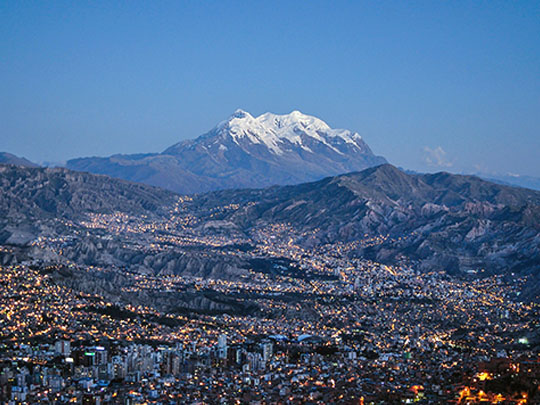
La Paz, founded in 1548 and set in a canyon at about 3,600 m beneath the peaks of Illimani, was besieged by Túpac Katari’s Aymara forces in 1781 and saw the rising of 16 July 1809 led by Pedro Domingo Murillo, who was hanged by Spanish troops in January 1810.
Plaza Murillo, the political heart of La Paz, is ringed by the cathedral, the legislature and the Palacio Quemado, the old presidential palace, and it was here in 1946 that a mob lynched President Gualberto Villarroel and hanged him from a lamppost.
La Paz commutes by cable car, for Mi Teleférico, opened in 2014 and recognised by Guinness as the world’s largest public-transit cable-car network, links the city to El Alto on the canyon rim and gives some of the best views in Bolivia.
9 – The Ruta del Che
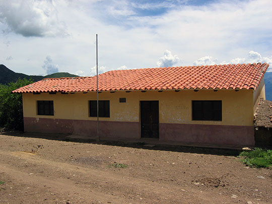

The Ruta del Che follows the end of Che Guevara’s Bolivian campaign in the hills of Santa Cruz department, where Bolivian rangers trained with US help, wounded and captured him in the Quebrada del Churo ravine on 8 October 1967.
The Ruta del Che runs to the hamlet of La Higuera, where Che was held in the schoolhouse and shot on 9 October on the orders of the Bolivian high command, and to Vallegrande, where his body was laid out in the laundry of the Señor de Malta hospital for the world’s press.
The army buried Che in secret beside the Vallegrande airstrip so the grave could never become a shrine, yet the Ruta del Che became exactly that, and after the remains were found in 1997 and returned to Cuba, some locals came to venerate him as “San Ernesto”.
10 – Tarija
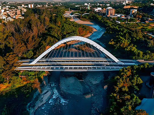

Tarija, founded in 1574 by the conquistador Luis de Fuentes on the Guadalquivir River at about 1,860 m in southern Bolivia, won its freedom from Spanish rule at the Battle of La Tablada on 15 April 1817 and chose to join Bolivia in August 1826, after years of rule from Salta.
Tarija is the heart of Bolivian wine country, with vineyards at around 2,000 m and the grape spirit singani, while its palaeontology museum displays Ice Age giant ground sloths and armoured glyptodonts from the Tarija valley, one of South America’s most important Pleistocene fossil sites.
Tarija is the most Irish corner of Bolivia, for Cork-born Francisco Burdett O’Connor, a veteran of Bolívar’s Irish Legion, became its military governor in 1826, won the nearby Battle of Montenegro in 1838 and died here in 1871, and a province of the region bears his name.