
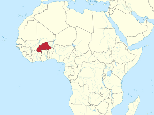
Wikimedia Commons / CC-BY-SA-3.0 / GFDL
Capital: Ouagadougou
Population: 24 million+
Language: Mooré, Dyula, Fula, Bissa (official). French and English
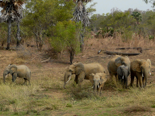
1 – Arli National Park
Burkina Faso’s own slice of that same great W-Arly-Pendjari wilderness, tucked into the country’s far southeast on the borders of Benin and Niger, and protected since 1954.
Savanna, gallery forest and the scenic Gobnangou sandstone escarpment shelter elephants, buffalo, antelope, leopard and the rare West African lion, with the Arli River drawing animals down to drink in the dry season.
Arli, Pendjari and W together form one of the last places in West Africa where elephants still roam freely across three national borders — the complex holds the great bulk of the region’s surviving savanna elephants.
2 – Karfiguela Waterfalls
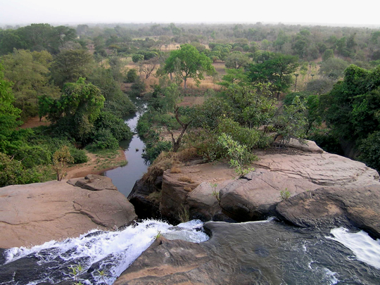
A series of tiered waterfalls where the Komoé River spills over sandstone cliffs near Banfora in southwestern Burkina Faso — so beloved that the surrounding administrative region is simply named “Cascades.”
Reached along a dreamy avenue of mango trees through sugarcane country, the falls drop in stages to natural pools up top where you can swim (best after the rains); the jagged Sindou Peaks and the hippos of Lake Tengréla lie within reach.
Right next door stand the Dômes de Fabédougou — surreal, beehive-shaped mounds of sandstone sculpted over roughly 1.8 billion years, among the most ancient formations you’ll ever set eyes on.
3 – Ouagadougou
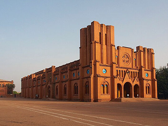
Burkina Faso’s capital and largest city sits on the dry central plateau and has been the Mossi capital since 1441, the permanent seat of the Moro-Naba — the Mossi emperor — since 1681, a monarchy that outlasted French conquest and still holds court today.
Come on a Friday at 7am for the Nab-Yaoré at the Moro-Naba’s palace, fifteen minutes in which the chiefs take their places by rank, the emperor appears on horseback in warrior red, withdraws, and returns in white for peace (no photographs); the rest of the week there’s the National Museum, the Musée de la Musique and the vast Grand Marché, and every second March the city fills for FESPACO, the biggest film festival in Africa.
Thomas Sankara seized power here in 1983 and a year later renamed Upper Volta as Burkina Faso, welding Mooré and Dyula together into a phrase meaning roughly “land of upright people”; he was assassinated in the city in 1987, in the coup that installed Blaise Compaoré.
4 – Ziniare Wildlife Park
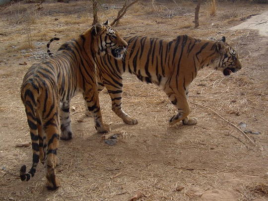
A wildlife park about 30km east of Ouagadougou, opened in 1994 on the edge of Ziniaré — the hometown of Burkina Faso’s long-serving former president, Blaise Compaoré.
Animals roam in semi-freedom along easy tracks — lions, elephants, hippos, buffalo, warthogs, crocodiles and the park’s prized red-necked ostriches — and the open-air granite sculptures of Laongo lie nearby.
The park was laid out around Compaoré’s country estate; he ruled for 27 years until a popular uprising swept him from power in 2014, and after a long spell of neglect the park was restored and reopened.
5 – Lake Bam
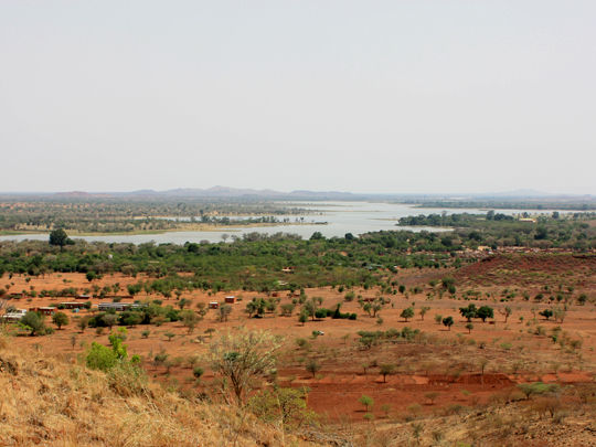
Burkina Faso’s largest natural lake, stretching some 20km near the town of Kongoussi north of Ouagadougou — a rare sheet of open water in the dry Sahel, and a lifeline for the tens of thousands who farm, fish and water their cattle along its shores.
Its green fringe of irrigated market gardens is the real draw, a patchwork of vegetable plots and palms alive with birdlife (the lake is a protected Ramsar wetland); the smaller Lake Dem lies to the southeast.
Those lakeside gardens once made Burkina Faso Africa’s second-largest exporter of green beans after Kenya — many flown from Ouagadougou to fill Parisian market stalls in winter — though siltation and drought have steadily been shrinking the lake.
6 – Tiébélé
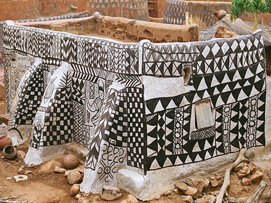
Down near the Ghana border, Tiébélé is the seat of the Kassena, among the oldest communities in the country, whose walled family compounds have been built and decorated the same way since about the 16th century.
The Cour Royale, the chief’s compound, is a cluster of houses of earth, wood and straw whose shape tells you who lives inside — and whose doorways are deliberately tiny, forcing a crouch and then a low wall immediately within, which keeps out raiders and the heat in equal measure.
The painting is women’s work, handed from mother to daughter: chalk for white, laterite for red, charcoal or basalt for black, laid on in geometric bands, burnished colour by colour with stones and sealed with a varnish boiled from the pods of the néré tree — and it goes on just before the rains, because the decoration is also the waterproofing.
7 – Ruins of Loropéni
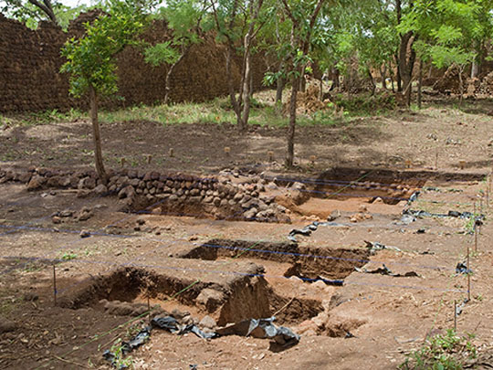
In the far southwest near Gaoua, laterite walls standing up to six metres high enclose a long-abandoned settlement — the best preserved of ten fortresses in Lobi country and part of a wider group of around a hundred stone enclosures, built by the Lohron or Koulango, who controlled the gold that went north by caravan to Djenné and Timbuktu and on across the Sahara.
There is a hectare or so of walls to walk, with trees growing straight out of the ramparts and almost nothing excavated inside; the market town of Gaoua, 40km east, is the base, and its Musée de Poni covers the Lobi country around it.
Inscribed in 2009 as Burkina Faso’s first World Heritage Site, the ruins are remarkable mostly for how little anyone can tell you about them — radiocarbon work in the 2000s pushed their construction back from roughly the 17th century to at least the 11th, six hundred years earlier than assumed, and the argument over what the place was for is still running.