
Marco Farouk Basir / CC-BY-SA-3.0 / GFDL
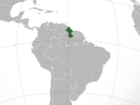
Capital: Georgetown
Population: 805,000+
Language: English (Guyanese Creole, plus Amerindian languages)
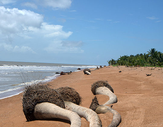
1 – Shell Beach (also above)
A wild stretch of Atlantic coast running well over 100 km through the Barima-Waini region in Guyana’s far north-west, close to the Venezuelan border, where what looks like sand is really a deep bank of crushed shell fragments washed ashore over centuries and where the country’s largest surviving mangrove forests back onto the shoreline. The whole area became a protected zone in 2011.
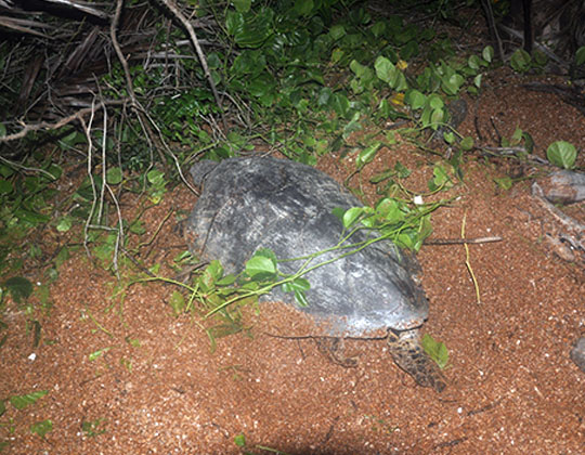
Almond Beach is the base, reached by light aircraft and boat rather than road, and from roughly February to August four of the world’s eight sea turtle species — leatherback, green, hawksbill and olive ridley — come ashore at night to nest, with rangers running guided patrols; behind the beach, mudflats and swamp forest hold scarlet ibis and more than 200 bird species.
Most turtle beaches in the world get one species, maybe two, and this one gets four — but the better story is who guards them, because the nightly patrols are walked by people from the local Amerindian villages, a good number of whom used to hunt the same turtles they now measure, tag and protect.
2 – Kaieteur Falls
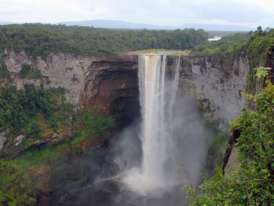
Deep in the rainforest of central Guyana, the Potaro River runs off the edge of a sandstone plateau and falls 226 m in a single uninterrupted drop — about five times the height of Niagara — into a gorge; the name comes from a Patamona story about a chief called Kai who went over the edge in his canoe as an offering to the great spirit Makonaima to save his people.
There are no roads, so almost everyone arrives by light aircraft on a strip cut into the plateau and walks a few minutes through the bush to viewpoints with no railings, no crowds and no barrier between you and the drop.
Giant tank bromeliads growing on the cliff edge hold several litres of water each, and inside those pools lives the tiny golden rocket frog, which spends its entire life in a plant — while flocks of swifts nest behind the falling water and fly straight through the curtain to reach their roosts at dusk.
3 – Mount Roraima
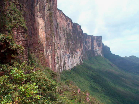
The tallest of the tepuis at 2,810 m and the point where Guyana, Venezuela and Brazil meet, with the Guyanese corner forming the country’s highest ground; the Pemón call it the mother of all waters, since rain falling on the summit ends up in the Orinoco, the Amazon and the Essequibo.
The walkable route is a multi-day trek from Paraitepui on the Venezuelan side, up a natural ramp that breaks the 400 m cliffs — Guyana’s own flank is vertical — and the summit turns out not to be a flat table at all but a black rock labyrinth of gorges, pools, quartz beds and carnivorous pitcher plants.
Reports of the mountain, and of the 1884 ascent by Everard im Thurn and Harry Perkins, gave Arthur Conan Doyle the idea for The Lost World in 1912 — the dinosaur-plateau novel that every lost-world story since has been borrowing from.
4 – Iwokrama Rainforest
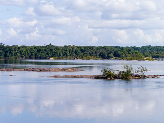
A 371,000-hectare block of untouched lowland rainforest in the middle of Guyana, split by the Essequibo River and the rough road from Georgetown to Lethem, its name Makushi for “place of refuge”.
The centrepiece is the canopy walkway, 154 m of suspended bridges and platforms 30 m up in the trees, best at dawn for macaws and toucans, with river trips for giant otters and black caiman, a stiff climb up Turtle Mountain for the view, and night drives on the forest road that make this one of the better places on Earth to actually see a jaguar.
The forest exists because in 1989 Guyana’s president stood up at a Commonwealth summit and offered nearly a million acres of it to the world as a research site — a poor country giving away a piece of itself to test whether rainforest can pay its way standing up.
5 – Georgetown Parliament
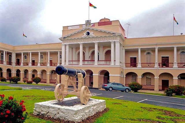
The cream-coloured Public Buildings on Brickdam, begun in 1829 and finished in 1834 for £50,000, sit on a foundation of greenheart logs and are stuccoed to look like stone — one of only two domed buildings in a low-lying capital otherwise built of timber and kept dry by a sea wall.
It’s admired from behind the railings rather than toured, with Crimean War cannon and a statue of trade union pioneer Hubert Critchlow in the grounds, and the rest of colonial Georgetown a short walk away: Stabroek Market’s iron clock tower and St George’s Cathedral, a 43 m Gothic church built entirely of wood.
On 1 August 1838 the proclamation ending slavery in the colony was read aloud from these lawns, to a crowd that included the enslaved people it freed — which is why the building matters here far more than its architecture does.
6 – Victoria Village
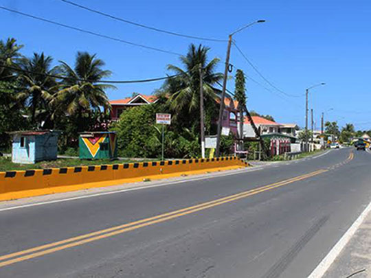
A village on the East Coast Demerara about 26 km east of Georgetown, and in a real sense the birthplace of free Guyana: on 7 November 1839, barely fifteen months after full emancipation, 83 formerly enslaved men and women from five neighbouring estates pooled their savings and bought the abandoned cotton plantation of Northbrook — some 500 acres — for 30,000 guilders, renaming it Victoria.
They had raised the money by “throwing box”, a West African rotating-savings custom carried across the Atlantic, and the story handed down is that the coins went to Georgetown in a wheelbarrow — the first plantation anywhere in the hemisphere bought outright by people who had themselves been owned, and the start of a movement that created more than a hundred villages within a decade.
It is a working village rather than a heritage site, with a monument to the purchase and the church and school plots the founders set aside for themselves, and the reason to come is the story rather than the sights — best on 7 November, now marked nationally as Guyana’s Day of Villages.
7 – Fort Island
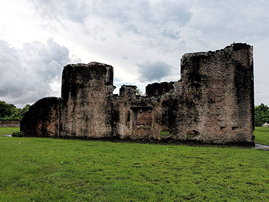
A low island in the Essequibo about 16 km up from the river mouth, reached by boat from Parika, which in the 1740s became the seat of government of Dutch Essequibo when the colony’s capital was shifted downriver from the old fort at Kyk-Over-Al.
Two buildings survive among the seventy-odd people who still live here: the brick Fort Zeelandia, a squat redoubt with earthen ramparts, an arched-roof armoury and a pair of Dutch cannon facing the water, and the Court of Policy of 1752 — the oldest non-military building in the country, once church, courthouse and government office all at once, and now a small museum with colonial tombs set into the floor.
The Dutch left far more than two buildings: Guyana’s entire populated coast is their creation, drained and diked into polders below sea level, and the seawall, canals and sluice gates that still keep Georgetown from flooding are the direct inheritance of the engineers who once governed from this island.
Also of note: Jonestown. It’s the single most internationally known event associated with Guyana, but the site is now abandoned jungle near Port Kaituma.