
Wikimedia Commons / CC-BY-SA-3.0 / GFDL
Capital: Amman
Population: 11.5 million+
Language: Arabic/English
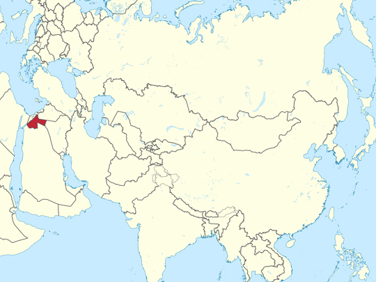
1 – Petra (also above)
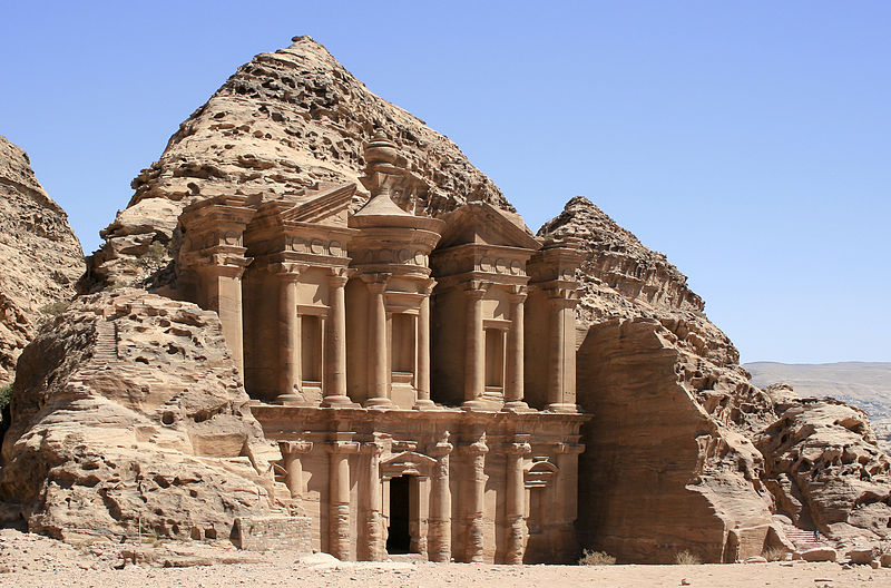
Petra was the capital of the Nabataeans, an Arab people who grew rich from about the fourth century BC by taxing and running the incense caravans between southern Arabia and the Mediterranean. The city is cut into rose-coloured sandstone in a basin in southern Jordan, entered through the Siq — a natural cleft in the rock over a kilometre long and in places only a few metres wide.
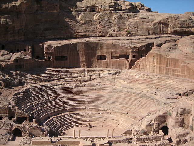
The Siq opens directly onto the Treasury, and beyond it Petra runs on for kilometres: the Street of Facades, a theatre cut into the rock for several thousand people, a colonnaded street, the Royal Tombs, and eight hundred steps up to the Monastery. The Nabataeans built dams, channels and cisterns that kept perhaps twenty thousand people alive in a desert.
Petra was never lost to the Bedouin who lived around it, but no European had seen it for centuries until 1812, when a Swiss traveller named Johann Ludwig Burckhardt — moving through the region as a Muslim scholar — talked a local guide into leading him to Aaron’s tomb on the mountain above, so that he could sacrifice a goat there. The route ran through the Siq.
2 – High Place of Sacrifice – Petra
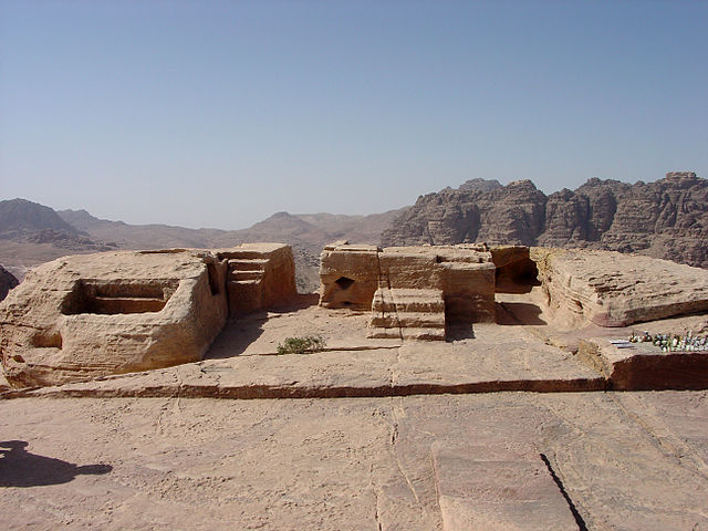
The High Place of Sacrifice is inside Petra, not a separate site — an open-air Nabataean sanctuary on the summit of Jebel al-Madbah, reached by around eight hundred rock-cut steps climbing from the Street of Facades, which takes most people the better part of an hour.
At the top of the High Place of Sacrifice is a levelled courtyard with a raised altar, a rectangular basin, and channels cut into the rock to drain liquid away. Two obelisks stand on the ridge nearby, left in place when the entire hilltop around them was quarried away. The view back down over Petra is the best there is. Nobody actually knows what happened up here.
The name is a nineteenth-century reading of those drainage channels, and there is no evidence of human sacrifice at the High Place of Sacrifice — animals are far likelier. Nabataean religion is poorly understood in general: their chief god Dushara was represented not as a figure at all but as a plain rectangular block of stone.
3 – Wadi Rum
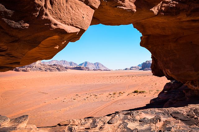
Wadi Rum is a valley of sandstone and granite mountains standing out of red sand in southern Jordan, and people have lived in it or crossed it for something like twelve thousand years. It was UNESCO-listed in 2011 as a mixed site — for the landscape and for what has been carved on it — and the Zalabia Bedouin still live and work there.
You go into Wadi Rum by 4×4 or camel from the village and stay overnight in a camp. The landmarks are the Seven Pillars of Wisdom rock face, Khazali canyon, Burrah canyon and the natural rock bridges. Lawrence of Arabia was filmed here in 1962, and Wadi Rum has stood in for Mars in several films since.
The rock faces of Wadi Rum carry something like 25,000 petroglyphs and 20,000 inscriptions, cut over twelve thousand years — hunting scenes, camels, human feet, and writing in Thamudic, Nabataean, Greek and Arabic. It is one of the longest continuous records anywhere of people leaving marks on the same stone.
4 – Jerash
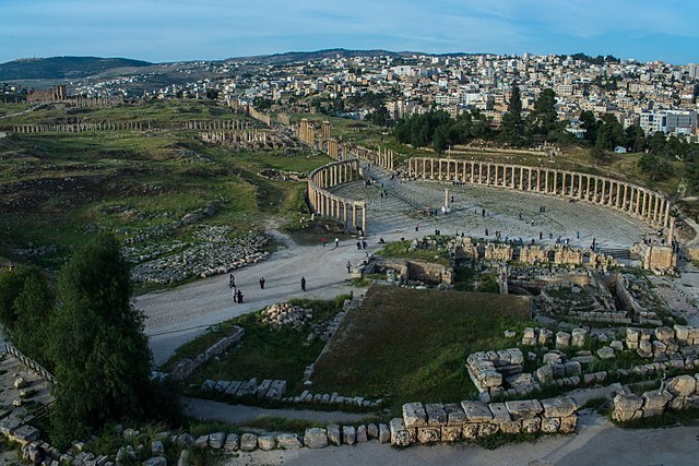
Jerash was Gerasa, one of the ten cities of the Decapolis, and it is among the best-preserved Roman provincial cities anywhere outside Italy. An earthquake flattened it in 749, soil gradually covered what was left, and nobody excavated it until 1925 — which is a large part of why so much of Jerash is still standing. Hadrian’s Arch went up for the emperor’s visit in 129.
Beyond it Jerash has an oval forum ringed by 160 Ionic columns, a colonnaded main street with chariot ruts worn into the paving, two theatres, a nymphaeum, and the Temple of Artemis on its terrace above everything else. The columns of the Temple of Artemis move.
The drums are not rigidly fixed to each other, and in a breeze you can wedge a spoon into a joint and watch it lift and settle. Whether that flexibility was designed in or is simply how the drums were stacked is argued over — but eleven of the twelve columns came through the earthquake that levelled the rest of Jerash.
5 – Dead Sea
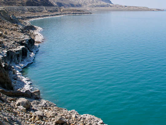
The Dead Sea lies about 430 metres below sea level along Jordan’s western border, the lowest exposed land anywhere on earth, and at roughly ten times the salinity of the ocean nothing lives in it. The Jordanian shore has the resorts and the mud, the hot springs and waterfall at Ma’in, and Lot’s Cave above the southern end.
The Greeks and Romans did not call it the Dead Sea. They called it Lake Asphaltites, because lumps of bitumen work loose from the seabed after earth tremors and float up — occasionally, according to ancient accounts, in pieces the size of buildings. That bitumen was the Nabataeans’ other business.
They collected it from boats and sold it into Egypt for shipbuilding, medicine and, it was long assumed, embalming. Arabs who later encountered blackened Egyptian bodies took the substance to be bitumen — mum — and called them mumiya. The English word “mummy” comes from that guess, and chemical analysis suggests the guess was largely wrong.
6 – Amman Citadel
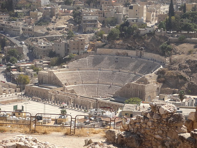
The Amman Citadel stands on Jebel al-Qala’a, the highest of the hills Amman is built across, and has been occupied since the Neolithic. It was Rabbath Ammon, capital of the Ammonites, then Philadelphia under the Greeks and Romans, then Byzantine, then Umayyad — and the modern city now runs right up to the foot of it.
On the Amman Citadel are the six standing columns of the Roman Temple of Hercules, a ruined Byzantine church, and the Umayyad palace complex with its restored domed audience hall. The Jordan Archaeological Museum is up there too, holding the Ain Ghazal statues — plaster figures made around 7000 BC, among the oldest large human statues ever found.
Beside the Temple of Hercules lie three marble fingers and an elbow. They are all that survives of a statue which, scaled up from the fragments, stood somewhere around twelve metres high — which would place it among the largest marble statues of the ancient world. The rest of it has never been found.
7 – Kerak Castle
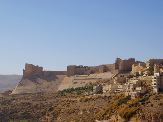
Kerak Castle sits on a spur above the King’s Highway at around 900 metres, roughly halfway between Amman and Petra. It was begun in 1142 as the chief stronghold of the Crusader lordship of Oultrejordain, built to control the caravan road between Damascus and Egypt, and it held out until 1188.
Kerak is a spur castle: a deep rock-cut moat across the vulnerable end, rectangular towers, vaulted stone galleries and a long dark corridor system running beneath the upper court, with Crusader, Byzantine and Arab building all mixed together in the fabric. A museum opened in the lower court in 2004.
In November 1183 Saladin besieged Kerak in the middle of a wedding — Raynald of Châtillon’s stepson was marrying the King of Jerusalem’s half-sister. The bride’s mother sent dishes out from the feast to Saladin’s camp, and he asked which tower the couple were in and told his siege engines to leave it alone. He took the town below, but not the castle.
8 – Jordan Valley
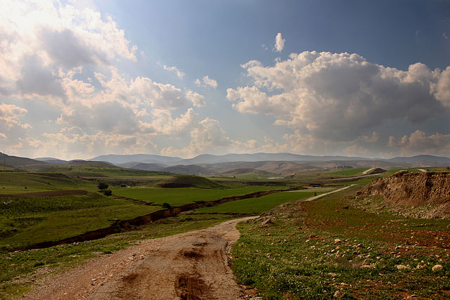
The Jordan Valley is the northern end of the great rift that runs from Turkey down to Mozambique, and the Jordanian stretch of it lies below sea level along its whole length. It is frost-free in winter and punishing in summer, which makes it the country’s market garden: bananas, citrus and vegetables grown here feed Jordan out of season.
At the southern end of the Jordan Valley is Al-Maghtas — Bethany Beyond the Jordan — UNESCO-listed in 2015 as the site where John baptised Jesus, a cluster of churches, pools and a riverbank platform that was only cleared of mines in the 1990s. Further north are Pella, occupied more or less continuously for millennia, and the hot springs at Himmeh.
The Jordan itself is hardly a river any more. Something like nine-tenths of its historic flow is taken upstream by Israel, Syria and Jordan before it arrives, and what reaches the baptism site is a few metres across and badly polluted. The Dead Sea it used to feed is dropping about a metre a year as a direct consequence.
9 – Dana Nature Reserve
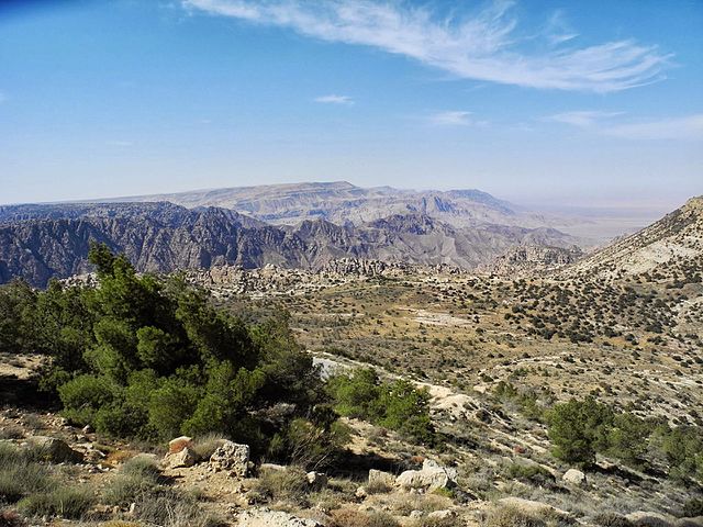
Dana is Jordan’s largest nature reserve, some 320 square kilometres running off the edge of the plateau and down into the rift, falling from about 1,500 metres to well below sea level in the space of a few kilometres. That drop crosses four separate biogeographic zones, which is why Dana has more recorded species than anywhere else in the country.
Dana village sits on the lip of the escarpment — an Ottoman-era stone settlement that was nearly abandoned and has since been restored — and trails run down the wadi from there to Feynan at the bottom, a long day’s walk. The lodge at Feynan runs on solar power, is lit at night by candles, and is staffed from the local Bedouin community.
The floor of Dana is one of the oldest industrial landscapes on earth. Copper has been mined and smelted at Feynan for around six thousand years — Chalcolithic, Egyptian, Edomite, Nabataean, and then Roman, who worked the mines with convict labour. The slag heaps are still lying there, black against the sand, and so are the shafts.
10 – Madaba & Mount Nebo
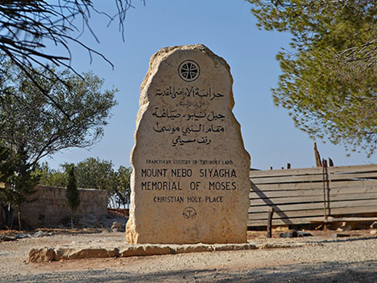
Madaba is a town half an hour southwest of Amman with an extraordinary quantity of Byzantine mosaic beneath it, and Mount Nebo is a ridge twenty minutes further on — the place where, in Deuteronomy, Moses is shown the promised land he will not be allowed to enter, and then dies. The two are almost always visited together.
The Memorial Church of Moses on Mount Nebo covers sixth-century mosaic floors, one of them a hunting and herding scene dated to 531, and looks west across the Jordan Valley to the Dead Sea, Jericho and — on a genuinely clear day — the hills of Jerusalem. In Madaba, the Church of St George, the Church of the Apostles and the archaeological park hold floors by the dozen.
The floor of St George’s in Madaba is the oldest surviving map of the Holy Land: laid in the 560s from over two million tesserae, running from Lebanon to the Nile delta, with Jerusalem drawn in enough detail to count the gates. It was found in 1884 when the new church was built. A century later, excavations in Jerusalem turned up the Cardo and the Nea Church exactly where the mosaic had put them.
11 – Umm Qais
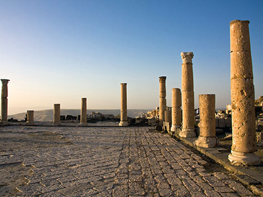

Umm Qais is the Roman city of Gadara, on a ridge in the far northwest of Jordan — another of the Decapolis cities, and built in black basalt rather than the pale limestone of Jerash, which gives the whole site a different colour and a different weight.
At Umm Qais there is a basalt theatre, a colonnaded street with the stumps of shopfronts along it, a vaulted terrace and a Byzantine basilica, with an Ottoman village built over the top whose largest house, Beit Russan, is now a museum. From the acropolis you look down on the Sea of Galilee, across the Yarmouk gorge into Syria, and up at the Golan Heights.
Gadara turned out an unlikely run of Greek writers for a hill town in Jordan. Menippus, a Cynic satirist of the third century BC, gave his name to Menippean satire. Meleager, a century later, assembled the Garland — the first Greek poetry anthology, and the ancestor of every anthology since. And Philodemus the Epicurean, whose library was buried at Herculaneum in 79 and is still being unrolled.
12 – Qusayr Amra
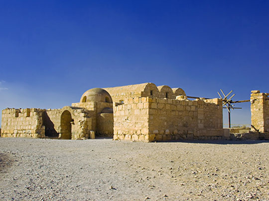

Qusayr Amra is a small stone bathhouse and audience hall standing on its own in the eastern desert about eighty-five kilometres from Amman, built somewhere between 723 and 743 by Walid ibn Yazid, an Umayyad prince who would briefly become caliph. UNESCO listed it in 1985, and from the outside it looks like almost nothing.
Inside, every surface of Qusayr Amra is painted — something like 350 square metres of fresco. There are hunting scenes with dogs, craftsmen at work, musicians, bathers, animals playing instruments, and the Six Kings: a panel showing the rulers of the known world ranged in deference to the caliph, among them the Byzantine emperor and the last Visigothic king of Spain.
The dome over the hot room at Qusayr Amra carries the earliest known painting of the night sky on a curved surface — thirty-five constellations with the zodiac running through them. And it is drawn backwards. The constellations are mirror-imaged and the lines radiate not from the centre of the dome but from the celestial pole, because whoever painted it was copying a globe, seen from the outside.