
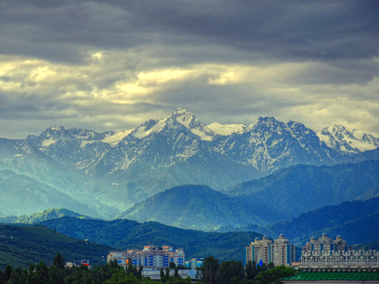
Irene2005 / Wikimedia Commons / CC-BY-SA-3.0 / GFDL
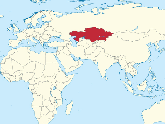
Capital: Astana
Population: 20.3 million+
Language: Kazakh/Russian
1 – Almaty (also above)
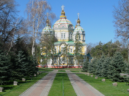
Almaty was the capital of Kazakhstan until 1997 and is still much the largest city, sitting under the Zailiyskiy Alatau range of the Tian Shan at around 800 metres, with snow peaks visible at the end of most avenues. Its name comes from alma, the Kazakh word for apple.
Almaty has the Zenkov Cathedral in Panfilov Park — a wooden Orthodox church put up in 1907 without nails, which came through the 1911 earthquake that flattened most of the city around it — along with the Green Bazaar, the Central State Museum, the Medeu skating rink up the gorge, and the Shymbulak ski slopes beyond that.
The apple in Almaty’s name is not decorative. The wild apple Malus sieversii still grows in the mountain forest directly above the city, and genome sequencing has confirmed what the Soviet botanist Nikolai Vavilov argued in the 1920s: it is the ancestor of every domesticated apple on earth. Every Bramley, Gala and Granny Smith traces back to these hills.
2 – Bayterek Tower – Astana
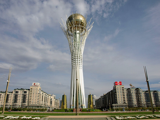
The Bayterek Tower stands at the centre of Astana, the capital Kazakhstan built out of a provincial town on open steppe after moving the government north from Almaty in 1997. The observation deck sits at exactly 97 metres for that year, and the tower opened in 2002.
Bayterek is a white lattice trunk carrying a golden sphere 22 metres across, and it is a folk tale made solid: Samruk, the bird of happiness, lays a golden egg in the branches of the tree of life, while the dragon Aidakhar gnaws at the roots below. Nazarbayev sketched the idea on a napkin during a flight, and the napkin is now in a museum.
At the top of the Bayterek Tower, inside the golden egg, sits a gilded impression of the right hand of Nursultan Nazarbayev, the president who ordered the capital moved. Visitors put their own hand into it and make a wish. The city around it has been Akmola, then Astana, then Nur-Sultan in his honour — and then Astana again, changed back in 2022.
3 – Taraz
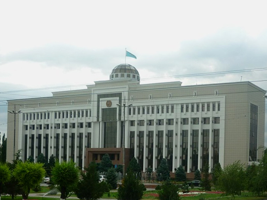
Taraz, in southern Kazakhstan on the Talas river, is one of the oldest cities in the country — roughly two thousand years old, and a Silk Road town for most of that. Under the Soviets it was called Dzhambul, and it got its old name back in 1997.
The best things at Taraz are twenty kilometres outside it: the mausoleums of Aisha Bibi and Babaji Khatun, small eleventh- and twelfth-century tombs faced in carved terracotta tile in dozens of different patterns, and the finest pre-Mongol architecture surviving in Kazakhstan. In town there is the Karakhan mausoleum and a bazaar built over a medieval bathhouse.
In July 751 an Abbasid army met a Tang Chinese one somewhere near Taraz and beat it — the only time those two empires ever fought, and the end of Chinese expansion westward. Tradition holds that captured Chinese papermakers passed the craft on to Samarkand and so eventually to Europe. Historians now doubt that direct link, but the battle itself settled which way Central Asia would face.
4 – Baikonur Cosmodrome
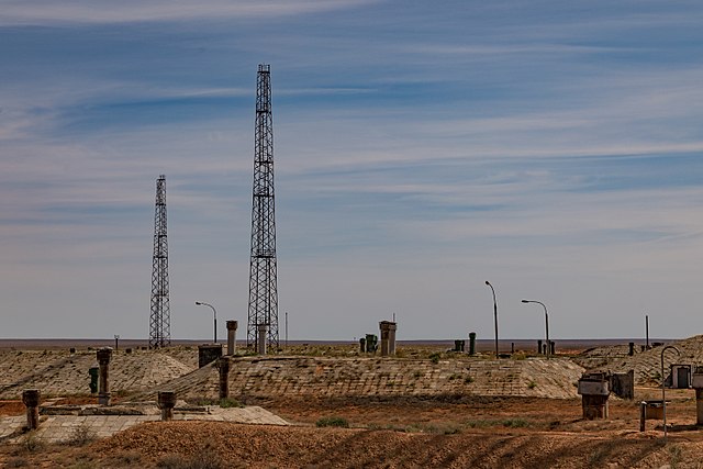
Baikonur Cosmodrome lies in the steppe north of the Syr Darya and is the oldest and largest space launch facility in the world. Sputnik went up from Baikonur in 1957 and Gagarin in 1961 — and between the retirement of the Space Shuttle in 2011 and the first crewed Dragon flight in 2020, every human being who reached the International Space Station left from this one place.
Kazakhstan leases the Baikonur Cosmodrome and the closed town beside it to Russia until 2050, and both are administered as Russian territory, so a permit has to be arranged well ahead. Visitors can see Gagarin’s Start, the assembly halls, the abandoned Buran shuttle in its hangar, and launches. Baikonur is not at Baikonur.
The site is at a railway halt called Tyuratam, and the Soviets gave it the name of a mining town 320 kilometres to the northeast to mislead Western analysts about where their rockets were. It worked for years — and the residents of the real Baikonur quietly exploited the confusion to order scarce supplies until Moscow noticed.
5 – Aktau
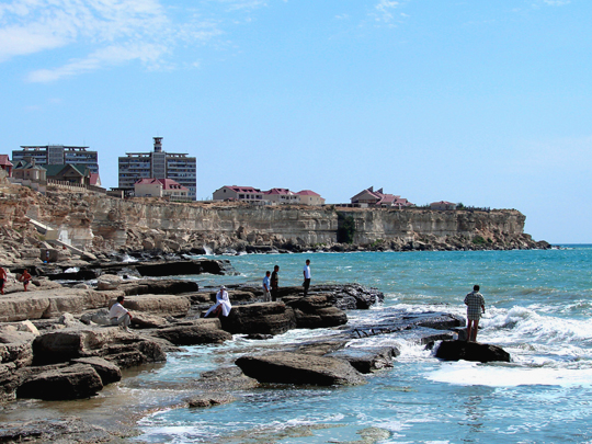
Aktau stands on a low cliff above the Caspian in the far west of Kazakhstan, and it exists because of uranium. The Soviets began building it in 1963 to house the workers of the Mangystau mining and processing combine, called it Shevchenko for most of its life, and kept it closed to outsiders. Aktau has no street names.
Addresses are a microdistrict number, a building number and a flat number, and there is nothing else to give a taxi driver. The seafront is the town’s own draw, but most travellers are really there for Mangystau beyond it — the chalk cliffs and canyons of Bozzhyra, and the underground mosques at Beket-Ata. For twenty-six years Aktau drank from a nuclear reactor.
The BN-350, a sodium-cooled fast breeder that ran from 1973 to 1999, generated the town’s electricity and at the same time distilled its drinking water out of the Caspian — the first plant anywhere to desalinate at commercial scale using nuclear heat, and for a long time the only one.
6 – Turkistan
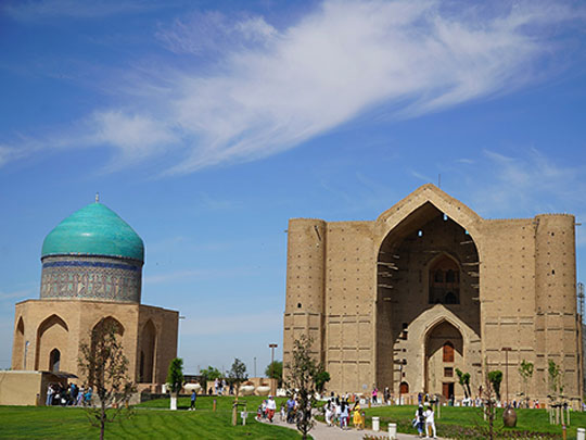

Turkistan in southern Kazakhstan grew up around the grave of Khoja Ahmed Yasawi, the twelfth-century Sufi poet who did more than anyone to carry Islam to the Turkic nomads, largely by writing in their language instead of Arabic. He died in 1166. Two hundred and thirty years later Timur ordered a mausoleum raised over him, and in 2003 it became Kazakhstan’s first UNESCO World Heritage Site.
The Mausoleum of Khoja Ahmed Yasawi at Turkistan is enormous: 65 metres by 46, with more than thirty rooms around a central hall covered by the largest surviving brick dome in Central Asia, over eighteen metres across. Timur died in 1405 with the work unfinished, and the main portal was left exactly as it stood — bare brick, with the wooden scaffolding beams still projecting out of it.
In the middle of that domed hall stands the Tai Kazan, a bronze cauldron cast in 1399: two metres across, two tonnes, holding three thousand litres of water for pilgrims, and the largest vessel of its kind in the Islamic world. It was removed to the Hermitage in Leningrad under the Soviets and returned to Turkistan in 1989.
7 – Charyn Canyon and the Kolsai lakes
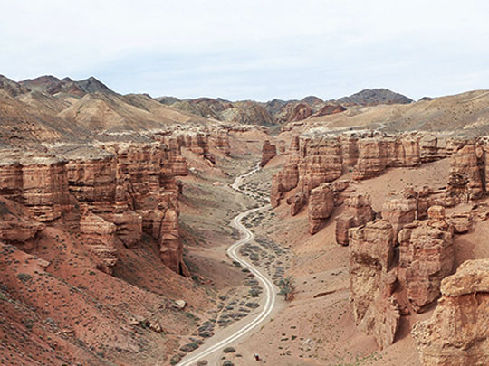

Charyn Canyon runs about 150 kilometres along the Charyn river some 200 kilometres east of Almaty, cut as much as 300 metres deep into red sandstone, and the Kolsai lakes lie a couple of hours south of it in the Kungey Alatau. The two make up the standard loop out of Almaty and are almost always done together.
The photographed part of Charyn Canyon is the Valley of Castles, a two-kilometre run of eroded towers you walk down through to the river. The three Kolsai lakes are stepped up a spruce valley from 1,800 to 2,650 metres — and nearby Kaindy is the odd one, a lake made by a landslide in the 1911 earthquake, with the trunks of the drowned spruce forest still standing up out of the water.
At the bottom of Charyn Canyon grows a forest of Sogdian ash. It is a relict: a species that covered much of this region before the last ice age and hung on only in this sheltered valley when the climate turned against it. The grove runs for a few kilometres, it is one of very few left anywhere, and it is why the national park exists at all.
8 – Tamgaly
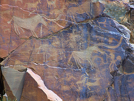
Tamgaly is a dry gorge in the Chu-Ili hills about 170 kilometres northwest of Almaty, holding roughly five thousand petroglyphs pecked into the rock across more than three thousand years — from the middle Bronze Age through the Saka and Turkic periods and on into the twentieth century. UNESCO listed Tamgaly in 2004, the first rock art site in Central Asia to be inscribed.
The carvings at Tamgaly are grouped in six main clusters along the canyon, alongside altars, settlements and stone-lined graves, so what you walk through is a complete sacred landscape rather than a gallery. There are hunters, chariots, bulls, warriors with maces, dancers, women giving birth and scenes of sacrifice.
The images Tamgaly is known for are the sun-heads: human figures whose heads are replaced by a disc with rays coming off it, cut deep and large enough to read from fifty metres away. Thirty have been found and twenty-six survive, all of them Bronze Age, and nobody knows whether they are gods, priests wearing something, or both at once.
9 – Altyn-Emel
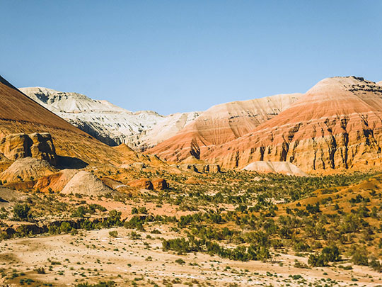

Altyn-Emel is a national park of some 4,600 square kilometres lying between two mountain ranges on the Ili river, three or four hours northeast of Almaty. It contains the Besshatyr necropolis — thirty-one burial mounds raised by the Saka in the fifth and fourth centuries BC, the largest of them a hundred metres across, built by the culture that produced the Golden Man.
Altyn-Emel also holds the Aktau mountains, chalk and clay ridges banded white, red and green by different sedimentary layers, with the darker volcanic Katutau beside them. Kulan and goitered gazelle have been reintroduced to the park, along with a herd of Przewalski’s horses — the only genuinely wild horse left anywhere.
The Singing Dune at Altyn-Emel is around three kilometres long and 150 metres high, and it sits between rocky hills without moving, which is unusual in itself. When the sand is dry and begins to slide down the face, the whole dune gives off a low droning note — something like a distant aircraft, or an organ — audible a kilometre away.
10 – The Aral Sea
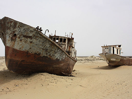
The Aral Sea was the fourth-largest lake on earth until the 1960s, when the Soviet Union began diverting the two rivers that fed it — the Syr Darya and the Amu Darya — to irrigate cotton across the surrounding deserts. It lost around nine-tenths of its volume and broke apart into separate basins. The northern one, inside Kazakhstan, is the part that still exists.
Aralsk was the main port on the Aral Sea, and its harbour is now a grassed-over hollow with a mural of fishermen on the station wall. The ship graveyard at Zhalanash outside the town has trawlers rusting on open sand. The exposed seabed has become a desert in its own right, the Aralkum, which lifts salt and agricultural chemicals into dust storms.
Then some of it came back. In 2005 Kazakhstan finished the Kokaral dam, a twelve-kilometre dyke holding the Syr Darya’s water in the northern basin. The level rose more than three metres in seven months where engineers had allowed a decade, salinity fell by two-thirds, two dozen fish species returned and the catch went from almost nothing to thousands of tonnes a year. It worked by writing off the southern basin, which is now effectively gone.