
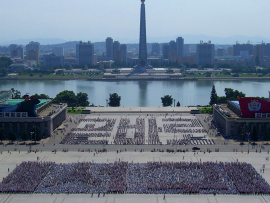
Wikimedia Commons / CC-BY-SA-3.0 / GFDL
Capital: Pyongyang
Population: 26.5 million+
Language: Korean
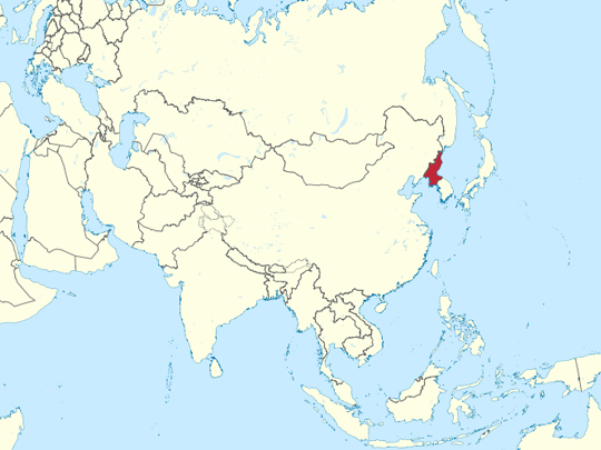
1 – Kim Il-Sung Square (also above)
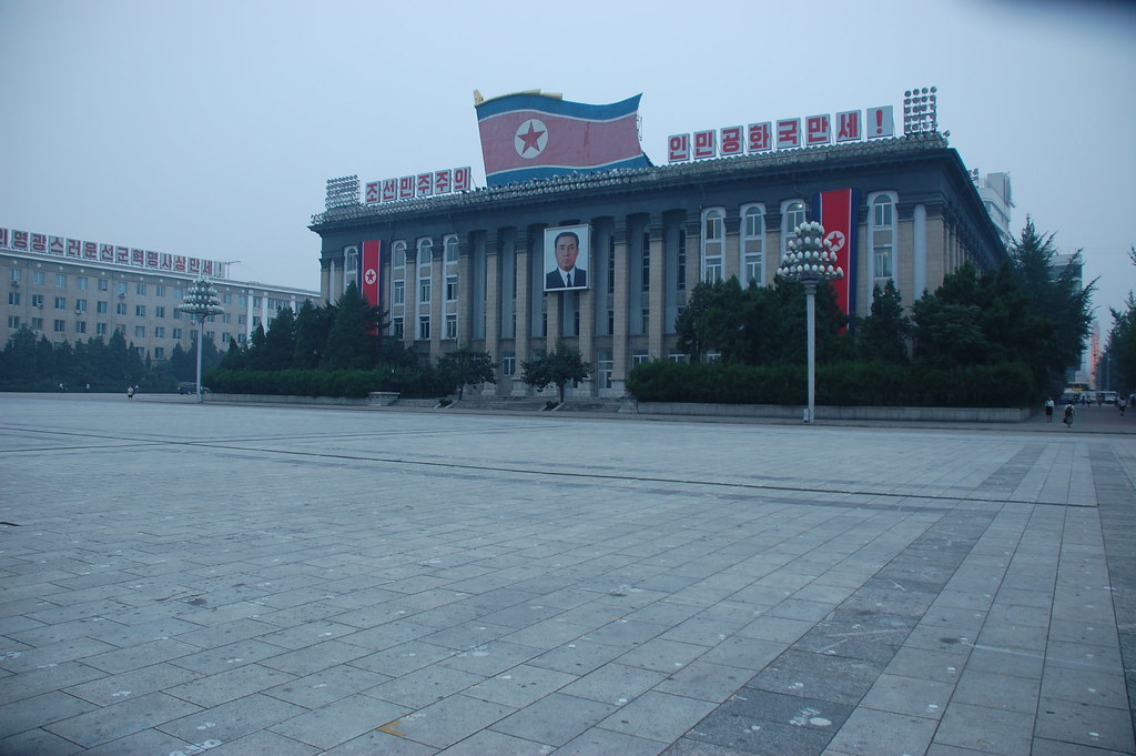
Kim Il Sung Square is the ceremonial centre of Pyongyang, laid out in 1954 on the west bank of the Taedong as part of the rebuilding of a city that had been almost entirely flattened by bombing during the Korean War. It holds upwards of a hundred thousand people, and it is where the military parades and mass displays are staged.
The Grand People’s Study House stands above Kim Il Sung Square on a terrace, with ministries and the national art gallery round the other three sides and the Juche Tower directly opposite across the water. On an ordinary day it is a very large empty expanse of granite with people walking across it. Look down.
The paving of Kim Il Sung Square is marked with thousands of small numbered dots, so that every participant in a parade or a mass display knows precisely which slab to stand on. They are permanent, they are visible in almost any photograph taken at ground level, and they are the reason the formations come out as exact as they look.
2 – Kumsusan Palace of the Sun
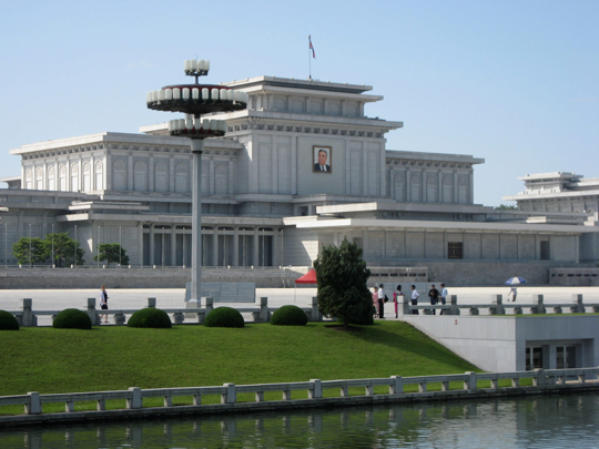
Kumsusan was built in 1976 as the Kumsusan Assembly Hall — Kim Il Sung’s official residence and office. After he died in 1994 his son had it converted into a mausoleum, and Kim Jong Il was placed there in turn after his own death in 2011. Both men lie embalmed in glass cases. Visiting Kumsusan Palace of the Sun is a procedure rather than a tour.
Cameras, phones and bags are left behind, dress is formal, and visitors are carried along several hundred metres of moving walkway and then through machines that blow the dust off them, before bowing three times to each body — at the feet and at either side, never at the head. The conversion of Kumsusan from residence to mausoleum was carried out between 1994 and 1995.
Those are the same years in which North Korea’s public distribution system collapsed into the famine that, by most estimates made outside the country, killed hundreds of thousands of people. Outside estimates of the building cost start at a hundred million dollars; no figure has ever been published.
3 – Juche Tower
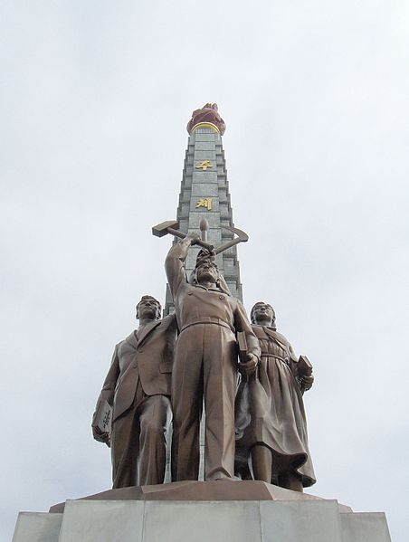
The Juche Tower rises 170 metres on the east bank of the Taedong, directly opposite Kim Il Sung Square, and was unveiled on 15 April 1982 for Kim Il Sung’s seventieth birthday. It is named for Juche, the doctrine of national self-reliance that is the official ideology of the North Korean state.
The Juche Tower is a tapering granite spire capped by a twenty-metre metal torch, lit red after dark and visible across the city, with a lift running to a viewing platform just below it. At the base, facing the river, a bronze group of a worker, a farmer and an intellectual hold up a hammer, a sickle and a writing brush.
The shaft of the Juche Tower is built from 25,550 granite blocks — 365 multiplied by 70, one for every day of Kim Il Sung’s first seventy years. The arithmetic leaves out leap days, so the tower stands seventeen blocks short of the days he had actually lived.
4 – Pyongyang Subway
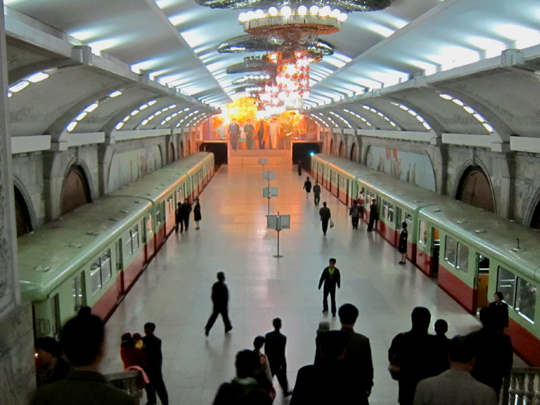
The Pyongyang Metro opened in September 1973 and runs two lines and sixteen stations over about 22 kilometres, entirely underground and entirely on the west side of the Taedong. At more than 110 metres down it is among the deepest metro systems in the world, and the stations were built with blast doors so they could serve as shelters.
The escalator ride down to a Pyongyang Metro platform takes about three and a half minutes, and the temperature there stays at eighteen degrees all year. The stations are modelled on the Moscow metro — marble, chandeliers, mosaic murals — and they are named for ideas rather than places: Glory, Victory, Reunification, Red Star, Paradise.
For years foreigners were shown only two stations, Puhung and Yonggwang, which produced a durable story in the Western press that the Pyongyang Metro was a stage set and the passengers were actors. From around 2014 visitors have been able to ride the whole system, and many have. It is a real metro, carrying several hundred thousand people a day.
5 – The Workers’ Party Monument
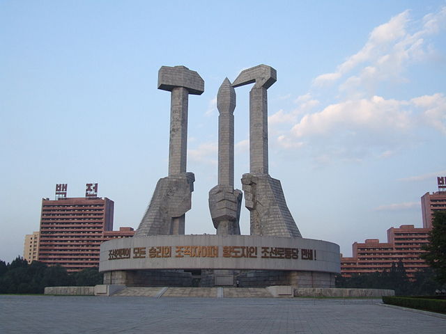
The Monument to the Founding of the Workers’ Party was unveiled in October 1995 for the party’s fiftieth anniversary. It is a granite group of three clenched fists, fifty metres high, holding a hammer, a sickle and a writing brush — the emblem of the Workers’ Party of Korea, in which the brush stands for the intellectual alongside the worker and the farmer.
That brush is what makes the emblem unlike its Soviet and Chinese equivalents, which use the hammer and sickle alone. A stone belt fifty metres across rings the fists, carrying a slogan about the unity of leader, party and people, and the whole thing stands on a pedestal seventy metres in diameter. Nearly every dimension of the Workers’ Party Monument is a number that means something.
Fifty metres and a fifty-metre belt for fifty years of the party; seventy metres back to 1925 and the anti-Japanese union it dates itself from; and the belt’s 216 blocks with its 42-metre inner diameter for 16 February 1942, the official birth date of Kim Jong Il — a date and a birthplace that sources outside North Korea dispute.
6 – Kaesong
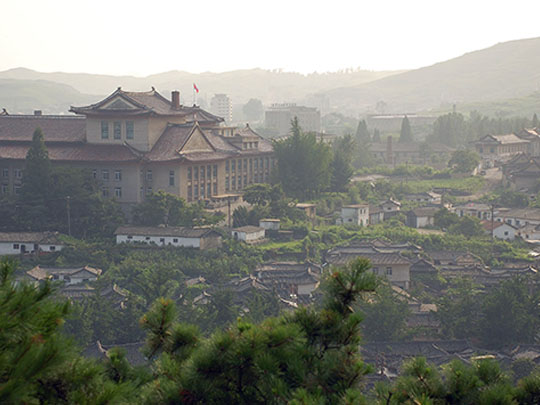
Kaesong sits in the far south of North Korea, eight kilometres from the Demilitarised Zone, and was the capital of the Koryo dynasty from 918 to 1392 — the state that first brought the whole peninsula under one crown. Twelve sites in and around the city were inscribed by UNESCO in 2013.
What survives at Kaesong is the Namdae Gate of the old inner wall, the Songgyungwan Confucian academy — now the Koryo Museum, with its celadon — the ruined Manwoldae palace, the royal tombs of Wang Kon and Kongmin outside town, and the Sonjuk Bridge, where the minister Jong Mong Ju was murdered in 1392 for refusing to abandon a dying dynasty.
Kaesong also has the best-preserved old streets in the country. The English word Korea comes from Koryo, the dynasty that ruled from Kaesong — so both Koreas are known abroad by the name of a kingdom neither of them names itself after at home. The North calls itself Chosŏn, the South calls itself Hanguk. And Kaesong lay on the southern side of the 38th parallel until the armistice of 1953 moved the line.
7 – Panmunjom and the DMZ
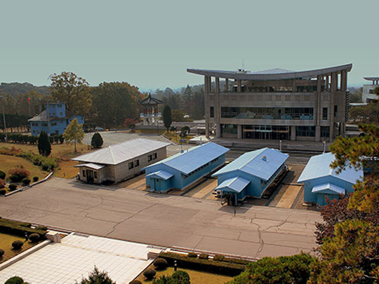
The Demilitarised Zone runs about 250 kilometres across the peninsula and is roughly four kilometres wide, and it was created by the armistice signed at Panmunjom on 27 July 1953. That armistice was a ceasefire between military commanders, not a treaty between states — no peace agreement has ever been signed, so the Korean War has technically never ended.
At Panmunjom, inside the Joint Security Area, a row of pale blue conference huts sits astride the demarcation line, with the microphone cable running down the middle of the table to mark the border — which means that inside the room you can step into the other country. Nearby is the Bridge of No Return, where prisoners were exchanged in 1953 and made to choose a side permanently.
Seventy years with almost nobody in it have turned the most heavily fortified strip of land on earth into one of the best-preserved temperate habitats in Asia. Red-crowned and white-naped cranes winter in the DMZ, along with musk deer and Amur goral, in a corridor nobody can farm, build on or walk across.
8 – Mount Paektu
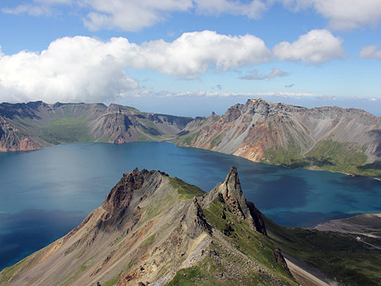
Mount Paektu is an active volcano of about 2,750 metres on the Chinese border — the highest point on the Korean peninsula, with a crater lake called Chon, Heaven Lake, filling the caldera. The North Korean side was recently designated a UNESCO Global Geopark, the country’s first natural site on any UNESCO list.
Mount Paektu is reached from Samjiyon, and North Korea presents it as the heart of the state’s own story: Kim Il Sung’s guerrilla base against the Japanese, trees in the surrounding forest carved with slogans said to date from that campaign, and a log cabin identified as the birthplace of Kim Jong Il — a claim sources outside the country reject, placing his birth in the Soviet Union.
The mountain is far older than any of that, and it belongs to both Koreas. Dangun, who founded the first Korean kingdom in legend, was born on Paektu to a mother who had been a bear. And the South Korean national anthem opens by naming it — until the waters of the East Sea run dry and Mount Paektu wears away. Fifty million people sing that about a mountain they cannot visit.