
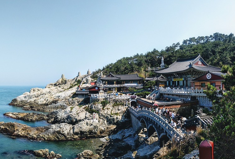
Wikimedia Commons / CC-BY-SA-3.0 / GFDL
Capital: Seoul
Population: 51.5 million+
Language: Korean
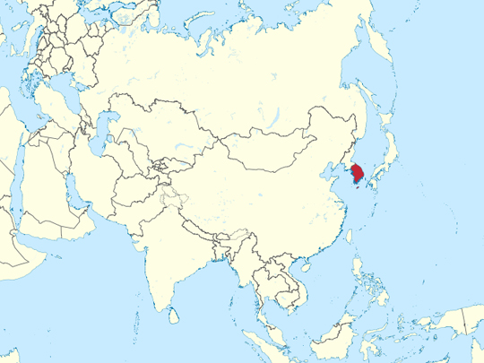
1 – Haedong Yonggungsa (also above)
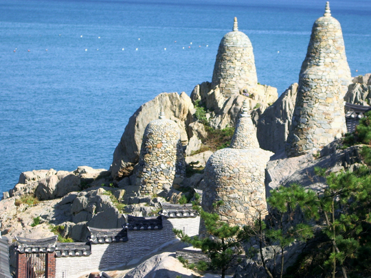
Haedong Yonggungsa stands on the rocks at the edge of the sea in Gijang, on the northeastern outskirts of Busan. It was founded in 1376 by the monk Naong during the Goryeo dynasty, destroyed in the Japanese invasions of the 1590s, and rebuilt in the 1930s.
You come into Haedong Yonggungsa past a line of stone zodiac figures and down 108 steps — one for each of the earthly torments in Buddhist teaching — to halls built onto the rock, with the water directly below and spray coming over the wall in rough weather. Sunrise is the point, and on New Year’s Day the place is solid with people.
Almost every old Buddhist temple in Korea is up a mountain, and that is not an aesthetic preference. The Joseon dynasty made neo-Confucianism the state doctrine and pushed Buddhism out of the towns, so the monasteries went uphill and stayed there for five centuries. A temple built out on the open coast, like Haedong Yonggungsa, is the exception that shows the rule.
2 – Jeju Island
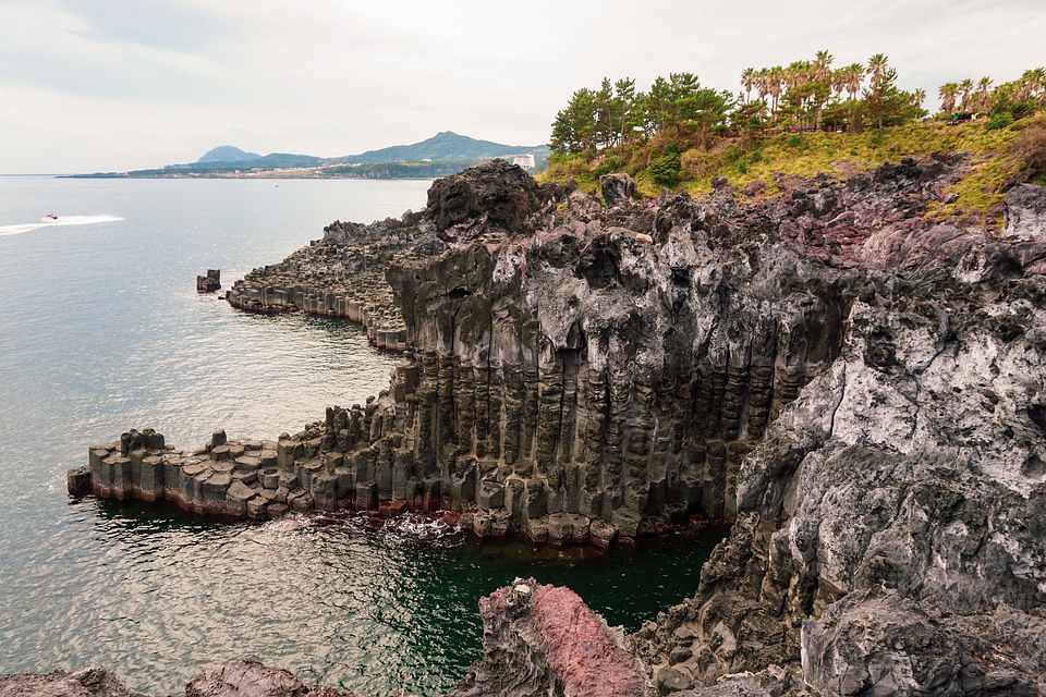
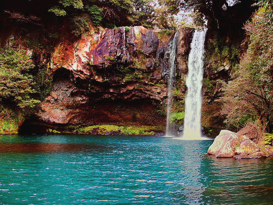
Jeju is a volcanic island about 85 kilometres off the southern coast, built up around Hallasan, which at 1,947 metres is the highest mountain in South Korea. UNESCO listed Jeju in 2007 for its volcanic landscape — the lava tubes at Manjanggul, the crater at the summit, and the tuff cone of Seongsan Ilchulbong rising straight out of the sea.
Jeju has beaches, a coastal walking route in twenty-odd numbered stages, tangerine groves, and the dol hareubang, the basalt “stone grandfathers” that stand at village entrances. It also has its own language, different enough from mainland Korean to be mutually unintelligible, and classified by UNESCO as critically endangered.
The haenyeo of Jeju dive for shellfish and seaweed without any air supply, holding their breath to twenty metres, and they are women — the trade shifted from men to women at some point in the Joseon period, making them the island’s main earners in a society that did not otherwise work that way. UNESCO listed them in 2016. Most still diving are now over seventy.
3 – Gyeongbokgung
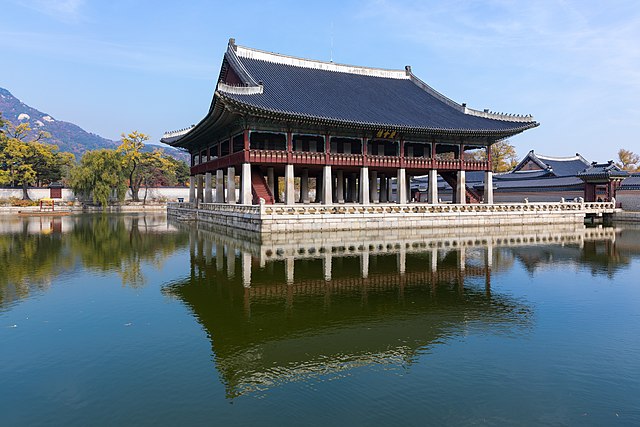
Gyeongbokgung is the principal palace of the Joseon dynasty, laid out in 1395, three years after the dynasty took power, at the head of the road that is still the ceremonial axis of Seoul. It burned during the Japanese invasion of 1592 and lay in ruins for 270 years before being rebuilt in 1867.
The throne hall at Gyeongbokgung stands on a terrace lined with rank stones marking where each grade of official was to stand; behind it the Gyeonghoeru banqueting pavilion sits on 48 stone pillars in an artificial lake. The National Palace Museum and the National Folk Museum are in the grounds, with a changing of the guard at the main gate.
Under Japanese rule Gyeongbokgung was taken apart: the great majority of its buildings were sold off or demolished, and in 1926 the Japanese Government-General put up its own headquarters directly in front of the throne hall, hiding it from the city. That building stood until 1995, when the Korean government demolished it on the fiftieth anniversary of liberation.
4 – Seoraksan National Park
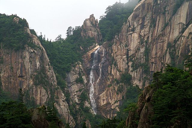
Seoraksan lies in Gangwon province near the east coast, and its high point, Daecheongbong, reaches 1,708 metres — the third-highest peak in South Korea. It became the country’s first UNESCO Biosphere Reserve in 1982.
A cable car runs up to the ruined fort at Gwongeumseong; on foot, Seoraksan has Ulsanbawi, a wall of six granite domes reached by several hundred steel steps, the gorge at Biseondae, and Sinheungsa with its huge seated bronze Buddha near the entrance. October is when the park turns colour, and it is extremely busy.
Seoraksan is one of the great peaks of the Baekdudaegan — the mountain spine that Korean divination treats as a single unbroken ridge running the length of the peninsula, from Mount Paektu on the northern border all the way to the south coast. The idea is centuries older than the division of the country, and it is one of the few frameworks in which Korea is still routinely described as one place.
5 – Bulguksa Temple

Bulguksa stands on the slope of Tohamsan outside Gyeongju, which was the capital of the Silla kingdom for very nearly a thousand years. The temple was completed in 774, and UNESCO listed it in 1995 along with the Seokguram grotto on the ridge above it.
The stone terraces, staircases and bridges at Bulguksa are original Silla work; the wooden halls standing on them are twentieth-century reconstructions, because the temple burned in the Japanese invasions of the 1590s. Two stone pagodas face each other in the main courtyard — the plain Seokgatap and the elaborate Dabotap, which appears on the ten-won coin.
In 1966, during restoration, a reliquary was found inside Seokgatap holding a scroll of mulberry paper six metres long: the Great Dharani Sutra, woodblock-printed somewhere between 704 and 751. It is generally described as the oldest surviving printed document in the world, though Chinese scholars have argued it was printed in Luoyang and sent to Silla.
6 – Ulleung Island
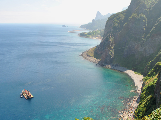
Ulleung is a volcanic island roughly 120 kilometres out in the East Sea, steep enough that it has almost no flat ground apart from the Nari Basin, a caldera floor near the top. Around nine thousand people live on it, mostly by fishing, and squid drying on racks is the standard view.
A road now rings most of Ulleung, with a walkway cut into the sea cliffs, an observatory below Seonginbong and a cable car above Dodong. The islets of Dokdo, which Japan also claims, are administered from Ulleung and reachable by boat when the sea allows, which is not often. Ulleung was deliberately emptied.
From the early fifteenth century the Joseon court kept the island uninhabited so that Japanese raiders could gain nothing by taking it — removing the population and sending inspection patrols out instead. That policy held until 1882, when it was reversed and settlers were sent back. Ulleung spent the best part of 470 years officially empty.
7 – Bukhansan National Park
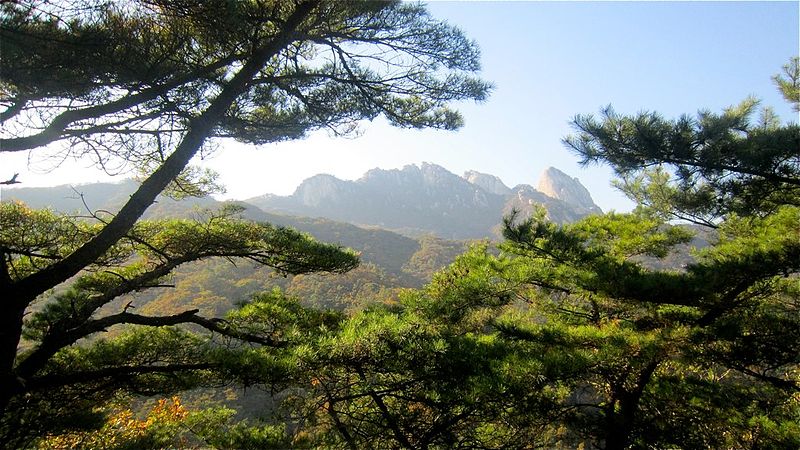
Bukhansan is a national park of about 80 square kilometres lying partly inside the administrative boundary of Seoul, which means you reach the trailheads by metro. Its granite peaks rise to 836 metres at Baegundae, with Insubong and Mangyeongdae alongside.
The Bukhansanseong fortress wall runs along the ridges of Bukhansan — a defensive circuit rebuilt in 1711 as a refuge for the court if the capital fell — with temples scattered through the valleys below it. Insubong is among the better-known granite climbing faces in Asia, carrying several hundred routes.
Bukhansan holds a Guinness world record as the most visited national park per unit area anywhere. Something like five million people a year walk a park the size of a small town, most of them arriving from a city of ten million on the subway — which is why the summit path on an autumn Sunday moves at roughly the speed of a queue.
8 – Seryang-Je
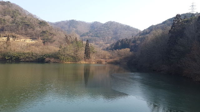
Seryangje is a small irrigation reservoir in Hwasun county in the southwest, dug in the 1940s to water rice fields. It is not a famous place in any conventional sense: it is a working farm pond that became, more or less by accident, one of the most photographed spots in the country.
What people come to Seryangje for lasts about two weeks in April — willow trees standing in the shallow water with cherry blossom behind them, and both reflected in a surface that has to be completely still, which in practice means arriving before sunrise. Photographers turn up in the dark and stand in rows.
Hwasun, the county Seryangje sits in, holds one of the three dolmen clusters UNESCO listed in 2000: several hundred Bronze Age burial stones scattered through the surrounding hills, some of them still lying where they were quarried. Korea has something in the order of thirty to forty thousand dolmens — a large share of every dolmen on earth.
9 – Hwaseong Fortress
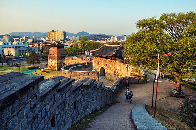
Hwaseong is a walled circuit of about 5.7 kilometres around the centre of Suwon, built between 1794 and 1796 by King Jeongjo, who had moved his father’s tomb nearby and meant to move the capital there as well. UNESCO listed Hwaseong in 1997.
The wall of Hwaseong Fortress runs across flat ground and up over Paldalsan, with four great gates, watchtowers, artillery bastions, a floodgate where the stream passes through and a command post on the hill; the full circuit takes two or three hours to walk. It was designed by the scholar Jeong Yak-yong, who built a pulley crane for the job.
Jeongjo ordered that all of it be written down, and the result was the Hwaseong Seongyeok Uigwe — nine volumes recording the drawings, the materials, the techniques, the workforce and the unit price of the nails. After the fortress was damaged under colonial rule and in the Korean War, restorers in the 1970s rebuilt it from its own construction manual.
10 – The Garden of Morning Calm – Gapyeong County
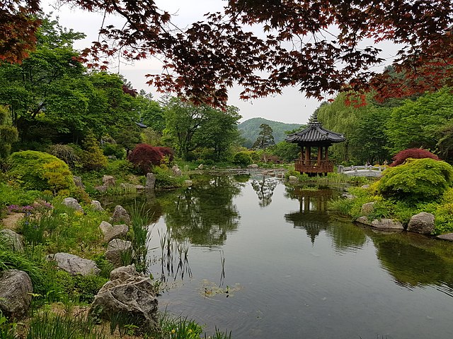
The Garden of Morning Calm is a private botanical garden in Gapyeong county, about ninety minutes northeast of Seoul, which opened in 1996. It was founded by Han Sang-kyung, a horticulture professor who set out to build a garden that would show Korean landscape design to people who had never seen any.
The Garden of Morning Calm runs over about thirty thousand square metres of hillside in themed sections — a sunken garden, a bonsai garden, a wild flower garden — planted in the Korean manner, which favours curves, asymmetry and letting the existing lie of the ground dictate the layout. The winter lighting display runs from December.
The name comes from “the Land of the Morning Calm”, which sounds ancient and is not. The phrase was popularised by an American, Percival Lowell, whose 1885 book on Korea took that reading from the two characters of Joseon. Koreans do not generally call their country that. It is a nineteenth-century Western coinage that came home and stayed.
11 – Gyeongju
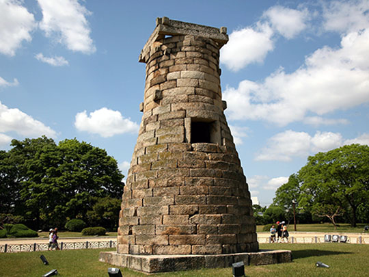
Gyeongju in the southeast was the capital of the Silla kingdom for close to a thousand years, from 57 BC to 935 AD, which makes it one of the longest-serving capitals anywhere. UNESCO inscribed the Gyeongju Historic Areas in 2000 as five separate zones in and around the modern town, and Koreans describe the place as a museum without walls.
Royal tombs stand in the middle of Gyeongju — grass mounds up to twenty metres high in a park with roads running past them. One of them, Cheonmachong, was excavated in 1973 and opened up, so you can walk inside; it gave up a gold crown and a painted saddle flap with a flying horse on it.
There is also the Wolji pond, the Namsan hillside covered in Buddhist carving, and Bulguksa sixteen kilometres out of town. Cheomseongdae, a nine-metre bottle-shaped tower standing alone in a field at Gyeongju, was built in the 630s or 640s and is the oldest surviving astronomical observatory in East Asia. It went up under Queen Seondeok — and Silla is the only Korean dynasty that ever had reigning queens. It had three of them.
12 – Seoul
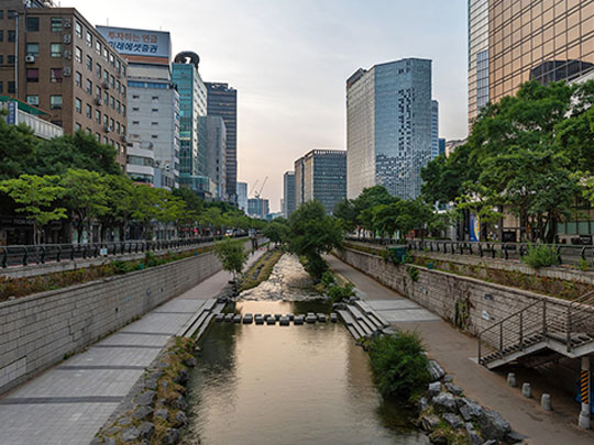
Seoul has been the capital since 1394, and it is now the centre of a metropolitan area of around 26 million people — roughly half of South Korea’s entire population living on about a tenth of its land. The city changed hands four times during the Korean War and was left largely in ruins, so almost everything you see went up afterwards.
Beyond the palaces, Seoul has Bukchon, a hillside of restored courtyard houses; the gallery and antique lanes of Insadong; Zaha Hadid’s Dongdaemun Design Plaza; the tower on Namsan in the middle of the city; the night markets; and the granite peaks of Bukhansan visible from the street at the northern end.
Cheonggyecheon is a stream running about eleven kilometres through the middle of Seoul, and for thirty years it was underneath a motorway — concreted over from 1958, with an elevated expressway finished on top of it in 1976. In 2003 the city pulled the expressway down and dug the stream back out. It now has to be fed daily with water pumped from the Han river and from groundwater under the subway.