

Wikimedia Commons / CC-BY-SA-3.0 / GFDL
Capital: Bishkek
Population: 7.1 million+
Language: Kyrgyz/Russian
1 – Ala Archa National Park (also above)
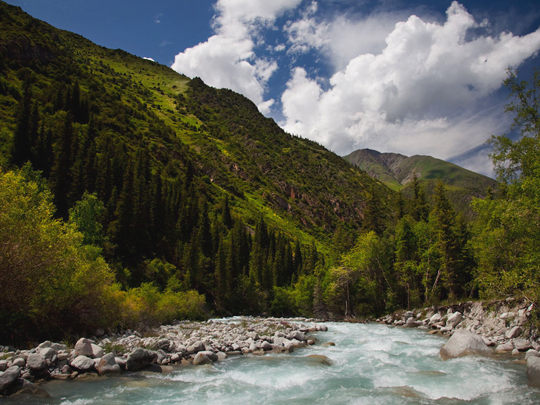
Ala Archa National Park begins about forty kilometres south of Bishkek, where the Kyrgyz Ala-Too range comes straight up out of the plain. It was established in 1976, covers roughly two hundred square kilometres, and holds more than twenty glaciers with peaks approaching 4,900 metres. The name means variegated juniper, for the trees on the lower slopes.
The road into Ala Archa runs as far as an alpine camp at around 2,100 metres, and the walking starts there: the Ak-Sai gorge and its waterfall, a mountain hut above that, and the glacier above that. The park was a training ground for Soviet mountaineers, and memorial plaques to the ones who did not come back are still fixed to the rocks near the entrance.
Ala Archa is forty minutes from a capital city, and that is the point. Kyrgyzstan is around ninety per cent mountain, with a large part of the country above 3,000 metres and almost none of it below 500. A national park with glaciers starting at the edge of the suburbs is not remarkable here — it is close to the national condition.
2 – Tash Rabat
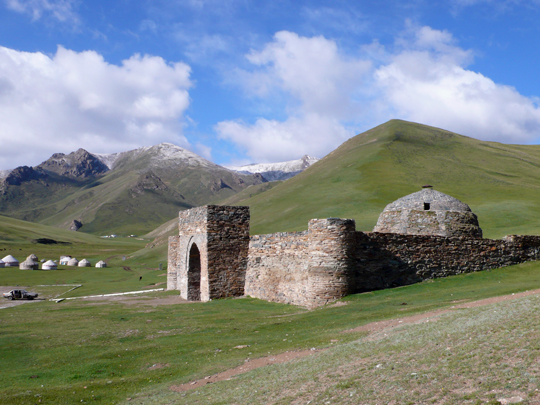
Tash Rabat stands at about 3,200 metres in a side valley of the At-Bashy range in Naryn province, not far from the Torugart pass into China. It is a squat stone building half sunk into the hillside, usually dated to the fifteenth century, on a route that carried Silk Road traffic between the Fergana valley and Kashgar.
Inside Tash Rabat are thirty-odd rooms and corridors under a stone dome — all of it dressed stone rather than mudbrick, which is unusual in itself — with a central chamber, cells off the passages and a deep vaulted space below. Yurt camps run in the valley through the summer, and the walking above it is excellent. Nobody is certain what Tash Rabat was.
The standard label is caravanserai, but the plan does not much resemble one: no obvious stabling, no open courtyard. It has been read instead as a Nestorian Christian monastery, as a fortress, and as a caravanserai built on top of an earlier monastery. The building is well preserved and its purpose is still an open question.
3 – Ala Too Square
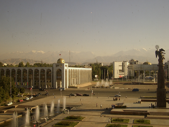
Ala-Too Square is the main square of Bishkek, laid out in 1984 for the sixtieth anniversary of the Kirghiz Soviet Socialist Republic, with the State Historical Museum along one side and the government White House a short walk away. Parades, concerts and protests all happen in the same place.
A changing of the guard takes place hourly beneath a 45-metre flagpole on Ala-Too Square, watched over by a ten-metre bronze Manas on horseback, with a monument to the writer Chingiz Aitmatov across from him. In September 2020 a manaschi stood here and recited the Manas epic continuously for fourteen hours and twenty-seven minutes.
The centre of the square has held three different statues in about twenty years. Lenin stood there until the early 2000s, when he was quietly moved round behind the museum — he is still standing there. He was replaced by Erkindik, a winged woman holding a yurt’s roof-ring, and she was replaced by Manas in 2011. Over the same period the square saw two of the three revolutions that have removed Kyrgyz presidents.
4 – Altyn Arashan

Altyn Arashan is a valley at about 2,600 metres in the Terskey Ala-Too above Karakol, and the name means golden spa: there are hot springs along the river and people have been getting into them for a very long time. A handful of guesthouses and yurt camps sit on the valley floor with 4,000-metre peaks on either side.
You reach Altyn Arashan either by walking three or four hours up from Ak-Suu, or by paying someone with an elderly Soviet truck to take you up a track widely held to be one of the worst passable roads in Central Asia. At the top the accommodation is basic and the bath is a tin shed over a hot spring.
Altyn Arashan is the usual finish for the walk over from Ala-Kul, a glacial lake at around 3,500 metres that turns an implausible turquoise in summer. The circuit up from Karakol to Ala-Kul, over the pass and down into Altyn Arashan is the best-known multi-day walk in Kyrgyzstan, and it can be done without a guide, a permit or a tent.
5 – Jeti-Oguz Valley
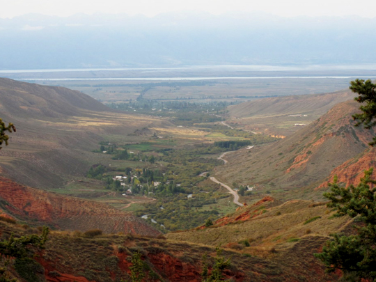
Jeti-Oguz is a valley about twenty-five kilometres west of Karakol, named for the wall of red cliffs standing at its mouth — jeti ögüz means seven bulls. The rock is Tertiary conglomerate, the formation has been a protected natural monument since 1975, and a Soviet sanatorium sits at the foot of it, still open and still very Soviet.
Just before the bulls stands the Broken Heart, a single cliff split cleanly down the middle, which has collected every tragic love legend in the district. Above the sanatorium the Jeti-Oguz valley opens out into meadows and the Valley of Flowers, with the 5,168-metre Oguz Bashy — the bull’s head — closing the far end. There are no longer seven bulls.
The cliffs are soft conglomerate and they keep splitting, so the count has quietly risen past the name: the formation is eroding in front of the people photographing it. The legend behind the name concerns a khan who had a rival’s wife killed and seven bulls sacrificed at her funeral.
6 – Issyk-Kul Lake
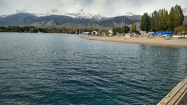
Issyk-Kul lies at 1,607 metres in a basin between two ranges of the Tian Shan — about 180 kilometres long and 668 metres deep, the second-largest mountain lake in the world after Titicaca. It is mildly saline, fed by streams with no outlet, and the name means warm lake: it does not freeze, even at that altitude in a Central Asian winter.
The northern shore of Issyk-Kul has the Soviet-era resorts and the beaches; the southern shore has the mountain valleys and far fewer people. Karakol at the eastern end has a wooden Orthodox cathedral and a Dungan mosque built by a Chinese architect without nails. There is a naval testing range at the western end, and it is still in use.
The Catalan Atlas of 1375 shows a place called Issicol with a monastery of Armenian brethren, and records that the body of the Apostle Matthew is kept there. Kyrgyz archaeologists have spent decades looking for it, turning up medieval Christian crosses, ceramics and cave cells on the northeastern shore — and settlements under the water, because the lake has risen and fallen repeatedly.
7 – Song-Köl
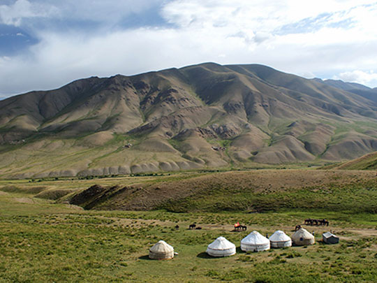
Song-Köl is a lake at 3,016 metres in the mountains of Naryn province, roughly twenty-nine kilometres long and the second-largest body of water in Kyrgyzstan. There is no town on Song-Köl and no permanent building of any kind: it sits on a jailoo, a high summer pasture, and it is under ice and snow for most of the year.
You reach Song-Köl over passes at around 3,400 metres, on tracks that open only in summer. From June to September herding families bring their flocks up from the valleys and live on the shore in yurts; a number of them take guests, and staying in one is the usual way to see the place. There is kymyz — fermented mare’s milk — and horses, and very little else.
In late September the families take the yurts down, load the animals and go back down the mountain, and Song-Köl is empty until June. That cycle is how the country pictures itself: the tunduk at the centre of the Kyrgyz flag is a yurt’s wooden roof-ring, seen from inside, looking up.
8 – Sulaiman-Too and Osh
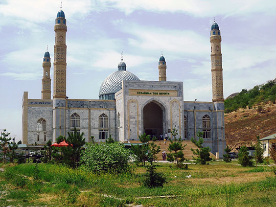

Osh lies in the Fergana valley in the far south, Kyrgyzstan’s second city and among the oldest continuously inhabited places in Central Asia — and Sulaiman-Too rises straight out of the middle of it, a five-peaked limestone crag about 150 metres high. UNESCO inscribed Sulaiman-Too in 2009: the first World Heritage Site in the country, and still the only one lying entirely inside it.
A stair climbs Sulaiman-Too past caves and shrines — petroglyphs of people, animals and geometric marks, seventeen ritual sites still in use, a museum built into a cave that the Soviets had first made into a restaurant, and the Ene-Beshik cave, where women still come to ask for children. The Osh bazaar runs along the river below.
Near the top of Sulaiman-Too stands a small prayer cell known as Babur’s House. Babur built it as a young man ruling Fergana — before he lost Fergana, lost Samarkand twice, went south to take Kabul and, in 1526, went further south and founded the Mughal empire. The dynasty that built the Taj Mahal began with a teenager’s shelter on this rock.
9 – Burana Tower
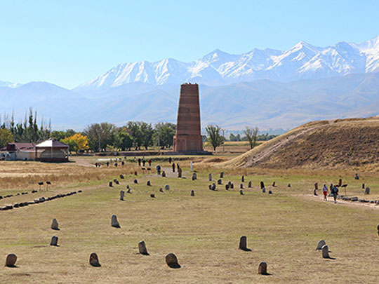

Burana Tower stands alone in the Chuy valley about eighty kilometres east of Bishkek, and it is very nearly all that survives of Balasagun — a Karakhanid capital founded at the end of the ninth century, with a citadel, bazaars, a bathhouse, a mosque and a church inside double walls enclosing some thirty square kilometres.
The Mongols came, the city declined, and by the fifteenth century it was empty. The tower at Burana is brick, patterned in geometric bands rather than tiled, and you climb a cramped spiral stair inside to the top. Around it stand rows of balbals — stone grave markers carved with faces, gathered in from across the valley — along with mausoleum foundations, petroglyphs and a small museum.
Burana Tower was originally about forty-five metres high; a fifteenth-century earthquake took the top half off and left the twenty-five metres you climb today. What it stands for is larger than what it is. Balasagun was one of the great cities of Central Asia, and the man remembered as Yusuf of Balasagun produced the Kutadgu Bilig in the 1060s — the earliest substantial work of Turkic literature that survives.