
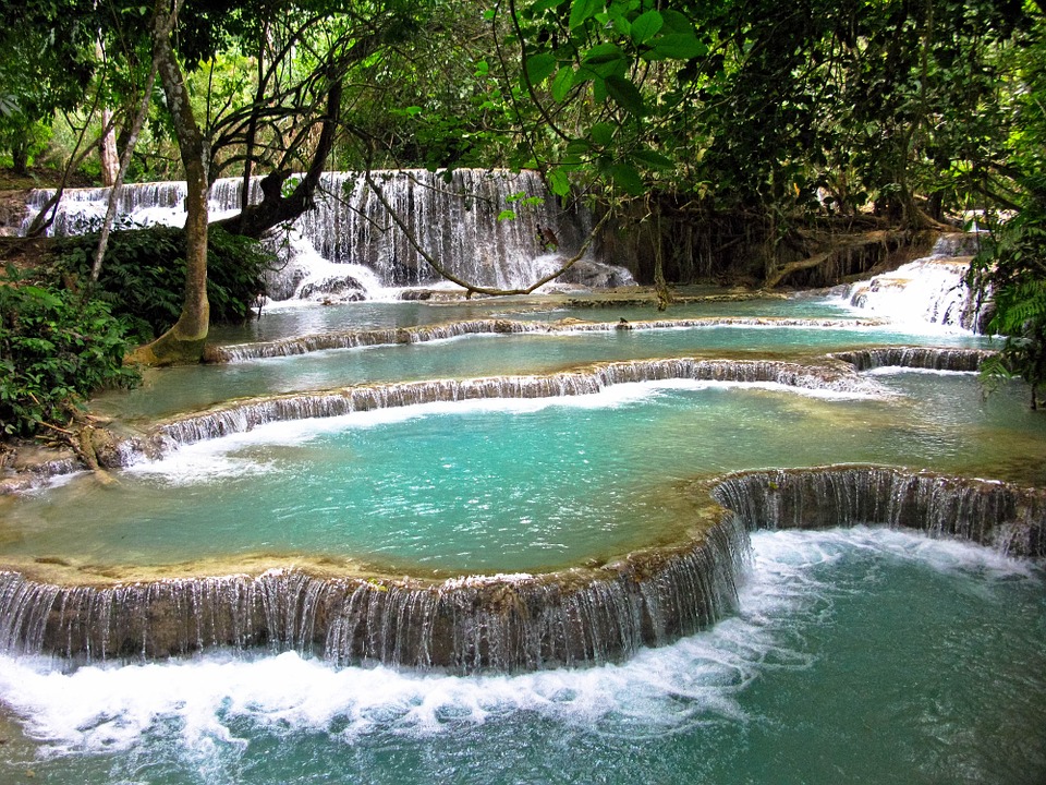
Wikimedia Commons / CC-BY-SA-3.0 / GFDL
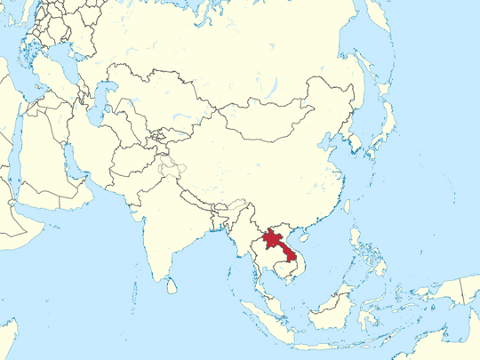
Capital: Vientiane
Population: 7.7 million+
Language: Lao
1 – Luang Prabang (also above)
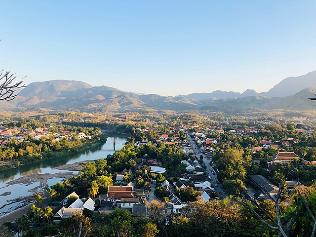
Luang Prabang stands on a peninsula where the Nam Khan runs into the Mekong in northern Laos, and it was the royal capital of the Lan Xang kingdom and then of Laos itself until the monarchy ended in 1975. UNESCO listed it in 1995, specifically for the way French colonial buildings and traditional Lao wooden houses stand together along the same streets.
There are more than thirty working wats inside the protected part of Luang Prabang, of which Wat Xieng Thong, built in 1560, is the one to see. Mount Phousi has three hundred-odd steps and the view from the top; the Royal Palace is now the national museum. Monks collect alms along the main street at dawn — a daily ritual that mass tourism has made genuinely difficult for the town.
Luang Prabang is named after a statue. The Phra Bang is an 83-centimetre standing Buddha, given by the Khmer king at Angkor to the first king of Lan Xang in 1359, and tradition holds that only a properly governed country keeps it. Siam took it in 1778 and handed it back in 1782 after a run of misfortune; took it again in 1828 and returned it in 1867, for the same reason.
2 – Vang Vieng
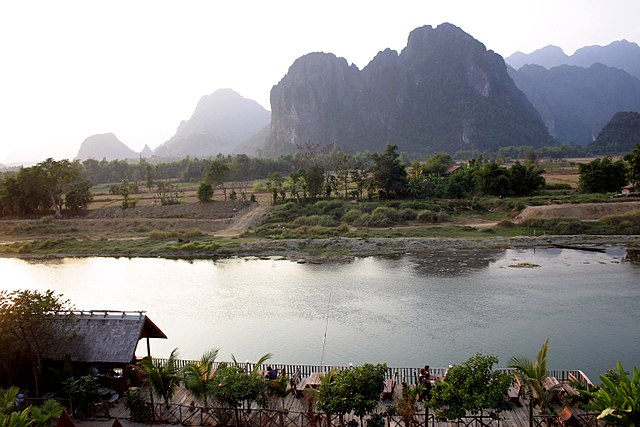
Vang Vieng is a town on the Nam Song about four hours north of Vientiane, set among limestone karst towers that rise straight out of the rice fields. During the war the Americans built an airstrip here — Lima Site 6 — and the old runway still runs along one side of the town.
Around Vang Vieng there are caves in the karst, lagoons in the limestone, hot air balloons at dawn and the river itself; Tham Chang and Tham Nam are the best known of the caves. The town is a base rather than a destination, and nearly everything worth doing is a few kilometres outside it.
For about a decade Vang Vieng was something else entirely — a string of riverside bars selling buckets of spirits to backpackers drifting past on tractor inner tubes, with rope swings and slides into shallow water. At least twenty-two foreign visitors died in 2011. The government closed most of the bars in 2012, and Vang Vieng has spent the years since rebuilding itself as an outdoor-sports town.
3 – Khone Phapheng Falls
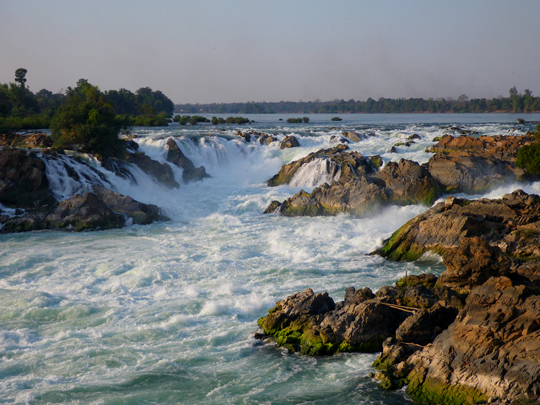
Khone Phapheng is on the Mekong in the far south of Laos, just above the Cambodian border, where the river spreads out through the islands of Si Phan Don and drops over a shelf of bedrock. The highest fall is only about 21 metres, but Khone Phapheng is close to eleven kilometres wide, which makes it the widest waterfall in the world.
These falls are the reason the Mekong has never been navigable from the sea to China, and a large part of why this stretch of river is as rich as it is: Irrawaddy dolphins survive in the pools below Khone Phapheng, and the giant Mekong catfish moves through. There are viewing platforms on the Lao bank and boats down from Don Det.
The French spent years trying to get gunboats past Khone Phapheng and failed, so in 1893 they laid a seven-kilometre narrow-gauge railway across two islands instead, hauling the boats out at one end and putting them back in at the other. It ran until about 1940, and it was the only railway in Laos until 2009. The locomotive is still sitting on Don Khon.
4 – Vat Phou
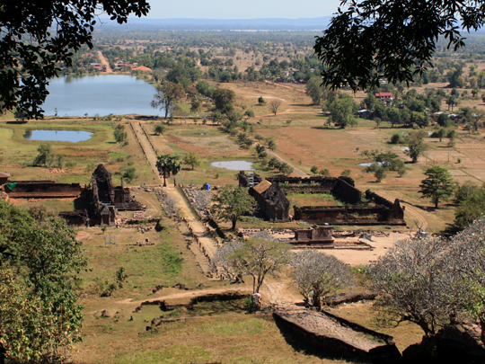
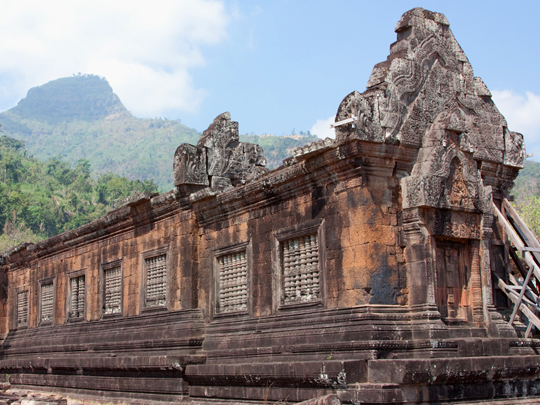
Vat Phou stands at the foot of Phou Kao in Champasak in southern Laos, and it is Khmer — the same empire and the same religious tradition as Angkor, but older. The sanctuary was in use from about the fifth century, when a pre-Angkorian capital stood nearby; most of what survives is eleventh to thirteenth century. UNESCO listed Vat Phou in 2001. What you climb at Vat Phou is an axis.
A causeway runs from the Mekong past two great reservoirs and two palace buildings, then a staircase goes up a terraced hillside lined with frangipani to the sanctuary at the top. A spring on the cliff behind was channelled to run straight onto the linga inside. A crocodile carved into a boulder nearby is usually read as an altar. The mountain is the point.
Phou Kao has a natural outcrop on its summit shaped like a linga, which is why a temple was built at its foot — and the whole ten-kilometre arrangement from peak to river was laid out around it. That idea, a mountain and a temple and water on a single axis, is what the Khmer took south to Angkor.
5 – Tham Kong Lo Cave
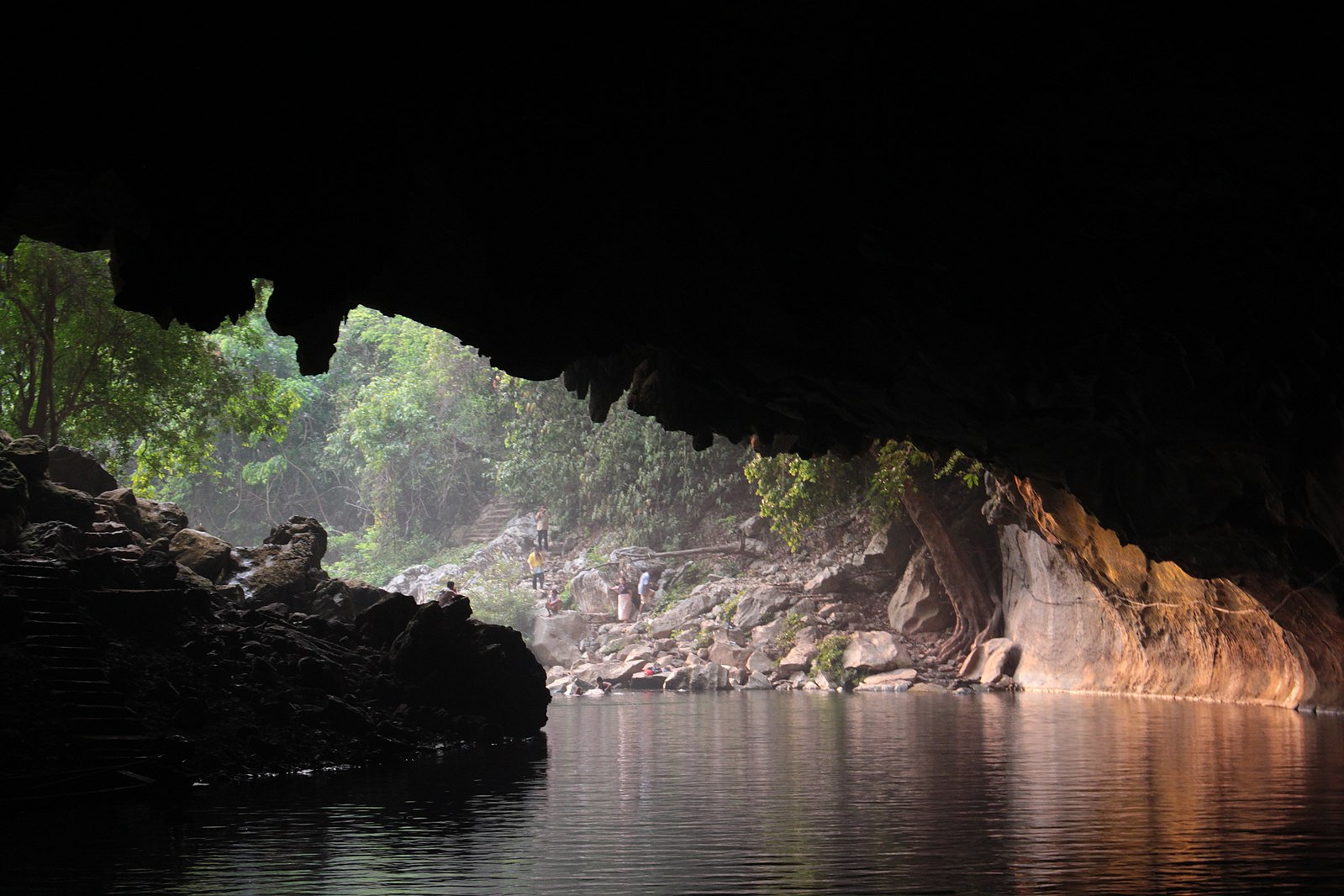
Tham Kong Lo runs seven and a half kilometres straight through a limestone mountain in Khammouane province, in the middle of Laos, and it is not a cave you walk into and back out of. The Nam Hinboun river goes into one side of the mountain and comes out of the other, and the cave is the river’s channel.
You go through Tham Kong Lo in a longtail boat with a headtorch, in near-total darkness, along a passage that opens in places to around ninety metres wide and as high; the boatmen get out and drag the boat over the shallows. It takes about an hour each way, and the far end comes out into an entirely different valley.
Tham Kong Lo was a working route long before it was anything else. Villagers on either side of the mountain used it to move goods and reach each other, and you can still see that in how the boatmen handle the shallows. The river had been cutting through the limestone for a very long time before anyone thought to ride it.
6 – Nong Fa Lake
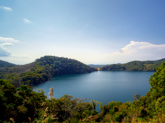
Nong Fa is a crater lake in the Dong Amphan protected area in Attapeu province, the far southeastern corner of Laos, close to the Vietnamese border. It is roughly circular, about a kilometre across, deep and an improbable blue, and local belief has it that the lake has no bottom. Getting to Nong Fa is the difficulty.
The lake sits in dense forest a long way from any surfaced road; the last stretch needs a 4×4 or a motorbike and somebody who knows the way, and there is nothing at all at the lake itself. For the small number of people who make the trip, that is the appeal. There is another reason hardly anyone goes.
This corner of Laos lay directly beneath the Ho Chi Minh Trail, and between 1964 and 1973 more than two million tonnes of ordnance were dropped on the country — more than fell on Germany and Japan together in the Second World War, on a population of around three million. Roughly a third of it did not go off, and it is still in the ground.
7 – Vientiane
Vientiane sits on a bend of the Mekong facing Thailand, and has been the capital of Laos since 1563, when the king moved it up from Luang Prabang for safety. That did not work. In 1827 a Siamese army took Vientiane, levelled it and marched most of the population away, and when the French arrived in 1893 they found a few thousand people living among ruins with forest growing through them.
Pha That Luang, the gilded stupa that appears on the national seal, was rebuilt in the 1930s from French drawings of the wreck. Wat Si Saket of 1818 is the one temple the Siamese left standing, its cloister walls lined with thousands of small Buddha images. Haw Phra Kaew beside it was built for the Emerald Buddha, which Siam took in 1779 and has never returned.
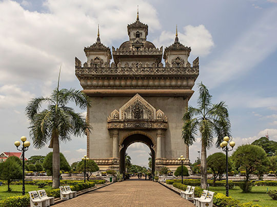
Patuxai is a triumphal arch in the middle of Vientiane, put up with American cement sent in the 1950s to surface a military runway and diverted into a monument instead — hence its nickname, the vertical runway. The official sign beside it is startlingly frank, describing the arch up close as “a monster of concrete”.
8 – Si Phan Don
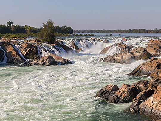
Si Phan Don means four thousand islands, and that is roughly what the Mekong becomes in its last stretch of Laos before Cambodia. The river spreads to around fourteen kilometres wide here — the broadest it gets anywhere along its length — and breaks into hundreds of channels between sandbars and wooded islands.
Don Khong is the largest island in Si Phan Don and the quietest; Don Det and Don Khon are where people stay, linked by the old French railway bridge, with bicycles, hammocks and the Li Phi falls. The island count is not fixed: in the dry season sandbars surface everywhere, and in the wet season most of them go under again.
The deep pool at the southern end of Si Phan Don, on the Cambodian border, held the last Irrawaddy dolphins in Laos. A handful remained by 2020, and the last one in Lao waters was found dead in early 2022. A small population survives downstream in Cambodia. Boat trips still go out to the pool, and what they mostly show you now is the border.
9 – The Plain of Jars
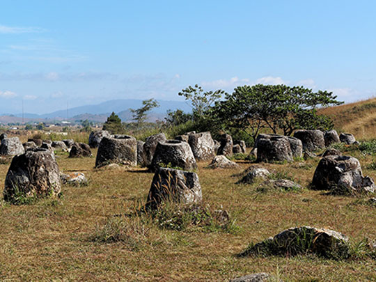
The Plain of Jars is a landscape of more than two thousand carved stone jars standing in some ninety recorded clusters across the Xieng Khouang plateau in northern Laos. They reach three metres tall and fourteen tonnes, and UNESCO inscribed fifteen of the sites in 2019 — the country’s third World Heritage listing, after Luang Prabang and Vat Phou. S
ites 1, 2 and 3 near Phonsavan are the accessible ones, and Site 1 alone holds around three hundred jars. Madeleine Colani surveyed the Plain of Jars in the 1930s and concluded the jars were funerary, which excavation has since supported; local tradition says a king of giants brewed rice wine in them after a victory. Recent dating puts some of them at three thousand years old.
Fewer than one site in ten has been cleared of unexploded ordnance. At the ones that are open you walk between white concrete markers laid down by a bomb-disposal charity, past craters sitting among the jars. Xieng Khouang was among the most heavily bombed places on earth, and the reason the Plain of Jars is still a mystery is that most of it cannot safely be dug.