
Wikimedia Commons / CC-BY-SA-3.0 / GFDL
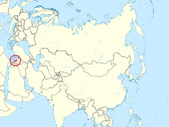
Capital: Beirut
Population: 5.8 million+
Language: Arabic/French/English
1 – Citadel of Raymond de Saint-Gilles (also above)
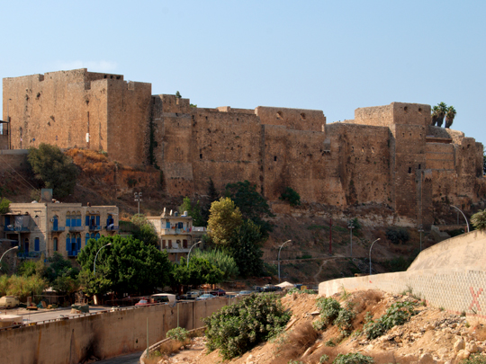
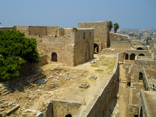
The Citadel of Raymond de Saint-Gilles stands on a hill above Tripoli in northern Lebanon, and it began life as a siege work. Raymond IV of Toulouse started building it in 1103 to starve the city out, naming the hill Mont Pèlerin — Pilgrim’s Mountain. He died in 1105, and Tripoli held for another four years before it fell in 1109.
What stands at the citadel today is mostly later: Mamluk and Ottoman rebuilding over the Crusader core, with a long entrance ramp, towers and a view down over the old city and the Abu Ali river. Below it, Tripoli holds the best-preserved Mamluk architecture in Lebanon — caravanserais, hammams and a souq that is still a working market.
When Tripoli fell in 1109 it possessed one of the great libraries of the Islamic world, the Dar al-Ilm, assembled by the Banu Ammar rulers over a century. It did not survive the conquest. Accounts of its size and of exactly what became of it differ sharply — which is itself part of the story, since the library is now remembered largely through arguments about how big it was.
2 – Jeita Grotto
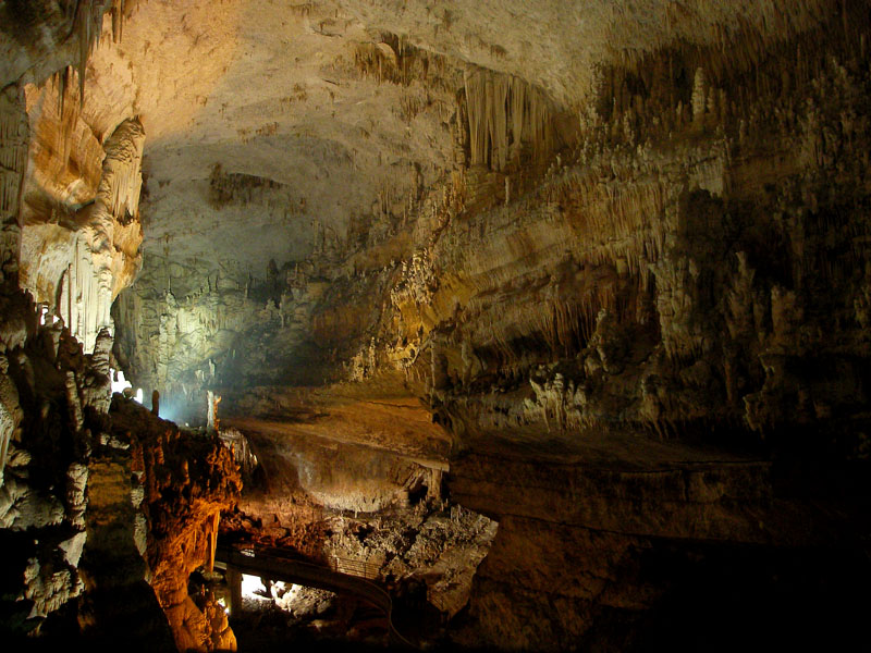
Jeita Grotto is a pair of limestone caves in the Nahr al-Kalb valley about twenty kilometres north of Beirut, hollowed out by an underground river over a very long stretch of time; more than nine kilometres have been surveyed. An American missionary named William Thomson went in with a rifle in 1836 and fired a shot to judge the depth from the echo.
The lower cave at Jeita Grotto is visited by boat along the river itself; the upper gallery, opened in 1958, is walked, and holds what is generally reckoned the longest stalactite known anywhere, a little over eight metres. The caves were closed through the civil war and used to store ammunition, and reopened in 1995. Jeita is not only a cave.
The river running through it is a major source of drinking water for Beirut and the coast — something over a million people — so the grotto is also a reservoir, which is why it is guarded as carefully as it is, and why cameras are not allowed inside.
3 – Zahlé
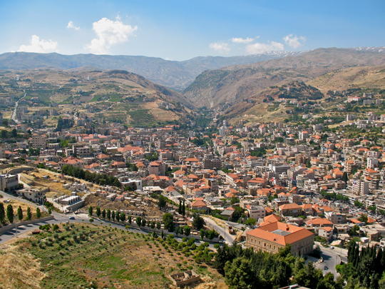
Zahlé is the main town of the Bekaa valley, an hour east of Beirut over the mountains, and the largest majority-Christian town in Lebanon. It sits where the Berdawni river comes down off Mount Sannine, and it has been known for a very long time as the bride of the Bekaa. The thing to do in Zahlé is eat.
A line of restaurants runs up the Berdawni gorge under the poplars, serving long mezze with arak, and the town treats that as an institution rather than a meal. Above the gorge the Bekaa opens out flat into the vineyards.
Lebanon has been making wine for something like five thousand years — the Phoenicians shipped it across the Mediterranean and carried viticulture to Greece, Italy and Spain with it. Château Ksara, just outside Zahlé, was founded by Jesuits in 1857 and keeps its wine in two kilometres of Roman-era tunnels beneath the estate, which were rediscovered by accident in the 1890s.
4 – Temple of Jupiter – Baalbek
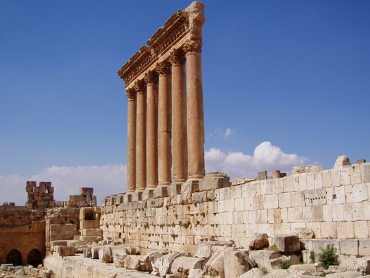
The Temple of Jupiter at Baalbek, in the northern Bekaa valley, was the largest Roman temple ever built. It went up over roughly two centuries from the reign of Augustus, on ground the Phoenicians had already used for the storm god Baal — which is where the name Baalbek comes from. Six of its fifty-four columns still stand, twenty metres tall.
The complex around the Temple of Jupiter also holds the Temple of Bacchus, smaller, almost intact, and among the best-preserved Roman temples anywhere, along with a round temple usually called Venus. UNESCO listed Baalbek in 1984, and a music festival has been staged in the ruins since 1956.
The temple sits on a platform, and three blocks in its western retaining wall — the Trilithon — weigh around 800 tonnes each and are nineteen metres long. They were cut from a quarry 800 metres away and uphill. Three larger blocks are still lying in that quarry, the biggest of them found in 2014 and estimated at 1,650 tonnes: the largest stone ever quarried anywhere.
5 – Sidon Sea Castle
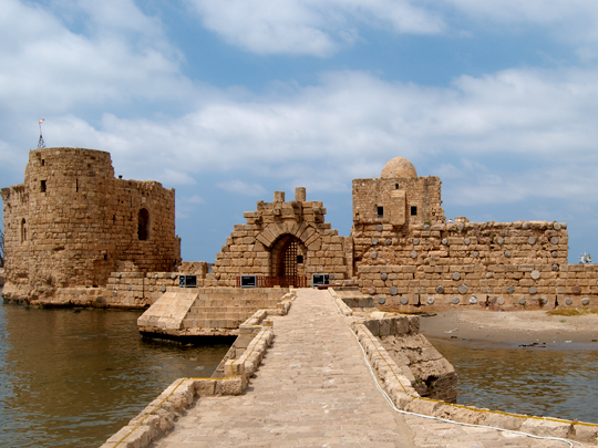
Sidon Sea Castle stands on a small island off the waterfront of Sidon, one of the oldest of the Phoenician cities, joined to the shore by a causeway on stone arches. The Crusaders built it around 1228 on the site of an earlier Phoenician temple, and it changed hands repeatedly afterwards, being wrecked and patched up each time.
The castle itself is not large: two towers, a ruined chapel later converted to a mosque, and a flat roof you can walk out onto with the sea on three sides. The old town of Sidon behind it has a Mamluk-era souq, a soap museum in a seventeenth-century factory, and a khan built for French merchants. Look at the walls.
Sidon Sea Castle is built partly out of Roman columns, laid horizontally through the masonry so the shafts run crosswise like reinforcing bars, their round ends showing in the face of the stonework. It was quick, it used material that was already lying about, and eight hundred years later the walls are still up.
6 – Byblos
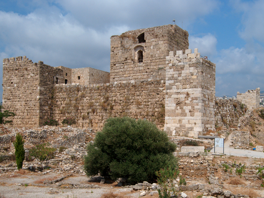
Byblos — Jbeil in Arabic — is on the coast about thirty kilometres north of Beirut, and it is among the strongest candidates for the oldest continuously inhabited place on earth: occupied by around 5000 BC, on ground people had been using for several thousand years before that. UNESCO listed Byblos in 1984.
Byblos Castle is the twelfth-century Crusader keep in the middle of the site, built out of stone robbed from the Roman ruins around it, and you climb it mainly for the view down over everything else — Bronze Age walls, the Temple of the Obelisks, a Roman theatre and colonnade, and the old fishing harbour below. Two things came out of Byblos that the world still uses.
The Greeks imported Egyptian papyrus through this port, and their word for it — byblos — became their word for a book, which is where “Bible” comes from. And the sarcophagus of King Ahiram, found here in 1923 and dating to about 1000 BC, carries the earliest substantial inscription in the Phoenician alphabet: the ancestor of Greek, Latin and most alphabets since.
7 – The Cedars of God and the Kadisha Valley
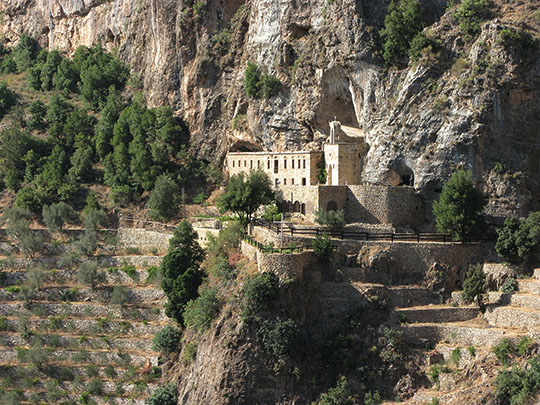
The Kadisha valley cuts down from the mountains of northern Lebanon, and the grove called Horsh Arz el-Rab — the Forest of the Cedars of God — stands above it near Bsharri. UNESCO listed the two together in 1998. The cedar on the Lebanese flag is this tree, and this grove is one of the last fragments of a forest that once covered these mountains.
The Kadisha valley below the cedars holds Maronite monasteries cut into the cliff faces and reached on foot — Qannoubine, the patriarchal seat for some five hundred years, and Qozhaya, where a printing press was set up in 1610 and produced what is generally described as the first book printed anywhere in the Middle East using movable type.
Lebanon’s cedars have been cut for four thousand years: by Egypt for ships and coffins, by the Phoenicians for their fleets, by Solomon for the Temple, by Rome for building, and by the Ottomans for the Hejaz railway. A few hundred trees survive in the Bsharri grove, some well over a thousand years old — and they are there partly because Queen Victoria paid for a wall around them in the 1870s to keep the goats out.
8 – Beirut
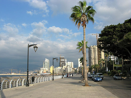
Beirut has been lived in for around five thousand years, and under Rome it was Berytus, a colony of veterans that became the empire’s leading school of law. Its professors wrote much of what went into Justinian’s codification, and the city was known as nutrix legum, the mother of laws. An earthquake, tsunami and fire destroyed Berytus on 9 July 551, and the school was never rebuilt.
Beirut has the National Museum, whose collection came through the civil war because the staff sealed the heavy pieces in concrete where they stood and walled up the rest; Roman baths and a colonnade downtown; Martyrs’ Square, with a statue still full of bullet holes; and the corniche along the sea. Gemmayzeh and Mar Mikhael are where the city goes at night.
On 4 August 2020 around 2,750 tonnes of ammonium nitrate that had sat in a warehouse at the port of Beirut for six years detonated. It was among the largest non-nuclear explosions ever recorded, killed more than two hundred people, injured thousands, and wrecked a large part of the city. The grain silos stood as a ruin until parts of them collapsed in 2022.
9 – Tyre
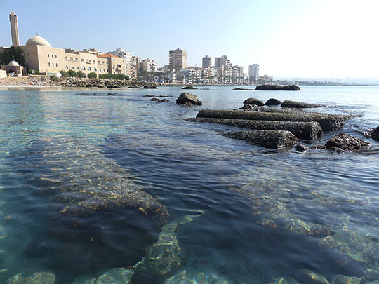
Tyre is on the southern coast of Lebanon and was the greatest of the Phoenician cities: a sea power that founded Carthage, traditionally in 814 BC, and supplied the ancient world with its most expensive dye. UNESCO listed Tyre in 1984. What survives at Tyre is largely Roman.
The Al-Bass site has a monumental arch, an aqueduct and an enormous necropolis, along with a hippodrome around 480 metres long — one of the largest to survive anywhere. The Al-Mina site out on the promontory has colonnaded streets and baths, and the fishing harbour is still working.
Tyrian purple came from a gland in the murex sea snail, and it took thousands of snails to produce a few grams, which is why purple meant royalty for two thousand years and why the dyeworks had to stand downwind of the town. Tyre itself was an island until 332 BC, when Alexander besieged it for seven months and built a causeway out from the mainland to reach it. Nobody removed it, silt gathered against it, and Tyre has been a peninsula ever since.
10 – Anjar
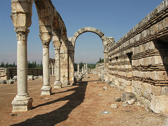
Anjar lies in the Bekaa valley near the Syrian border, and it is the only Umayyad city in Lebanon and one of very few anywhere. It was laid out in the early eighth century on a Roman military plan: a rectangle inside walls with forty towers, two colonnaded streets crossing at the centre, two palaces, a mosque and baths. Anjar was never finished.
Caliph Ibrahim was defeated in 744, the city was damaged, its people left, and nothing was ever built on the site again. UNESCO listed Anjar in 1984, and what you walk through is a complete street grid with standing arcades, an intact palace facade and the tetrapylon where the two main streets meet. That short life is the point.
Almost every other ancient city in the region is a stack of periods; Anjar is a single moment. It was also lost until 1939, when several thousand Armenian refugees from Musa Dagh were settled here, started building a village, and found the Umayyad city underneath. Their neighbourhoods are still named after the six villages they came from.