
Wikimedia Commons / CC-BY-SA-3.0 / GFDL
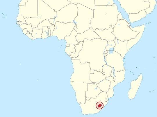
Capital: Maseru
Population: 2.3 million+
Language: Sesotho and English
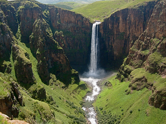
1 – Maletsunyane Falls (above)
In the highlands of central Lesotho, near the village of Semonkong, the Maletsunyane River hurls itself 192m off a basalt cliff in a single, uninterrupted plunge — one of the tallest waterfalls in Southern Africa, throwing up a permanent column of spray that gives Semonkong its name: “Place of Smoke.”
The classic way to reach it is on a sure-footed Basotho pony, riding through rolling highlands past shepherds wrapped in traditional blankets; the roar of the water echoing off the gorge walls is so eerie that local legend says it’s the wailing of those who have drowned there.
For the truly brave, this is the site of the longest commercially run single-drop abseil on Earth — a Guinness-record 204m rappel down the cliff face right beside the thundering falls, into the swirling mist below.
2 – Sehlabathebe National Park
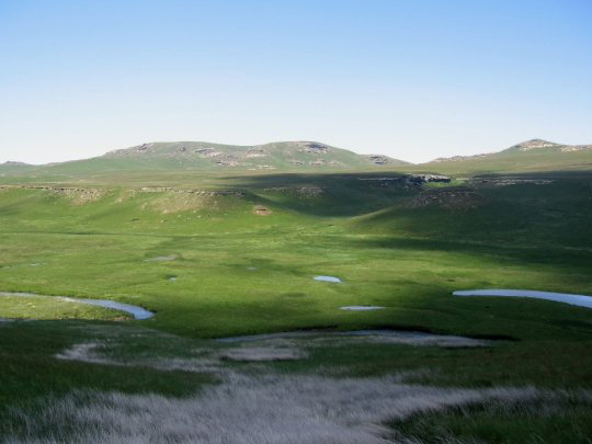
High in the remote southeastern corner of Lesotho, reached only by rough mountain tracks, Sehlabathebe is the kingdom’s oldest and most isolated national park — a wild, silent world of rolling grassland, wetlands and weathered sandstone above 2,400m, and since 2013 the Lesotho half of a World Heritage Site shared with South Africa.
Its otherworldly landscape of natural rock arches, twisted pinnacles and mirror-still rock pools draws hardy hikers and pony-trekkers for the solitude, the wildflowers and the huge skies where bearded vultures wheel; the park’s stone lodge, built as a prime minister’s mountain retreat, still stands alone in the grassland with no road worth the name reaching it.
The park’s clear mountain streams are the only home on Earth of the Maloti minnow — a tiny, critically endangered fish that lives here and nowhere else in the world.
3 – Katse Dam

Deep in the Maloti Mountains, the Katse Dam is one of Africa’s great engineering feats — a soaring concrete arch wall 185m high, among the tallest dams on the continent and the highest in altitude, holding back a vast reservoir that snakes for miles between the peaks at nearly 2,000m above sea level.
Its gracefully curved wall — bowed both side-to-side and top-to-bottom — is one of only around thirty such double-arch dams in the world; visitors can tour the wall and its inner galleries, cruise the deep blue lake, or fish for trout, all ringed by dramatic 3,000m mountains.
The dam turned water into Lesotho’s “white gold” — this rain-rich mountain kingdom pipes its water clean through the mountains and sells it to neighbouring South Africa, helping keep the taps of Johannesburg flowing.
4 – Afriski
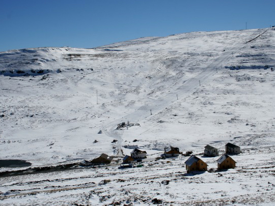
High in the Maluti Mountains of northern Lesotho, near the highest tarred pass in Southern Africa, Afriski is that most unlikely of things — a ski resort in Africa, the only one in the country and one of just two in the whole of sub-Saharan Africa.
Perched around 3,000m, it’s a small but modern resort with a handful of runs, snow-making machines and a terrain park, buzzing with visitors through the June-to-August winter; come summer the snow gives way to mountain biking, hiking and quad trails, with après-ski at one of the highest pubs on the continent.
There’s a reason a slice of the Alps can exist here — Lesotho is the only country on Earth that lies entirely above 1,000m, a lofty “Kingdom in the Sky” whose lowest point is higher than that of any other nation, cold and high enough to hold real winter snow.
5 – Drakensberg Mountains

Forming the towering eastern wall of Lesotho, the Drakensberg — “Dragon’s Mountains” — is the highest and longest mountain range in Southern Africa, a rampart of dark basalt cliffs and grassy summits crowned by Thabana Ntlenyana (3,482m), the highest peak anywhere south of Kilimanjaro.
It’s a paradise for hikers and pony-trekkers, all soaring escarpments, waterfalls and the hair-raising 4×4 switchbacks of the Sani Pass; its caves and rock shelters hold one of the greatest collections of ancient San rock paintings on Earth, protected within a UNESCO World Heritage Site.
These mountains are also dinosaur country — their pale sandstones preserve fossilised dinosaur footprints still pressed into the rock, and one of the creatures that once roamed here was named after the kingdom itself: Lesothosaurus, the “lizard of Lesotho.”
6 – Thaba Bosiu
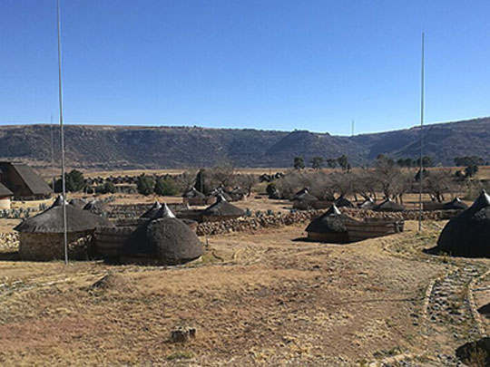

Twenty kilometres east of Maseru, a flat-topped sandstone plateau rises 120m out of the plain, ringed by cliffs, fed by its own springs and broad enough on top to hold cattle through a siege — and it is where Lesotho began: Moshoeshoe I brought his followers here in 1824, fleeing the Lifaqane wars, and built a nation out of the survivors of a dozen shattered clans.
A steep path climbs the Khubelu Pass to the summit, where the sandstone ruins of his royal compound still stand beside the cemetery holding Moshoeshoe himself and every king since, down to Moshoeshoe II.
Attacked by the Batlokoa, the Ndebele, the British and repeatedly by the Boers, the mountain was never once taken — Moshoeshoe put it about that it grew taller in the dark, which is one explanation of its name, “mountain at night” — and from the top you can see the pinnacle of Qiloane, whose conical shape is said to have given the Basotho hat its form, the hat that sits at the centre of the national flag.