
Wikimedia Commons / CC-BY-SA-3.0 / GFDL
Capital: Lilongwe
Population: 22 million+
Language: English/Chichewa

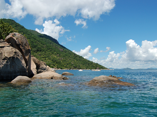
1 – Cape Maclear (above)
A palm-fringed sweep of white-sand beach and granite islets at the southern end of Lake Malawi, Cape Maclear is the heart of the world’s first freshwater national park — a UNESCO World Heritage Site — and was named by the explorer David Livingstone, who reached the lake in 1859.
It’s a laid-back haven of lakeside lodges and the busy fishing village of Chembe, where days are spent kayaking to offshore islands and snorkelling in warm, glass-clear water among dazzling clouds of tiny, jewel-coloured fish that will feed right out of your hand.
Those fish are cichlids, and Lake Malawi has more species of them than any other lake on Earth — hundreds upon hundreds found nowhere else, a living laboratory of evolution that has stocked tropical aquariums the world over.
2 – Nyika National Park
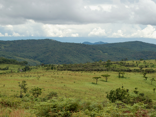
High in the far north of Malawi, Nyika is the country’s largest and oldest national park — a vast, rolling plateau of montane grassland above 2,000m, so cool, green and misty it feels more like the Scottish Highlands than tropical Africa.
This is a safari like no other, explored on foot, by mountain bike or by 4×4 across endless grassy hills grazed by herds of zebra, eland and roan antelope, with one of the highest densities of leopard in central Africa prowling the forested valleys.
Nyika is really a giant natural garden — its slopes burst into colour in the rains with wildflowers and more than 200 species of wild orchid, the richest concentration of orchids anywhere in south-central Africa.
3 – Liwonde National Park
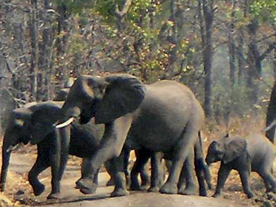
Strung along the broad, hippo-filled Shire River in southern Malawi, Liwonde is the country’s finest wildlife park — and one of Africa’s great conservation comeback stories, transformed since 2015 from a poaching-ravaged reserve into a thriving sanctuary.
The classic way to explore it is by boat, gliding past pods of hippo, basking crocodiles and herds of elephant coming down to drink; on land, lion, cheetah, black rhino and wild dog — all reintroduced after decades away — once again roam the mopane woodland and palm-dotted floodplains.
Its recovery was so complete that Liwonde ended up with more elephants than it could hold — so it became a donor park, and in one of the largest elephant moves ever attempted, hundreds were trucked off to restock other reserves, including nearby Nkhotakota.
4 – Nkhotakota Bay
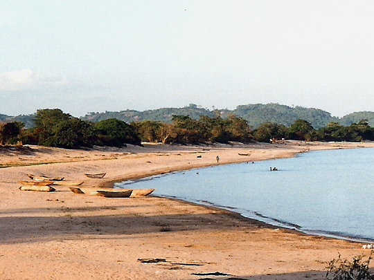
A sleepy town strung along a bay on the western shore of Lake Malawi, Nkhotakota is one of the oldest settlements in the region — and hides a dark past as the largest slave-trading depot on the lake, where 19th-century traders shipped thousands of captives across the water toward the distant coast.
Today it’s a relaxed lakeside spot of beaches, fishing boats and the weekly Ilala ferry, backed by the vast Nkhotakota Wildlife Reserve — Malawi’s oldest and largest, a rugged miombo wilderness of rivers, waterfalls and elephants best explored on foot.
It was here, beneath a fig tree that still stands, that the explorer David Livingstone confronted the local slave-trading chief and pleaded with him to end the trade — a meeting now marked by the “Livingstone Tree.”
5 – Mount Mulanje

Rising sheer and alone from the tea plantations of southern Malawi, Mount Mulanje is a colossal granite massif — one of the largest inselbergs on Earth — that soars so high above the surrounding plains it’s known as the “Island in the Sky,” crowned by Sapitwa (3,002m), the highest peak in Central Africa.
A network of trails and mountain huts leads walkers up through cedar forests and montane grassland, past tumbling waterfalls and ice-cold pools, onto a wonderland of some twenty rocky peaks and hidden basins wrapped, more often than not, in drifting cloud.
The summit’s name, Sapitwa, means “the place where you do not go” — for the massif is held sacred as the home of ancestral spirits, said to conjure sudden mists and lead travellers astray, and over the years several climbers really have vanished on its misty heights.
6 – Chongoni Rock Art Area
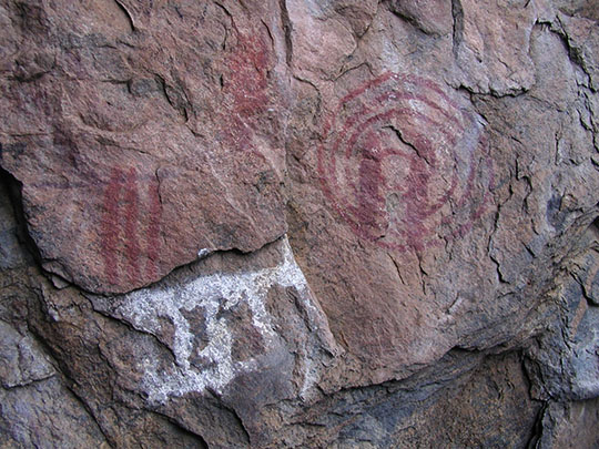

In a cluster of forested granite hills near Dedza, 80km southeast of Lilongwe, 127 painted rock shelters are scattered across 126 square kilometres — the richest concentration of rock art anywhere in Central Africa, and a UNESCO World Heritage Site since 2006.
Two traditions overlap on the same walls: spare red figures left by BaTwa hunter-gatherers from the late Stone Age, and bold white clay designs painted by Chewa farmers who arrived in the Iron Age and carried on painting into the twentieth century — a record that takes in the shift from hunting to farming, the Ngoni invasions and the arrival of Europeans. Only a couple of sites are open, reached on a steep walk through the woods with a guide from Dedza.
Unusually for rock art anywhere in the world, most of this was made by women, and the tradition has not ended: the symbols belong to Chinamwali, the Chewa girls’ initiation, and to rain-making and funeral rites — ceremonies still held, quietly, inside some of the painted shelters.
7 – Livingstonia
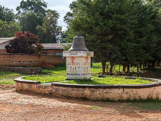
Scottish missionaries founded this mission at Cape Maclear in 1875, moved it to Bandawe in 1881, and finally hauled it 900m up the escarpment in 1894 — each move forced by the same thing, malaria, which had been killing them faster than they could replace themselves on the lakeshore.
Up in the cool air the red-brick mission still stands among the trees: the Stone House, the first house built here and now a small museum; the church, with a stained-glass window showing Livingstone at the lake with his sextant and his medicine chest; the David Gordon Memorial Hospital of 1910; and Manchewe Falls plunging off the escarpment nearby. The road up from the lakeshore climbs in some twenty hairpin bends.
Robert Laws ran the place for 52 years and taught teachers, ministers, clerks, carpenters and printers in it — and he wanted a university on this escarpment, a notion thought faintly absurd at the time; it finally opened in 2003, more than a century after he first proposed it.