
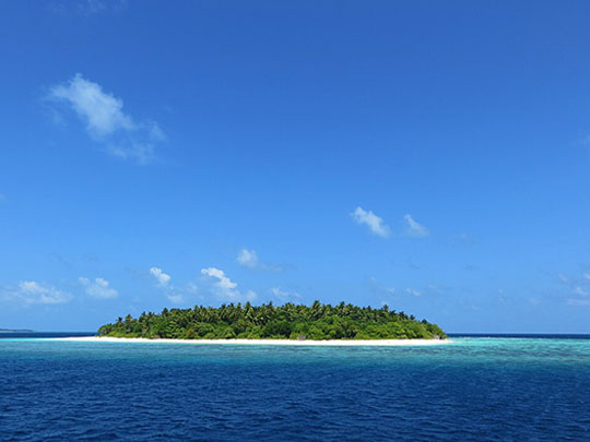
Frédéric Ducarme / CC-BY-SA-3.0 / GFDL
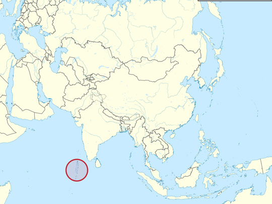
Capital: Malé
Population: 515,000+
Language: Maldivian (Dhivehi, written in Thaana)
The English word atoll comes from Dhivehi atholhu. It is one of very few words English has taken from the Maldives.
1 – Baa Atoll (also above)
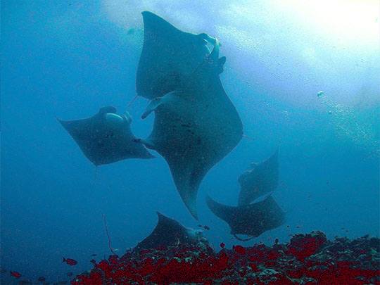
Hanifaru Bay is a small funnel-shaped inlet off an uninhabited island in Baa Atoll, in the northern Maldives. From about May to November the southwest monsoon current runs up against the incoming lunar tide at the mouth of the channel, and the counter-current that forms traps plankton inside the bay and holds it there.
Hanifaru became a Marine Protected Area in 2009, and in 2011 the whole of Baa Atoll was made a UNESCO Biosphere Reserve. That trapped plankton draws reef manta rays — as many as two hundred at once, in a bay not much bigger than a couple of football pitches — along with whale sharks, which slide in among them. Scuba diving at Hanifaru Bay is banned, because the bubbles disturb the animals; it is snorkelling only, with a cap on boats and swimmers and rangers on the water enforcing it.
When the plankton gets dense enough the mantas stop feeding in lines and begin to spiral. Dozens of them form a rotating column — cyclone feeding — all turning the same way so they can filter without colliding, sometimes for an hour together. It has been recorded in only a handful of places on earth.
2 – Malé City
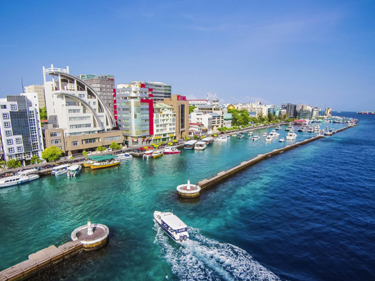
Malé is the capital and occupies its own island of about two square kilometres, holding something over 150,000 people, which makes it one of the most densely populated cities anywhere on earth. The island has been reclaimed and built out repeatedly, and there is essentially no undeveloped ground left on it.
The Hukuru Miskiy, the old Friday Mosque of 1658, is cut entirely from coral stone with lacquered woodwork inside; it sits on the UNESCO tentative list and is the finest old building in the country. Malé also has the gold-domed Islamic Centre, a fish market that works on the same schedule as the boats, and an artificial beach along the eastern shore.
Malé is ringed by a concrete seawall, built with Japanese funding after severe flooding in 1987. When the Indian Ocean tsunami arrived in December 2004 the water came over parts of it, but the city largely held while low-lying islands elsewhere in the country were swamped. The wall cost tens of millions of dollars and is generally reckoned to have paid for itself in a morning.
3 – Hulhumalé
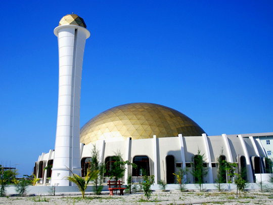
Hulhumalé is an island that did not exist thirty years ago. Reclamation began in 1997 in a lagoon beside the airport, and it now carries tens of thousands of people, a hospital, schools, apartment blocks and the mosque this entry is named for, with a second phase begun in 2015 and a bridge across to Malé opened in 2018.
The mosques on Hulhumalé are modern and plain next to the coral-stone work in Malé, which is rather the point: this is a planned city being built from nothing, on a grid, with wide roads and a long beach down the eastern side. It exists to take the overcrowding out of the capital.
Hulhumalé was pumped up to about two metres above sea level — roughly a metre higher than most of the Maldives. In a country whose average ground level is around a metre and a half, that extra metre is deliberate policy. The island was built high on purpose, as somewhere for people to go when the rest of the country starts going under.
4 – Addu Atoll
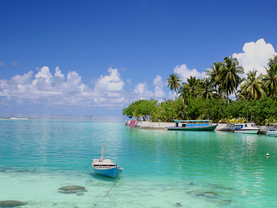
Addu is the southernmost atoll in the Maldives, some 540 kilometres from Malé and just below the equator, and it is the only part of the country besides the capital with a substantial settled population. Its islands are joined by causeways, so you can cycle from one end of Addu to the other — about fifteen kilometres.
The British ran an air base on Gan from 1941 until 1976, first as a wartime staging post and then as RAF Gan, and the causeways, the road network and a good deal of the English spoken in Addu date from it. There is a wreck dive on the British Loyalty, an oil tanker torpedoed in 1944, and manta rays through the channels.
The highest natural point in the whole of the Maldives is on Villingili in Addu Atoll, and it is about two and a half metres above sea level. The country’s average ground level is around a metre and a half. There is no hill anywhere in the Maldives, no river, and nowhere you cannot see the sea from.
5 – Utheemu Ganduvaru
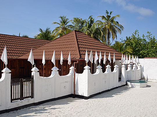
Utheemu Ganduvaru is a timber house on the island of Utheemu in Haa Alif Atoll, nearly three hundred kilometres north of Malé. It went up in the early sixteenth century, which makes it among the oldest surviving buildings in the Maldives, and it was the home of Mohamed Thakurufaanu — the country’s national hero, and the reason anyone makes the journey north to see it.
The house at Utheemu Ganduvaru is small and low, with carved wooden panels, lamps that burned coconut oil, and undholi — swing beds hung from the ceiling to move air in the heat — along with a palm-thatch hut in the compound that served as a guest room. A museum guide walks you round it, and there is a monument to Thakurufaanu’s boat down on the beach.
The Portuguese killed the sultan, took Malé in 1558 and held the Maldives for fifteen years. Thakurufaanu, his two brothers and a few companions fought them from a single boat, the Kalhuohfummi, for around eight years — landing on a different island each night, attacking the garrison, and being back out at sea by daybreak. They retook Malé in 1573, and the Maldivian national day still marks it.