
Christopher Brown / CC-BY-SA-3.0 / GFDL

Capital: Port Louis
Population: 1.25 million+
Language: English/French/Mauritian Creole
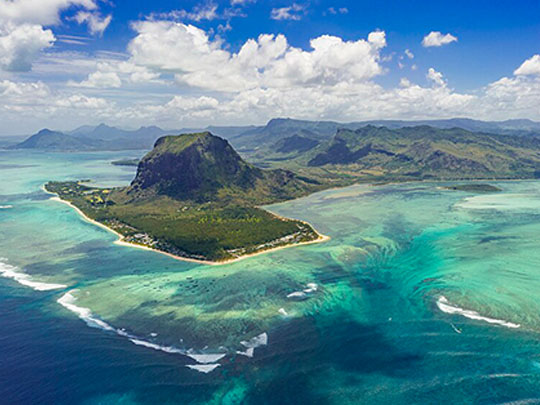
1 – Le Morne Brabant (also above)
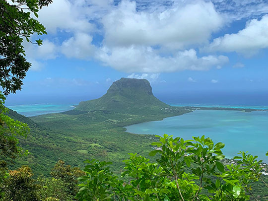
A sheer basalt monolith rearing 556m straight out of the sea at the island’s southwestern tip, Le Morne was listed by UNESCO in 2008 not for the rock but for who lived on it: through the 18th and early 19th centuries its caves, overhangs and summit plateau sheltered runaway slaves — maroons — who built settlements up there behind cliffs no soldier could climb quickly, and its fame as a refuge carried right across the Indian Ocean.
A trail climbs through forest to the shoulder, with the final scramble to the summit done with a guide; from the top the lagoon spreads out in bands of turquoise, and from the air the sand streaming off the shelf below creates the famous illusion of an underwater waterfall.
The story handed down here is that in 1835 a party climbed the mountain to tell the maroons that slavery had been abolished — and that they, assuming they had come to take them back, threw themselves from the cliffs. Mauritius marks abolition at the foot of this mountain every year.
2 – Black River Gorges
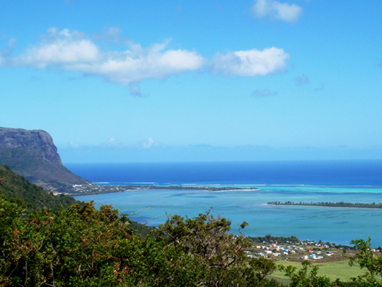
Cloaking the mountainous southwest of the island, Black River Gorges is Mauritius’s largest national park and the last great refuge of its native forest — a wild tangle of ravines, waterfalls and hiking trails rising to Black River Peak (828m), the island’s highest point.
Its dripping green slopes shelter creatures found nowhere else on Earth — the pink pigeon, the echo parakeet (the last native parrot of the region) and giant fruit bats — among ancient ebony trees and wild orchids, all best explored on the 60km of trails winding through the hills.
This forest was the stage for one of the greatest wildlife rescues ever attempted: the Mauritius kestrel, once the rarest bird on the planet — reduced to just four survivors in the 1970s — was pulled back from the edge here and now numbers in the hundreds, a triumph on the very island that gave the world the dodo.
3 – Tamarind Waterfalls
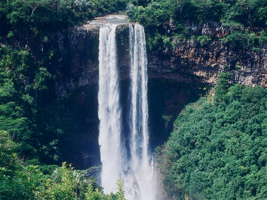
Tucked into a lush volcanic gorge in the highlands of central Mauritius, near the village of Henrietta, the Tamarind Falls — better known as the “Seven Cascades” — are a staircase of waterfalls tumbling down the Tamarin River through dense green forest.
Reaching them is a proper adventure: a steep, muddy, hands-on scramble down basalt slopes and across streams, rewarded at each drop by an emerald plunge pool cool enough for a swim, with a clifftop viewpoint that sweeps across the whole gorge to the distant ocean.
For all the name, there are actually more than seven falls here — up to eleven cascades step down the gorge in all — and the more daring don’t just hike them but abseil down the rock faces beside the thundering water.
4 – Pieter Both Mountains
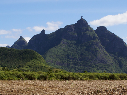
Instantly recognisable from across the island, Pieter Both is Mauritius’s second-highest peak (820m) and its most distinctive — a slender pinnacle crowned by a colossal round boulder that looks uncannily like a human head balanced on a neck of rock; it’s named after the first Dutch governor-general of the East Indies, who drowned in a shipwreck off these very shores.
That head-shaped summit has made the mountain a national symbol, even appearing on the country’s emblem; reaching the top of the boulder is a serious climb up steep gullies with fixed ropes and iron spikes, though the shoulder just below rewards hikers with sweeping views over the north of the island.
Legend gives the rock a stranger origin — the story goes that a milkman from the village at its foot once stumbled on a secret gathering of fairies, who let him watch on condition he told no one; when he broke his word, they turned him to stone, and his petrified head is the boulder that still crowns the peak.
5 – Trou aux Cerfs
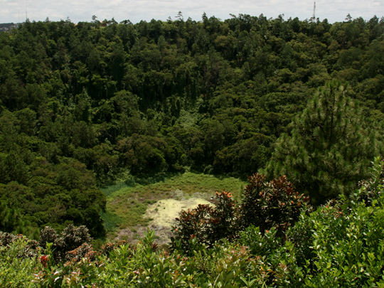
In the middle of the highland town of Curepipe yawns Trou aux Cerfs — a near-perfect volcanic crater some 350m across, a vivid reminder that the whole island of Mauritius is really the summit of a long-dead volcano risen from the floor of the Indian Ocean.
A paved path circles the forested rim, popular with joggers, while a small lake lies at the bottom; from the top there’s a sweeping 360° panorama over the town and the island’s jagged mountains — Rempart, the Trois Mamelles and the Moka range — and, on the clearest days, out to sea.
Though it hasn’t erupted in around 700,000 years, geologists file Trou aux Cerfs as dormant rather than extinct — meaning this tranquil, tree-lined crater sitting quietly in the heart of a residential town is, technically, a sleeping volcano that could one day stir back to life.
6 – Ganga Talao
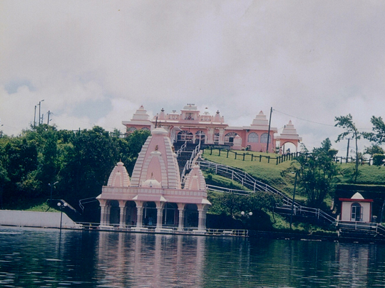
Hidden in a forested crater high in the hills of central Mauritius lies Ganga Talao — the holiest Hindu site on the island, sacred to the descendants of the Indian labourers brought here in the 19th century to work the sugar plantations, who found in this quiet lake a piece of home.
The approach is guarded by two towering 33m statues of the gods Shiva and Durga, and temples ring the shore where pilgrims leave offerings and sacred eels glide through the water; legend says the lake formed when a few drops of the holy River Ganges spilled from Shiva’s hair as he flew over the island, enchanted by its beauty.
To seal that link, in 1972 water carried from the Ganges in India was poured into the lake, renaming it “Ganga Talao” — the Lake of the Ganges — and each year, on the night of Maha Shivaratri, as many as 400,000 pilgrims walk here on foot, one of the largest Hindu gatherings anywhere outside India.
7 – La Preneuse
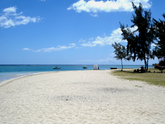
A tranquil sweep of white sand on the west coast, gazing across the bay to the great peak of Le Morne, La Preneuse is one of the loveliest and most historic beaches in Mauritius — named after a French warship that made its last stand in these waters during the long Franco-British struggle for the island.
Old cannons still lie half-buried in the sand, and guarding the shore stands the best-preserved Martello tower on the island — a squat, thick-walled British fort of the 1830s, now a little museum of colonial and military history; come evening, the beach draws crowds for some of the most spectacular sunsets in Mauritius.
The British raised a string of these stout towers along the coast bracing for a French counter-attack that never came — so not one of them ever fired a shot in anger, and their curious name, “Martello,” is simply a mangling of “Mortella,” a tower in Corsica whose stubborn defence had once impressed them.
8 – Aapravasi Ghat
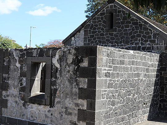
On the waterfront at Port Louis stand the remains of the depot where Britain began what it called the great experiment: with slavery abolished in 1835, indentured labourers were shipped in to replace the enslaved on the sugar estates, and Mauritius was chosen as the trial — nearly half a million people, most of them from India, landed here over the following decades. UNESCO listed it in 2006.
What survives is a fragment of what was: the sixteen stone steps up from the harbour that every arrival climbed, part of the hospital block and the immigration sheds, with a museum setting out how the system worked and what it cost.
The experiment succeeded, in its fashion, and was exported from here across the empire — to the Caribbean, South Africa, Fiji, Malaya — moving well over a million people; roughly two-thirds of today’s Mauritians descend from those who came up those steps, and the arrival registers survive, so families can still find the ship their ancestor sailed on.