
Wikimedia Commons / CC-BY-SA-3.0 / GFDL
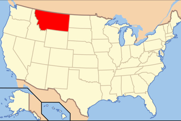
Capital: Helena
Population: 1.1 million+
Language: English
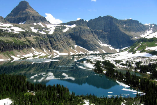
1 – Glacier National Park (also above)
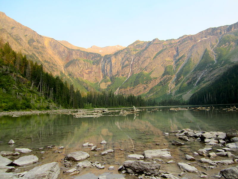
Glacier National Park straddles the Continental Divide in northwest Montana, on the ancestral lands of the Blackfeet, Salish and Kootenai peoples, and was created on 11 May 1910 after a campaign led by George Bird Grinnell, who had dubbed it the “Crown of the Continent”, before joining Canada’s Waterton Lakes in 1932 as the world’s first international peace park.
Glacier National Park is crossed by the 50-mile Going-to-the-Sun Road, dedicated at Logan Pass in 1933, where red 1930s “Jammer” tour buses, named for the way drivers had to jam their gears, carry visitors past Swiss-chalet lodges built by the Great Northern Railway to sell the park as “America’s Switzerland”.
Glacier National Park became a sister park to Killarney National Park in County Kerry in 2021, and the park’s old signs warning that its glaciers would be gone by 2020 were swapped out in 2019, after the forecasts were revised, for wording that says it depends on how and when we act.
2 – Little Bighorn Battlefield


Little Bighorn Battlefield, on the Crow Reservation in southeast Montana, is where Lakota, Northern Cheyenne and Arapaho warriors, with Sitting Bull and Crazy Horse among their leaders, wiped out George Armstrong Custer’s own five companies on 25–26 June 1876, killing about 268 soldiers, scouts and civilians in what the Lakota call the Battle of the Greasy Grass.
Little Bighorn’s sights include Last Stand Hill and its 1881 granite memorial, the Reno-Benteen battlefield about three miles away, red stone markers for fallen Native warriors placed since 1999, and the Indian Memorial, dedicated in 2003 under the theme “Peace Through Unity”, 12 years after Congress dropped Custer’s name from the site.
Little Bighorn had a strong Irish thread, since about one in six of Custer’s men were Irish-born, among them Captain Myles Keogh of Leighlinbridge, County Carlow, credited with bringing the Limerick drinking song “Garryowen” into the 7th Cavalry, and his horse Comanche became famous as the battle’s “sole survivor”, although historians reckon more than a hundred cavalry horses survived and were taken by the victors.
3 – Flathead Lake
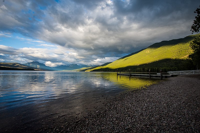
Flathead Lake fills a basin in northwest Montana carved by an ice-age glacier and held back by a glacial moraine at Polson, and it’s billed as the largest natural freshwater lake by surface area west of the Mississippi in the lower 48 states.
Flathead Lake’s highlights include Wild Horse Island, a state park where Native people are said to have kept horses safe from raiders, the cherry orchards lining the east shore between Polson and Bigfork, and the Seli’š Ksanka Qlispe’ Dam, owned by the Confederated Salish and Kootenai Tribes, which controls the lake’s top 10 feet.
Flathead Lake takes its name from the Flathead people, a misnomer, since the Salish never flattened their heads, and it has its own Nessie-style legend, with monster sightings going back to 1889 and a 7.5-foot white sturgeon produced in 1955 as possible proof.
4 – Grinnell Glacier Trail
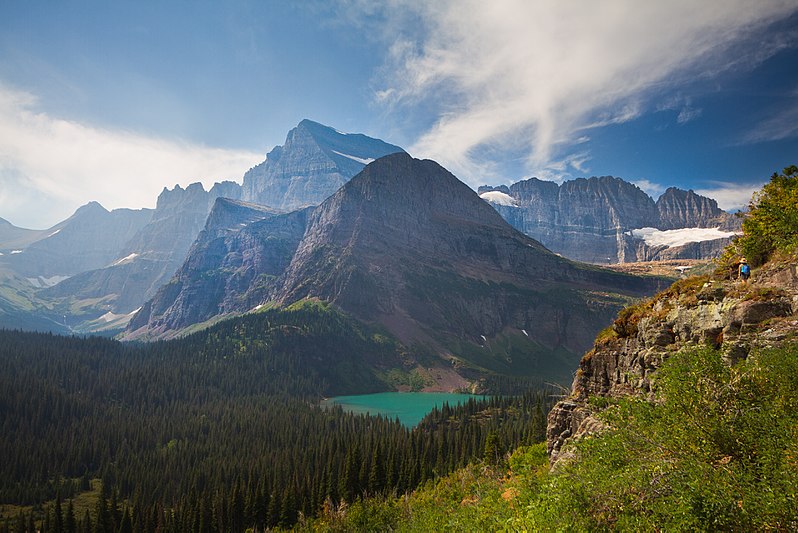
Grinnell Glacier Trail climbs about 1,600 feet over roughly 10.6 miles round trip from the Many Glacier area of Glacier National Park to the glacier named for George Bird Grinnell, who visited the valley in 1886, and whose companion, Lieutenant John Beacom, took the first photograph of the ice the following year.
Grinnell Glacier Trail passes high above the milky turquoise Grinnell Lake, coloured by rock flour ground off by the glacier, and you can cut the hike to about 7 miles by taking the boats across Swiftcurrent Lake and Lake Josephine.
Grinnell Glacier has been photographed from the same viewpoints from 1887 onwards, a running record of how far the ice has shrunk, while Grinnell himself started the first Audubon Society in 1886, co-founded the Boone and Crockett Club with Theodore Roosevelt in 1887, and was made an honorary Blackfeet chief.
5 – Medicine Rocks State Park
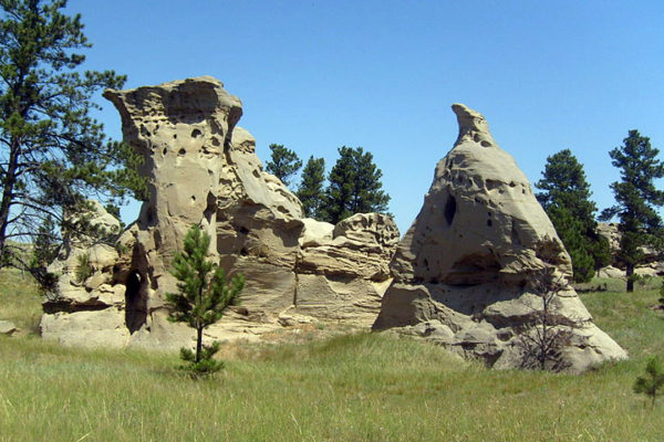
Medicine Rocks State Park lies about 11 miles north of Ekalaka in southeast Montana, where soft sandstone has weathered into pillars riddled with holes, and Native hunting parties gathered here at a place of “big medicine”, known in Lakota as Inyan Oka-lo-ka, “rock with a hole in it”.
Medicine Rocks State Park is covered in carvings, from Indigenous petroglyphs of warriors and animals to names left by fur trappers, gold seekers, cowboys and homesteaders, and it became a state park in 1957.
Theodore Roosevelt, then a young rancher, passed through Medicine Rocks in the 1880s and called it “as fantastically beautiful a place as I have ever seen”.
6 – Chief Mountain
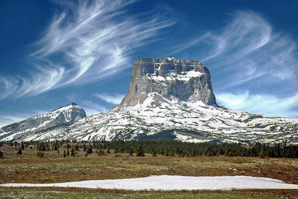
Chief Mountain rises to about 9,080 feet on the boundary between Glacier National Park and the Blackfeet Reservation, and the Blackfeet, who call it Nínaiistáko, hold it sacred and have long used it for vision quests.
Chief Mountain stands alone at the edge of the plains, best seen from the Chief Mountain International Highway, and it’s a geological oddity called a klippe, a block of rock about 1.5 billion years old that slid some 50 miles east along the Lewis Overthrust to sit on top of rock only about 70 million years old.
Chief Mountain’s first recorded ascent by outsiders came in 1892, when Henry L. Stimson, later US Secretary of War and Secretary of State, climbed the east face with Walter James and Blackfeet guide William Kipp, only to find an old bison skull already on the summit, left by earlier Native climbers.
7 – Butte
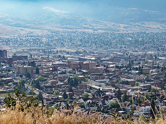

Butte grew on copper in southwest Montana into the “Richest Hill on Earth”, where Marcus Daly, born in Ballyjamesduff, County Cavan, in 1841, built the Anaconda copper empire, and around 1900 about one in four residents claimed Irish ancestry, many of them miners from Beara in County Cork, where the Allihies copper mines had closed.
Butte’s skyline bristles with steel headframes, the “gallows frames” over old mine shafts, alongside the Berkeley Pit, an open-pit mine worked from 1955 to 1982 that has filled with acidic, metal-laden water, and Our Lady of the Rockies, a 90-foot statue airlifted onto the Continental Divide by helicopter in 1985.
Butte, often called the most Irish town in America, also saw the Speculator Mine fire of 8 June 1917, which killed 168 men and is often called the deadliest hard-rock mining disaster in US history, and it’s the hometown of Evel Knievel, born here in 1938 and nicknamed after a night in the local jail next to a man called “Awful Knofel”.
8 – Grant-Kohrs Ranch
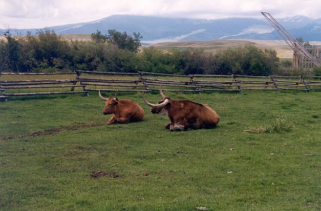
Grant-Kohrs Ranch in Deer Lodge, western Montana, began with Métis rancher Johnny Grant, who built its house in 1862 and sold up in 1866 to Conrad Kohrs, a butcher from Holstein who became “Montana’s Cattle King”, running cattle at his peak on about 10 million acres across four states and two Canadian provinces.
Grant-Kohrs Ranch is a working cattle ranch run by the National Park Service, with the original 1862 house and its later brick extension and Victorian furnishings added by Kohrs’s wife Augusta.
Kohrs rode out the Hard Winter of 1886–87, which wiped out herds across the northern plains, and his grandson Conrad Warren later sold Grant-Kohrs Ranch to the National Park Service on condition that it stay a working ranch.
9 – Roosevelt Arch – Yellowstone
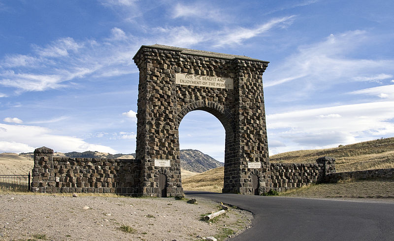
Roosevelt Arch stands at Yellowstone’s north entrance in Gardiner, Montana, where Theodore Roosevelt laid the cornerstone on 24 April 1903, and the basalt arch went up that year facing the town’s new railway depot, often attributed to architect Robert Reamer, though the records can’t confirm who designed it.
Roosevelt Arch is carved with “For the Benefit and Enjoyment of the People”, taken from the 1872 law that created Yellowstone, and it served as the park’s main gateway until car entrances opened in the 1920s and 1930s.
Roosevelt Arch’s cornerstone reportedly holds a time capsule with a Bible, a photo of Roosevelt, newspapers and coins, and the park it welcomes you into, widely regarded as the world’s first national park, lies about 96% in Wyoming and only about 3% in Montana.
10 – Missoula
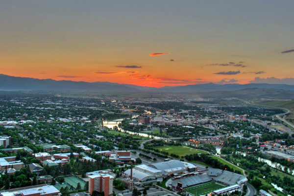
Missoula sits on the Clark Fork River in western Montana, home to the University of Montana, and its name is usually traced to a Salish word often translated as “place of frozen water”.
Missoula’s sights include Fort Missoula, a Second World War detention camp for Italian seamen and World’s Fair staff, who nicknamed it “Bella Vista”, and for Japanese immigrants, plus the Smokejumper Visitor Center, whose crews lost 12 men in the 1949 Mann Gulch fire, the tragedy behind Norman Maclean’s Young Men and Fire.
Missoula once lay deep under Glacial Lake Missoula, whose ice dam failed and refilled 40 or more times about 15,000 years ago, and its old shorelines still show as faint lines on Mount Sentinel and Mount Jumbo, while Maclean’s A River Runs Through It is set in Missoula but the 1992 film was shot around Livingston and Bozeman.
11 – Pictograph Cave State Park
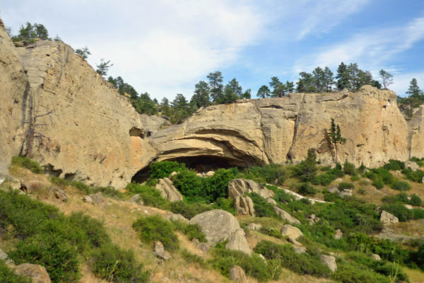
Pictograph Cave State Park lies a few miles south of Billings, where three sandstone caves, Pictograph, Middle and Ghost, were dug by WPA crews from 1937 to 1941, turning up more than 30,000 artefacts and layers of occupation that became a reference for dating sites across the region.
Pictograph Cave State Park’s main draw is its rock art, with 106 paintings recorded in red, white and black, the oldest more than 2,000 years old, and the site was made a National Historic Landmark in 1964.
Many of the Pictograph Cave paintings recorded in the 1930s have faded or disappeared under mineral crusts, and some show up only when the rock is wet.
12 – Bannack
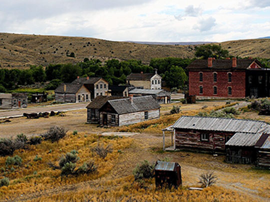
Bannack sits on Grasshopper Creek in southwest Montana, where John White’s party struck gold on 28 July 1862, Montana’s first major gold strike, and it was named for the Bannock people, only for the spelling to get mangled in Washington, before serving as the first capital of Montana Territory in 1864.
Bannack is a ghost town and state park with some 60 buildings, among them the Hotel Meade, built in the mid-1870s as the Beaverhead County Courthouse, the 1874 Masonic Lodge with the schoolhouse below it, and a replica gallows.
Bannack’s sheriff, Henry Plummer, was hanged without trial by vigilantes on 10 January 1864, accused of secretly leading a gang of road agents, on gallows built on his own orders, and historians still argue over whether he was guilty, so much so that a 1993 mock retrial ended in a 6–6 hung jury.
13 – Bozeman
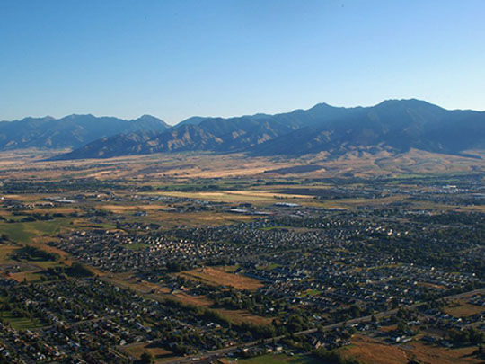
Bozeman sits in the Gallatin Valley, where William Clark crossed Bozeman Pass in July 1806 with Sacagawea as his guide, and John Bozeman laid out the town in 1864 after blazing the Bozeman Trail in 1863 through Lakota and Cheyenne hunting grounds, a route that sparked Red Cloud’s War and was closed under the 1868 Fort Laramie Treaty.
Bozeman is home to Montana State University, founded in 1893, and its Museum of the Rockies, which says it holds the largest collection of North American T. rex and Triceratops fossils, guarded at the entrance by “Big Mike”, a full-size bronze T. rex named not after the dinosaur but after a former university president, Michael Malone.
John Bozeman was killed on the Yellowstone River in 1867, his partner blamed the Blackfeet, later historians suspected the partner himself, and Waterford-born acting governor Thomas Francis Meagher raised a militia to hunt the killers, though it never found them.
14 – Pompeys Pillar
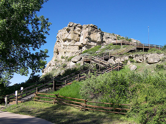
Pompeys Pillar is a sandstone butte beside the Yellowstone River about 25 miles east of Billings, where William Clark carved his name and the date, 25 July 1806, often called the only remaining physical evidence of the Lewis and Clark expedition along its route.
Pompeys Pillar keeps Clark’s signature behind protective glass, alongside hundreds of petroglyphs and pictographs, most probably Crow, whose name for the butte translates as “the Mountain Lion’s Lodge”, and it became a national monument in 2001.
Clark named it Pompy’s Tower after Sacagawea’s son Jean Baptiste, nicknamed “Pomp”, the baby on the Sacagawea dollar, but editor Nicholas Biddle renamed it in 1814 after Pompey’s Pillar in Alexandria, a column that has nothing to do with Pompey either, since it was put up for the Roman emperor Diocletian.
15 – Virginia City

Virginia City grew up along Alder Gulch after gold was found there on 26 May 1863, one of the richest placer strikes in the Rockies, and served as capital of Montana Territory from 1865 to 1875.
Virginia City and neighbouring Nevada City were preserved by Charles and Sue Bovey from the 1940s, with more than 30 buildings moved into Nevada City from around Montana, and the town printed Montana’s first newspaper, the Montana Post, in 1864, and published its first book, Thomas Dimsdale’s The Vigilantes of Montana, in 1866.
Virginia City’s vigilantes organised in December 1863, and on 14 January 1864 they hanged five men from a beam in an unfinished building on Wallace Street and buried them on Boot Hill, where one, “Clubfoot” George Lane, was identified in 1907 by his deformed foot, which ended up on display in a local museum, while the vigilante code “3-7-77” has been on the Montana Highway Patrol’s shoulder patch since 1956, though nobody knows what it means.
16 – Helena
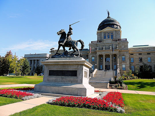
Helena, Montana’s capital, began in 1864 when the “Four Georgians”, only one of whom actually came from Georgia, struck gold in Last Chance Gulch, which became the main street, and it won the 1894 vote to stay capital, beating Anaconda by about 2,000 votes after copper kings Marcus Daly and William Clark poured well over a million dollars into the fight.
Helena’s sights include the copper-domed State Capitol (1902), the twin-spired Cathedral of St Helena, modelled on Vienna’s Votivkirche, the 1874 Guardian of the Gulch fire tower above downtown, and, just north, the Gates of the Mountains, named by Meriwether Lewis in 1805.
Helena’s Capitol is fronted by an equestrian statue of Thomas Francis Meagher, the Waterford-born Young Irelander who unveiled the Irish tricolour in 1848, was sentenced to death for treason before being transported to Van Diemen’s Land, led the Irish Brigade in the Civil War and became acting governor of Montana Territory, before falling from a steamboat into the Missouri at Fort Benton in 1867, his body was never found.