
Wikimedia Commons / CC-BY-SA-3.0 / GFDL
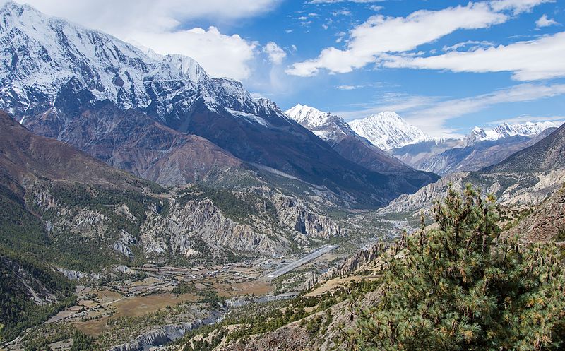
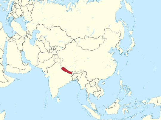
Capital: Kathmandu
Population: 29.2 million+
Language: Nepali (more than 120 languages spoken).
1 – Annapurna Circuit (also above)
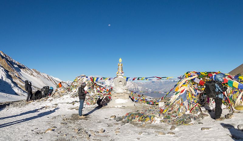
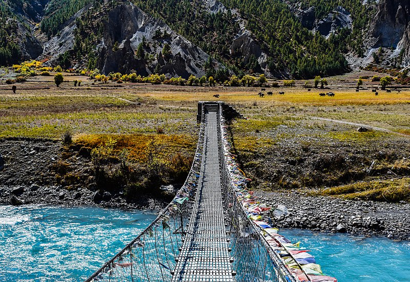
The Annapurna Circuit runs anticlockwise around the Annapurna massif in central Nepal, crossing the Thorong La at 5,416 metres and dropping into the Kali Gandaki — which, cut between Annapurna and Dhaulagiri, is the deepest river gorge in the world. The whole massif sits inside the Annapurna Conservation Area, Nepal’s first and largest, run by a trust rather than by the state.
The walk takes two to three weeks and passes through more climate zones than almost any trek on earth: subtropical terraces at the start, then pine and rhododendron, then the dry Tibetan country around Manang. Road building has shortened the classic route, and many walkers now take side trails or start further up.
Annapurna I was the first mountain over eight thousand metres anyone climbed — Maurice Herzog and Louis Lachenal, on 3 June 1950, three years before Everest, without bottled oxygen and at the first attempt. Both lost fingers and toes coming down. It has since become the deadliest of the fourteen eight-thousanders, with roughly one death for every three or four people who reach the top.
2 – Mount Everest Base Camp

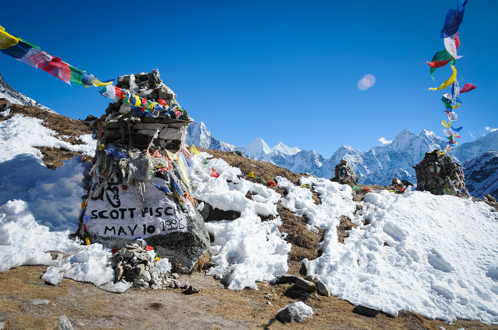
The mountain has three names. Nepalis call it Sagarmatha, Tibetans call it Chomolungma, and the British named it in 1865 after George Everest, a former Surveyor General of India — who objected to the honour, on the grounds that the name could not be written in Hindi and that local names ought to be used.
He never saw it. South Base Camp sits at 5,364 metres in the Khumbu, reached on a walk of eight to twelve days from the airstrip at Lukla, through Namche Bazaar and the Sherpa villages of Sagarmatha National Park. Most people climb Kala Patthar nearby for the view, because from Everest Base Camp itself the summit is hidden behind Nuptse.
Base camp is not on rock. It sits on the Khumbu Glacier, which is moving — around a metre a day in places — so the ice beneath the tents shifts, cracks and melts through the season, and the whole camp has to be surveyed and laid out again each year. It is a small town rebuilt annually on something that will not hold still.
3 – Phewa Lake

Phewa is the second-largest lake in Nepal, on the edge of Pokhara at around 800 metres, and the reason it is famous is what stands behind it — the Annapurna wall, and Machhapuchhre, reflected in the water on a still morning.
Boats go out to the Tal Barahi temple on the island in the middle of Phewa Lake, and the lakeside strip is where the trekking industry lives: gear shops, bakeries, and people either preparing for the hills or recovering from them. Paragliders come off Sarangkot on the ridge above the northern shore. Machhapuchhre, the fishtail, has never been climbed.
A British party got within about fifty metres of the summit in 1957 and stopped, having given their word not to set foot on the top; the mountain was closed to climbing afterwards and no permit has been issued since. It is sacred to Shiva, it is just under seven thousand metres, and nobody has stood on it.
4 – Stupa – Boudhanath
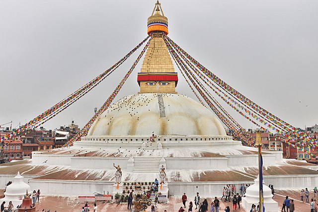
Boudhanath is one of the largest stupas in the world — a white dome thirty-six metres high in the east of Kathmandu, with the Buddha’s eyes painted on all four sides of the tower above it. It probably dates from around the fourteenth century, and it stands on an old trade route between Tibet and the valley.
You walk clockwise around Boudhanath with everybody else, past prayer wheels and monasteries; the quarter around the stupa filled with Tibetan monasteries after 1959, when refugees began arriving in numbers. Rooftop cafés look down onto the dome, and the circuit is busiest at first light and at dusk. The 2015 earthquake cracked the dome and wrecked the spire.
Boudhanath was the first major monument in Nepal put back, reopening in November 2016 — and it was rebuilt without government money. Donors gave more than two million dollars and thirty-one kilos of gold, and the prime minister used the reopening ceremony to note that the state had managed nothing comparable anywhere else.
5 – Bhaktapur
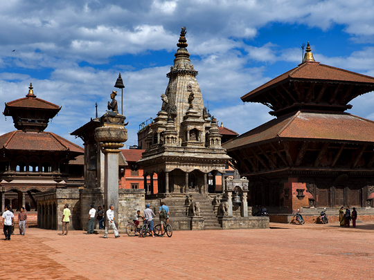
Bhaktapur is the best-preserved of the three old royal cities of the Kathmandu Valley, about thirteen kilometres east of the capital. It was the seat of one of the three Malla kingdoms that split the valley between them, and it is still a working Newar town of potters, weavers and brick lanes rather than an open-air museum.
Durbar Square in Bhaktapur has the 55-Window Palace and the Golden Gate; Taumadhi Square has Nyatapola; Dattatreya Square is the oldest of the three. Pottery Square is where the wheels actually turn, and the local yoghurt, juju dhau, is sold in unglazed clay pots that are part of the recipe rather than packaging.
Nyatapola — five storeys, the tallest temple in Nepal — went up in six months across 1701 and 1702, on a stepped plinth guarded by pairs of stone wrestlers, elephants, lions, griffins and goddesses. It has come through every major earthquake since, including 1934 and 2015. The Bhairavnath temple on the same square was flattened in 1934.
6 – Gosaikunda

Gosaikunda is a lake at 4,380 metres in the Langtang range north of Kathmandu, one of a cluster of more than a hundred small lakes in a high basin, and frozen from around October to June. It is a pilgrimage site for both Hindus and Buddhists, and a Ramsar-listed wetland.
You walk up to Gosaikunda from Dhunche or across from Langtang in two or three days, and the trail carries on over the Laurebina pass down into Helambu. At Janai Purnima in August tens of thousands of pilgrims come up, many walking through the night, and bathe in water that is barely above freezing.
The story is that Shiva drank the poison churned out of the ocean of milk to save the world, and it burned his throat and turned it blue. He drove his trident into the mountainside here to release water to cool it, and the springs that feed Gosaikunda are the marks of the prongs. A rock beneath the surface is said to be Shiva himself, lying down.
7 – Kathmandu Valley
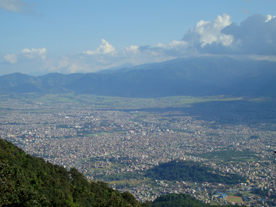
The Kathmandu Valley is about twenty-five kilometres across, holds most of Nepal’s urban population, and was inscribed by UNESCO in 1979 as a single World Heritage Site made up of seven separate monument zones — two of which are Boudhanath and Bhaktapur’s Durbar Square, entries 4 and 5 on this page.
The other five zones of the Kathmandu Valley are the durbar squares of Kathmandu and Patan, the hilltop stupa at Swayambhu, the Hindu temple and cremation ghats at Pashupatinath, and Changu Narayan, the oldest of them. This is Newar country, and the architecture — brick, carved timber, tiered pagoda roofs — is Newar rather than Indian or Tibetan.
There are three royal squares within fifteen kilometres of each other because in 1482 a Malla king divided the valley between his three children, and Kathmandu, Patan and Bhaktapur spent the next three hundred years as rival kingdoms trying to outbuild one another. That competition is the reason a valley this small contains this much architecture.
8 – Lumbini
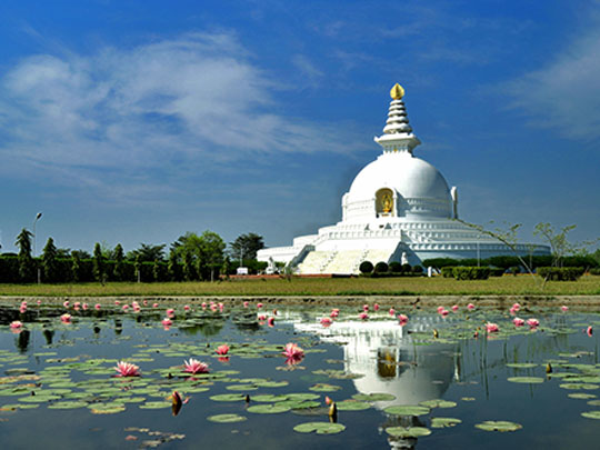

Lumbini lies in the Terai plains of southern Nepal, close to the Indian border, and it is where Siddhartha Gautama was born — traditionally in 623 BC, to Maya Devi, who was on the road to her parents’ house at the time. UNESCO inscribed Lumbini in 1997, and it is one of the four principal pilgrimage places of Buddhism.
The Maya Devi temple at Lumbini covers the excavated brick foundations of successive shrines going back to the third century BC, and within them a marker stone identifying the precise spot. Outside are the Puskarini pool, the Ashokan pillar, and a monastic zone where some thirty countries have each built a monastery in their own national style.
We know where the Buddha was born because of a tax exemption. The pillar Ashoka raised at Lumbini in 249 BC carries an inscription recording that he came in the twentieth year of his reign, worshipped the spot because the Buddha was born there, and freed the village from tax, leaving it to pay only an eighth share. It is the oldest inscription in Nepal, and it is what identified the site when the pillar was dug up in 1896.
9 – Chitwan National Park
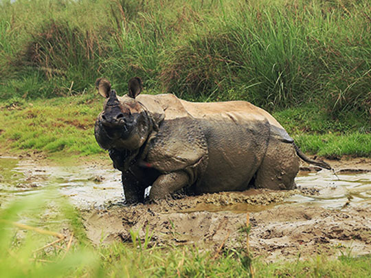
Chitwan covers 952 square kilometres of the Terai, the flat subtropical belt along Nepal’s southern border. It became Nepal’s first national park in 1973 and its first World Heritage Site in 1984 — and before that it was the hunting reserve of the Rana rulers, who kept it for themselves and their guests. Rhino and tiger were royal game, and nobody else was permitted to shoot them.
You go into Chitwan by jeep, by dugout canoe on the Rapti, or on foot with two guides. There are greater one-horned rhinos, Bengal tigers, sloth bears, gharial crocodiles and well over five hundred bird species; and the Tharu, indigenous to the Terai and historically resistant to its malaria, live all around the park. The malaria was what had protected it.
When a WHO-backed campaign sprayed the Terai with DDT in the 1950s the land opened up, settlers came down from the hills, the forest was cleared, and the rhinos fell from around eight hundred to fewer than a hundred in twenty years. Creating the park reversed that — there are roughly seven hundred rhinos now — but it also meant evicting more than twenty thousand people, most of them Tharu.