

Stefan Klopp / Wikimedia Commons / CC-BY-SA-3.0 / GFDL
Capital: Belfast
Population: 1.9 million+
Language: English

1 – Giant’s Causeway (also above)

The Giant’s Causeway is a headland of about 40,000 basalt columns on the north Antrim coast, formed by volcanic eruptions around 60 million years ago, and it came to scientific attention in 1693 when a letter describing it appeared in the Royal Society’s Philosophical Transactions, long before UNESCO listed it in 1986.
The Giant’s Causeway’s best-known formations are the Organ, the Giant’s Boot, the Camel’s Hump and the Chimney Stacks, and the Spanish Armada galleass Girona sank off nearby Lacada Point in October 1588, with only nine of around 1,300 aboard surviving, leaving treasure that is displayed in the Ulster Museum.
Legend says Finn McCool built the Giant’s Causeway to reach his Scottish rival Benandonner, and that Finn’s wife disguised him as a baby so the terrified Scot fled home tearing up the causeway behind him, with matching columns rising out of the sea at Fingal’s Cave on Staffa.
2 – Ballycastle

Ballycastle is a harbour town on the north-east corner of Antrim facing Rathlin Island, where the MacDonnells were granted the right to hold fairs in 1606, and in 1898 Marconi’s company ran wireless trials between the town and Rathlin, probably the first wireless installation in Ireland.
Ballycastle’s sights include the ruined Franciscan Bonamargy Friary, where Sorley Boy MacDonnell is buried and the hermit Julia MacQuillan, the Black Nun, lies beneath the path so that visitors walk over her grave, along with the ferry to Rathlin and the 200-metre cliffs of Fair Head.
Ballycastle’s Ould Lammas Fair, held at the end of August, is famous for dulse and yellowman, and legend says the Children of Lir spent 300 years of their curse as swans on the stormy Sea of Moyle just offshore.
3 – Portrush
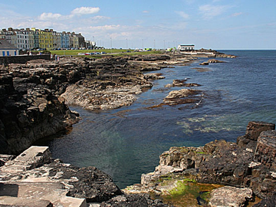
Portrush sits on the Ramore Head peninsula on the Causeway Coast, and in 1951 Royal Portrush Golf Club hosted the first Open Championship held outside Scotland and England, before Offaly’s Shane Lowry won the Open there in 2019.
Portrush’s coast runs past the chalk caves and arches of Whiterocks to the cliff-top ruins of Dunluce Castle, stronghold of the MacQuillans and then the MacDonnells, whose gatehouse was armed with cannon salvaged from the Armada ship Girona.
The story that Dunluce Castle’s kitchen fell into the sea in 1639 is a myth, as the kitchens stand intact, and Portrush’s own rocks settled a famous geology dispute in 1802, when John Playfair showed that the “basalt” with ammonites in it was really baked mudstone.
4 – Derry

Derry, by tradition founded as a monastery by St Columba around 546, was renamed Londonderry under a royal charter of 1613, and its walls, built in 1613–19, make it the only remaining completely walled city in Ireland, never breached even during the 105-day siege of 1689.
Derry’s walls run for about a mile around the old city above the Guildhall and the Bogside murals, the Peace Bridge of 2011 crosses the Foyle, and in WWII the city was a key escort base in the Battle of the Atlantic, where German U-boats surrendered at Lisahally in May 1945.
On 30 January 1972, Bloody Sunday, soldiers of the Parachute Regiment shot dead 13 people in Derry, and in 2010 the Saville Inquiry found that none of them was posing a threat of causing death or serious injury, leading Prime Minister David Cameron to call the killings “unjustified and unjustifiable”.
5 – Portstewart

Portstewart is a seaside town on the County Londonderry coast, where O’Hara’s Castle, built in 1834, became the Dominican College in 1917, and in early 1944 the US 508th Parachute Infantry Regiment was based nearby before heading for England and D-Day.
Portstewart’s promenade curves round towards Portstewart Strand, two miles of National Trust beach backed by dunes up to 6,000 years old, and just west at Downhill the Earl Bishop’s Mussenden Temple of 1785 stands on the cliff edge.
Portstewart Strand stood in for the coast of Dorne in Game of Thrones, while Downhill Strand below Mussenden Temple played Dragonstone.
6 – Belfast

Belfast, from Béal Feirste, the mouth of the Farset, grew into a city of linen and shipbuilding where Harland & Wolff built the Titanic from 1909 to 1911, and on the night of 15–16 April 1941 a German raid killed around 900 or more people, the heaviest loss of life in a single night outside London during the Blitz.
Belfast’s sights include the domed City Hall of 1906, Titanic Belfast on the old shipyard slipways, the yellow Samson and Goliath cranes, Crumlin Road Gaol and the Ulster Museum beside the Botanic Gardens.
The Good Friday Agreement was reached at Castle Buildings on Belfast’s Stormont estate on 10 April 1998 and approved in referendums north and south of the border that May, and CS Lewis, creator of Narnia, was born in the city in 1898.
7 – Enniskillen
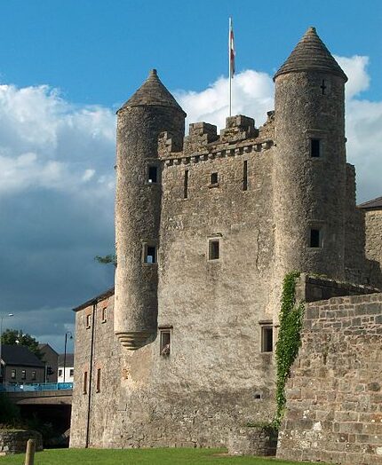
Enniskillen is the county town of Fermanagh, built on an island in the River Erne between Upper and Lower Lough Erne, and its castle was a stronghold of the Maguire chieftains from the 15th century.
Enniskillen Castle houses the Inniskillings Museum, which tells the story of what it calls the only town in Britain and Ireland to give its name to two regiments, while Portora Royal School counts Oscar Wilde and Samuel Beckett among its old boys and Castle Coole stands just outside town.
On 8 November 1987 an IRA bomb at Enniskillen’s war memorial killed 11 people at a Remembrance Day ceremony, and Gordon Wilson, whose daughter was among the dead, said “I bear no ill will. I bear no grudge.”
8 – Lough Erne

Lough Erne is a pair of lakes, Upper and Lower, strung along the River Erne through Fermanagh and scattered with around 150 islands, and in WWII flying boats from RAF Castle Archdale reached the Atlantic over Donegal through a secret arrangement with the Irish government known as the Donegal Corridor.
Lough Erne’s islands include Devenish, with the monastery founded by St Molaise in the 6th century and its 12th-century round tower, Boa Island with its two-faced Janus figure of uncertain date, and White Island with its row of early Christian carved figures.
On 26 May 1941 a Catalina flying boat from Lough Erne found the German battleship Bismarck, with a US Navy ensign, Leonard Smith, at the controls months before the US entered the war.
9 – Carrick-a-Rede Rope Bridge

Carrick-a-Rede Rope Bridge spans the chasm to a small rocky island near Ballintoy, first strung across in 1755 by salmon fishermen, and its name comes from the Irish for the rock in the road, an obstacle for migrating salmon.
Carrick-a-Rede’s bridge is about 20 metres long and some 30 metres above the sea, with views out to Rathlin Island, and nearby Larrybane, an old limestone quarry, served as Renly Baratheon’s camp in Game of Thrones.
Fishermen worked the Carrick-a-Rede salmon fishery for centuries until 2002, when the last salmon was landed.
10 – Murlough Reserve

Murlough National Nature Reserve lies on Dundrum Bay in County Down below the Mourne Mountains, on a dune system up to 6,000 years old, overlooked by Dundrum Castle, begun by the Norman knight John de Courcy traditionally around 1177.
Murlough’s boardwalks cross the dunes to a beach about four miles long, where common and grey seals haul out, with the Mournes rising behind.
Murlough became the first nature reserve in Ireland in 1967, a year after the National Trust took over the land.
11 – Armagh
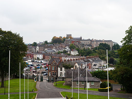
Armagh is where, by tradition, St Patrick founded his main church in 445, which is why the small city is the ecclesiastical capital of Ireland and the seat of both the Catholic and the Church of Ireland archbishops, each called Primate of All Ireland, and Brian Boru was buried there after the Battle of Clontarf in 1014.
Armagh’s two St Patrick’s cathedrals stand on neighbouring hills, the Robinson Library of 1771 holds Jonathan Swift’s own copy of Gulliver’s Travels with corrections in his hand, the Observatory dates from 1790, and Navan Fort, the Emain Macha of Ulster legend, lies just west of the city.
Armagh’s Archbishop James Ussher, born in Dublin and educated at Trinity, worked out that the world was created on 23 October 4004 BC.
12 – Downpatrick
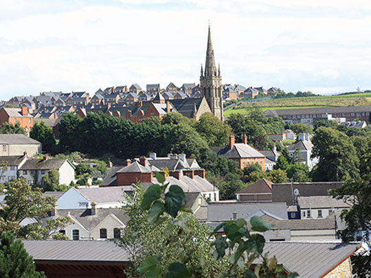
Downpatrick, from Dún Pádraig, Patrick’s fort, is the county town of Down, set on a hill above the River Quoile, and tradition holds that St Patrick is buried at its cathedral, while nearby Saul is by tradition the site of his first church, in a barn given to him in 432.
Downpatrick’s sights include Down Cathedral, with a granite slab laid around 1900 over Patrick’s traditional grave, the Saint Patrick Centre, the Down County Museum in the old county gaol, the Cistercian ruins of Inch Abbey and the holy wells at Struell.
Legend says the Norman knight John de Courcy found the remains of Patrick, Brigid and Columba in the 1180s and reburied them together at Downpatrick, and the granite slab was put on the grave to stop pilgrims carrying away its soil.
13 – Carrickfergus Castle
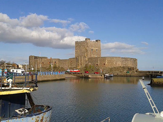
Carrickfergus Castle was begun by John de Courcy in 1177–78 on a rock on the north shore of Belfast Lough, besieged by King John in 1210 and by Edward Bruce in 1315, and William III landed at the harbour on 14 June 1690 on his way to the Boyne.
Carrickfergus Castle is one of the best-preserved medieval buildings in Ireland, with its massive keep and gatehouse guarding the lough, a statue of William III by the harbour where he came ashore, and a keep that served as an air-raid shelter in WWII.
In 1760 a French force under François Thurot captured Carrickfergus Castle and held the town for about five days, and in 1778 John Paul Jones in the Ranger captured HMS Drake off the mouth of Belfast Lough, an early victory that made him the US Navy’s first hero.
14 – Castle Ward
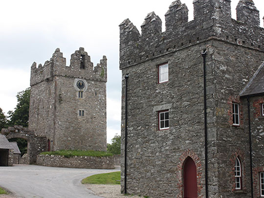
Castle Ward stands above Strangford Lough near the village of Strangford, built in the 1760s for Bernard Ward, later Lord Bangor, and his wife Lady Anne, with an early 17th-century tower house in its farmyard.
Castle Ward has a Classical front facing the drive and a Gothic front facing the lough, with the split carried through the rooms inside, while its farmyard served as Winterfell in the first season of Game of Thrones.
Tradition says Castle Ward got two styles because husband and wife could not agree, he wanting Classical and she wanting Gothic, and Lady Anne left soon after the house was finished.
15 – Dark Hedges


The Dark Hedges is an avenue of beech trees on the Bregagh Road between Armoy and Stranocum in County Antrim, planted by James Stuart around 1775 to line the approach to his house, Gracehill.
The Dark Hedges’ twisting branches meet overhead to form a natural tunnel, which played the Kingsroad in Game of Thrones and also appeared in Transformers: The Last Knight.
Legend says a Grey Lady glides along the Dark Hedges at dusk and vanishes at the last tree.