
Johannes Vogel / Wikimedia Commons / CC-BY-SA-3.0 / GFDL
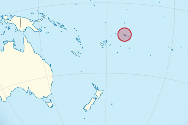
Capital: Apia
Population: 200,000+
Language: Samoan/English
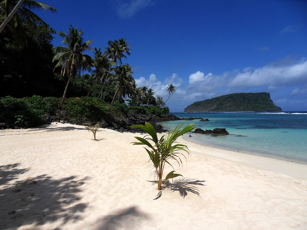
1 – Lalomanu Beach (also above)
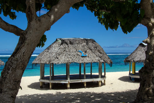
A long curve of white sand at the southeastern tip of Upolu in the Aleipata district, facing four uninhabited volcanic islets across a lagoon, and the place that put Samoan beach fales on the map — open-sided thatched sleeping platforms on the sand, run by the families who own the beach.
Day fales can be hired for a few tala, the lagoon is a marine reserve with good snorkelling and turtles, and the tuff-ring silhouette of Nu’utele across the water is the shape in almost every photograph ever taken of Samoa.
On the morning of 29 September 2009 an earthquake south of the islands sent a tsunami ashore within minutes, and Lalomanu was the worst-hit village in the country; the fales were rebuilt, some families moved their houses further up the hillside, and the coral in the lagoon is still growing back.
2 – Sopoaga Falls

Just above the junction where the south coast road meets Le Mafa Pass, near Lotofaga, the Sopoaga stream drops around 54 metres off the edge of an old lava shelf into a gorge full of jungle.
You see it from a lookout on the far side of the gorge, reached through a garden where every plant is labelled with its Samoan name and traditional use, and the family who own the land run coconut-husking and umu demonstrations beside it.
The gate fee is the interesting part: roughly four-fifths of all land in Samoa is customary land, held not by individuals but by extended families under their matai and unable to be sold — which is why so many of the country’s natural wonders are reached by paying a few tala to somebody’s grandmother at a garden gate.
3 – Falefa
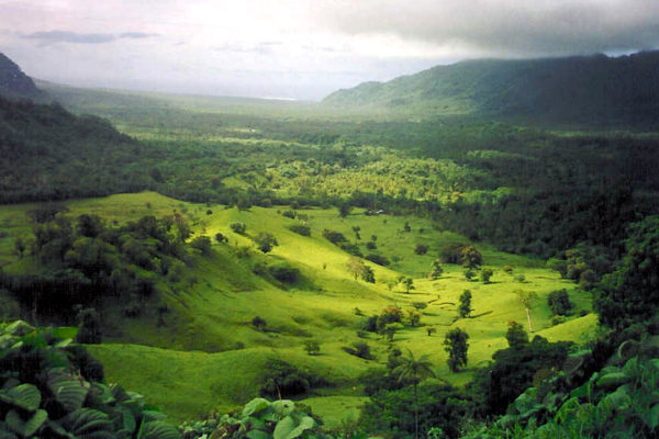
A village at the northern end of a broad valley on Upolu’s east coast, Falefa is one of the oldest and largest settlements in Samoa and the home of ʻAiga Sā Fenunuivao, the family that holds the Tupua Tamasese title — one of the four paramount titles around which Samoan politics still turns.
Falefa Falls is a wide, low cascade on the river at the edge of the village, the Le Mafa Pass road climbs south from here through the valley, and the freshwater cave pool at Piula, beneath a Methodist college, is a short drive along the coast.
Archaeologists digging in the Falefa valley found that the settlement started well inland, on the ridges and slopes, and only moved down to the shoreline later — which is the reverse of how Samoan villages look today, strung almost entirely along the coast road.
4 – Alofaaga Blowholes
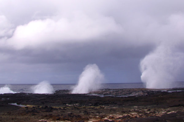
On the south coast of Savai’i at the village of Taga, ancient lava tubes run from a flat shelf of black rock down into the sea, and every swell that hits the coast is forced up through them and fired out of holes in the ground.
The jets go up tens of metres with a deep thumping noise, and the site is right at the edge of Savai’i’s lava country, within reach of the Saleaula lava fields and the crater of Mount Matavanu, which buried villages along the north coast between 1905 and 1911.
The show is improved considerably by the local men who wait at the holes with armfuls of coconuts: they time the swell, drop one in, and the blowhole spits it a hundred feet into the air, where it comes down shredded.
5 – Lepea
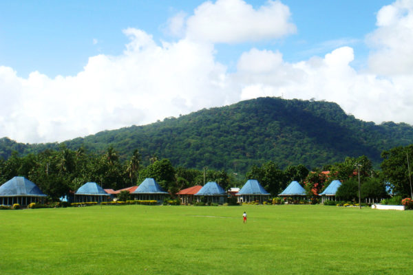
A small village on the western edge of Apia, laid out in the traditional way with fale facing a central malae, Lepea is the burial place of Tupua Tamasese Lealofi III — the paramount chief who led the Mau, the non-violent movement for Samoan independence from New Zealand rule.
His tomb stands in the village in tiers of black stone, and the Mau’s octagonal headquarters stood in neighbouring Vaimoso under the motto Samoa mo Samoa, Samoa for Samoa.
On 28 December 1929 New Zealand police fired on a peaceful Mau procession in Apia and killed him along with eight or more other Samoans; his dying words, asking his people not to avenge him and to keep the peace at any price, are carved on the tomb in Samoan, and Samoa became independent in 1962, the first Pacific nation to do so.
6 – Papapapaitai Falls
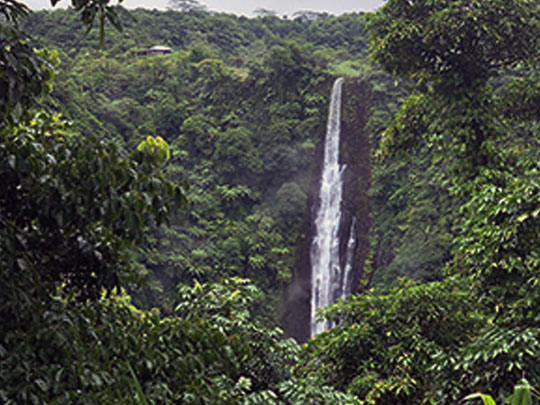
Fourteen kilometres up the Cross Island Road from Apia, where the ridge down the spine of Upolu catches the island’s heaviest rain, the Papapapaitai stream goes over the edge in a single drop of about 100 metres — the tallest waterfall in Samoa, and known just as often as Tiavi Falls after the district around it.
It is seen from a signed lookout right at the roadside across a deep gorge, which makes it a five-minute stop rather than a walk and one of the very few natural sights in the country you can see for nothing; the same road carries on over the ridge past Lake Lanoto’o and the Baháʼí House of Worship.
The gorge it falls into was not carved out by the river at all — it is the remnant of an old volcanic crater — and the walls are steep enough that there is no route down, so the foot of Samoa’s tallest waterfall is a place almost nobody has ever stood.
7 – Vailima
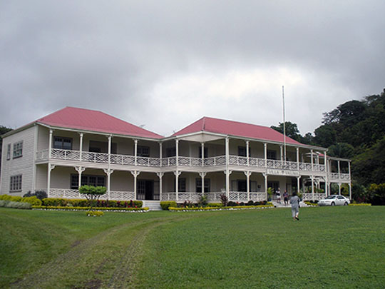
Four kilometres inland from Apia below Mount Vaea, Vailima — “five waters” — is the house Robert Louis Stevenson built in 1890 after sailing to Samoa for his health; he spent the last four years of his life here, was given the Samoan name Tusitala, teller of tales, and used much of his remaining energy attacking the way Britain, Germany and the United States were carving the islands up between them.
The restored villa is a museum now, with tours through the library, the great hall panelled in Californian redwood, and the only fireplace ever built in Samoa, which its homesick owner is said never to have lit; from the garden a trail climbs Mount Vaea to his tomb, about an hour up, with Apia and the reef laid out below.
The chiefs he had defended cut a road to his door in gratitude and named it the Road of the Loving Heart — and when he died suddenly at 44 in December 1894, around two hundred Samoans worked through the night to cut a path up the mountain, then carried his coffin to the summit in relays the following day.
8 – To Sua Ocean Trench
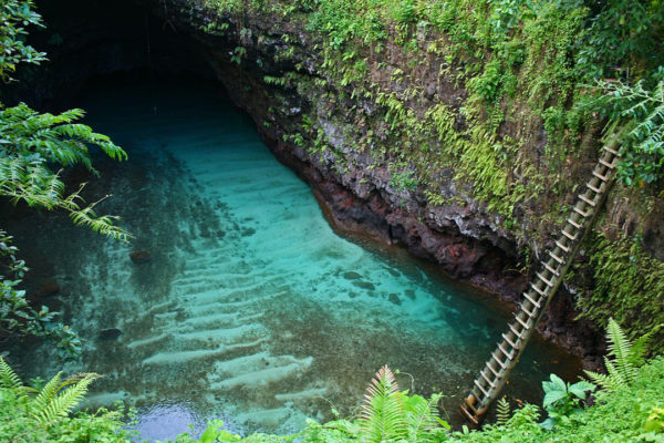
At Lotofaga on Upolu’s south coast, the roof of an old lava tube collapsed and left two enormous holes in the ground joined underground, the larger of them filled with clear sea water some 30 metres below a lawn — the name means, plainly enough, big hole.
You go down a long wooden ladder from the rim to a small platform on the water, with gardens, a cliff walk and blowholes on the shoreline behind, and the whole site is run by the village.
The pool is connected to the open Pacific through a passage in the lava, so it is not still water at all: it rises and falls with the tide and surges when there is swell on the coast, which is why the ladder is sometimes the least frightening part of the visit.